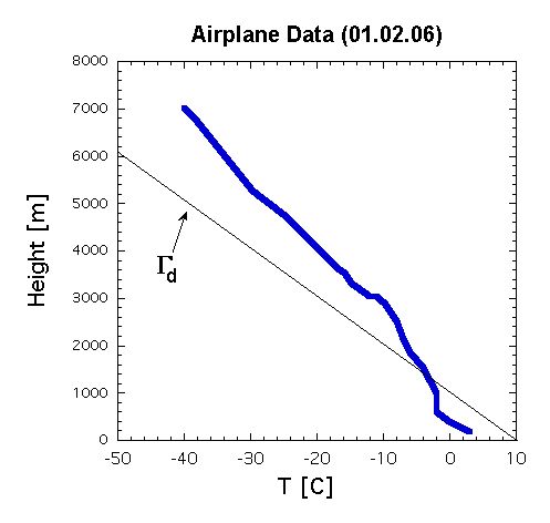
Temperature sounding during flight descent
This "sounding" was made using the height & temperature information
available to passengers on jets with map screens. In this case, the
information was collected while flying a Boeing 777 (United flight
929) on approach to Chicago's O'Hare Airport (ORD) on 6 February 2001.
The raw data (below) indicates relatively homogeneous conditions
across the region of descent, which is why the observations are
considered a vertical sounding even though the plane was flying
approximately 200 mph.
|
Temperature vs. height
|
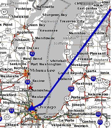
|
Approximate flight path
|
Height  Temperature
 [m]      [oC]

7010.0	-40.000
6705.0	-38.000
5307.0	-30.000
4770.0	-25.000
3661.0	-17.000
3546.0	-16.000
3353.0	-15.000
3353.0	-15.000
3359.0	-15.000
3354.0	-15.000
3048.0	-12.000
3048.0	-12.000
3046.0	-11.000
2916.0	-10.000
2509.0	 -8.000
2133.0	 -7.000
1844.0	 -6.000
1526.0	 -4.000
1524.0	 -4.000
976.00	 -2.000
619.00	 -2.000
400.00	  0.000
180.00	  3.000
|
Data collected
6 February 2001 from about 1320 - 1345 CST on approach to ORD. Plane
traveling about 200 mph from NE (across Lake Michigan to
ORD). Observations about 1 minute apart.
|
Go to
Meteorology 301 Home Page
Go to ISU
Meteorology Course Catalog
Go to ISU
Atmospheric Sciences Homepage