May 29, 2008:
I woke up this day to find our slight risk had been upgraded to a high risk, and I had 10 or so emails asking me if I was going to chase. I had to pinch myself
just to make sure I wasn't still sleeping. I quickly packed my bags and headed into work. Our chase group consisted of Dave Flory, Adam Clark, and Tracy Rowlandson. We
left Ames at noon, heading west for an undecided target, debating on somewhere between western IA, and maybe as far west as Lincoln, NE. As we traveled west on I-80,
storms initiated in southwestern Nebraska, and we realized they would be the only game in town. So, we decided to continue west and intercept these storms near the Grand
Island area. Our thinking was that the storms would be long-tracked supercells, as well as being prolific tornado producers, making the long journey west well worth the
drive time. When we arrived at Grand Island, NE we decided to go west just a bit further. We intercepted the storms approximately 10 miles to the east of
Kearney, NE. Through spotter network, we learned that Kearney was hit by the tornado. Moments later we witnessed an interesting cloud feature sticking out the front end
of the storm. It was difficult from our perspective what exactly this feature was, but had the apparence of the funnel, and was in the same general area of the storm where
the tornado had been moments earlier. It was at about this time that the storms began to fall apart in our area. I believe this was mainly due to anvil
seeding from a storm in northern Kansas. Many chasers in our area bailed and headed south to intercept this storm. This turned out to be a good decision, as it turned out
to be the prolific tornado producer of the day. As for us, we needed to return to Ames that night, so we followed our mushy storm east as it became outflow dominent.
On our way home a small storm began organizing north of I-80 in Audubon county. Since it was paralleling our movement, and began looking supercellular on reflectivity, we
deciding to give it a look. It was very difficult to spot for this storm, beings it was dark. We did see a lowered base, but couldn't confirm anything. It gave us an
entertaining ride home anyway.
|
|
|
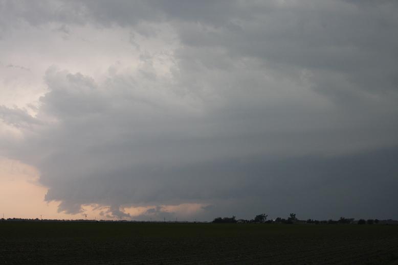
Leading edge of RFD gust front.
|
|

Possible wall cloud.
|
|
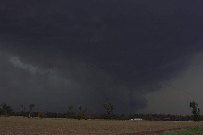
Starting to turn HP.
|
|

Interesting cloud tag sticking out there.
|
|
Feel free to contact me at: karstens.chris@gmail.com
Updated 12 May 2008