A challenging day to decide whether or not to chase from Ames, but in the end we found the potential too hard to resist. Morning convection over much of Iowa persisted
until mid to late morning. The computer models had a difficult time picking up on this feature, thus making our decisions a bit challenging to make. After the morning RUC
runs starting coming in, Dr. Gallus noted that it was picking up on the mesohigh in Iowa. Thus, confidence in the model progs was higher, which hinted at some potential
for tornadoes in western Iowa.
Around 12:30pm we made the decision to head out west, debating between taking Hwy 30 or I-35. We knew that Hwy 30 west of Boone was closed due to water over the road, and
we felt the initial target would be somewhere along I-80 in western IA, so we elected to take I-35 south to catch I-80 west. I drove my little 4 cylinder car, with Dave
Flory, Phil Butcher, and Jason Patton packed in. Dr. Gallus drove his car with his son Nick and Scott Lincoln. Two other cars with undergraduates were along as well.
Our first stop was in Adair where we communicated our thoughts about what we were seeing in the atmosphere and on RUC analysis. We had a lot of optimism, but felt we
needed to continue west. The next stop was in Avoca where a similar conversation took place. At the time, storms just began froming along the cold front. We decided to
head north to Harlan to get gas and make a firm decision. After filling up with gas in Harlan, we had a few options to choose from. A nice looking storm had formed to our
northwest, and an intercept would be northwest of Denison - within reach. The other option was to wait form the disorganized convection west of Omaha to get its act
together and roll in our direction. Since the mode of the convection near Omaha looked linear, we decided to take a chance and head northwest of Denison.
The intercept was made in the town of Mapleton. However, by this time the storm was rather disorganized, and it appeared as though all of the convection was going linear
very quickly. On radar we noted a better looking storm just to our south, and we make another good intercept. So, we retreated to the southeast toward Ute, then blazed
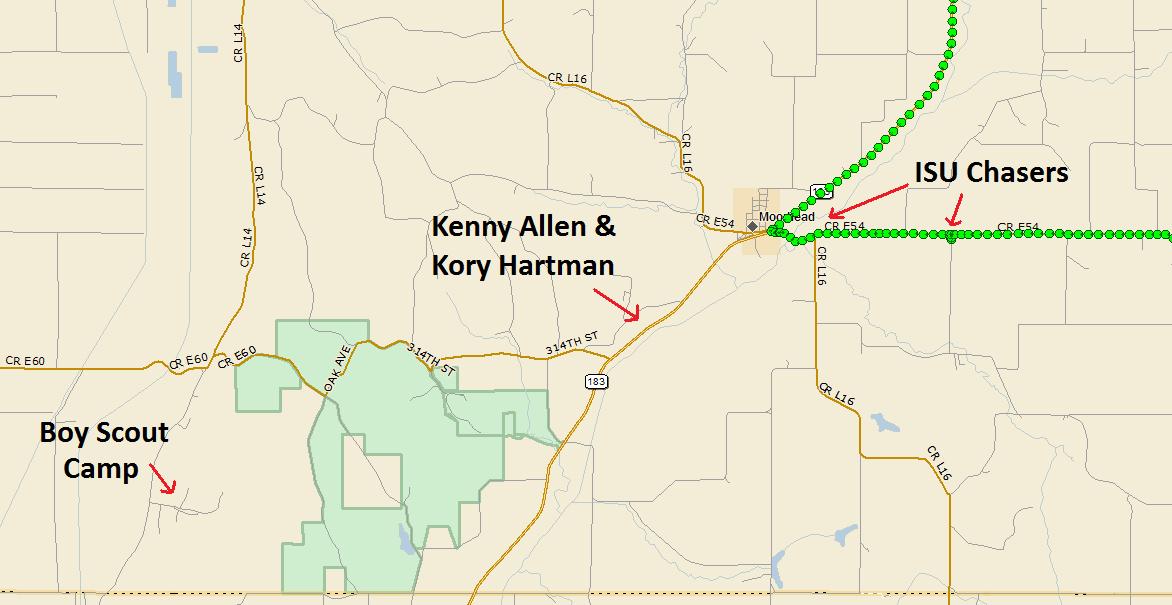
southwest toward Moorhead. We were debating on turning southeast at Soldier, but Flory made the call to continue southwest - which ended up being a good decision.
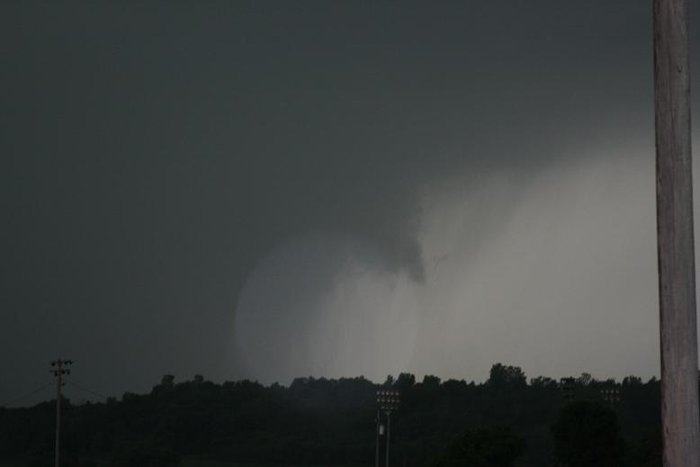
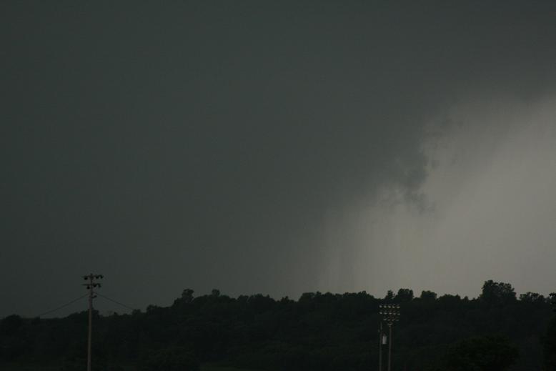
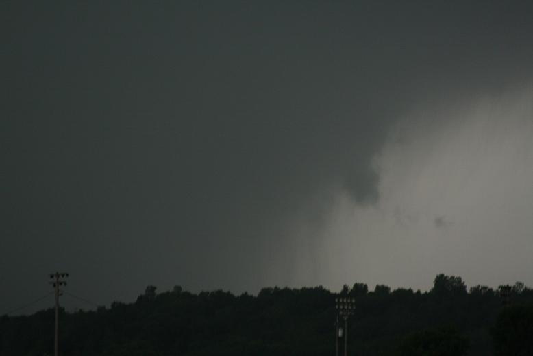
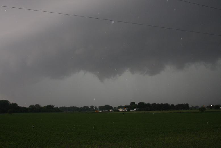
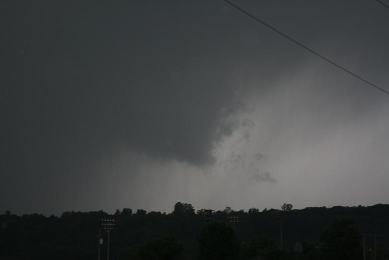
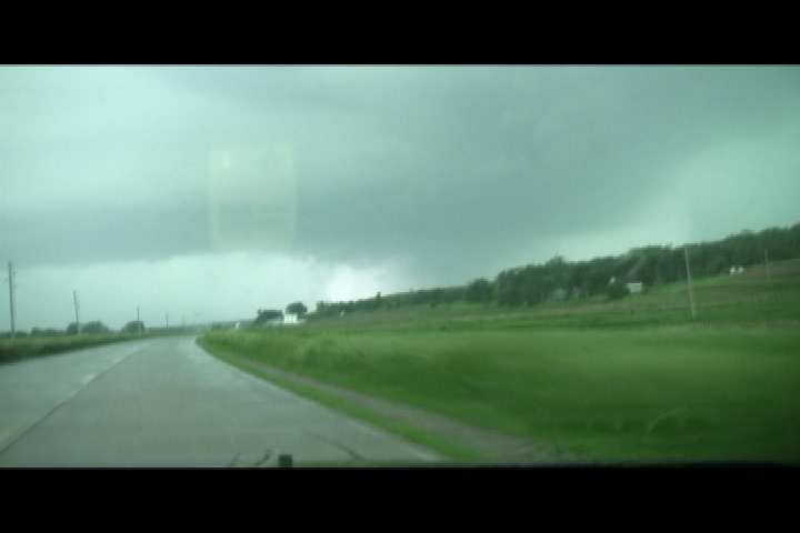
We arrived at Moorhead at 6:45pm. We noticed a nice couplet on radar heading in our general direction. The video below show us pulling into town, and after turning east
and pulling over, I got out and snapped a few photos (below). This was near the time when the tornado was going through the boy scout camp near Little Sioux (~10 miles
away). We believe the tornado was wrapped in rain, thus we were unable to see it.
After a quick look, we retreated east toward Dunlap. At this time the OAX radar went down, and we thought it was a problem with our cellular internet. We went without
seeing a radar image for nearly 50 minutes. During this time saw several emergency responders heading to the west (likely in response to the boy scout camp) and were
hearing reports over the radio that tornadoes were occuring in Omaha. By the time we got a radar image we were near the town of Avoca again, on I-80. We noted that the
convection had indeed turned linear, with a few embedded supercells. Of particular interest was a cell southwest of Omaha. So rather than throwing in the towel, we
decided to make one last play on this storm, with a possible intercept near Treynor or Henderson.
After leaving Oakland, we began experiencing internet connectivity issues again. Thus when it came time to make a decision to go west on Hwy 92 toward Treynor, or continue
south toward Henderson, we had no data to make the decision. We continued south, which ended up being a bad decision once we got the internet back up. So we turned the
cars around and went back to Hwy 92 and proceeded west of Carson a few miles. By the time we arrived, the storm we were trying to intercept had fallen apart, but was
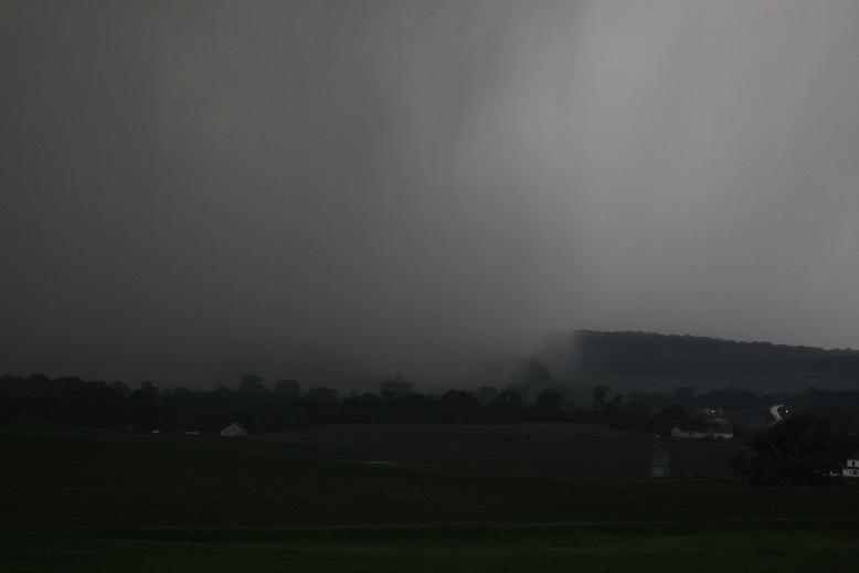
redeveloping to the south. So we continued south on M16 toward Henderson. We observed a nice mesocyclone, though it was getting very dark, and likely drove underneath
this feature. After turning east and traveling a few miles, the storm fell apart and the chase was officially over.
No tornadoes were observed, likely due to being rainwrapped, but I still had a lot of fun.
|