 |
 |
 |
 |
 |
 |
 |
 |
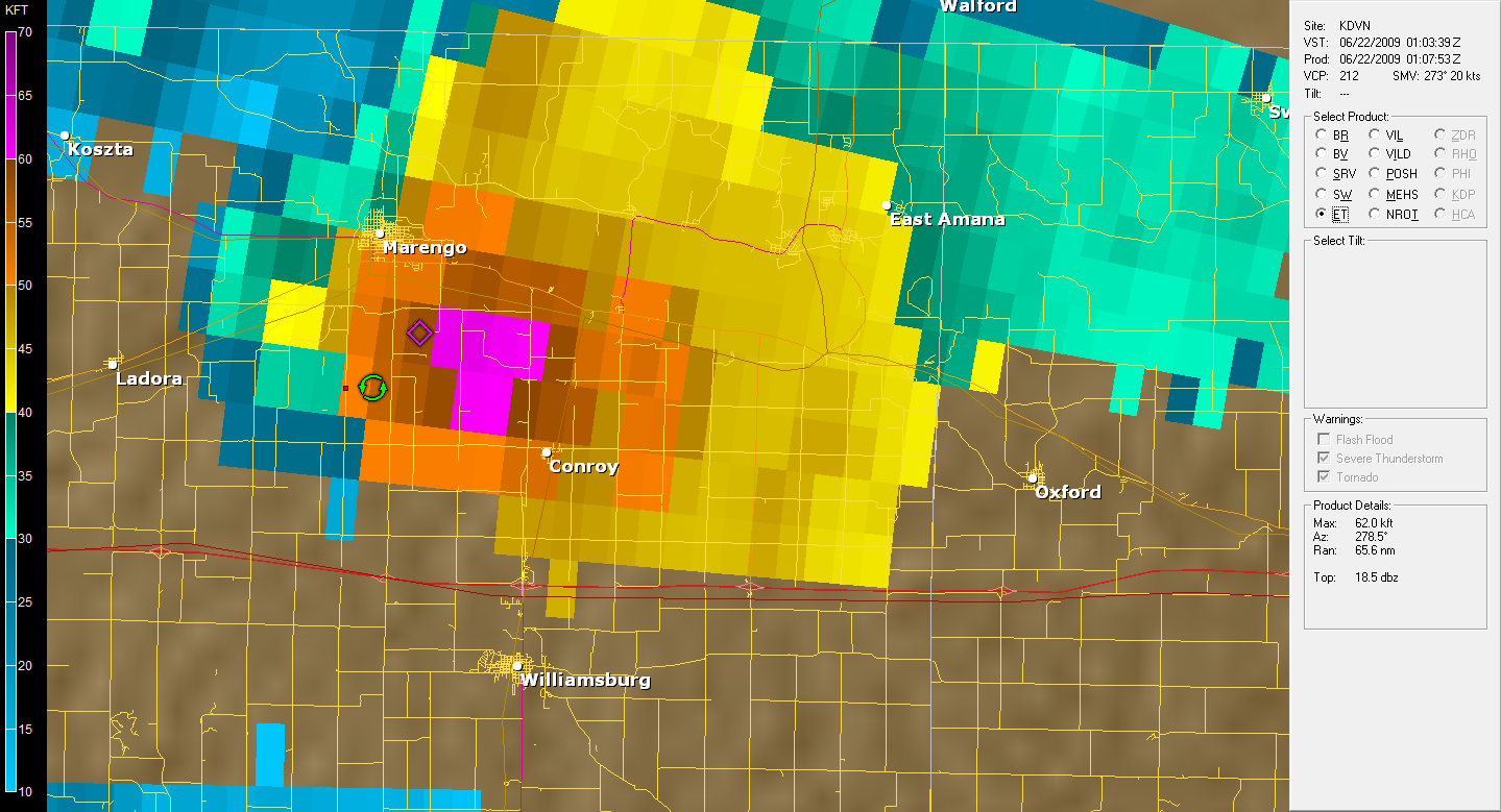 |
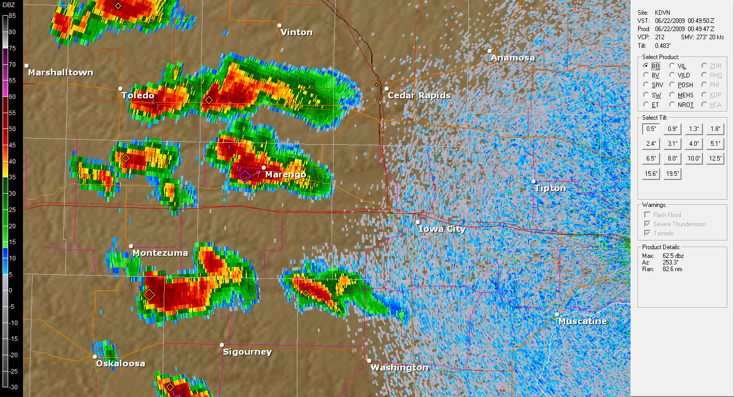
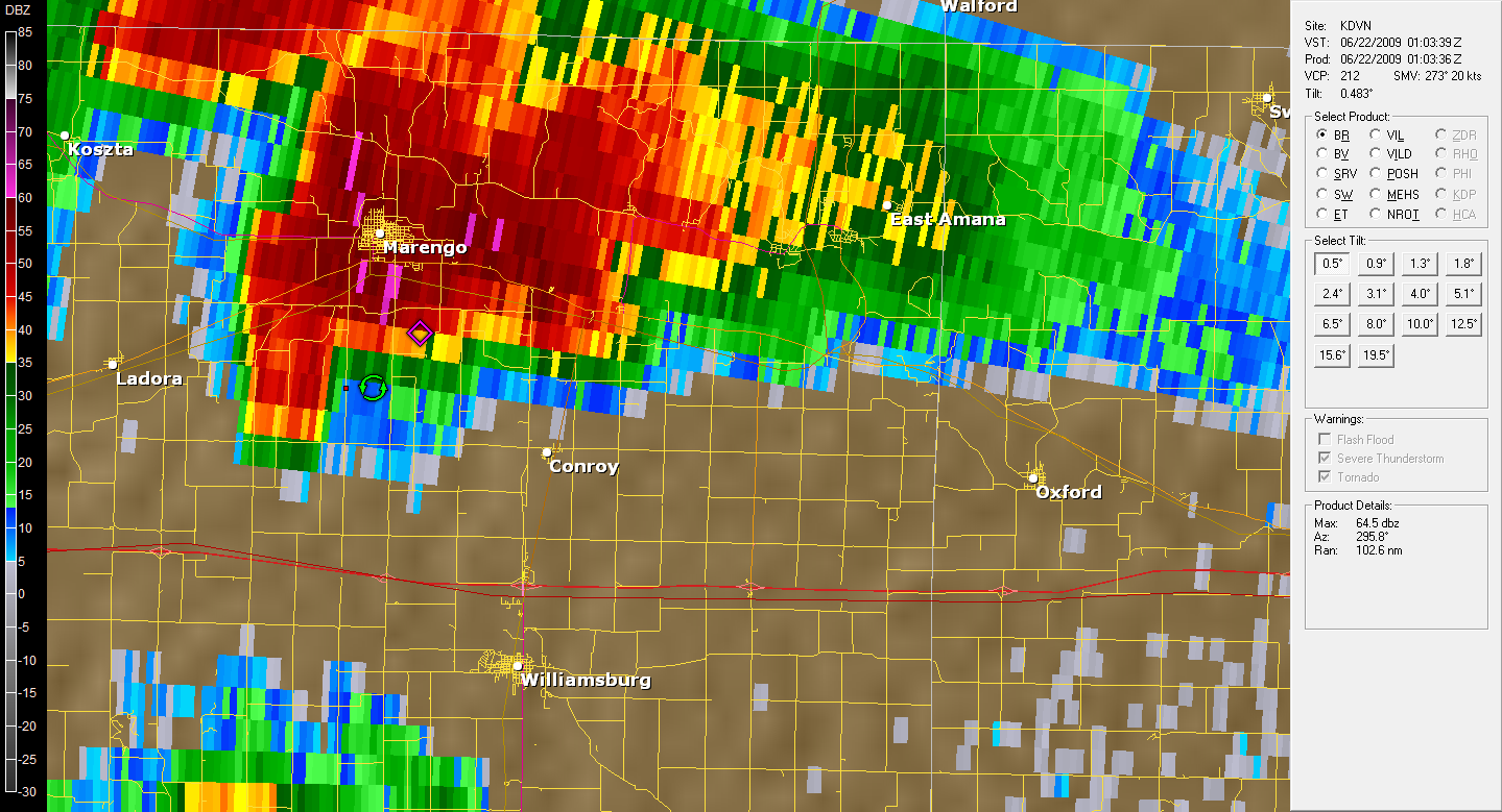
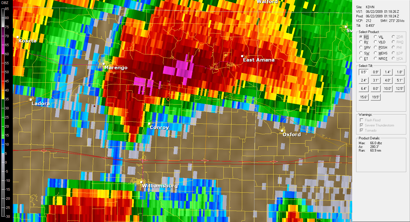
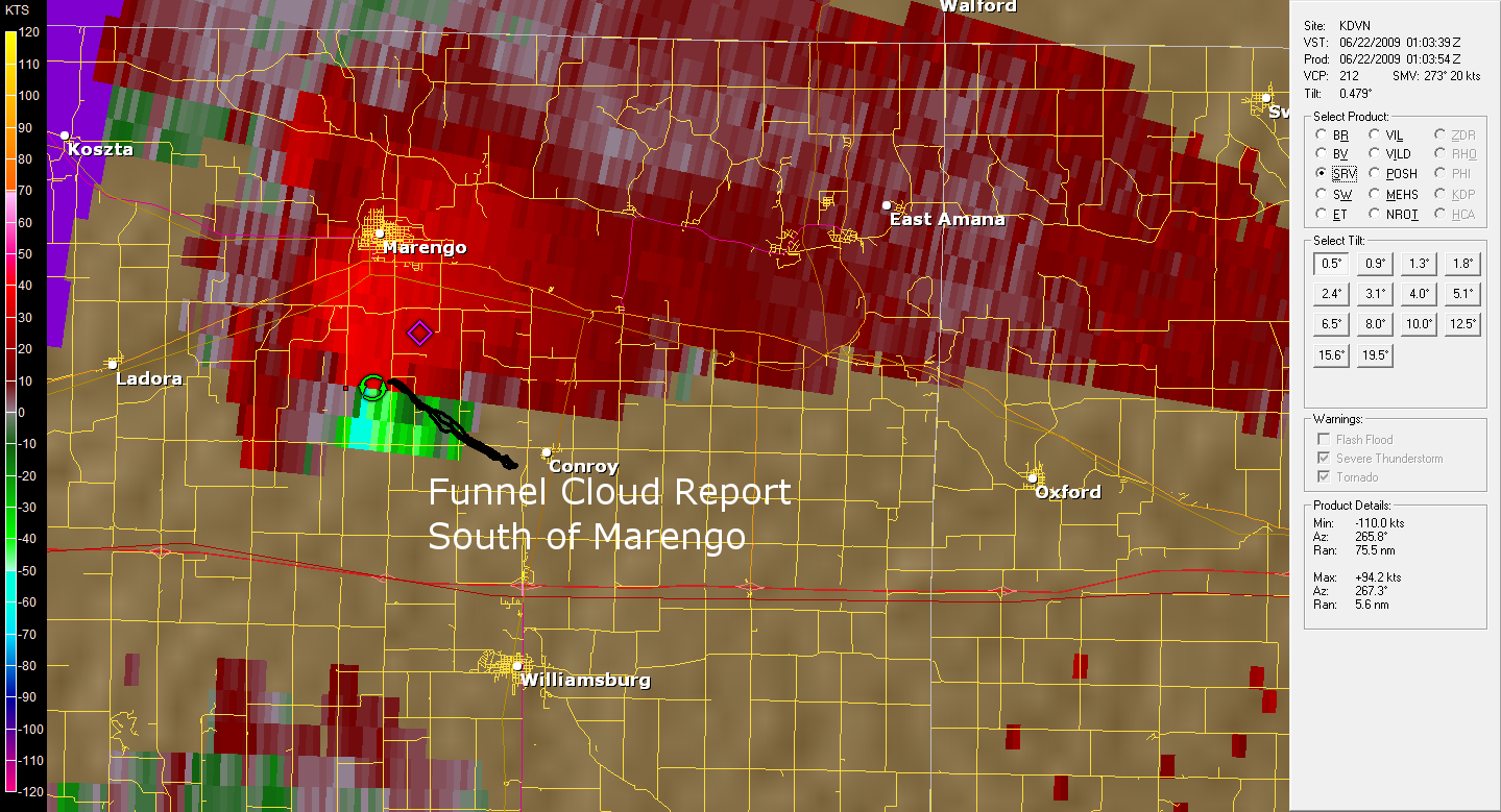
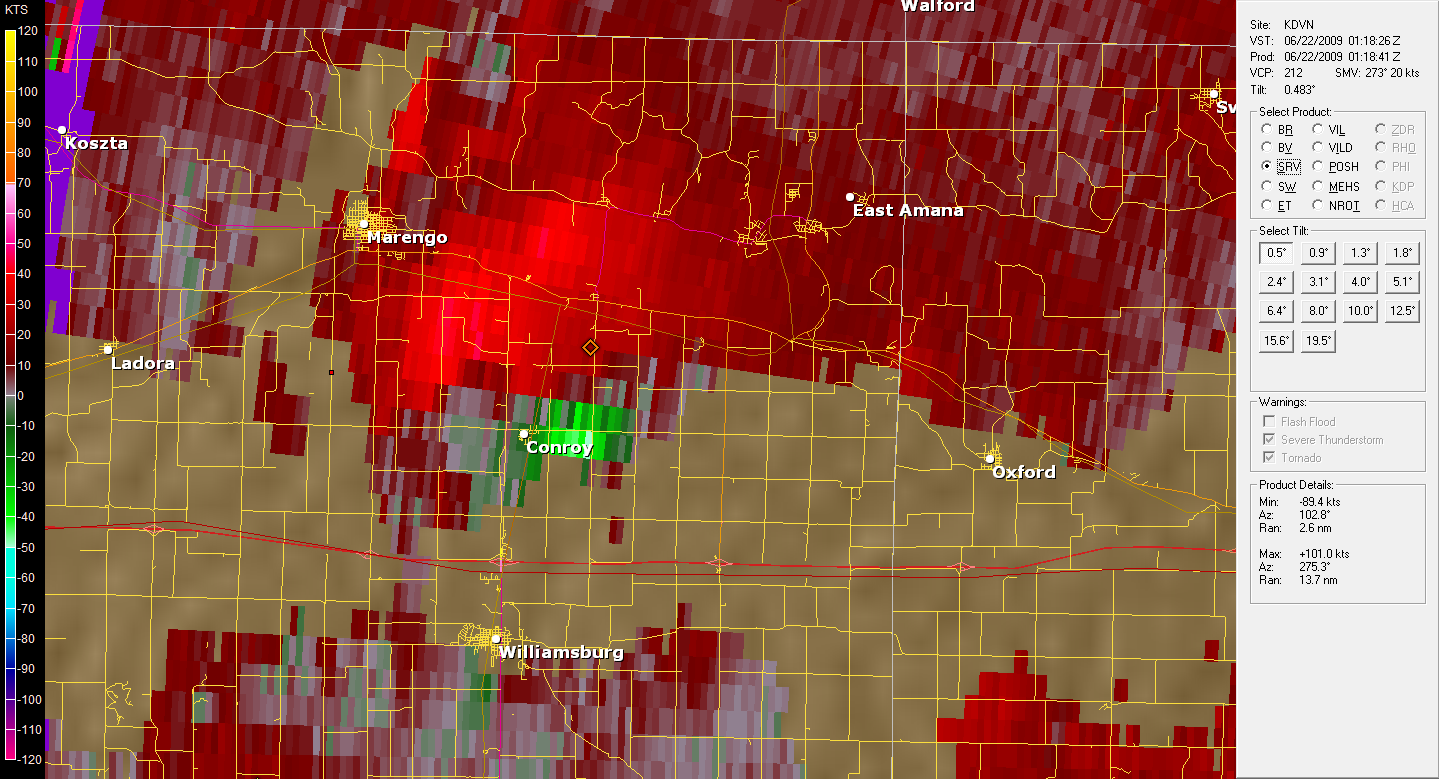
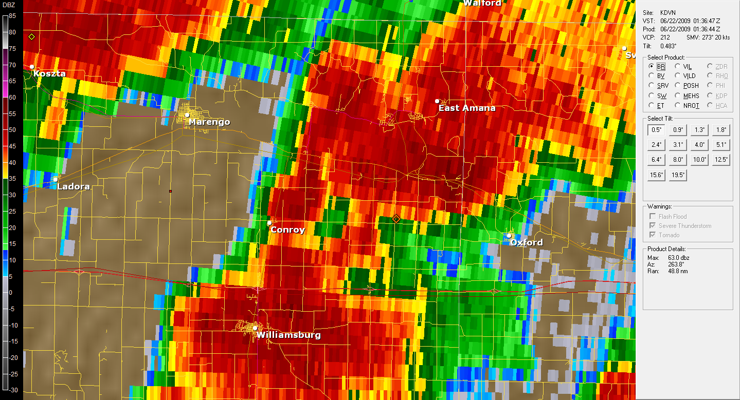
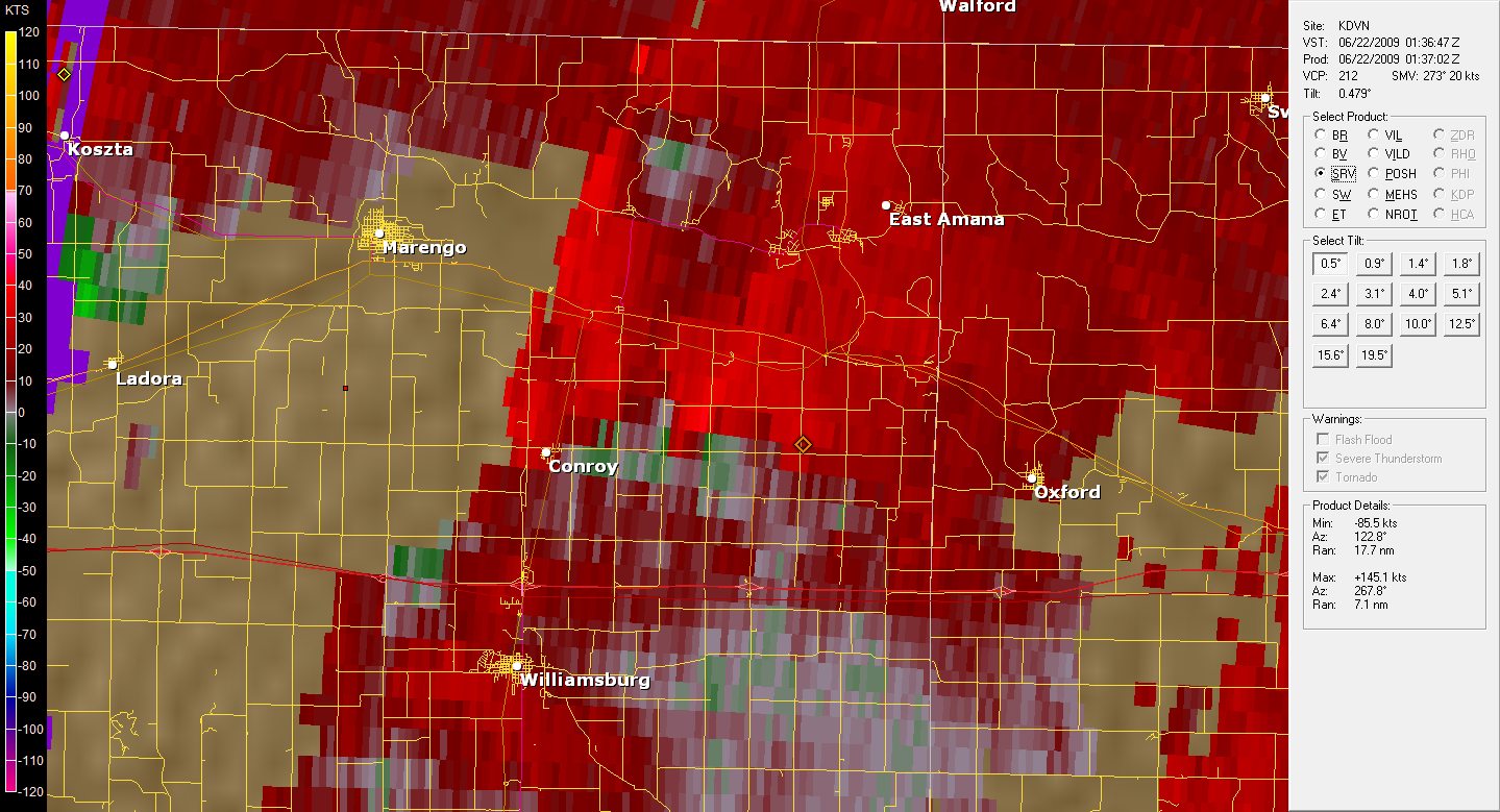
Some thoughts: This storm was one of the strongest of the day with echo tops breaking the 60,000ft barrier. The storm up near Waterloo that produced a very weak tornado only had storm tops around 50,000ft. This storm really began to organize as it neared Marengo where a nice area of rotation begin to form which is when funnel cloud reports began to come in. Reflectivity also begins to show a nice hook forming as the meso begins to wrap the rain around. As it passed Oxford it began to merge with the storm to the south which killed the rotation and the storm began to disorganize. Of all the storms I have chased thus far, the rotation in this storm has been the most pronounced. Hail was also reported up in Marengo which radar verifies well with 60+ dBZ values going over the town. If the storm to our south had not merged with this supercell it most likely would have kept it's rotation.
General Route
Ended up intercepting the supercell as it was dying. We found a hill just SW of Oxford, IA and watched a lowering that seemed to be rotating. No funnels were observed. The lowering seemed to disorganize quickly as the merger began. We left around 9 pm due to low light and obvious storm weakening.