 |
 |
 |
 |
 |
 |
 |
 |
 |
 |
 |
 |
 |
 |
 |
 |
 |
 |
|
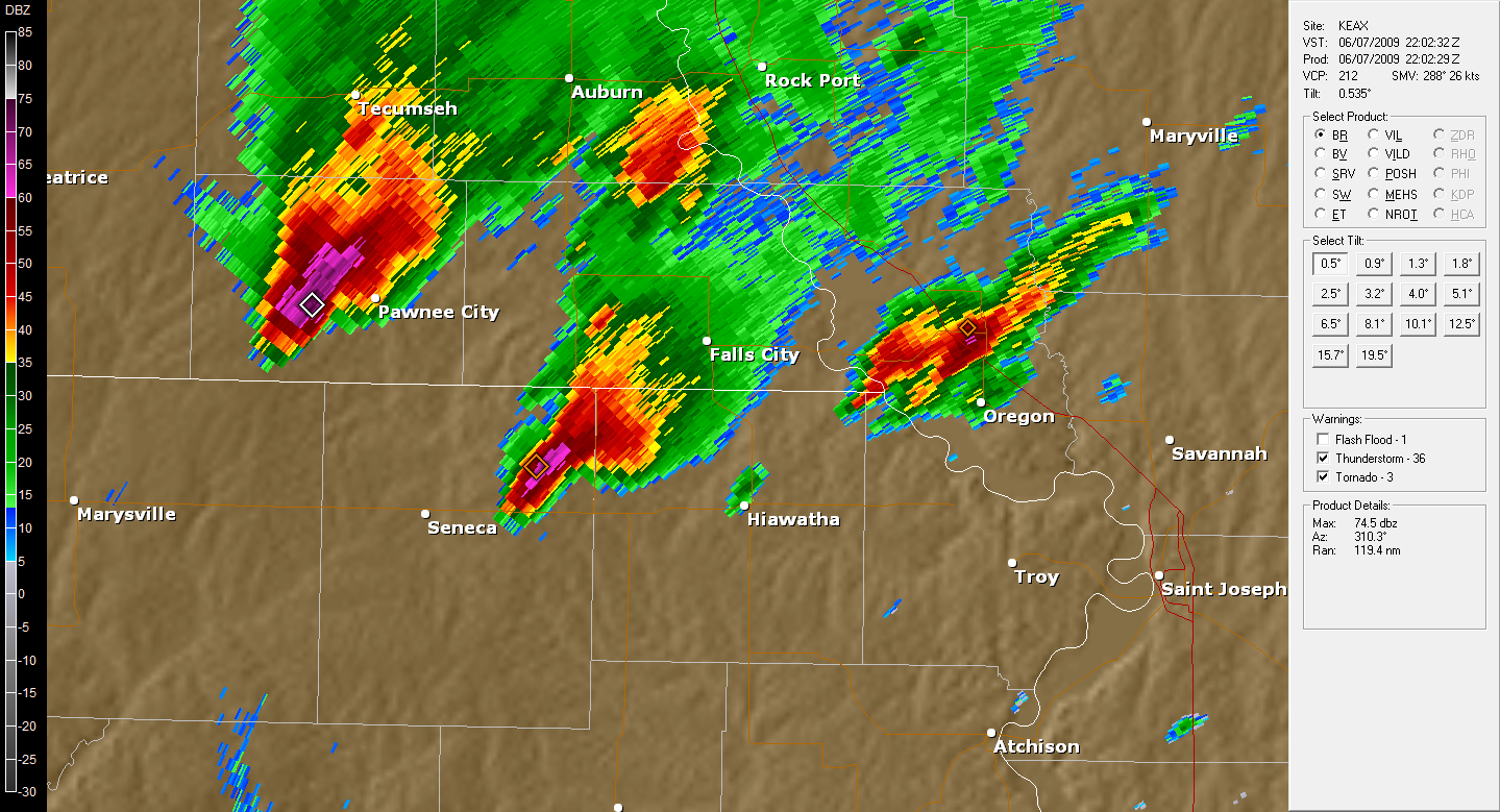
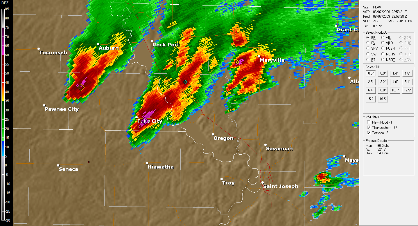
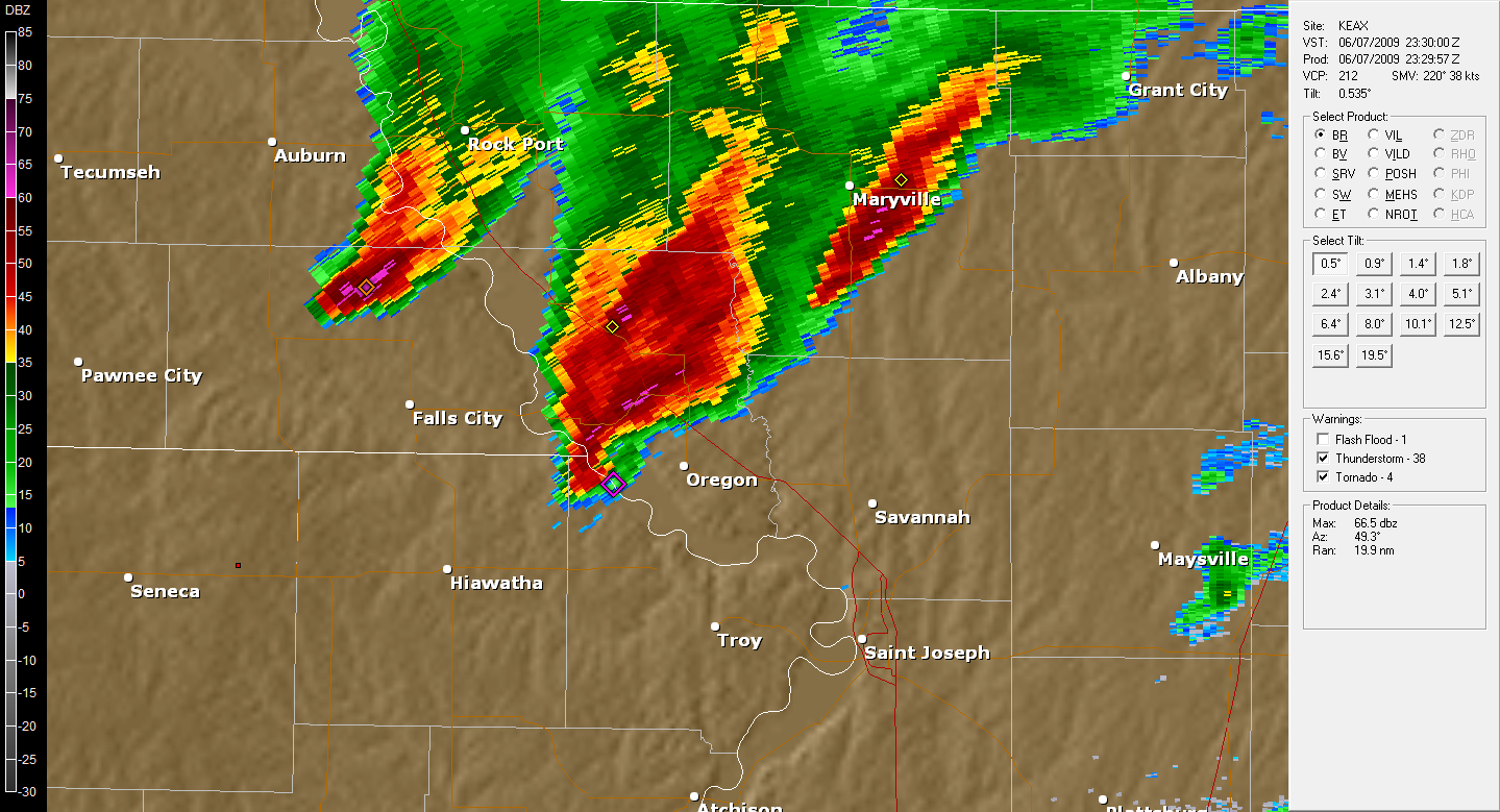
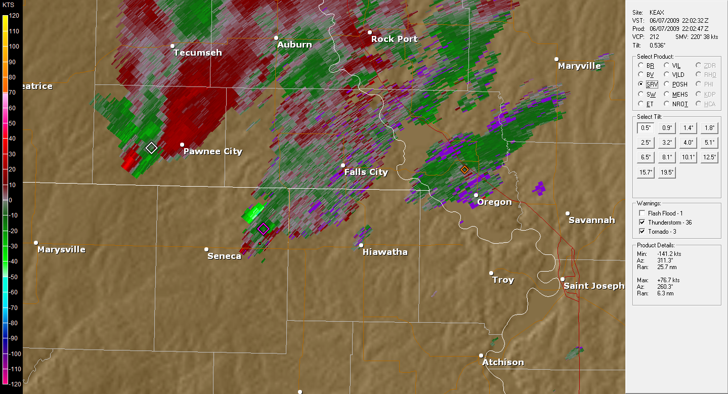
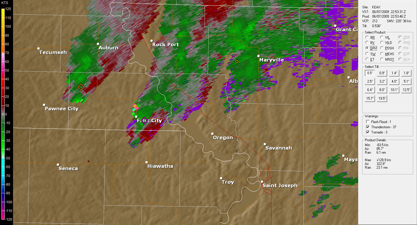
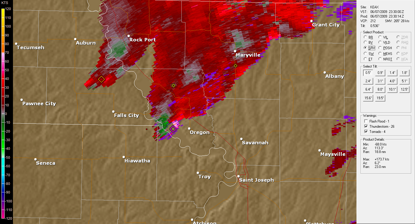
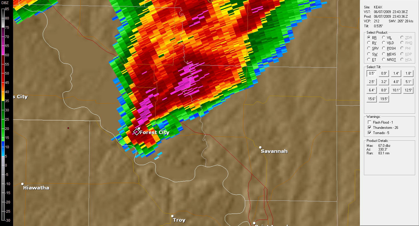
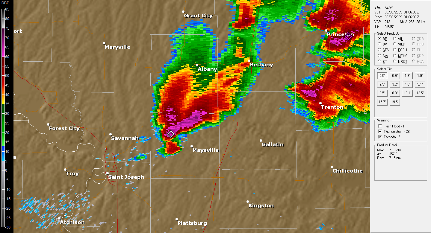
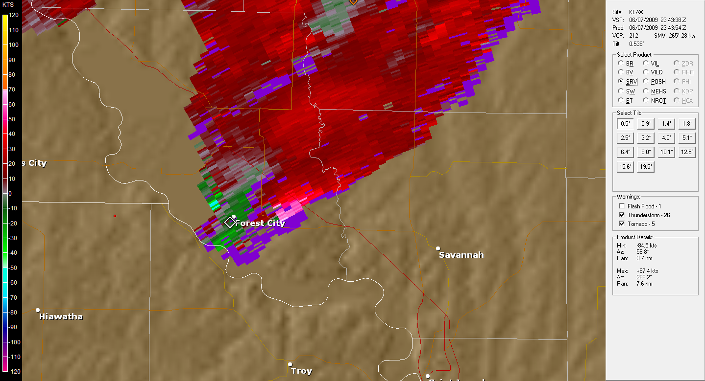
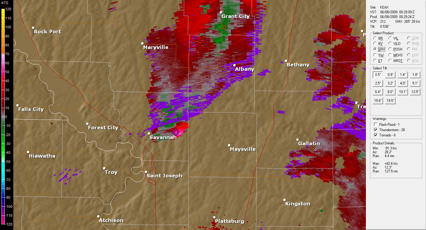
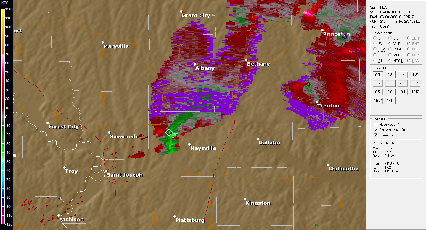
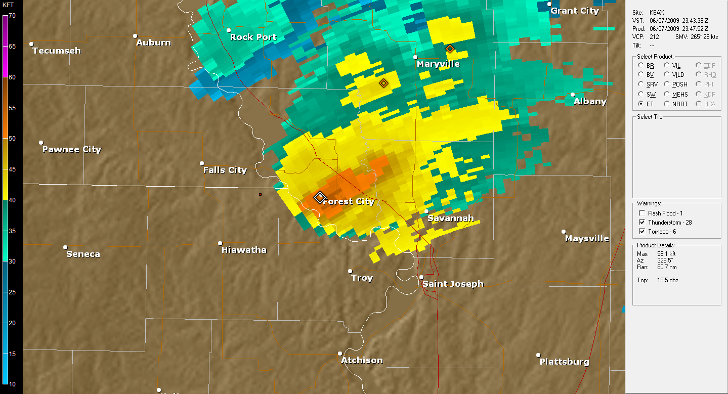
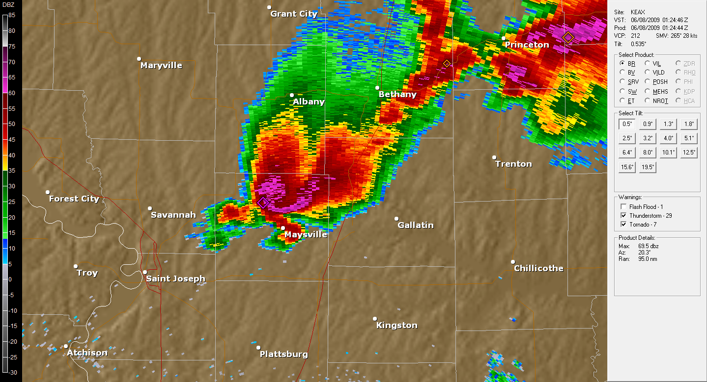
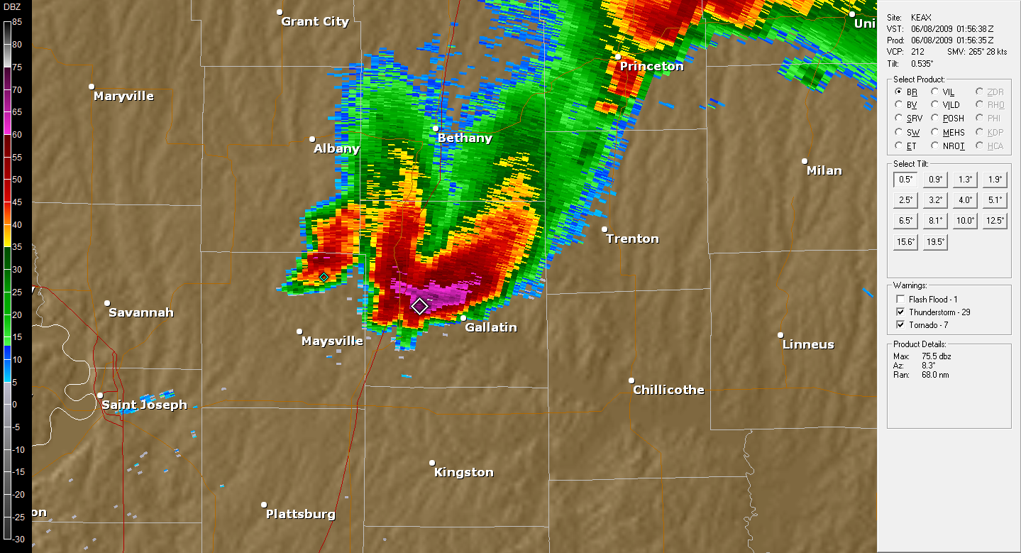
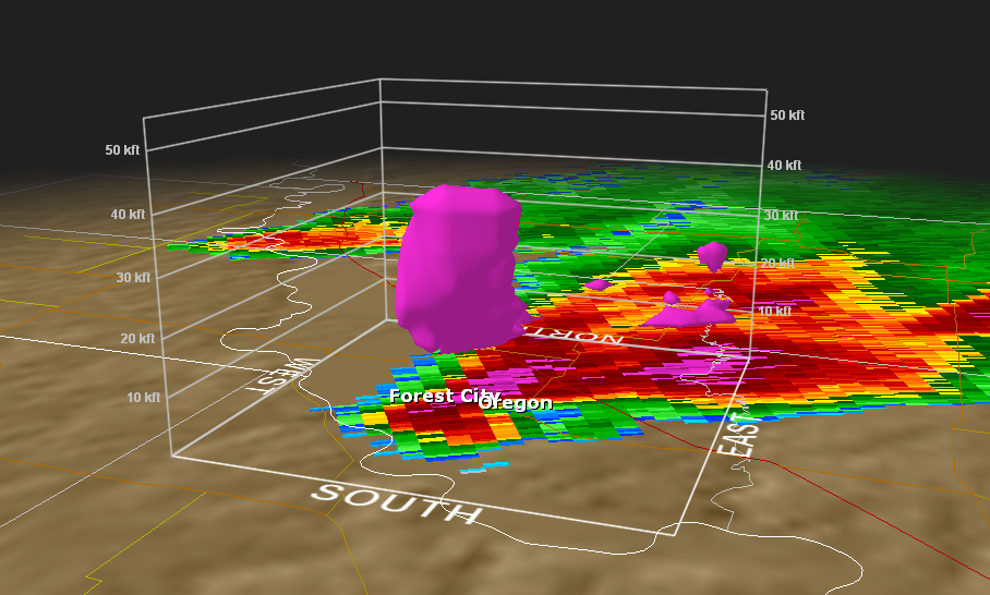
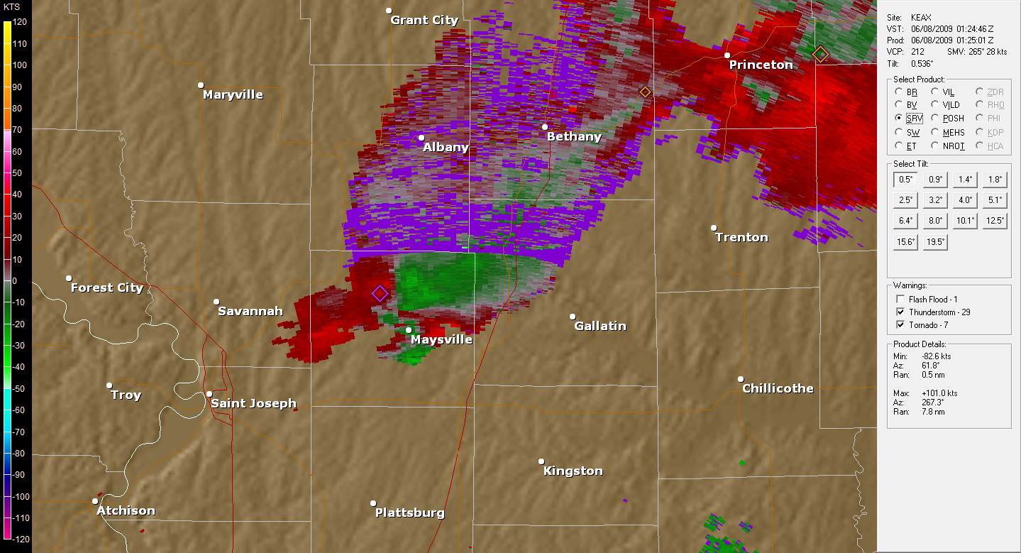
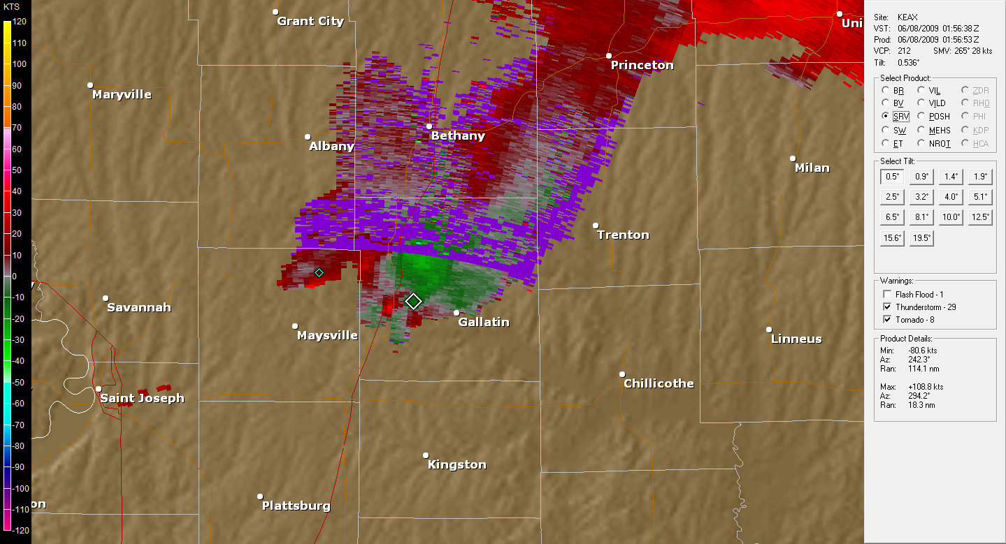
Some thoughts: From looking at reflectivity you would of thought this storm should of dropped a strong tornado with its large hook and screaming eagle appearance. The level 2 data really shows on storm relative velocity that no real strong couplet formed with this storm. The base velocity images shows very poor organized winds at the .5 degree tilt angle. Looking at other tilts shows that a mesocyclone was present it just was not all that strong which is really quite suprising considering how hard this storm right turned along with the large hook. The storm literally goes from a NE heading to a ESE heading as it approached the Missiouri border, an extreme right turn that caused many chasers to get caught in hail which right as it right turned the large hail numbers came on radar. The bottom left image shows that 65+ dBZ Hail Core extending up to near 40,000 ft which is incredible. This was around the time 4" hail was reported. Again the radar really confirms that the updraft was extremely powerful but low level winds were just not good for tornado development. |
Mesoscale Analysis, RUC @0z
 |
 |
 |
 |
 |
.png) |
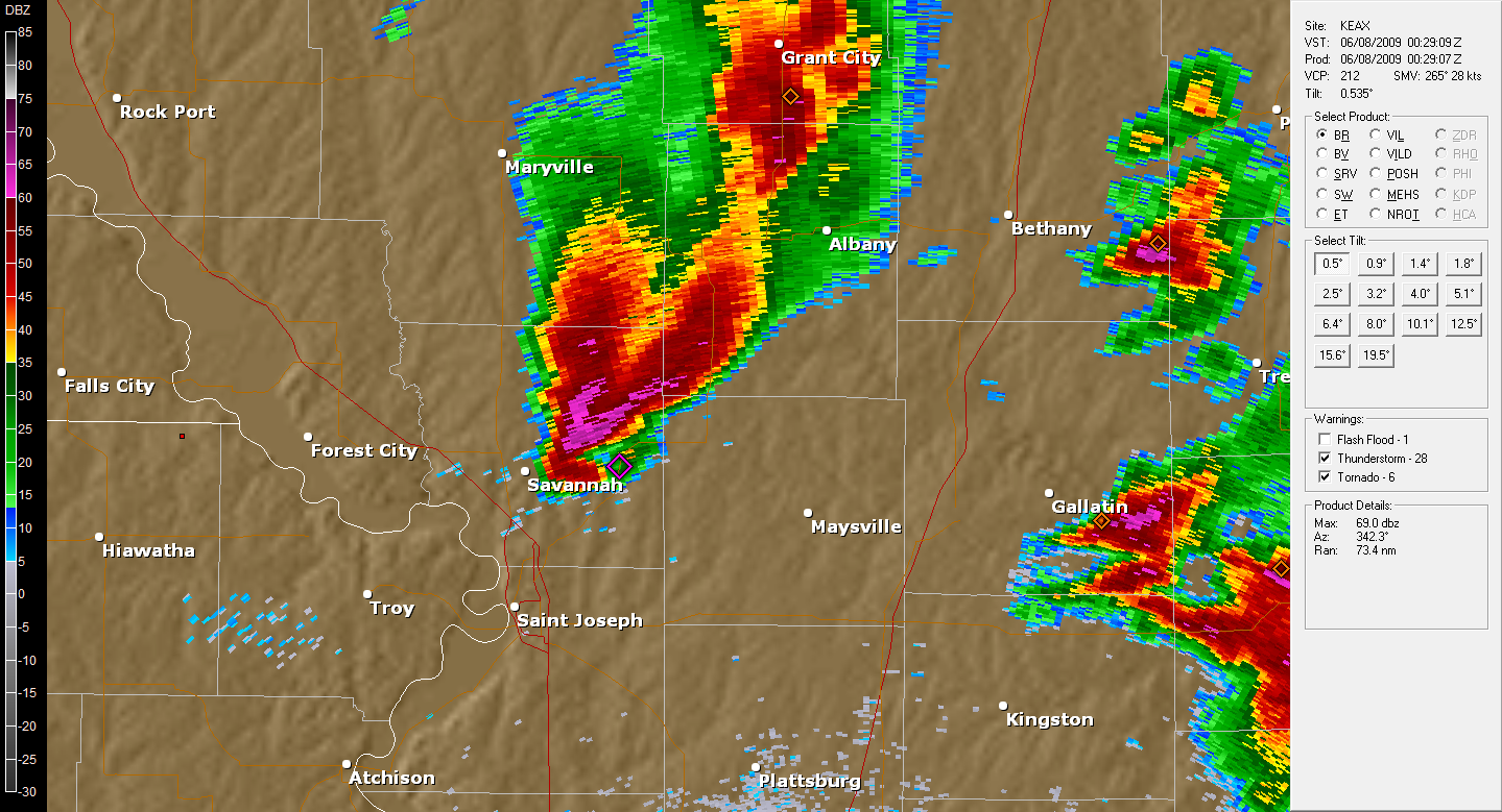
Some thoughts: This storm developed on the southern edge of where the cap was eroded enough for development where also instability was the greatest. Originally two supercells were present, the other was up north in Nebraska which our group did not jump on. That storm died out eventually leaving our storm which stayed strong until past 1z. The big question is why did this storm not produce a tornado? Well according to some there was not enough low level acceleration to help concentrate the main rotation in the storm to the ground. After looking at some RUC model charts one can see that this in fact looks to be true. 0-1km lapse rates show lowered accelerations as you move into NW Missiouri which will yield a slower updraft near the surface. Also effective storm relative helecity numbers are noticibely cut off just north of Kansas City where the storm passed. 0-3km CAPE is also very low in that area which again is a good measure of low level accelerations. It would be false to say that the updraft was weak because of the amazing hail that this storm produced. Overall amounts of CAPE are quite strong in that area so it is no suprise with an intense rotating updraft large hail was produced. Another thing to note is that LCL heights were rather high around 1400 meters. |
Hail Reports From NWS
| Time (UTC) | Size (inches) | Location | County | State | Lat | Lon | Comments |
| 2240 | 1.00 | DREXEL | CASS | MO | 38.48 | -94.61 | (EAX) |
| 2245 | 1.00 | LAKE LOTAWANA | JACKSON | MO | 38.93 | -94.26 | (EAX) |
| 2258 | 0.88 | DREXEL | CASS | MO | 38.48 | -94.61 | (EAX) |
| 2308 | 1.00 | 4 W HARRISONVILLE | CASS | MO | 38.66 | -94.42 | (EAX) |
| 2314 | 1.00 | 6 S BATES CITY | LAFAYETTE | MO | 38.92 | -94.07 | (EAX) |
| 2317 | 1.00 | OAK GROVE | JACKSON | MO | 39 | -94.13 | (EAX) |
| 2325 | 2.75 | MOUND CITY | HOLT | MO | 40.14 | -95.23 | (EAX) |
| 2330 | 2.00 | BATES CITY | LAFAYETTE | MO | 39.01 | -94.07 | (EAX) |
| 2331 | 2.75 | FOREST CITY | HOLT | MO | 39.98 | -95.19 | (EAX) |
| 2348 | 4.25 | OREGON | HOLT | MO | 39.98 | -95.14 | (EAX) |
| 2354 | 0.75 | RICHMOND | RAY | MO | 39.28 | -93.97 | (EAX) |
Hail Pics from other Chasers
 |
 |
|
Some thoughts: These reports are very scary considering the two largest reports of 4.25" and 2.75" both were towns I drove through. The hail must of started just minutes after we went through the town. Other chasers were not as fortunate as us and now have broken wind shields. We did run into hail but it was very intermittent and between pea and golf ball size causing no damage to my car |
Pictures
 |
 |
| Large Rotating Cloud Base | Towering Cumulus on SW part of Storm |
 |
 |
| Met up with group North of Hiawatha,KS | Doppler on Wheels slowing us down |
 |
 |
| SW Cloud Base, Rain Wrapping Around | Sun setting through rain shaft |
 |
 |
| Rotating Cloud Base, all cars are chasers! Looking over Maysville, MO | Tail Cloud, downdraft on right |
 |
 |
| Under broad wall cloud, very close to rotation | Wall Cloud, Striations Indicate Rotation |
 |
 |
| Looking west, Storm Organizing | Our crew unites, Watches Storm |