
|
|
|
|
|
|
|
|
|
|
|
|
|
|
|
|||||||
|
|
|
|
|
|
|
|
|
||
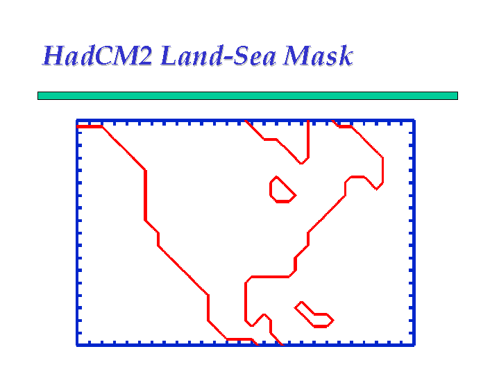 Figure 1 - HadCM2 Land-Sea Mask
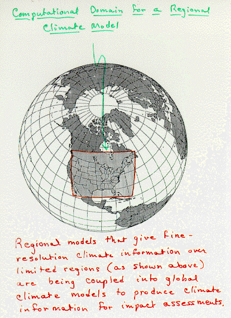 Figure 2 -
Computational domain for a regional climate model. NCAR/TN - 381 +1A. A user's guide to the Penn
State/NCAR mesoscale modelling system.
Figure 2 -
Computational domain for a regional climate model. NCAR/TN - 381 +1A. A user's guide to the Penn
State/NCAR mesoscale modelling system.
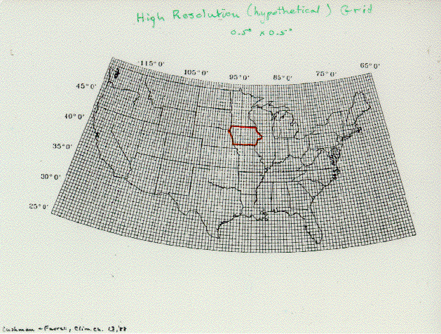 Figure 3 - High resolution (hypothetical) grid. Cushman and Ferres, Climate Change Quarterly, 77
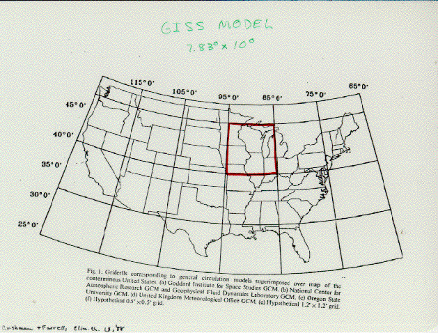 Figure 4 -
Giss model.
Figure 4 -
Giss model.
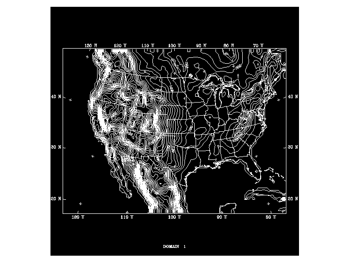 Figure 5 -
 Figure 6 - PIRCS Grid and Domain - CM vs. GCM
 Figure 7 -
Simulation of a
short period (60 days) during the 1988 drought. Adapted from CAC, NWS, NOAA.
Figure 7 -
Simulation of a
short period (60 days) during the 1988 drought. Adapted from CAC, NWS, NOAA.
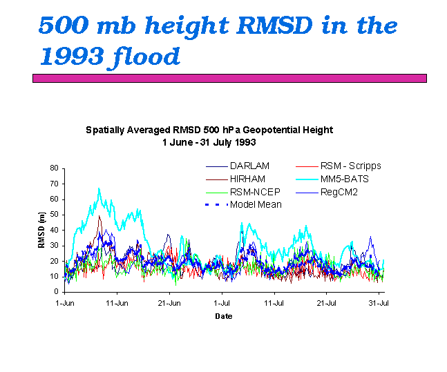 Figure 8 -
500 mb height RMSD in the 1993 flood.
Figure 8 -
500 mb height RMSD in the 1993 flood.
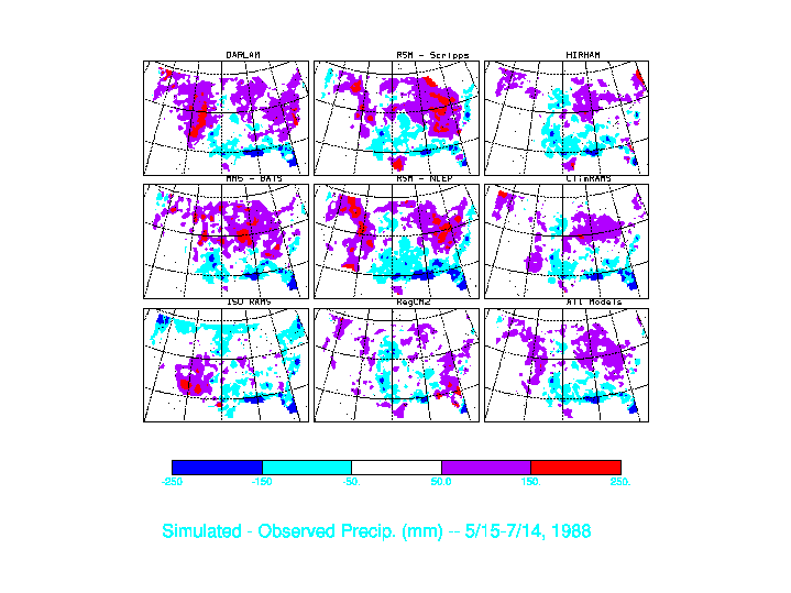 Figure 9 -
500 mb height RMSD in the 1993 flood.
Figure 9 -
500 mb height RMSD in the 1993 flood.
 Figure 10 -
Comparison of PIRCS models with precipitation analysis.
Figure 10 -
Comparison of PIRCS models with precipitation analysis.
 Figure 11 -
Daily maximum temperatures.
Figure 11 -
Daily maximum temperatures.
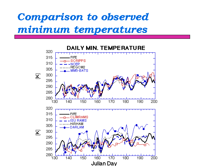 Figure 12 -
Daily minimum temperatures.
Figure 12 -
Daily minimum temperatures.
 Figure 13 -
Mod - Obs Max Temp (K) - 06/01-07/31, 1993
Figure 13 -
Mod - Obs Max Temp (K) - 06/01-07/31, 1993
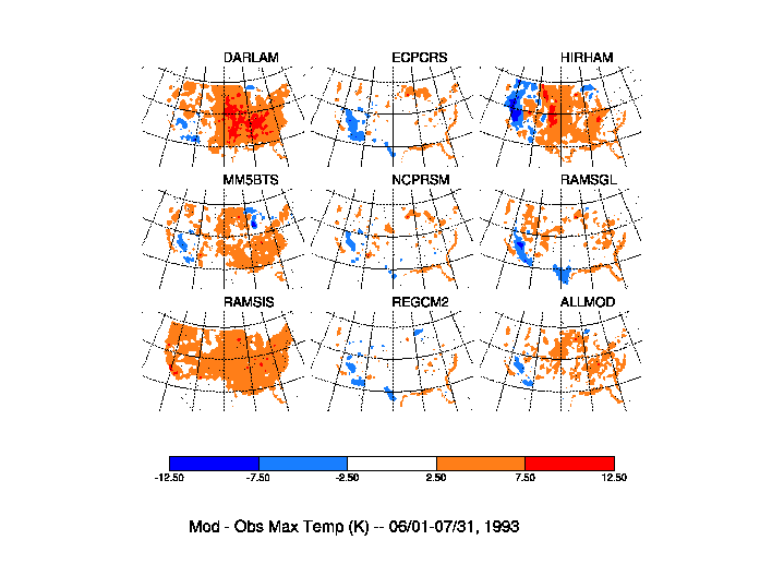 Figure 14 -
Mod - Obs Min Temp (K) - 06/01-07/31, 1993
Figure 14 -
Mod - Obs Min Temp (K) - 06/01-07/31, 1993
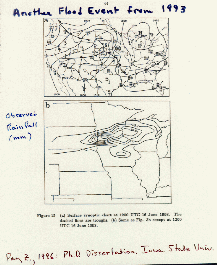
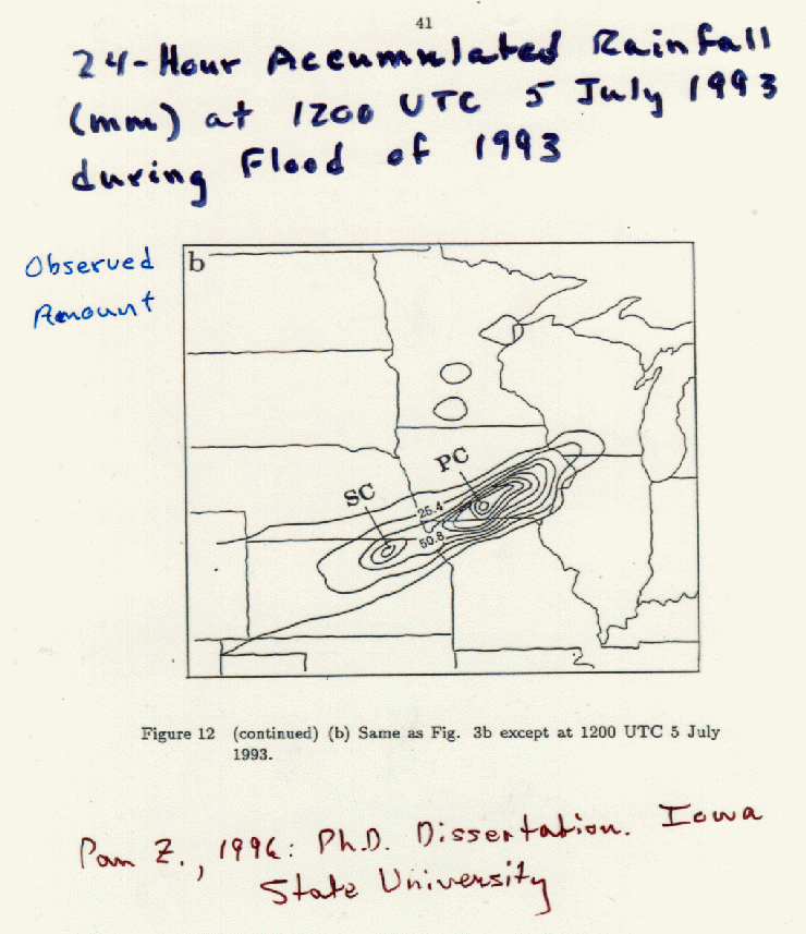 Figure 15 -
Measured accumulated rainfall for the 24-hour period ending 1200 UTC 5 July 1993. Pan, 1996,
PhD dissertation, Iowa State University.
Figure 15 -
Measured accumulated rainfall for the 24-hour period ending 1200 UTC 5 July 1993. Pan, 1996,
PhD dissertation, Iowa State University.
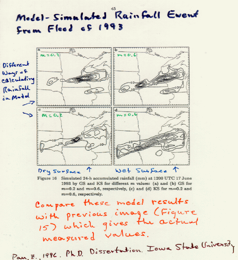
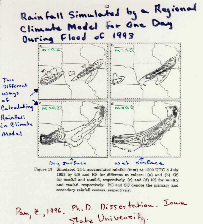 Figure 16 -
Model results using two different options for representing rainfall processes. Pan, 1996,
PhD dissertation, Iowa State University.
Figure 16 -
Model results using two different options for representing rainfall processes. Pan, 1996,
PhD dissertation, Iowa State University.
 Figure 17 -
Simulation of a rainfall event by a regional climate model. Pan, 1996,
PhD dissertation, Iowa State University.
Figure 17 -
Simulation of a rainfall event by a regional climate model. Pan, 1996,
PhD dissertation, Iowa State University.
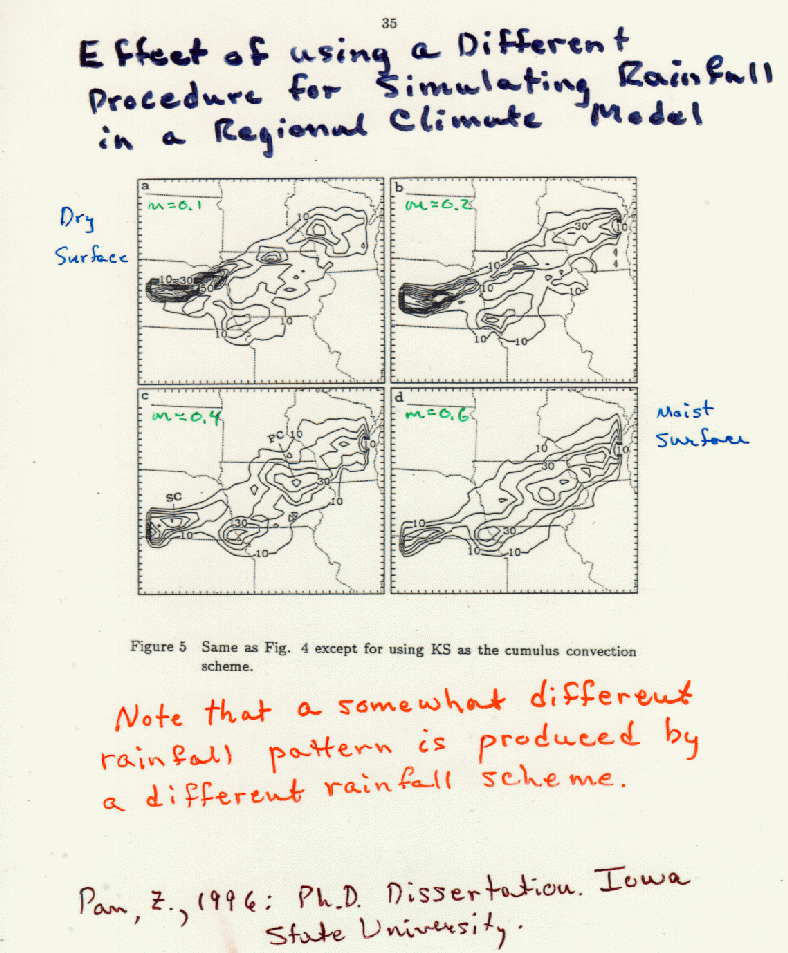
 Figure 18 -
Effect of surface moisture on rainfall as simulated by a regional climate model. Pan, 1996,
PhD dissertation, Iowa State University.
Figure 18 -
Effect of surface moisture on rainfall as simulated by a regional climate model. Pan, 1996,
PhD dissertation, Iowa State University.
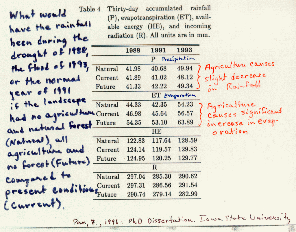 Figure 19 -
Meteorlogical conditions during 1988 drought, 1993 floods, and 1991 normal year. Pan, 1996,
PhD dissertation, Iowa State University.
Figure 19 -
Meteorlogical conditions during 1988 drought, 1993 floods, and 1991 normal year. Pan, 1996,
PhD dissertation, Iowa State University.
Related Class Images
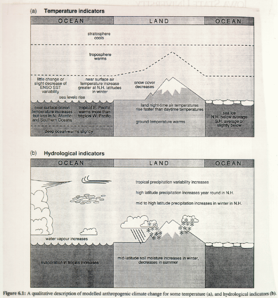 Qualitative description of modeled anthropogenic climate change for some temperature and hydrological indicators.
Climate Change 1995. The Science of Climate Change, Figure 6.1.
Qualitative description of modeled anthropogenic climate change for some temperature and hydrological indicators.
Climate Change 1995. The Science of Climate Change, Figure 6.1.
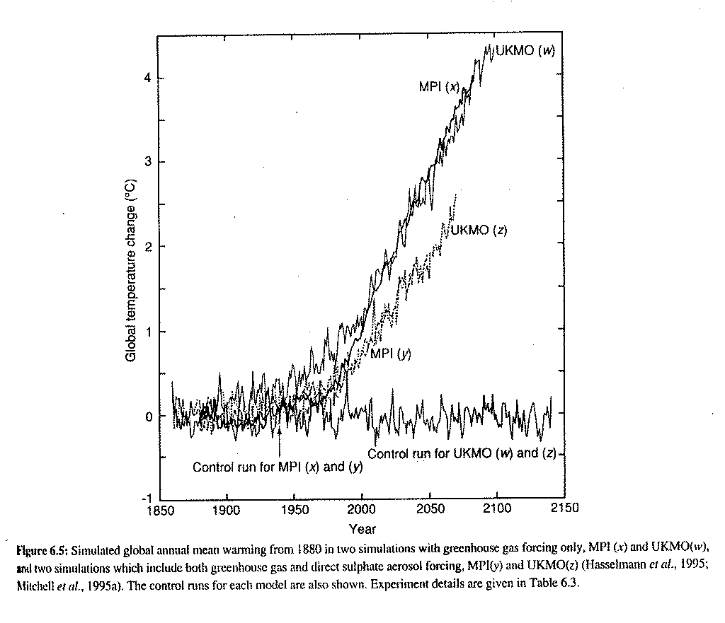 Simulated global annual mean warming from 1880 in two simulations with greenhouse
gas forcing only and two simulations which include both greenhouse gas and direct sulphate aerosol forcing.
Simulated global annual mean warming from 1880 in two simulations with greenhouse
gas forcing only and two simulations which include both greenhouse gas and direct sulphate aerosol forcing.
Climate Change 1995. The Science of Climate Change, Figure 6.5.
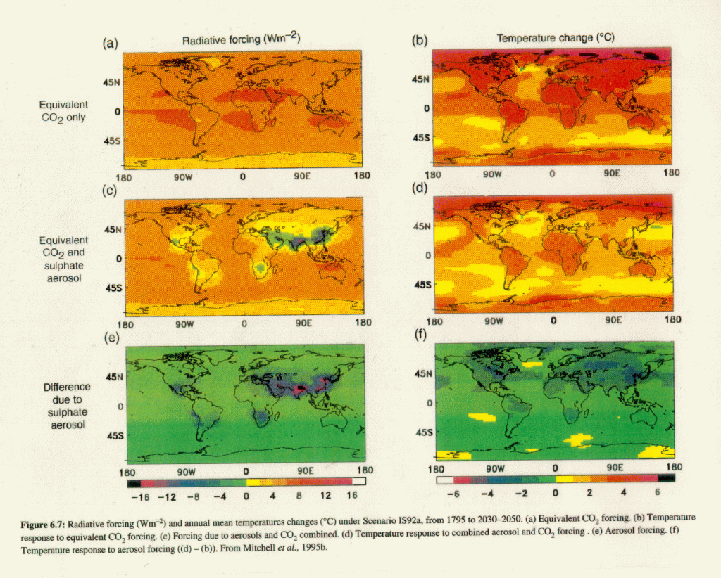 Radiative forcing (Wm-2)and annual mean temperature changes (0C)
under Scenario IS92a from 1795 to 2030-2050.
Radiative forcing (Wm-2)and annual mean temperature changes (0C)
under Scenario IS92a from 1795 to 2030-2050.
Climate Change 1995. The Science of Climate Change, Figure 6.7.
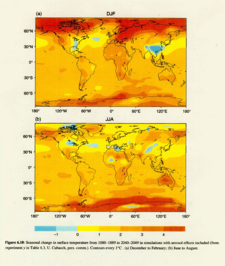 Seasonal change in surface temperature from 1880-1889 to 2040-2049 in simulations with
aerosol effects included.
Climate Change 1995. The Science of Climate Change, Figure 6.10.
Seasonal change in surface temperature from 1880-1889 to 2040-2049 in simulations with
aerosol effects included.
Climate Change 1995. The Science of Climate Change, Figure 6.10.
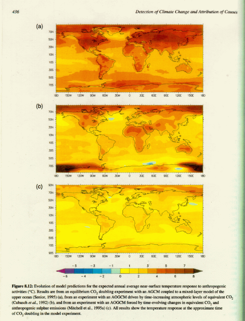 Evolution of model predictions for the expected annual average near-surface temperature
response to anthropogenic activities (0C).
Climate Change 1995. The Science of Climate Change, Figure 8.12.
Evolution of model predictions for the expected annual average near-surface temperature
response to anthropogenic activities (0C).
Climate Change 1995. The Science of Climate Change, Figure 8.12.
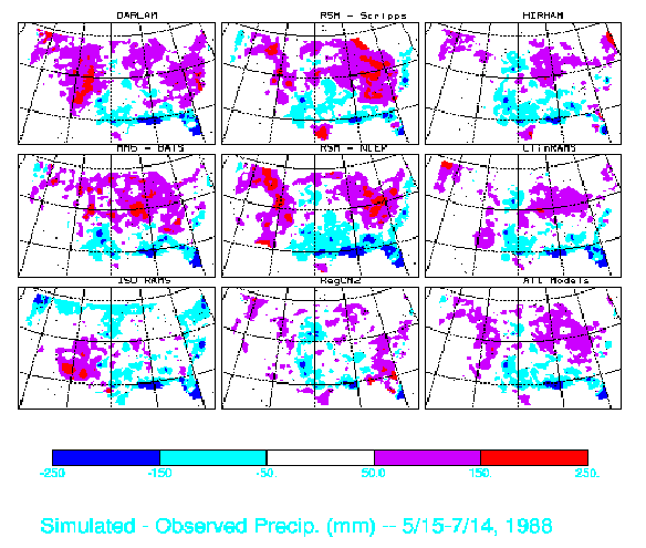 Simulated - Observed Precip (mm) - 5/15-7/14, 1988
Back to Unit Page