
|
|
|
|
|
|
|
|
|
|
|
|
|
|
|
|||||||
|
|
|
|
|
|
|
|
|
||
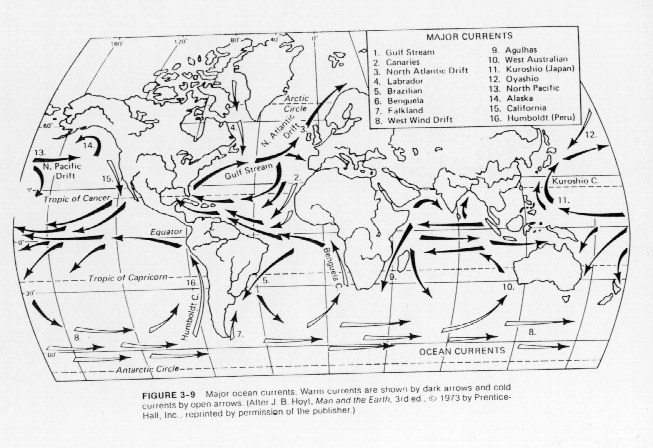
Coastal Currents and Land Mass Interactions
Figure 1 of this unit showed the existence of strong
ocean currents along coastlines of continents. The interaction of the
coastal currents with the land mass leads to important characteristics of
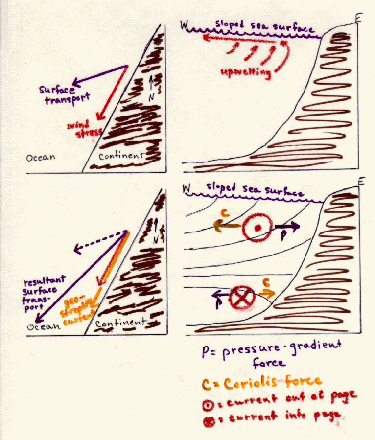
the temperature and biological activity in these regions. Figure 11 shows coastal flow in the Northern Hemisphere with a wind generally
from north to south parallel to the west coast of a continent. The
Coriolis force provides a force to the right of the wind and tends to
transport surface water away from the continent. This lowers sea level
slightly near the continent and draws colder water from deeper levels leading to
what we call upwelling. The sloped ocean surface also establishes a force
directed toward the continent. Flow resulting from this force also is
deflected to the right (in the Northern Hemisphere) further intensifying
the southward coastal flow along the continent. A wind from the south on
the east coast of a continent in the Northern Hemisphere will have the same
effect.
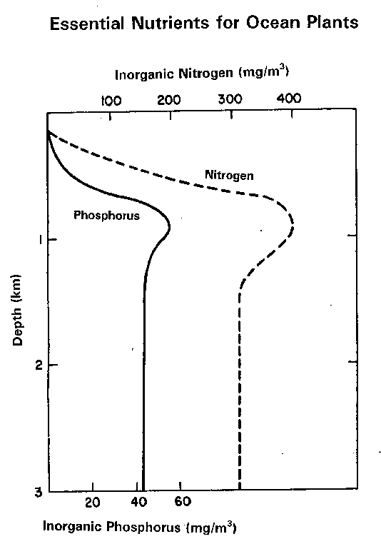
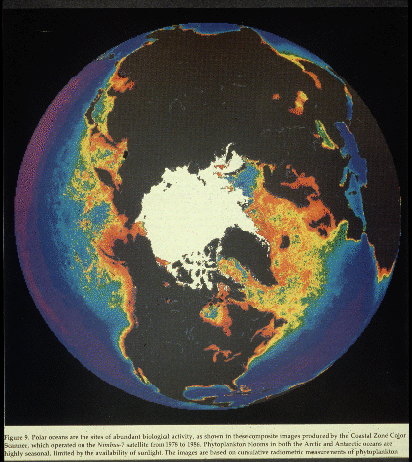
Upwelling along continental coastlines brings colder, nutrient-rich waters (Figure 12) from deeper layers into the euphotic zone and promotes rich biological activity (Figure 13) as previously shown in satellite pictures of the Northern Hemisphere (Figure 14) and Southern Hemisphere (Figure 15). A close-up of the California coast shows the abundance of phytoplankton off the coast of Northern California (Figure 16).
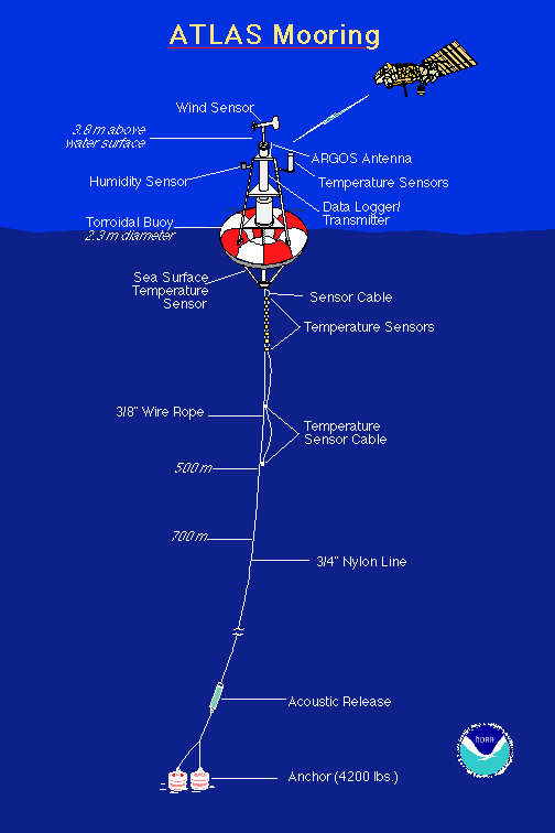
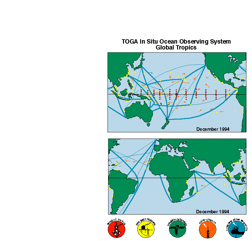
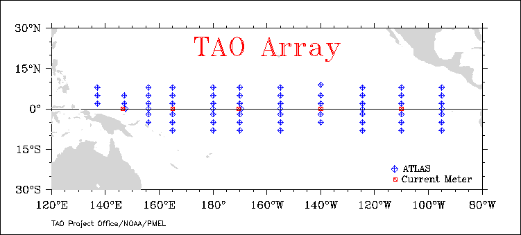
Measurements of meteorological and oceanographic data at remote locations in the ocean are made with moored buoys such as the Atlas system (Figure 17). During the Tropical Atmosphere/Global Ocean (TOGA) experiment a network of such moored buoys was deployed (Figure 18). The Pacific array presently provides real-time measurements of sea-surface temperatures (Figure 19). These will be of considerable interest when we begin discussing El Nino. A variety of surface and subsurface ocean data can be accessed online. Data from an oceanographic research ship presently in the TOA array also can be accessed in real-time.
Satellites provide complete mapping of sea surface temperatures in real-time as is shown on this map of sea surface temperatures of today.