
|
|
|
|
|
|
|
|
|
|
|
|
|
|
|
|||||||
|
|
|
|
|
|
|
|
|
||
Estimates and Risks of Change
Estimates have been made of how the warming as projected by climate models
will change the mass balance lines for the Greenland and Antarctic ice
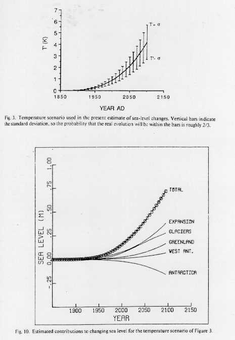
sheets of previous graphs. Figure 16 shows temperature scenarios from
climate models and the resulting changes in sea level due to thermal
expansion of the oceans, melting of mountain glaciers, melting on
Greenland, increased calving of the West Antarctic ice sheet, and the
change in the mass balance of the rest of the Antarctic continent. Note
that the increased accumulation by Antarctica due to global warming will
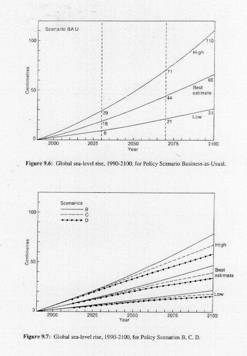
suppress sea-level rise. More recent calculations of sea level rise for different
policy scenarios (discussed in precious lectures) are shown in Figure 17.
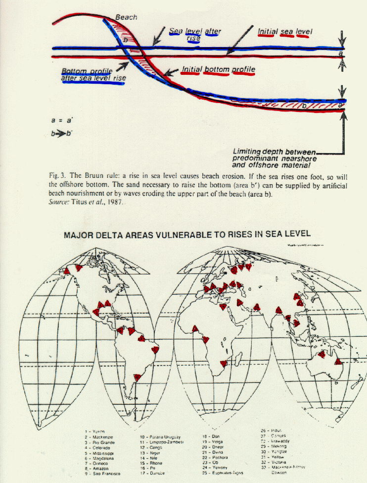
Figure 18 gives a sketch of how beach erosion proceeds under rising sea levels. Also given here is a map of major river delta areas of the world that are at risk to flooding under sea-level rise. Historically, locations where navigable rivers (i.e., ones entering from flat continental areas) entered major oceans were prime areas for the development of cities. These cities, now some of the major cities of the world, are home to millions of people that potentially could be at risk under rising sea levels due to global warming.
NOAA has a website giving the latest data on sea-level changes.
The US Global Change Research
Program has issued a comprehensive review of the impact of climate
change on coastal areas and marine resources.