May 25, 2008 chase account
This was a rather frustrating chase day despite the tragedy that unfolded in Parkersburg. I headed out
with my girlfriend (now fiancee) Megan towards Atlantic, IA, since a focused chase target was difficult to pin down.
SPC had two moderate risk areas: one in KS/NE and one in far NE IA/SW WI/SE MN. I met up with some Iowa State friends near
Atlantic. We decided to head northward waiting for initiation to take place somewhere. About the time we
reached Carroll on Highway 71, a PDS tornado watch was issued for almost the entire state! Since we were on the
far western edge of the watch box, we decided to head east.
Immediately after we left Carroll, heading east on Highway 30, we witnessed a rather massive agitated CU
go up just to our northeast. The thing looked like a beast! Unfortunately, shortly after going up, it came
right back down. Capped? I wasn't sure, but the longer we headed east, the more we started to realize
initiation was not going to occur anywhere in western Iowa.
As we continued to head east-northeast in the general direction of Waterloo, storms finally fired near Webster
City and began moving northeast. After a fuel stop we began heading more northeast, expecting more storms
to fire southwest of the first few along the cold front. None did, and the ones that first fired quickly became
severe, one going tornado warned near Mason City. We got into "hurry-up mode" as we realized we were far behind
where the action was going to be. We made it up to Highway 20 and began traveling at quite great speeds to try
to catch up to the storms.
The EF5 tornado struck Parkersburg at about 5 PM. We had just about gotten to Highway 20 at that time, and
thus were nowhere near that storm when it was ravaging Butler and Black Hawk Counties. Anyway, we raced east,
finally approaching Waterloo after the worst had happened. We continued east on Highway 20 trying to catch what
was left the cell, and we finally did catch up to, and pass it, once we neared Dubuque!
Storm reports showed a tornado touched down near Peosta (official NWS report
here), which was just a few miles from where we stopped and
let the storm overtake us. We never saw it, only a wall of water. The drive home added to the frustration, as
the rest of the line finally lit up, thus forcing us to dodge other tornado and severe warned storms all the way
back to Ames. Note on the reports page that most of the severe reports in central Iowa came well after sunset.
Thus, we saw NOTHING.
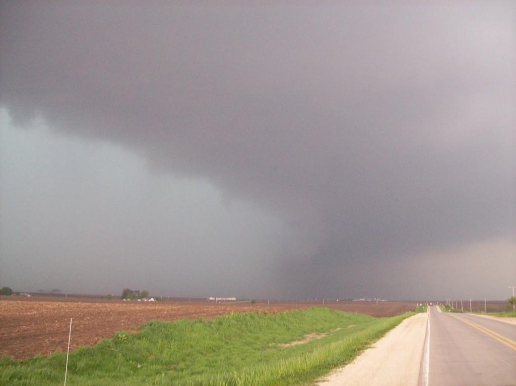
| Downdraft punching out of the back of the storm (possibly an RFD?). Taken looking north from Highway 20. |
 |
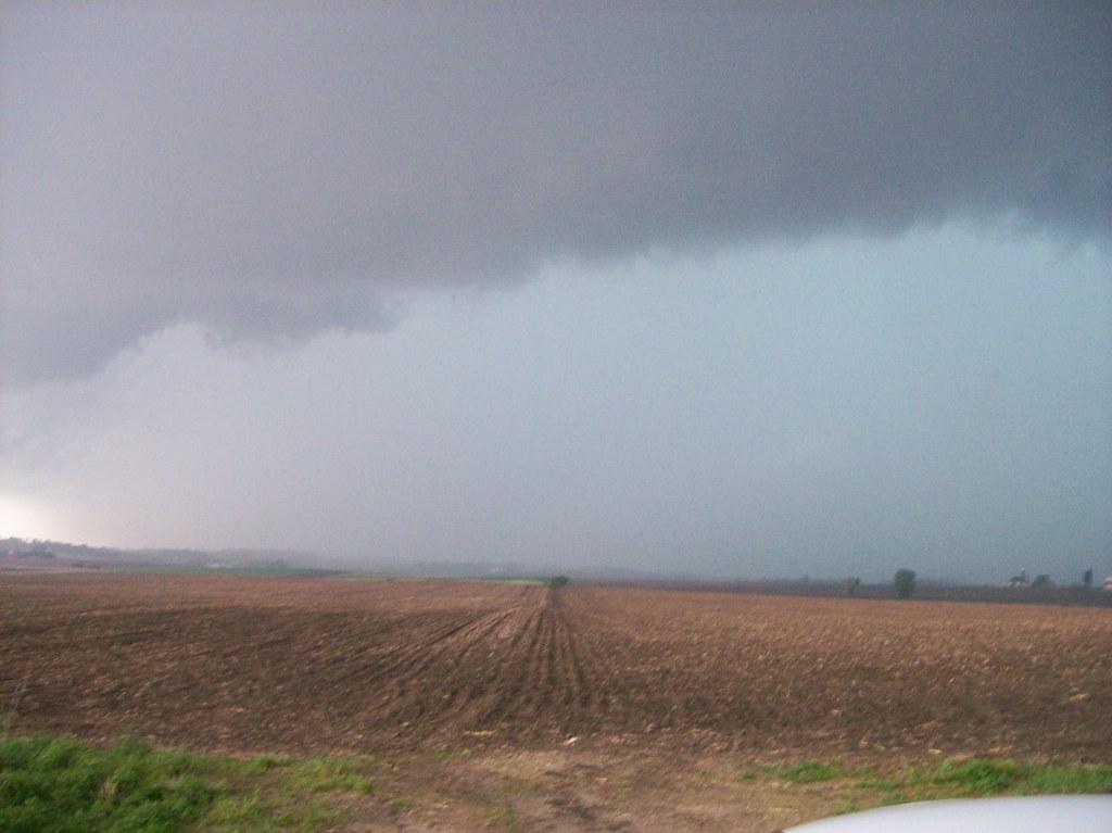
| According to the event summary, a tornado occured about 3 miles up this road a short time after this picture was
taken. Good thing we decided not to go that way, as we had previously discussed jumping north to a parallel east-west road to get
a better look into the storm. I suggested not doing so, as the storm appeared to be moving pretty fast and I didn't
think we'd have much time to mess around up there. |
 |
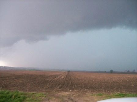
| All we really saw coming at us: a wall of water. |
 |
Return to 2008 - chasing home page