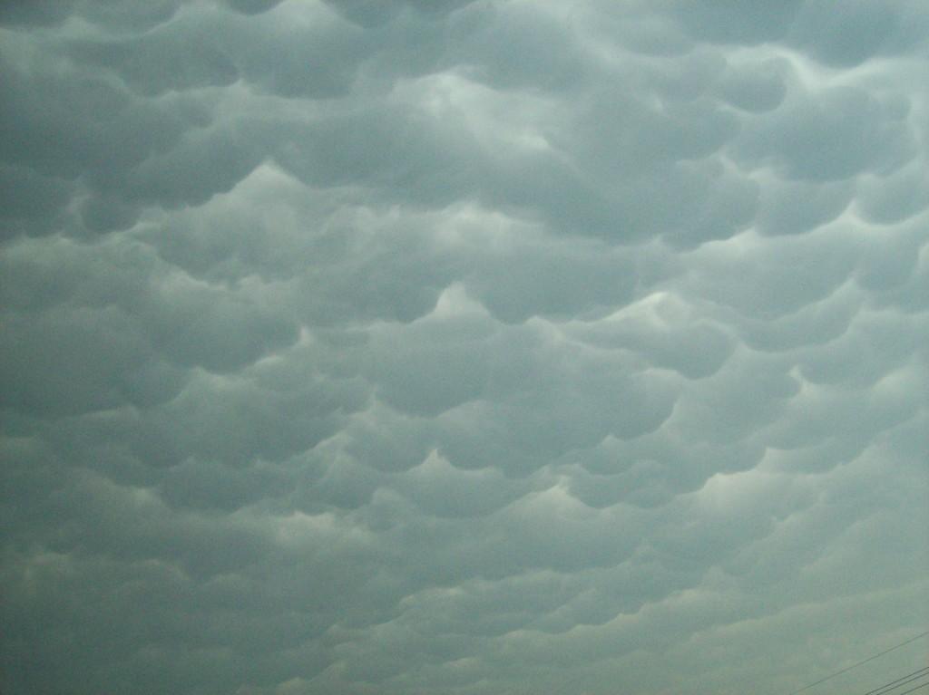
Mammatus under the anvil of the approaching supercell in Grand Island. We could see the anvil of the storm when we were well north of town, well out ahead of it.

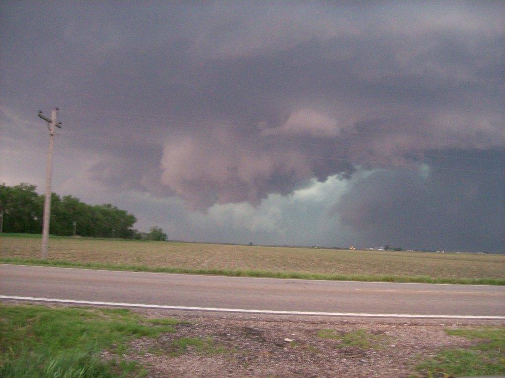
Base of the storm coming into view as we raced west on I-80 from Grand Island.
I chased on this day in Nebraska and Kansas with TWISTEX. It looked to be a great day since SPC issued a high risk for tornadoes in C/SC Nebraska. Chase partner Brandon and I left Ames for a primary target of O'Neill, NE. However, before we even got there, we were being pulled farther south and west, to Burwell, then Broken Bow and eventually to Lexington. Apparently, storms fired early in SW NE/NW KS. We were a long way away from our Lexington target, but we headed south on Highway 281 anyway to get to Grand Island before flying west on I-80 and getting there as soon as we could.
We finally met a supercell as it approached Kearney and proceeded to whip the town with EF2 damage. We watched it from just off Highway 30 a few miles east of town (we hadn't met up with the rest of the TWISTEX crew yet). The tornado became wrapped in rain from our vantage point, however, and we never actually saw it, just a few power flashes within the rain.

The storm was eventually overtaken by another supercell to its west. This merger seemed to be rather deadly to our storm, but we sat a few miles south of I-80 between Kearney and Grand Island for awhile watching the storm struggle. Eventually, the call came out that we were going to try to intercept a supercell down in Kansas that was already well underway and had a history of producing tornadoes. It was ahead of all other convection and had the best environment to work with. Thus we began flying south on 281 again through Hastings and Red Cloud, where we finally met up with the rest of the team at a gas station.
We continued to move south quickly. The storm was moving east-northeast in such a way that if we didn't hurry, it would cut off our route down there. That, and another supercell had begun to form just to the northeast of the first one, further cutting us off. We had no choice: we had to core punch the lead supercell. The storm became tornado warned just as we were punching it, but fortunately, we saw nothing other than some tremendously heavy rain and pea sized hail. However, while in the fray, we and the other mesonet car fell far behind the lead vehicle. After all, it's difficult to maintain 70 mph in a Cobalt with wings on it (the mesonet station) while driving through a carwash and with next to no visibility. After we escaped the core of that storm and found out how far back we were, we began absolutely blazing south, approaching speeds that I will not mention here, but speeds such that, coupled with the 20 knot southerly winds we were driving against, would've been easily enough to lift a small personal jet from a stop. While catching up, the TVN crew flew by us, too. It's a lot easier to maintain higher speeds when driving an SUV...
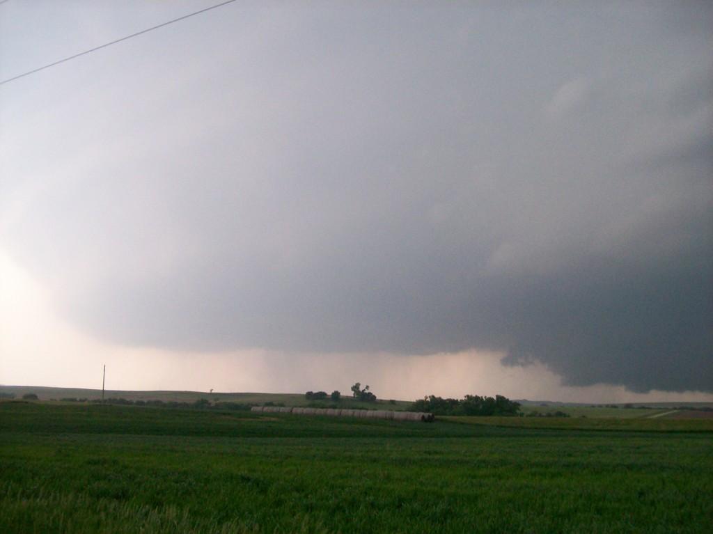
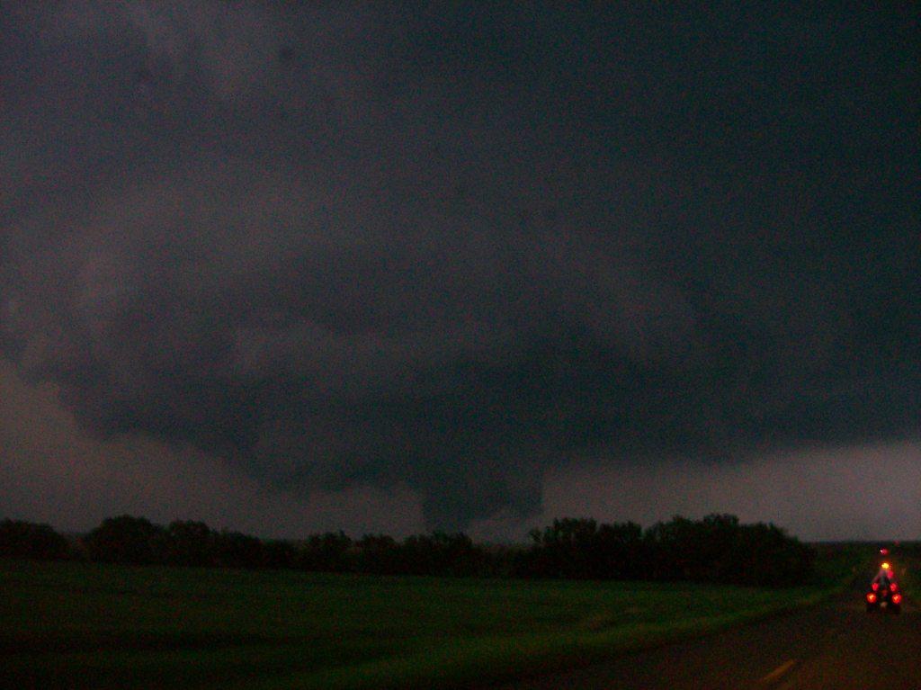
We cleared the lead supercell and could immediately see the beast of a storm we had coming our way. Thankfully, we hurried fast enough to get down into Osbourne County, KS with the mesocyclone of the storm still a good 10 miles to our southwest. We eventually stopped near a turn on Highway 181 a few miles northwest of Tipton. Tim deftfully commentated the tornadogenesis process right along as it was occurring! It amazed me how well he had it called.

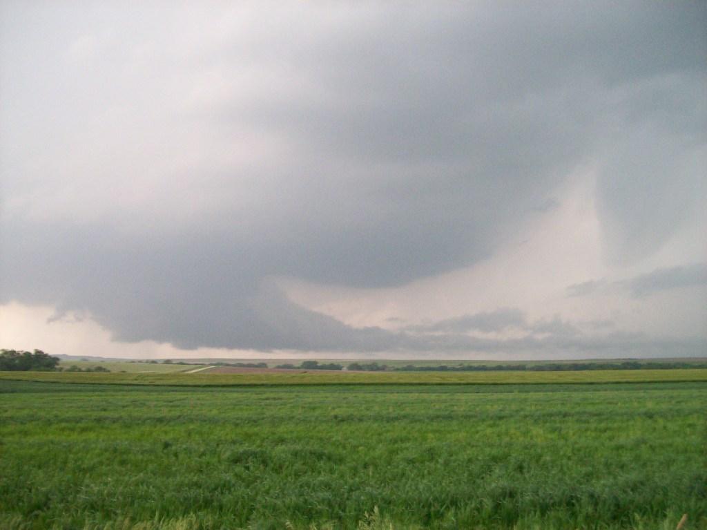
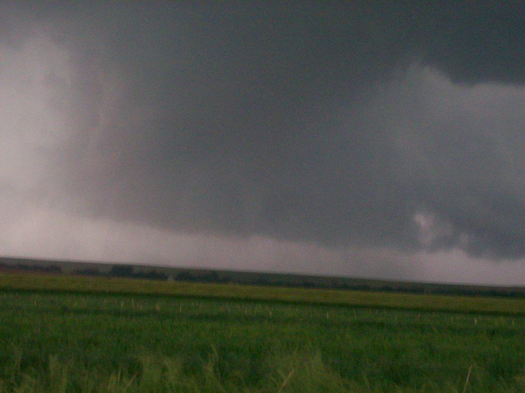
We had about 10 minutes to watch before we ran operations (with some success). The tornado passed about 1 or 1.5 miles to my north. I freaked out when I saw how close it was coming to us at first and turned around and drove about a half mile south. We got blasted hard by the RFD on it (I think we measured winds exceeding 50 knots).


After successful operations with the tornado, we decided to try to get it again. We worked our way east and northeast, battling intense chaser convergence along the way. Meanwhile, the tornado became a multi-vortex carousel! It was quite a sight.
Unfortunately, we weren't making much progress on catching up to the tornado and we were also working against increasing darkness. Hell, by the time we saw the first tornado, it was already 8:30. Shortly after passing through Beloit, we determined that it was getting too dark to try to pursue the tornado any further, especially after Tim's truck got stuck in a muddy ravine on a dirt road just off of Highway 14. We and the other mesonet car thus pulled back and sat on a dirt road for awhile, thinking that the day was over for us. We were wrong...
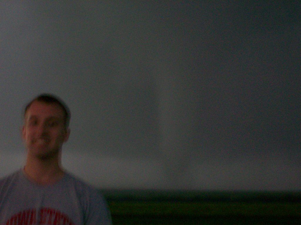
After a few minutes of sitting at a T-intersection (with about four other chasers around us), I took an innocent look southwest and saw a needle funnel touchdown no more than a mile away. Immediately, it was evident that it was coming straight at us. I frantically began pointing out the window, screaming, "TORNADO!" and honking my horn to alert others, as well as announce it on the radio. Tony (the driver of the other mesonet car) commented that he saw it, but said it looked like it was going to move to our east. I lost sight of it after squawking on the radio, so I trusted Tony's word that we were fine. I was still nervous, though, not being able to see it. (Really the only reason I saw it the first time was because there was still enough twilight and contrast left under the base of the storm to make out a tiny needle below it.) After maybe 30 seconds I took another innocent look outside the car...
...my heart dropped when I managed to see the funnel directly over the top of the car. I exclaimed and told Brandon, "This is gonna be bad..." A few seconds later, the tornado moved directly over us. It only lasted about five seconds since it was so small, but it still scared me. I felt my ears pop painfully (that's how I knew it was a tornado and not possibly some other gust) and dust and rocks smacked the car, causing lost visibility. Before I knew it, I felt the back of the car begin to get light and I nearly had a heart attack as I realized the tornado was picking up the car! It didn't pick it up much, though, and before I could blink, the tornado had already passed. Not only did Tony's dash-mounted camera capture this event (I have a physical copy of the video), but another chaser, Chris Collura, who was among the bystanders just feet away, captured the event also. You can find it on his YouTube video (already linked to the relevant mark).
After recovering from the sneak attack on us, we moved through the towns of Jewell and Randall, noting that either the main tornado or RFD must've hit Jewell, as there were trees down everywhere, and the town was dark. However, we could not see any structural damage. Randall was dark, too. We eventually moved south of Randall and sat on the same road that Tim was stuck on, but several miles east of his location. They were really stuck. It took three hours and a local farmer to pull them out with his tractor. We just sat on the road watching other storms go by. No more hit us where we were. I visited with Verne Carlson and son Mike while waiting. Eventually we made it to Salina at about 2:30 AM where we revisited the day at an IHOP near I-70 before making it to bed at about 4 AM. My first tornado on an actual storm chase, and a multiple tornado day!
Other photos:
| The 2008 TWISTEX armada minus M1 in Salina (poor Bruce and Cathy...couldn't make it for that day). The mud sprayed against the side of the nearest car (ours) is indeed thanks to that little sneaky tornado that *assumes southern accent* jumped right up 'n bit us. | 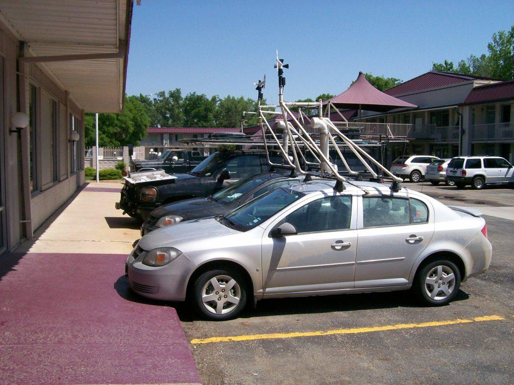 |
Return to 2008 - chasing home page