June 7, 2008 chase account
This was a local chase, although it didn't turn out as well as I'd hoped it would. I banked on supercells
developing in northwest Iowa during the early to mid afternoon during the day, but initiation was late and
organization was slow to occur. Finally, around 4 PM, I headed out with chase partners Ben, Logan, Adam and
others towards some cells that were developing (sadly, into a line, but slowly) northwest of Rockwell City.
We got lucky. After sitting in Rockwell City for a few minutes, an element of the line went tornado warned
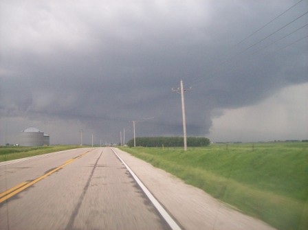
just to our northwest, near Fonda. Unfortunately, the storm looked its absolute best when we first got on it,
as is evident by the wall cloud seen here. Even more unfortunate, the storm
did not produce anything tornadic that we could see, and immediately began to weaken.
We followed it eastward towards Fort Dodge, but it never seemed to get any better organized until just as
we witnessed a gustnado form along the gust front. Suddenly, a rotating wall cloud emerged out of the shelf
cloud! It actually began moving directly east toward us. For the next few minutes, we were actually being
chased by this wall cloud as we approached Fort Dodge. It never produced, though, and seemed to get sucked
into the line, which bowed out a bit as another part of the line just to the north of Fort Dodge became
tornado warned. A bit of an RFD cut in front of us, spreading precipitation to obscure our vision of it, and
we never really got around it before the whole line began to crap out. We gave up shortly after chasing it east
of Fort Dodge and by the time we got back home, most of the line had dissipated. It never actually reached
Ames.
| The wall cloud to our west as we first approached the tornado warned storm near Fonda. |
 |
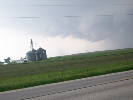
| Let the crapfest begin! |
 |
| Another of the storm's pathetic attempts at producing a wall cloud. |
 |
| Far off and kind of hard to tell, but likely gustnado. Contrast
enhanced crop shows it better. |
 |
Return to 2008 - chasing home page


