April 28, 2016 chase account

Summary: intercepted two supercells in northwest TX, each of which displayed impressive visual structure in a unique way.
Chase partners: none
There was never much threat for tornadoes this day. Frankly, I was surprised to see any threat at all show up on the models. Just two days after a major trough passage, and under shortwave ridging, moisture was not forecast to be sufficient for tornadoes. However, moisture return was expected to be enough to result in 1000-2000 J/kg of CAPE and rather extreme deep layer shear, reaching 70 kts, was forecast. I figured the lack of moisture along with the very strong shear would allow for the possibility of incredible structure, but it was seeing upper 50s dewpoints reaching Wichita Falls by midday that really got me out the door. I had been skeptical of the NAM's progged moisture return, but after seeing 12:00 PM obs, I started to think it might be right. As it turned out, daytime PBL mixing resulted in a drop in those dewpoints throughout the afternoon. Dewpoints ended up struggling to stay in the lower 50s throughout the remainder of the afternoon.
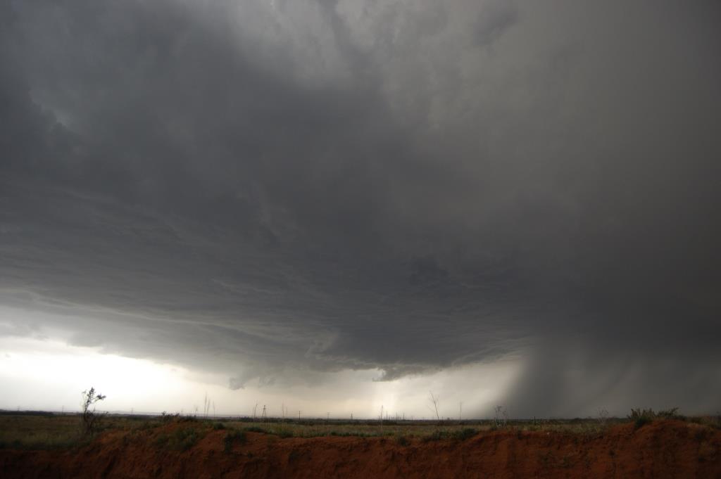
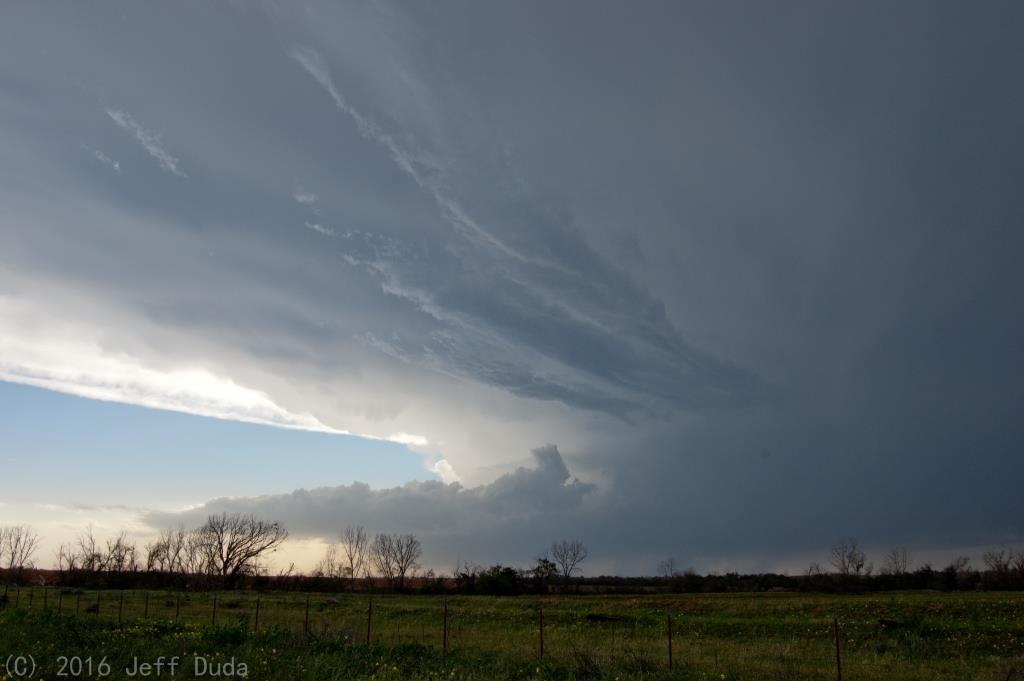
I left Moore at around 1 PM with an initial staging target of Childress. On the way there a CU field developed over west-central TX and initiation had occurred near Plainview just before I reached Childress. From there I had to make a decision on where to go next. I needed to get west, but I could either go well northwest on U.S. 287 towards Amarillo, cut up 287 to TX-86 towards Turkey, or go south and west from Childress. Initial storm motion was NNE, but new storms were developing south of the existing ones, so I could've made either play. I initially decided on the northernmost play to stay in range of the first storm that was already looking good on radar northeast of Plainview. Before I reached the TX-86 intersection, however, I made a last second decision to go west towards Turkey as the northern storm made a hard right turn, but was just about to merge with the next storm down the line, which I figured would be fatal for it. The storms did merge as I headed west, but the merger was not fatal to the storms. A vicious looking supercell with very high reflectivity emerged from the merger and was heading towards Turkey. Thankfully I was at least several minutes ahead of it and had time to stop and enjoy the view from just outside of Turkey before I saw the hail core moving in. I knew I had to bail south.


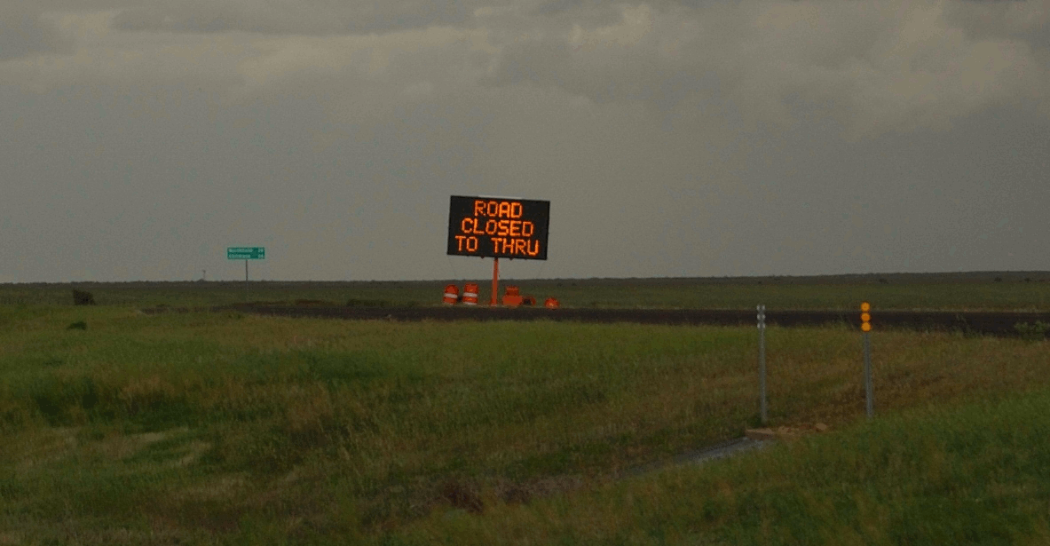
I was in a part of Texas not known for having a lot of roads. In fact, the road network in this part of the state is about as bad as you can find anywhere in tornado alley. I only had three real options: 1) go south on TX-70 all the way to Matador, which would give me just one brief glimpse of the storm crossing to my north before falling behind it and probably having to follow it on a hail covered TX-86...no thanks; 2) go south, then west, on F.M. 97 towards new convection billowing to the southwest, which would essentially be giving up on an established supercell for a non-guaranteed storm; 3) take a risk on an unknown F.M. 696 that went ESE from just south of Turkey. I went with option 3, and was delighted at the quality of the road and the visiblity. For the first 10 miles it was as flat and open as I could hope for. The only problem was there were absolutely no other thru roads in the event of a road closure or I otherwise got trapped. The road went far enough south, however, to keep me out of the core.
I enjoyed several views and stops along this stretch, watching a very impressive, wide, flat, albeit high based supercell base evolve as it moved east. It had that plaster-on-the-ceiling type structure indicative of a well established updraft ingesting parcels with low RH. The storm even put out an RFD surge that prompted a shallow wall cloud that probably rotated, although I couldn't see through the blowing dust for long enough to discern. At some point I measured 20-30 kt sustained inflow winds, but the amount of lofted dust made things difficult.
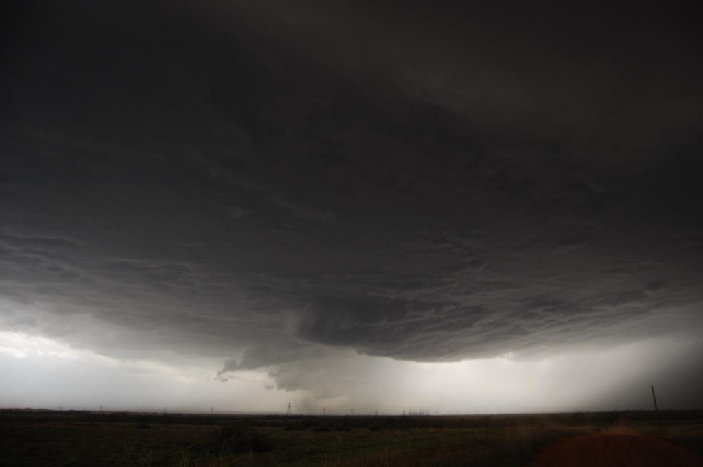

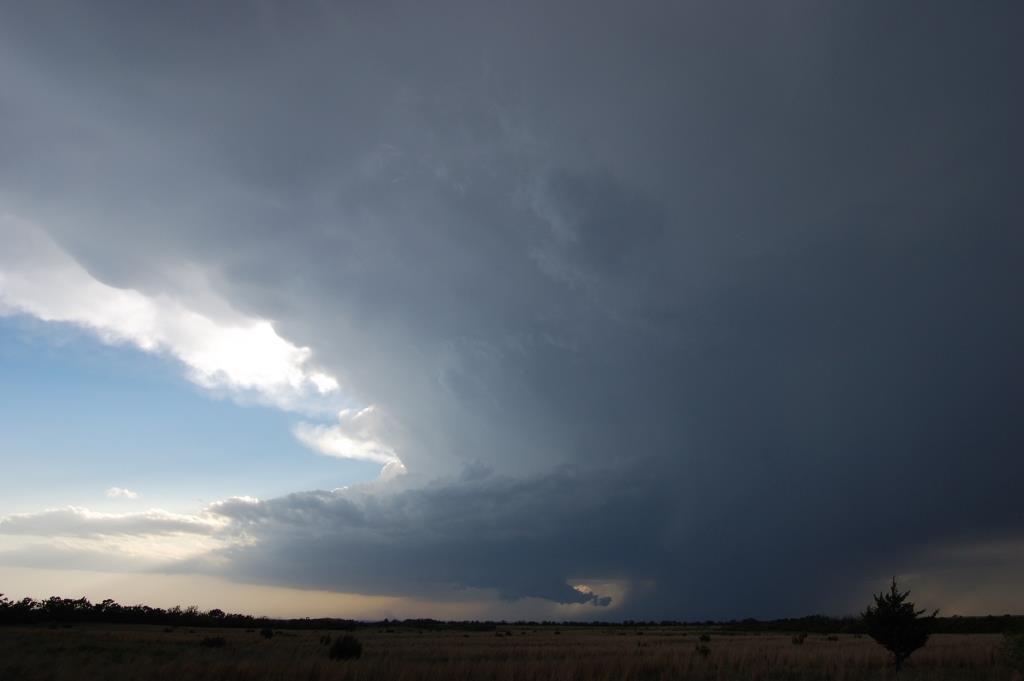
After awhile I chose simply to go all the way east to Northfield before taking another look. A disaster (not really) - the road going east from the intersection with F.M. 94 was closed, thus forcing me to take one last gander at the stationary (not evolving) base of the first storm before bailing and heading southwest towards Matador, where the convection had developed into a second, and at the time better looking, supercell. I wasn't going to have any time to mess around on 94, so I booked it. I had about 28 miles to go before having any other semblance of an escape, and the storm was closing in on Matador. Thankfully, I made it in more than enough time. I stopped a mile north of U.S. 70 where F.M. 94 hooks west towards town.
There I met up with Nick Nolte, Brad Goddard, and Jonathan Williamson. They had been there for awhile and informed me I hadn't missed much on the second storm. We talked for a few minutes, noting some random CGs landing fairly close by, as well as behind us (so 40 miles ahead of the updraft). I attempted some timelapse of the cell as it approached, but it never showed much in the way of further organization, and I began to wonder if I had made the wrong decision leaving the first storm, as it had a reported tornado (not verified, and I question its validity) and large hail, and seemed to look pretty good on radar. It had strong rotation in the mid levels, something I wasn't seeing as much indication of from the second storm. Also seeing the second storm was heading towards a region downwind of an 81/49 ob near Paducah, whereas the dewpoints upstream of the northern storm were holding in the low-mid 50s, I figured the second storm wasn't going to put on much of a show and decided to chase down the northern storm. So I flew east on 70 towards Paducah.
When I got to Paducah I was going to take F.M. 104 to continue to pursue the northern storm, as taking U.S. 62 back to Childress would not be good enough to get back ahead of it. On the way there, I looked back and noticed the storm I had left was starting to exhibit some rather impressive structure visually, and the northern storm was starting to look like it was losing its organization.

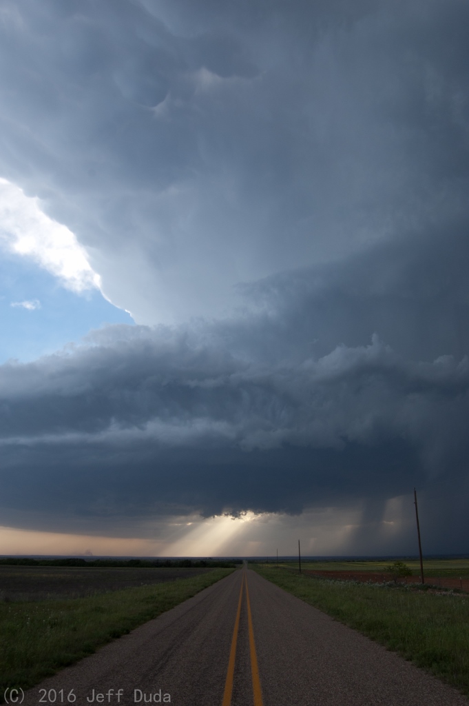
I cancelled my pursuit of the northern storm and went back through town to get on 62 north to get a better and closer view of the southern storm. There I witnessed it drop a rather large wall cloud that persisted for several minutes. I couldn't tell if it ever rotated much.
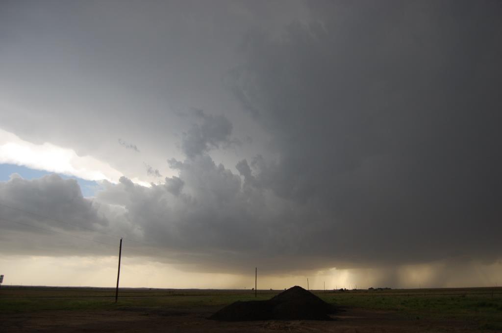
As it fizzled, I repositioned, then caught some excellent photos from Ranch Road 3256 with Jonathan, Brad, and Nick. The photos I got at this point were probably the highlight of the chase.


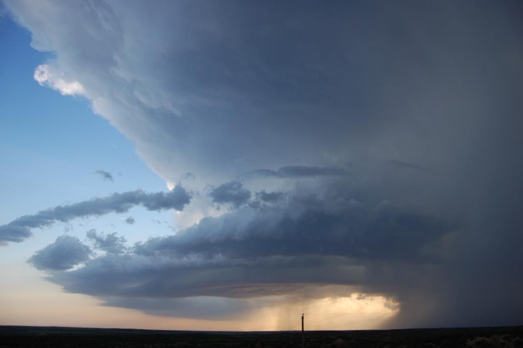
However, the thermodynamics of the environment this storm was moving into was still an issue, and I figured the storm was going to begin dying, as little CAPE remained immediately to its east. Given it was starting to exhibit even more impressive structure, but being too close to fit it all in my lens, I bailed back northeast on 104 to try to do the same thing I did back on 15 April in the northern TX panhandle - get as far ahead of it as possible before it died or my view of it became blocked by precip. I snagged a few final photos near the Pease River before being satisfied the storm had given me all it was going to. I called off the chase by the time I reached the turn east towards Quanah.
The funny thing about the end of the chase was that I had wondered how the northern storm had looked after I had left it. Throughout my time on the southern storm, I took peeks back to my northeast but saw nebulous cloud features. I figured I was too far away to actually see the northern storm. As it turns out, I was able to see the backside of the base of the northern storm the whole time! I just didn't recognize it as being the other storm. In fact, on the way north back into Oklahoma, I witnessed the northern storm's demise as its base gradually shriveled up and dissipated, even though it was probably at least 30 miles north of me. I can probably thank the high LCLs for that one.
Return to 2016 - chasing home page