
|
|
|
|
|
|
|
|
|
|
|
|
|
|
|
|||||||
|
|
|
|
|
|
|
|
|
||
Precipitation
The persistent flow across warm ocean surfaces into the tropical regions
moves significant amounts of moisture into regions of convergence and upward
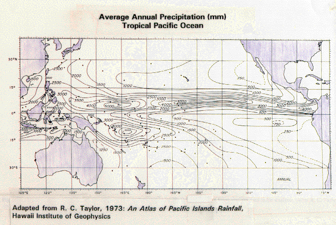
motion. A map of global rainfall shows tropical areas receive very large
amounts of precipitation along what is called the Intertropical Convergence
Zone (ITCZ), shown in Figure
13. Some regions receive in excess of 5 meters of rain annually. We
will revisit the details of tropical precipitation when we discuss the El Nino.
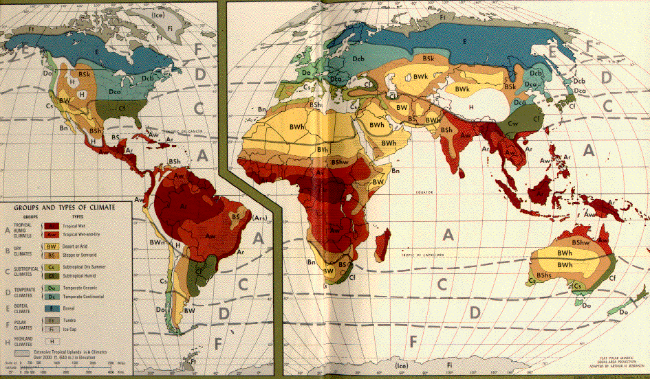
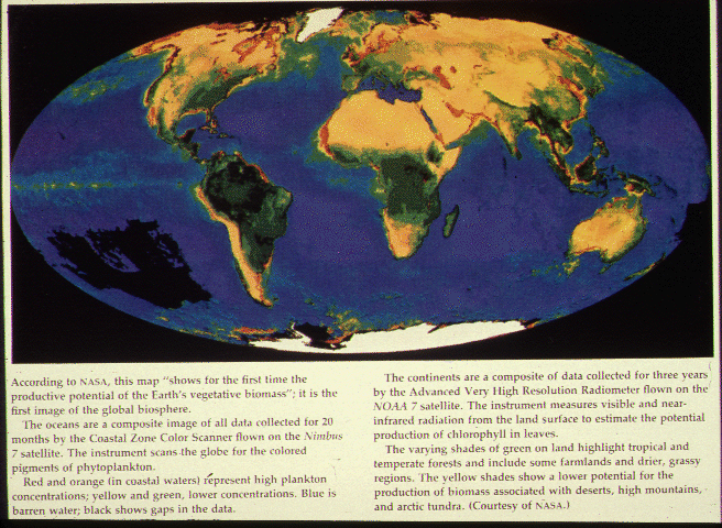
The atmospheric circulation also controls the precipitation patterns in the subtropical high-pressure belts near 30° north and 30°south of the Equator. And the movement and development of low-pressure zones along the frontal boundaries in the middle latitudes likewise govern precipitation in these regions. Comparison of global maps of precipitation and vegetation reveals the importance of precipitation amounts in determining the level of biological production, as is shown in Figure 14. Even from this general viewpoint, we can see that changes in the global circulation patterns and precipitation patterns can have significant impacts on global vegetation (see Figure 15). We will consider these issues again when we examine the carbon cycle of the planet and the land-use practices now in place over large regions of the earth's surface.
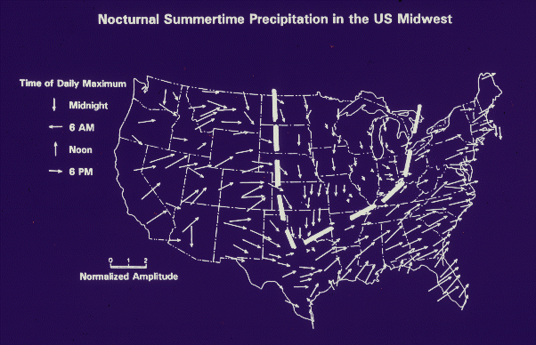
Regional precipitation patterns may be governed by peculiar processes not linked to the global circulation. In the Midwest US, for instance, the summertime precipitation pattern is quite different from the rest of the US, as can be seen from the map showing the timing of summertime rainfall. Most regions of the US have precipitation occurring during the middle to late afternoon, in response to warming of the surface and evaporation of moisture that leads to cloud development and precipitation. The Midwest, by contrast, has a maximum rainfall occurring at night, as is illustrated in Figure 16. The Great Flood that occurred during the summer of 1993 produced much of its heaviest rainfall after sunset. The reason for this is that the Midwest experiences what are called mesoscale convective complexes (MCC). These large-scale systems originate in the Great Plains to the west in the afternoon and drift into the Midwest after sunset. Instead of dissipating after the loss of solar heating at sundown, these MCCs draw additional moisture from the low-level jet stream from the south that serves as an efficient conveyor belt of moisture from the Gulf of Mexico. The intensification of the jet after sunset fuels the afternoon thunderstorms from the plains region and allows them to persist and grow as they move across the Midwest after sunset.
These regional precipitation processes are not completely understood, and how they will be affected by changes in the global climate due to greenhouse warming is not very well known. Estimations of how precipitation patterns change under global warming are among the largest uncertainties of our projections of climate change. And because of the strong link between global precipitation patterns and vegetation, projections of impacts on agriculture and natural systems also have large uncertainty.
More information on the basics of clouds and precipitation can be found on the University of Illinois WW2010 website. PREVIOUS: Atmospheric Circulations