
|
|
|
|
|
|
|
|
|
|
|
|
|
|
|
|||||||
|
|
|
|
|
|
|
|
|
||
Climate Model Grids
For a global climate model we determine values of temperature, wind
speed, pressure, density, and concentration of water vapor, liquid water,
and ice crystals at each of about 50,000 to 150,000 grid points over the
earth at each time step (typically an hour) for the duration of the
simulation (corresponding to the number of pegs in our pinball analogy),
which typically might be a 30-year period (262,800 time steps). As an
estimate of the volume of numbers created by such a model, if 10 variables
are saved for each of 150,000 grid points at 262,800 time steps, the data
to be saved totals 400,000 megabytes.
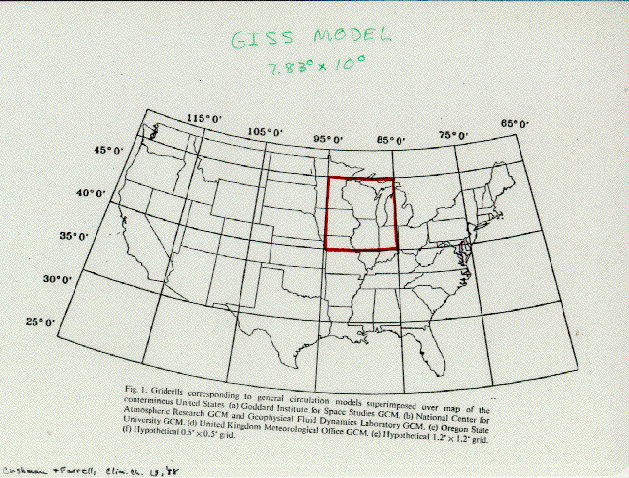
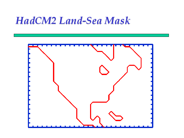
A typical grid used in a global climate model is shown in Figure 3. Each point on this grid has a vertical column of points at which variables are calculated. The number of points in the vertical direction ranges from as few as 2 to as many as about 20 levels. Note that typical global models have a have a horizontal grid spacing of about 500 km (300 miles). This means that a single surface grid point must represent all the surface processes in a box larger than the state of Iowa. Most global models have resolution too coarse to even recognize the existence of the Great Lakes, and some completely ignore the Florida peninsula. For example, see the outline of North America as seen by the Hadley Centre global model (Figure 4).
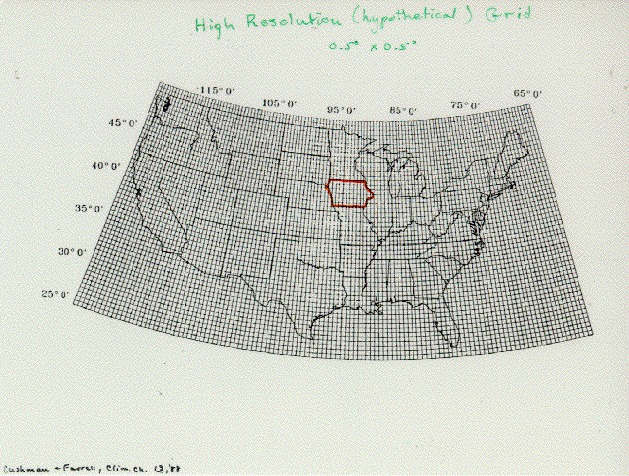
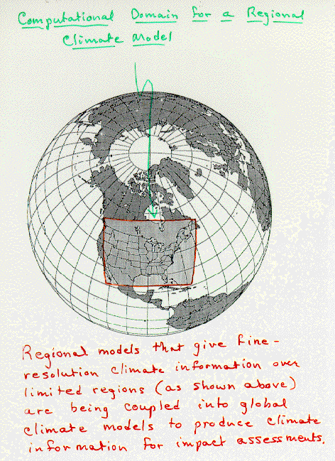
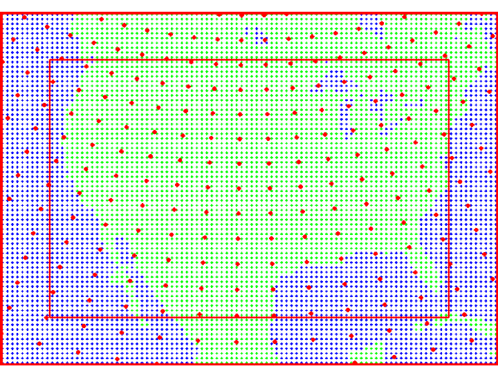
A more desirable grid is given in Figure 5, but such fine resolution for a model spanning the entire globe is unmanageably large ( 8 billion megabytes of data!) with present computational capabilities. Regional climate models, designed to cover a limited area of the globe as shown in Figure 6, allow resolution of more spatial details than global models but require information from some other source at their lateral boundaries. Using regional models to study climate change has become a more important approach in recent years. One such study here at ISU is the Project to Intercompare Regional Climate Simulations (PIRCS). The grid used in these studies has 50km resolution.