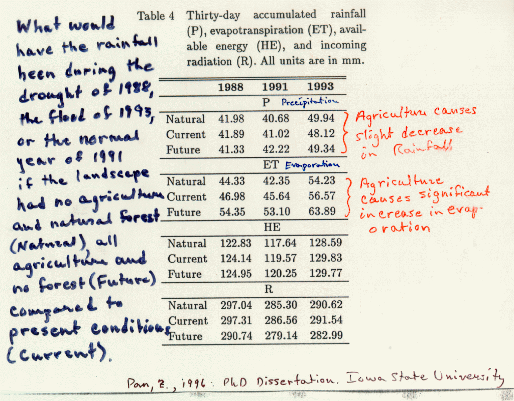
Land Use Changes
In a final analysis, we show results of a simulation, Figure 19,
over the whole US to examine the influence of land use changes since the European settlement of the US.
In this experiment we use observed meteorological conditions for a normal year, a flood year ,
and a drought year, and compare results from simulations using three different
assumed land use patterns:
- natural forest and grassland representing the pre-European settlement
landscape.
- current land use with crop land replacing much of the native prairie and
some forested land.
- hypothetical situation with crop land covering the whole US.
It is known that agricultural crops draw more moisture from the soil, particularly the deep
soil, than native grasses. For a year with normal precipitation the total precipitation over
the US is increased by 0.89% for the current land use compared to pre-European settlement
landuse. The hypothetical all-crop land use increases precipitation by 1%. It is noteworthy
that precipitation records for the US over the last 100 years reveal a precipitation increase
over the US of 1%. There may be reasons other than landuse that are the dominant cause of this
increase but land use change might well be a contributing factor.
For simulation of flood-year precipitation over the US for both current and full-crop landuse
increased precipitation by about 2%, although precipitation over the flood area decreased somewhat
for both present and full-crop land use. For the drought year, land use seemed to have very little effect.
PREVIOUS: Extreme Weather Events and Regional Models
Back
