
|
|
|
|
|
|
|
|
|
|
|
|
|
|
|
|||||||
|
|
|
|
|
|
|
|
|
||
Satellite Measurements
Polar orbiting satellites,
like GOES, have vertical sounding units for monitoring temperature and moisture. A second
type of instrument on polar orbiting satellites is the radiometer, which measures
energy at individual wavelengths of both visible and infrared radiation. The
Advanced Very High Resolution Radiometer (AVHRR) (Figure 12)
senses data in 5 different channels at both 1 km and 4 km resolution. Examples
of data from the AVHRR are given in
Figure 13. Polar orbiting satellites also provide image data for a variety
of environmental assessment needs and space environmental monitors similar to
those on the GOES satellites. Gathering weather data for use in initializing
weather forecasts requires at least daily and hopefully twice daily or more
frequent observations. By placing two companion satellites in synchronous low
polar orbits, we can acquire data over the entire surface of the earth on a
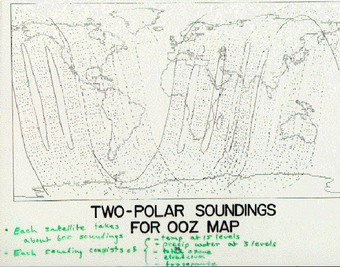
daily (or more frequent) basis (Figure 14).
A companion pair of polar orbiting satellites can be synchronized (called sun synchronous) so
that one passes over the particular location in the morning and the other passes overhead at
this location in the early evening. Note that the converging tracks of adjacent
orbits give multiple measurements in polar regions. Each satellite takes about
600 vertical profiles of measurements each day. Each profile of measurements
includes temperature at 15 levels, precipitable water at 3 levels, total column ozone, cloud cover,
and tropopause height (Figure 15). An example of
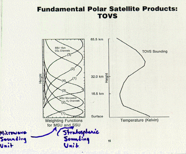
data derived from a sounder is given in Figure 16.
By making such measurements over each of the points in a 3-dimensional volume of
atmosphere (Figure 17), polar-orbiting satellites
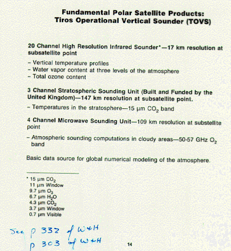
provide data for use in computer models used for weather forecasts. A summary of fundamental
products of polar orbiting satellites are given in (
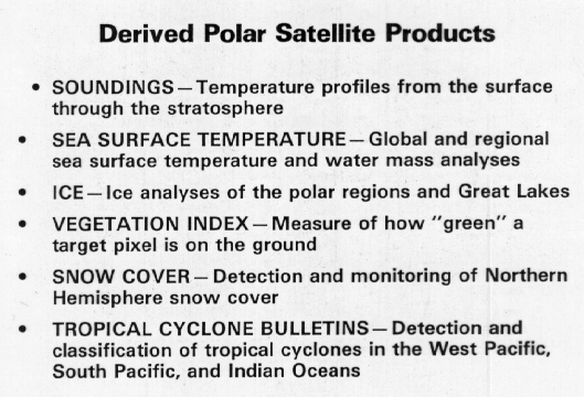
Figure 18) and derived satellite products in the following figure
(Figure 19).
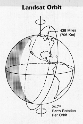
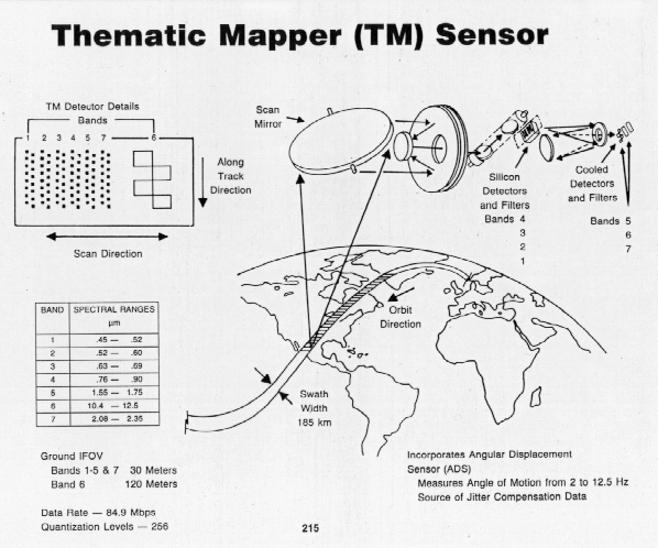
A special NASA polar orbiting satellite, no longer in operation but from which data are still used, is the Landsat satellite (Figure 20) which had a multispectral scanning sensor (Figure 21). Its very low orbit of 706 km (438 miles) allowed it to get very high resolution images of the earth as is shown for Detroit (Figure 22). Another instrument, the thematic mapper (Figure 23) operated in both visible and infrared to give detailed land surface images.
PREVIOUS: Active and Passive Sensors
NEXT: International Deployment of Satellites