
|
|
|
|
|
|
|
|
|
|
|
|
|
|
|
|||||||
|
|
|
|
|
|
|
|
|
||
Polar-Orbiting Satellites
A disadvantage of geostationary satellites (Figure 9) is that their large
distance from the earth's surface compromises their ability to capture fine
detailed resolution of the planet surface. Satellites put in low earth orbit,
typically 850 km (531 miles) above the surface, can resolve topographic and
other environmental features as small as 1 km, and perhaps even much smaller.
However, this close proximity to the earth's surface limits their field of view
to a swath about 2,500 km (1,560 miles) wide as the satellite orbits the
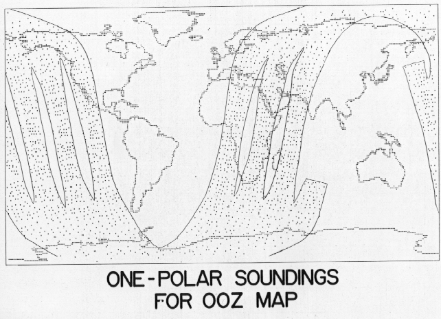
planet. Maximum areal coverage is achieved if the satellite orbits from pole
to pole (Figure 10). By use of
the last equation of the height derivation, with a satellite height above
ground of 850 km, we get an orbital period of about 100 minutes. The satellite
orbiting from pole to pole crosses the equator going from south to north every
100 minutes, and between these equator crossings the planet will have rotated
by 28.8o. This allows the satellite to view a new swath that is
adjacent to the west of the swath from the previous pass. By manipulating the
height of the satellite, as can be seen from the equation for satellite period,
the orbital period can be adjusted to give the desired degree of overlap
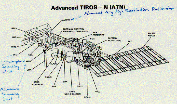
between adjacent sweeps across the equator. Polar orbiting satellites are sufficiently
close to the earth's surface to acquire high resolution data
(Figure 11).
The NOAA website provides updated information on polar orbiting satellites.
NEXT: Active and Passive Sensors