April 26, 2009 chase account
***BUSTED***
Very little to talk about for a chase account on this day. Chased an area in the warm sector near the
center of low pressure. The warm front had sailed way north and was cluttered with convection, so we (myself
and chase partners Adam, Logan, and others) decided it best to play the area with better instability. After
all, it was Iowa in April...instability was not a given. The entire center of the country was a mess,
with the only SPC
high risk of the 2009 season located in south-central Kansas and western Oklahoma.
However, Iowa was only in a slight risk, and little happened in the state during daylight hours
(see SPC reports),
with the one exception being a nice EF1 tornado 15 miles from my parents' house in Marion. More on that later,
as this account will be more of a case study on this date than a chase account.
As for our chase, we moved southwest towards Creston and watched all convection heading our way line out,
and with little intensity at that. We only saw two SVR warnings in the state near us while we were out, and
we saw nothing other than a meager shelf cloud. Therefore, I have no pictures or videos from this day. Our
chase ended near Indianola when we chased part of the line that had bowed out, a part that swallowed us eventually.
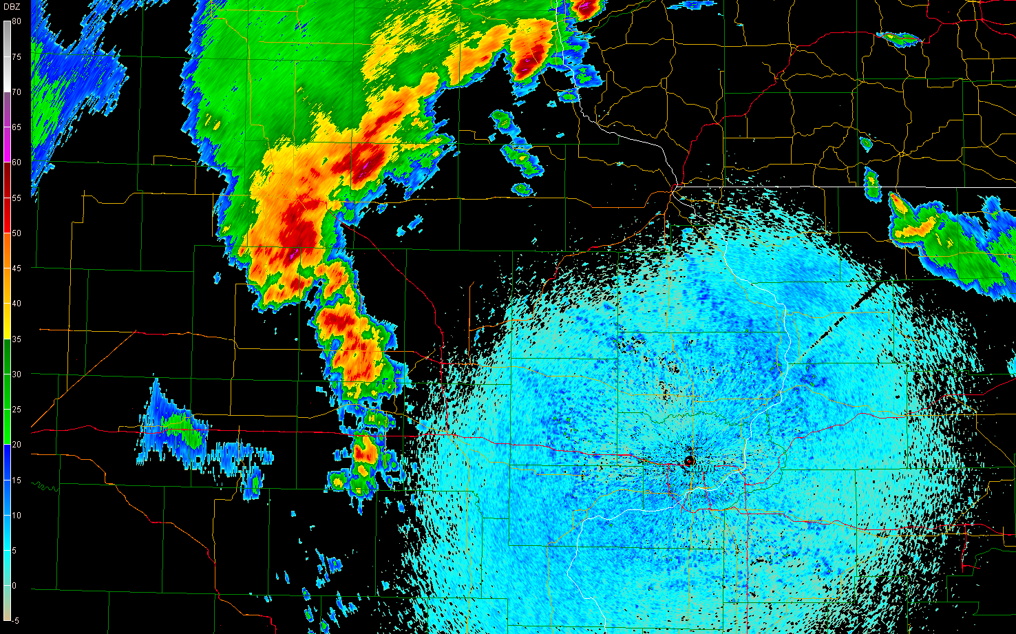
Case study: The EF1 tornado in Linn County, Iowa
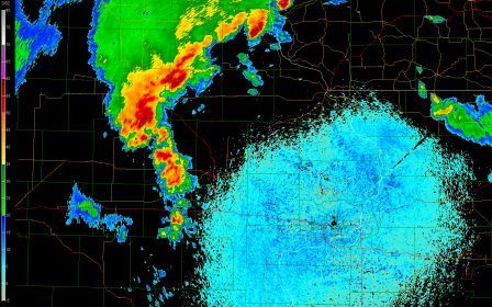
This storm went supercellular after seemingly "tripping" over a secondary warm frontal boundary draped across
east-central Iowa (see pictures below and
this link). Before that, it was just some disorganized convection lined up north-south. The tornado occurred
around 2200UTC (5:00 PM).
Images and more analysis (Note: Linn County is near the center of the images, and is the easternmost of
three counties in a west-east line shaped the same as it, which is rectangular, but taller than it is wide. I-380,
the red line moving south-northwest, enters the southern part of the county and exits the far northwestern part
of it. Yes, I know, it would've been easier to have just turned county names on in GR...maybe I'll redo this
later and change that.)
Line of storms at 2102UTC before going tornadic. Looks pretty ordinary, doesn't it? |
 |
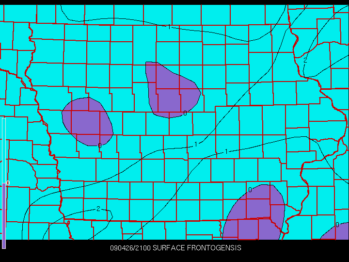
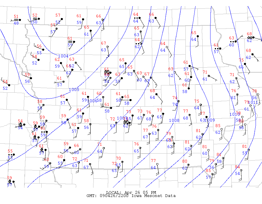
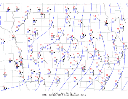
Associated 2100UTC surface analysis, frontogenesis, convergence, SRH and BR fields are below. Observe that
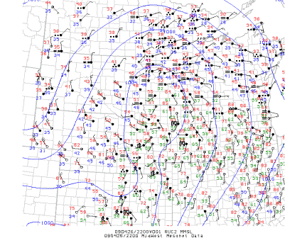
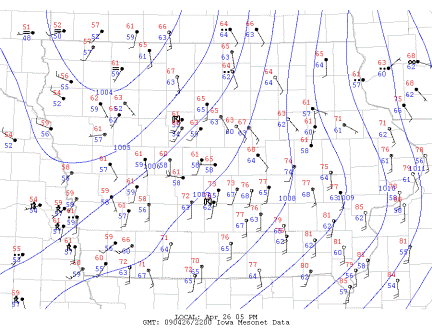
the main warm front has cleared the Minnesota/Iowa border by 2100UTC.
Surface analysis (Midwest)
 |
Surface analysis (Iowa)
 |
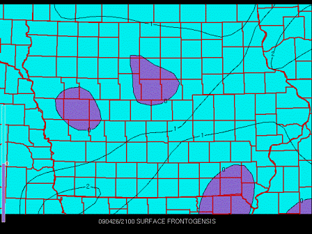
Frontogenesis
 |
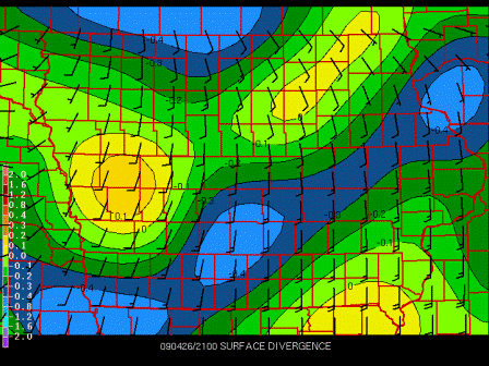
Divergence
 |
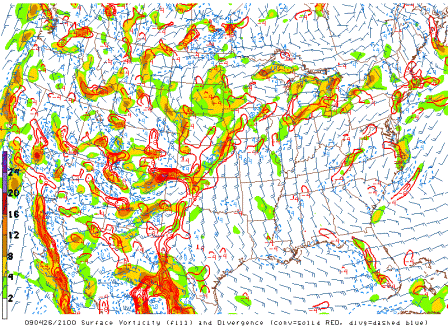
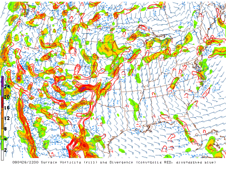
Divergence and vorticity
 |
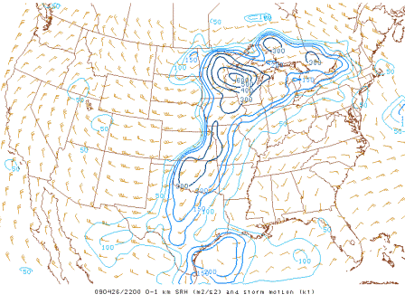
0-1 km SRH
 |
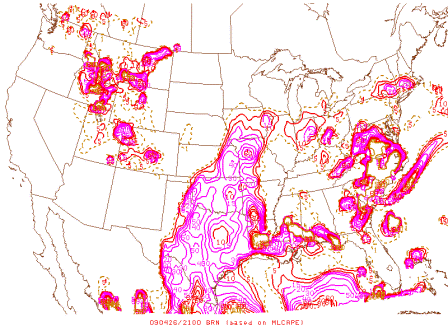
BRNs
 |
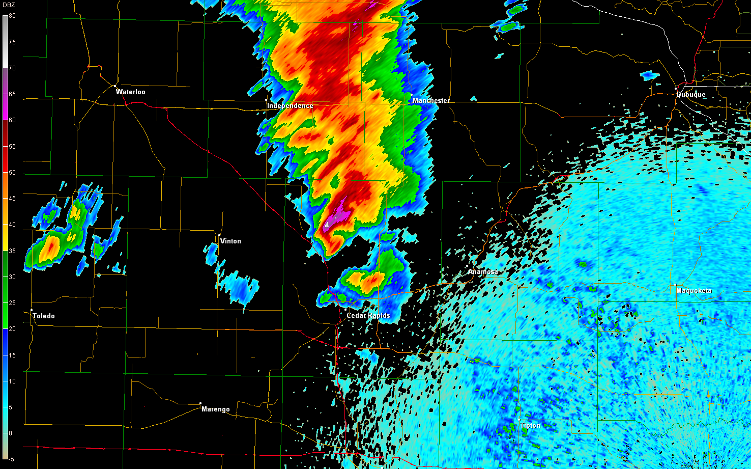
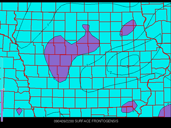
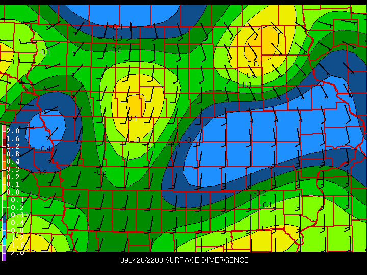
As 2200UTC approached, the storm suddently intensified and started to develop supercellular characteristics
such as a hook echo and rotation. It also obtained a hail spike - best visible on 3.1° BR - and at least
at this elevation angle, showed a prominent spike for six consecutive scans from 2136 to 2158.
2200UTC parameters
Surface analysis (midwest)
 |
Surface analysis (Iowa)
 |
Frontogenesis
 |
Divergence
 |
Divergence and vorticity
 |
0-1 km SRH
 |
BRNs
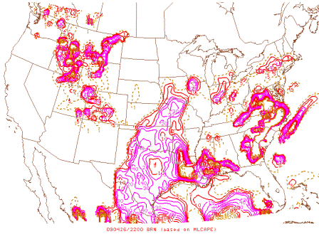 |
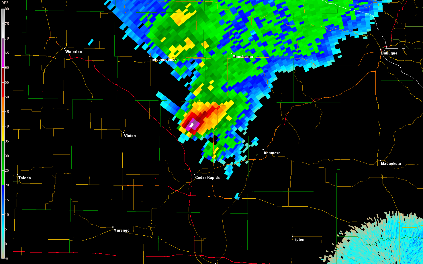
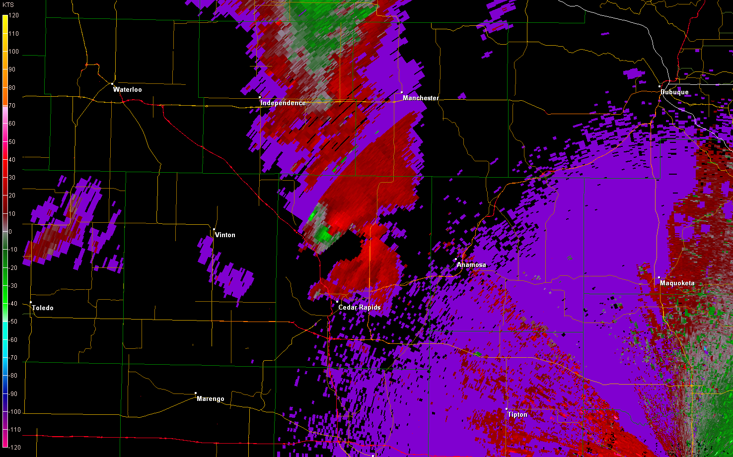
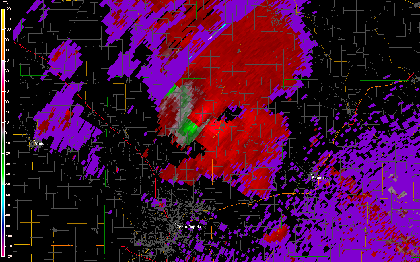
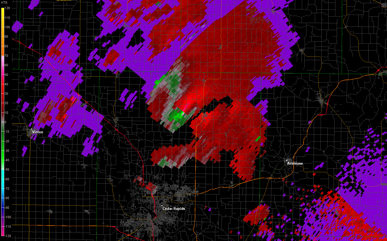
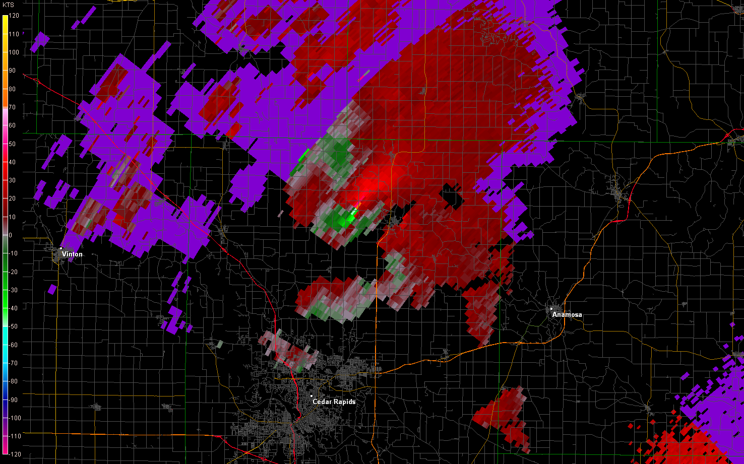
By 2157, the tornado had touched down just west of Alburnett, hitting Pinicon Ridge State Park on it's
way northeast on a 22 mile path. The rotation looked awfully impressive at about this time. SRV showed about
70-80 kts gate-to-gate with one exception.
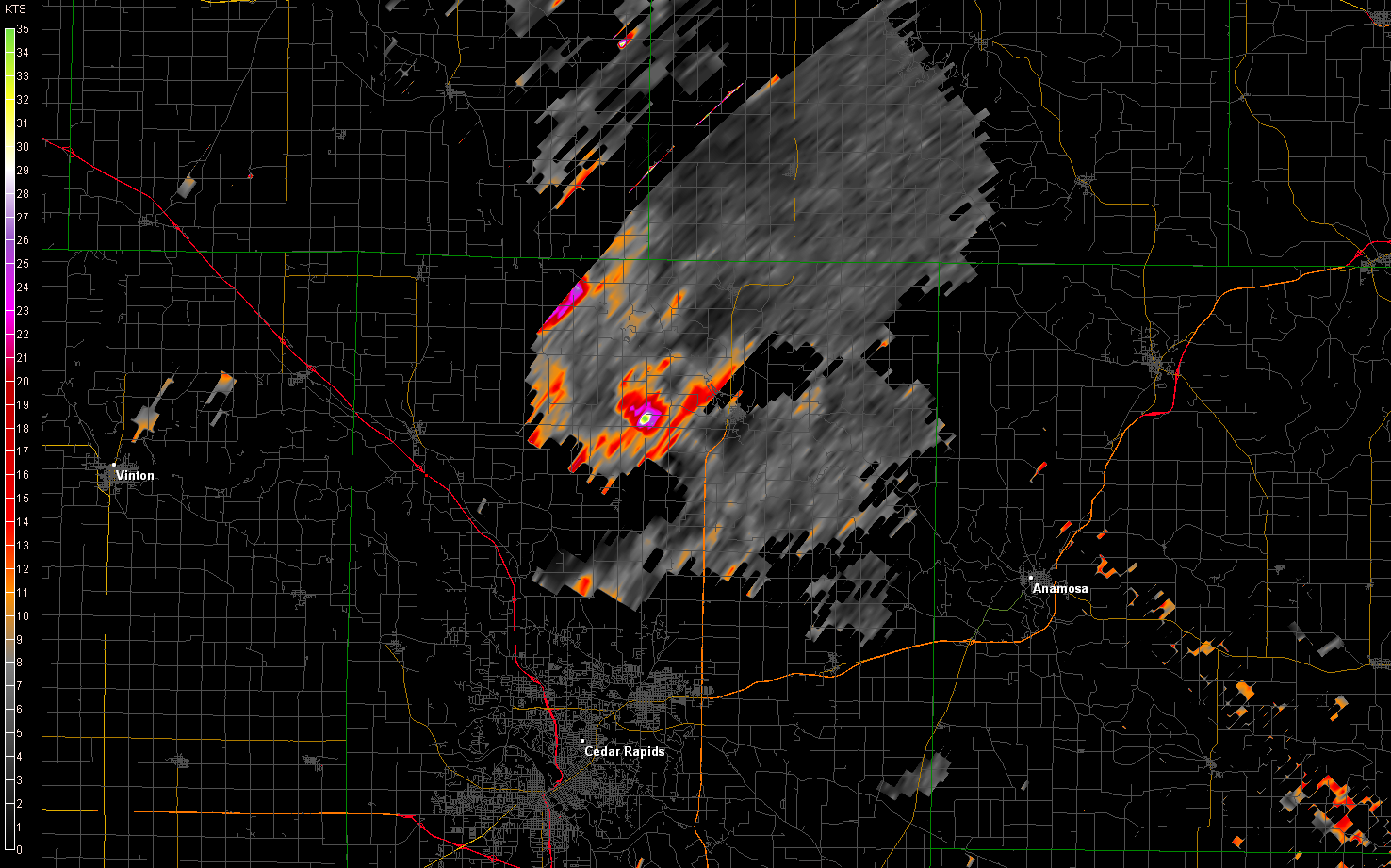
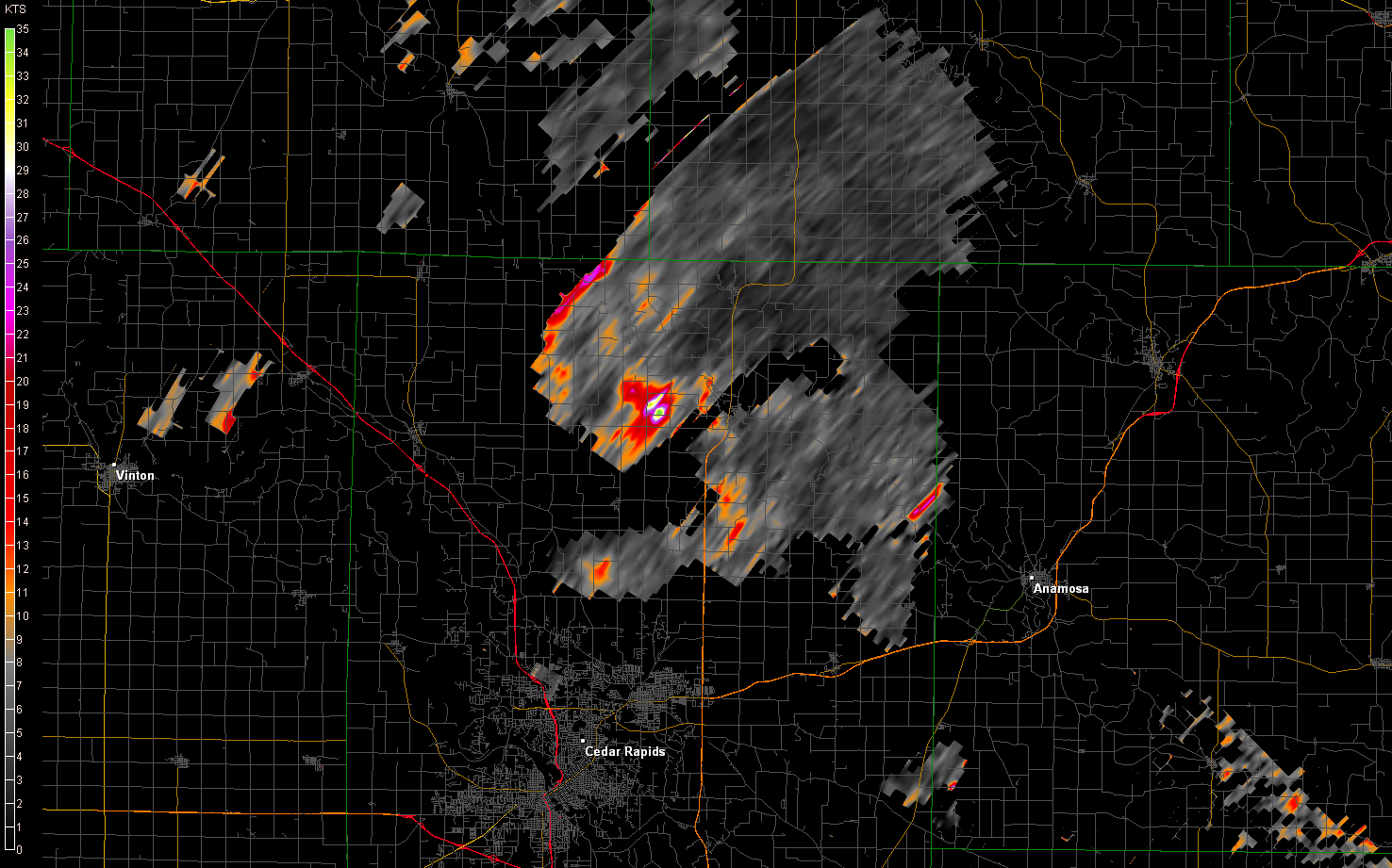
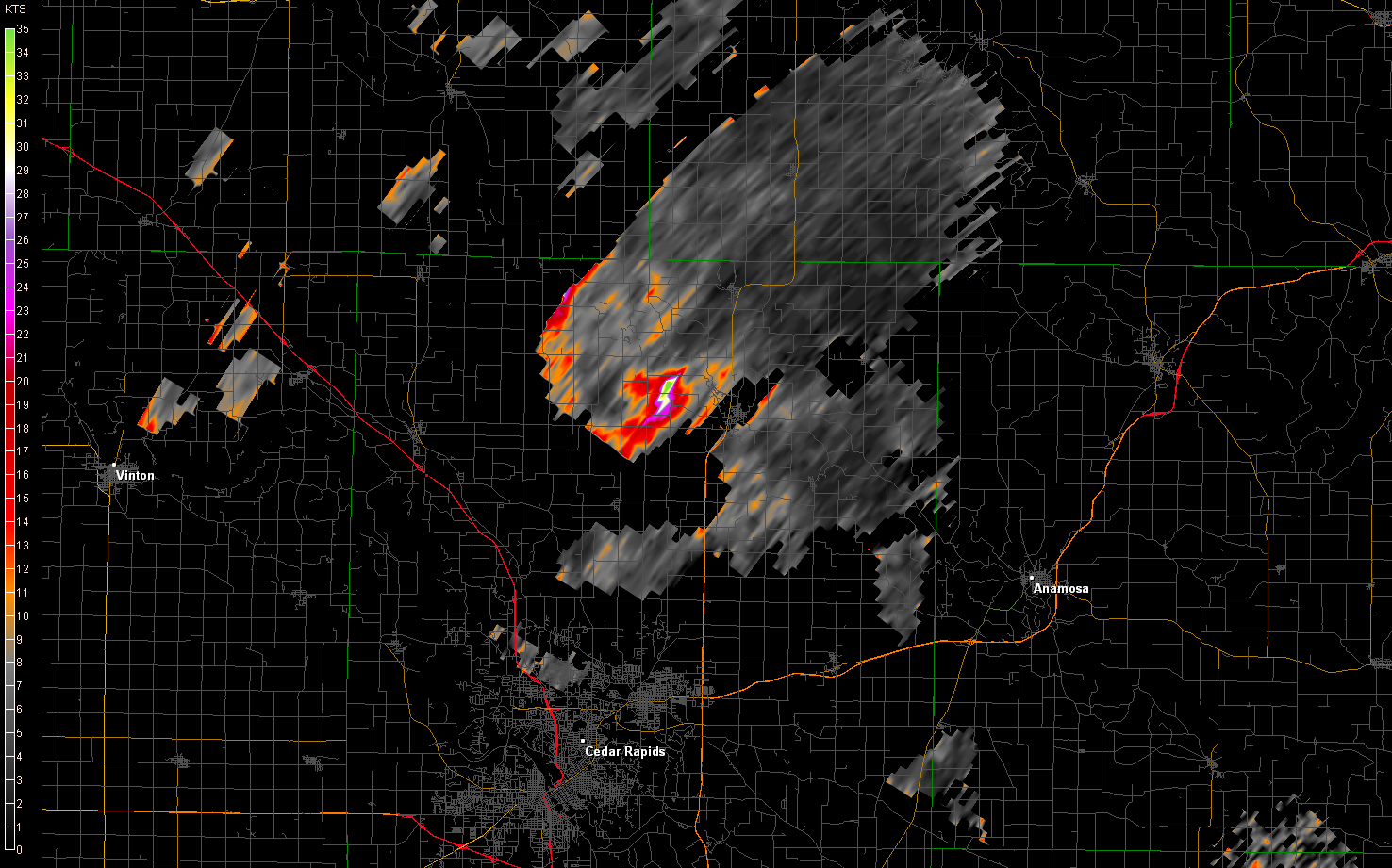
| Storm-relative velocity | Spectrum width |
|---|
| 0.5° | | 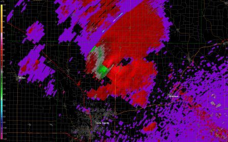 |
Note the bullseye likely pinpointing the tornado's location |
 |
|---|
| 0.9° | |
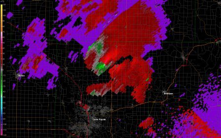 |
|  |
|---|
| 1.3° | Zoomed in view of this image (may not be easy to see without viewing actual data)
shows 120 kt gate-to-gate shear where the light green and orange pixel meet! |
 |
| 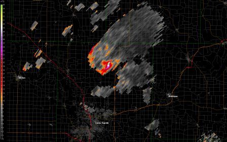 |
|---|
I haven't done much further analysis than what I presented here, but I have strong reason to believe it was
that second boundary laying across the area including Linn County that played a significant role in causing
that storm to become tornadic.
Return to 2009 - chasing home page