
It's really bad when this is the highlight of your chase...
But then again, southern Iowa and northern Missouri are bonafide Amish country...
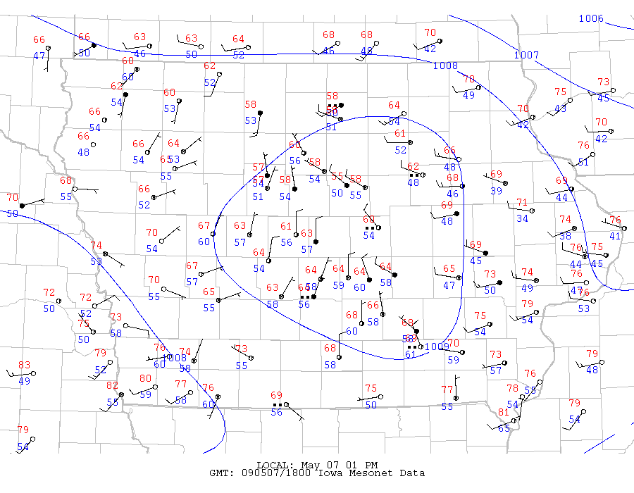
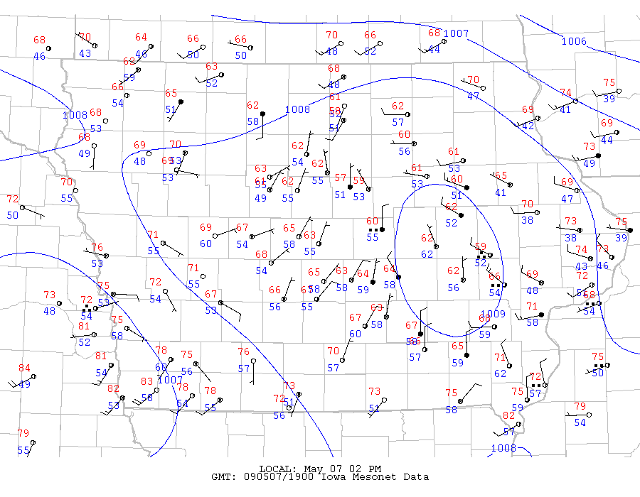
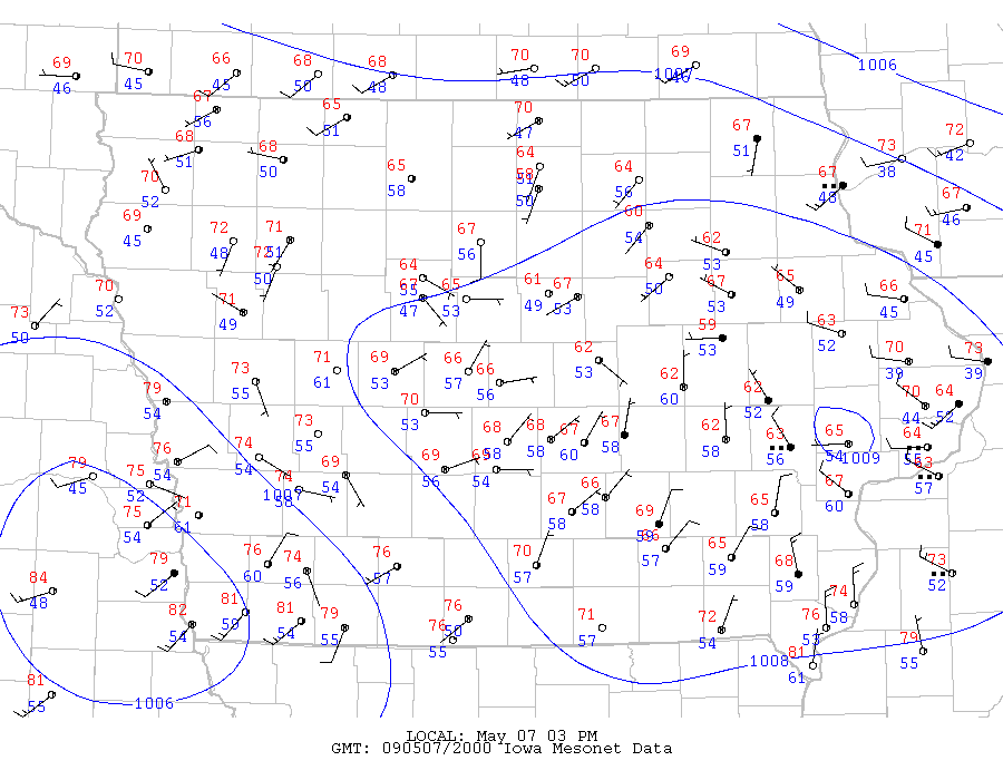
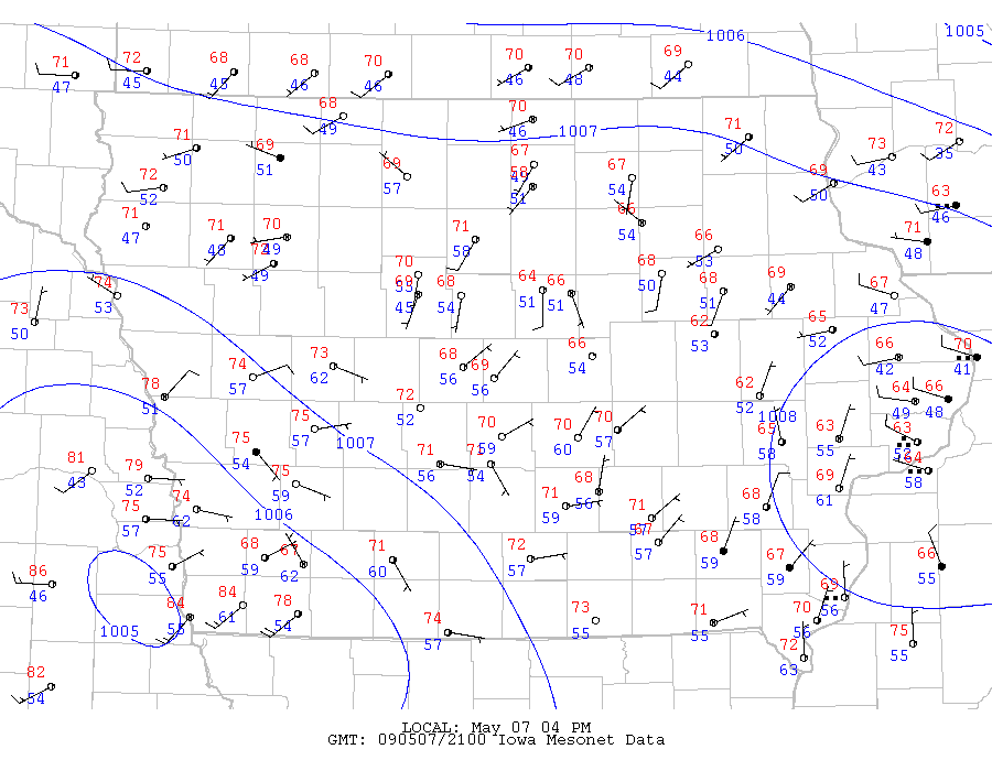
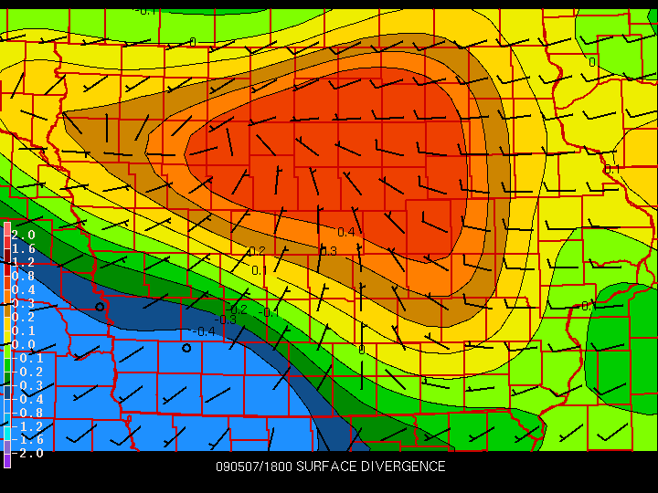
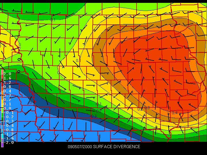
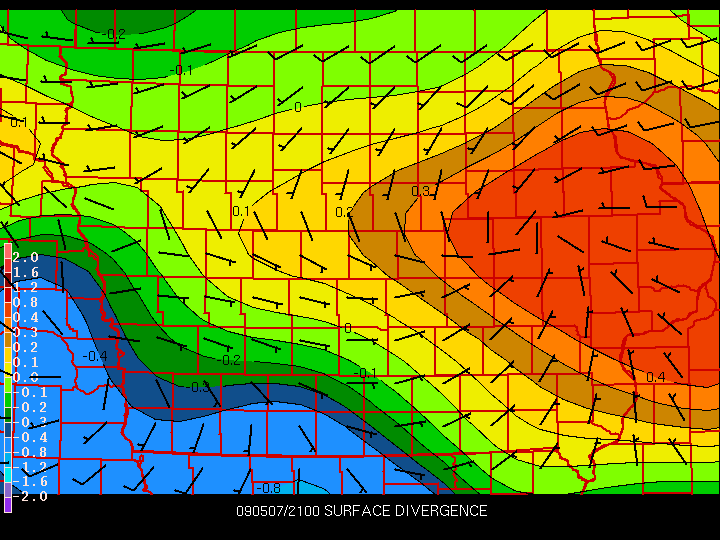
Needless to say, I wasn't even planning on going chasing until the sudden issuance of Tornado Watch #258. As soon as I saw it issued, though, I knew exactly why. A small patch of showers/embedded thunderstorms had tracked east-southeast across northern/central Iowa during the morning, leaving a really nice meso-high and outflow boundary footprint behind it (see surface analyses: 1800UTC, 1900UTC, 2000UTC, 2100UTC). The outflow boundary left a really nice convergence band across southeast Nebraska, southwest Iowa, and northwest Missouri (see divergence plots: 1800UTC, 1900UTC, 2000UTC, 2100UTC).
I, along with Logan and many other ISU students, headed south on I-35 at around 3:30 to intercept non-severe convection that had already fired up along the OFB in SW IA, hoping it would intensify and become the storms to pursue. For a few brief moments here and there, things looked good. A lowering of some kind appeared on a storm near Lamoni, but it quickly became outflowish and shelflike, and after watching the storms in that area for awhile and noting that nothing impressive was happening, Logan and I decided to head home.
When we got back, I checked radar and my heart dropped...a tornado warning had finally been issued on a storm near Chillicothe, MO! Not only that, but it had rotation and looked like a supercell. I wasn't happy, but at the same time realized I would've had to have pursued the storm quite a ways away from home to catch it. Of the pictures of it I saw, it wasn't impressive. Plus I was graduating the next day and I didn't feel like being out all night chasing, so I didn't feel as bad knowing I gave up on this day too early. But whatever. You win some, you lose some, and you take what you can learn from the losses and use them to win next time.
Return to 2009 - chasing home page