 |
 |
 |
 |
 |
 |
 |
 |
I'm not calling this one a bust because we (TWISTEX) technically got on a storm that was tornado warned for a time and probably had supercell characteristics for a few minutes. But really, it was a very disappointing day severe weather wise. It ended on a good note, though.
This was a day in which SPC really blew it (see Day 1). Days like this are making me weary whenever I see a 15% hatched moderate risk for tornadoes. A look at the reports from this day reveal the poor overforecast tornado threat.
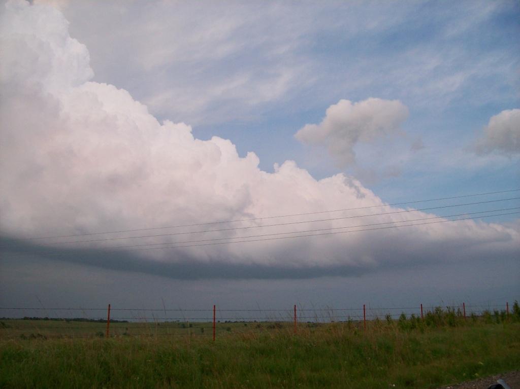
This day had an obvious forecast target: an early morning to early afternoon MCS that went across northeast Kansas and into Missouri put out a nice outflow boundary. It was plainly visible in the surface observations. As it slowly sank southward, it was clear that it would provide the forcing needed to initiate convection. Thus, we targeted the boundary to the south and east of Wichita. It was in this area that instability and shear were forecast to be colocated and highest in magnitude. However, the shear aspect took a long time to develop (effective helicity).
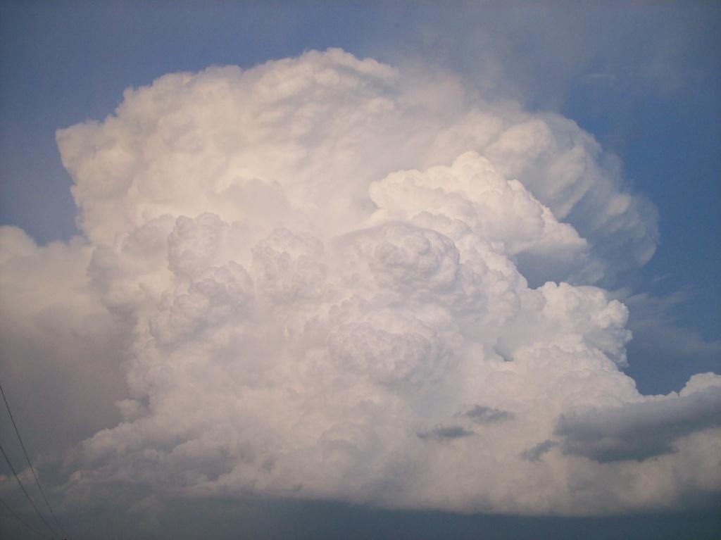
We sat in a few fields just off Highway 400 in Greenwood County for hours waiting for initiation. I got sunburn from sitting outside for so long. It was a tantalizing wait, as we witnessed at least five solid updrafts with associated cumulus towers go up along the outflow boundary, but then get pushed off it by the winds aloft and die due to losing the initial forcing. Finally, though, storms began to fire late in the afternoon. However, they were very disorganized and multicellular, rather than organized and supercellular (the obvious better alternative).
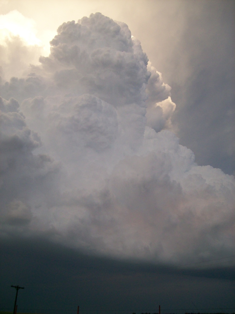
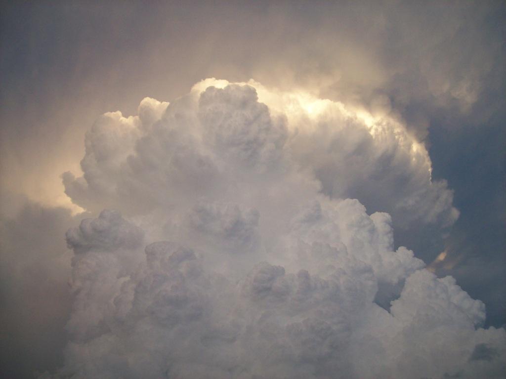
We stopped in Moline, KS to fuel up when we heard reports of a wall cloud forming on the storm that was affecting the edge of town. The wall cloud was a few miles west of town. We went out to have a look as the storm became tornado warned. When we got there, I saw one of the most impressive updrafts I've ever seen. You could literally see the clouds getting sucked into the updraft base and then turning upward! We didn't have much time to sit around though, as the storm was rapidly closing in on us and violent CGs were pelting the nearby landscape every few seconds. Some were loud enough and close enough that I could hear the boom from inside the car. We tried to run operations on it but had little chance, because as soon as the storm started looking good it puked its guts out with outflow, thus ending its life as any sort of supercell. We knew the storm was done with any tornado threat so we left it. At this point there wasn't much left to do except for to pursue a few storms that were initiating in far SE KS and across the border in far NC OK. Thus we decided to press south and go after the closest one.
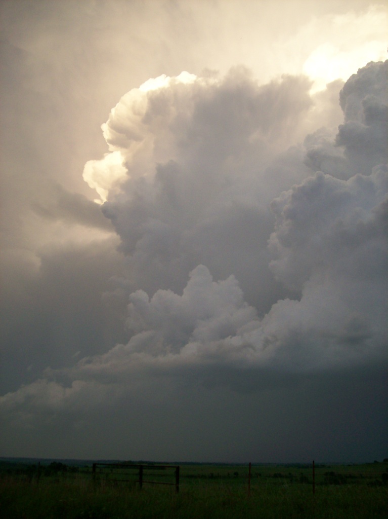
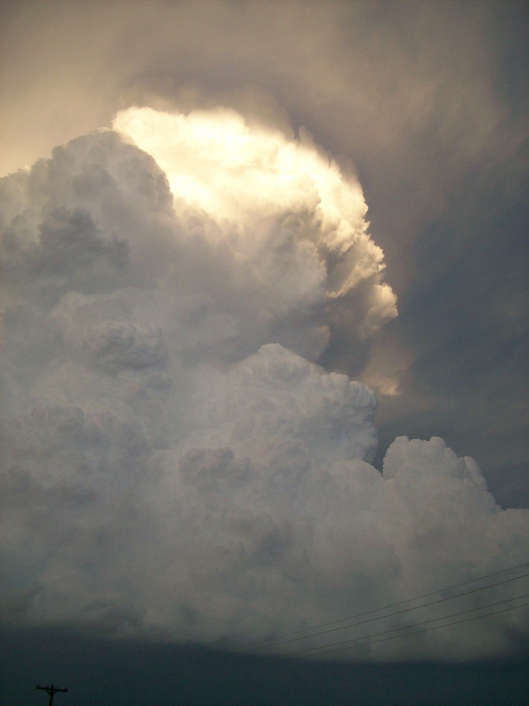
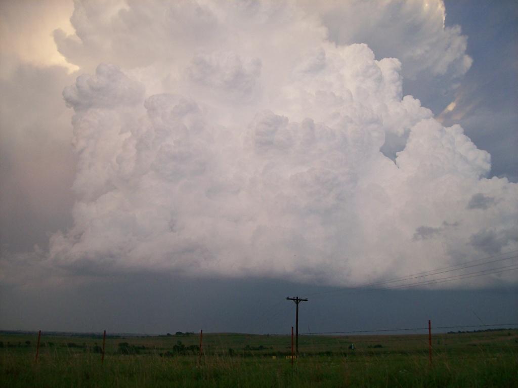
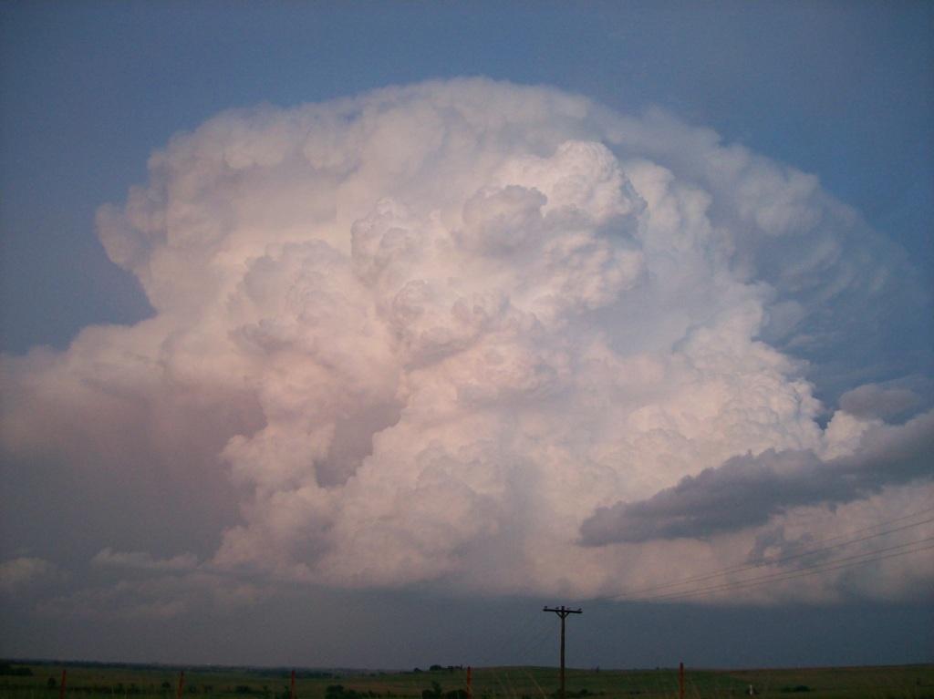
Unfortunately, this storm became much less organized and appeared to die before we could even get close. Having nothing else to do (and being on one of the only highways around), we kept going after it, finally pulling in behind it west of Pawhuska, Oklahoma. The storm had miraculously gained some strength as we continued approaching and was severe warned for hail at the time. We crept south a few miles from Highway 60 and watched as the storm roared off to the east, to our east. Despite being only marginally severe, this storm was a beautiful sight, being completely isolated and cellular. From just behind the back of the storm, we spent a good 45 minutes watching it move off into the distance. The updraft stayed strong and visible the whole time, all the way past sunset. We left it due to loss of light and stayed in Blackwell for the night.
Expectations were low for the next day, and after changing targets twice, we decided to break the team up for the trip. Thus Chris and I headed home, enduring a blown tire in the process. As luck would have it, though, (we tried to force some good luck upon ourselves by having tacos for lunch...but it wasn't Taco Johns...it was Taco Bell) the half of the team that went west managed to witness a tornado in far SW KS late that evening.
|
|
|
|
|
|
|
|
Return to 2009 - chasing home page