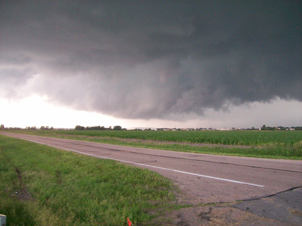
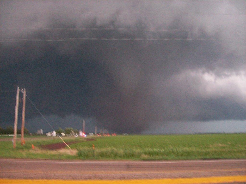
Nice blocky wall cloud forming on the storm as we neared Grand Island.
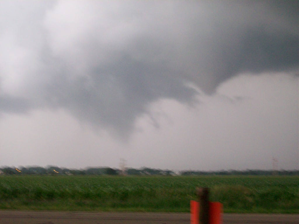
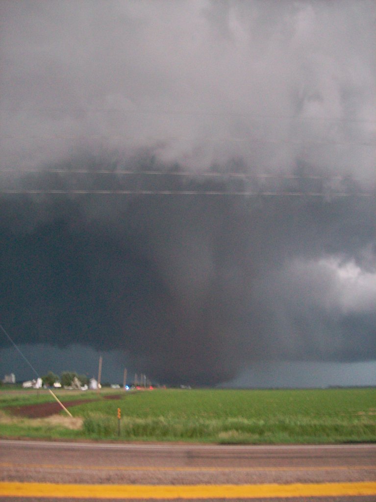
Wall cloud encroaching on our position. RFD cut beginning to become visible just above the third tall tree from the left.
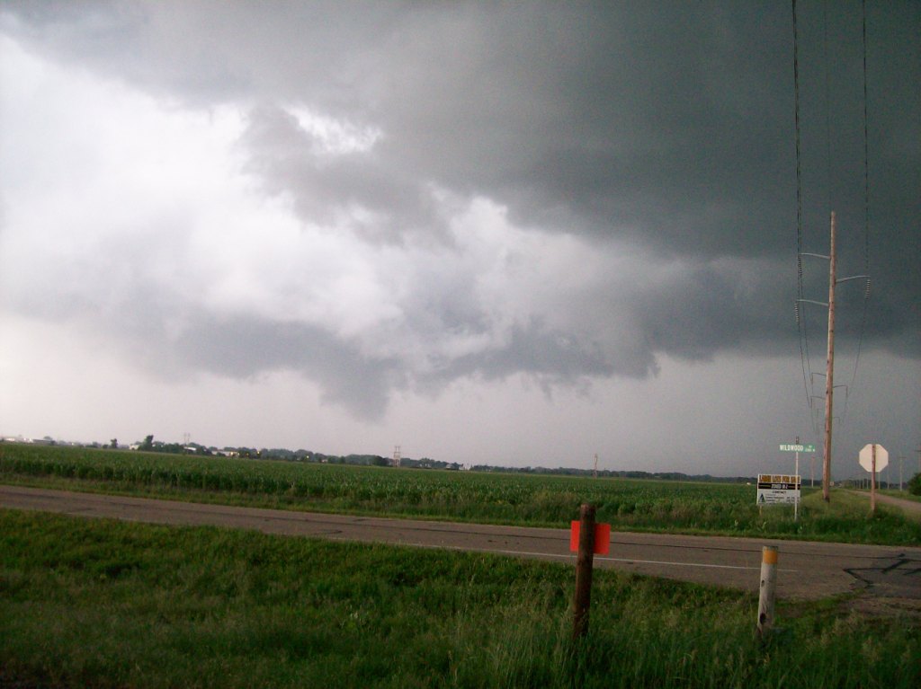
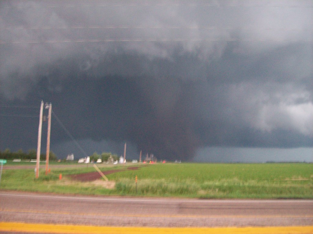
Yay spiral banding on the side of the updraft/meso!
This was a red letter day for me. I bagged at least two tornadoes without being with TWISTEX and by using only the forecast guidance and expertise of my chase partners (usual characters: Adam and Logan, with Ryan) and myself. We made a late-day gamble that paid off: we saw the Aurora EF2 and a weak tornado that skirted the south side of Grand Island for sure. We might have seen another one, but I can't confirm it. We paid the price for our gamble later.
This day looked good most of the way across the board. Instability was forecast to be absolutely tremendous, with forecast CAPE values in southeast Nebraska and vicinity to be well over 5000 J/kg and approaching 7000 J/kg in some localized areas! Shear wasn't extremely high, but was acceptable, and I've been shown that ridiculous values of CAPE can compensate for less-than-ideal shear values to get supercells. The only other non-positive things were a lack of a significant forcing mechanism and a possible cap. Always have to watch out for that cap...So, Adam, Logan, Ryan and I targeted southeast Nebraska, right where things looked conducive for atmospheric nuclear bombs to detonate. One of the weird things about this day, however, started soon after our chase began.
While enroute to our target via Omaha, we observed storms firing far to our southwest. In fact, at first, we could only faintly see the anvils of the storms, probably 125 miles away at this point. They came more into view as we proceeded west, though. Things got interesting when they started becoming severe and tornado warned, taking on supercell characteristics. Having just stopped for lunch in Council Bluffs, we were stunned. It was only noon, yet supercell storms were already underway in our target area! We didn't know exactly what to do. We weren't sure if those were the storms of the day already in progress and that we needed to fly south to get to them or if they were a tease and would move on and weaken before we could get there, not only dragging us somewhat away from our initial target, but "ruining" the local atmosphere's prospects for later convection, and pulling us away from a better target that may be evolving elsewhere. Eventually we decided to take a stab at them, but with the condition that we would not chase them down into Kansas or Missouri. We wanted to stick to our guns and stay with our initial target, which still looked reasonable at the time.
Well, soon after chasing these storms, they indeed began to weaken. This was a good thing for a number of reasons, most notably, because the road we took to get out of Omaha (U.S. Highway 75) was nothing but construction and one-lane sections with slow cars at the heads of the lines. It was so frustrating trying to get south out of town. Now, someone might say, "Why didn't you take Interstate 29?" Despite the fact that I-29 is a main road that essentially paralleled 75, from past experience I knew there was a ton of road construction with two-way traffic sections that would've slowed us down anyway. So, I thought I could be sneaky and avoid it. Guess I got screwed on that call.
Anyway, back to the storms...that really lost their identities and strength as we watched them in Nebraska City. Seeing the weakening trend, we decided to revert back to our initial chase target, which we finally agreed upon to be Beatrice, NE. Skies were plenty clear and it was getting very warm and humid in the area, so we figured the atmosphere was starting to bake and sizzle...preparing to blow.
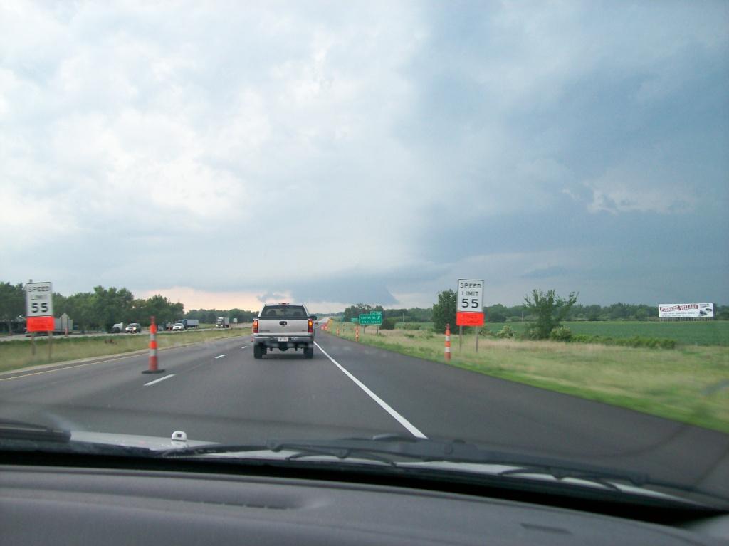
When we arrived in Beatrice and looked at the SPC mesoanalyses, we were again stunned and I was personally very frustrated. While we were making our way out to SE NE, a very dominant cap had set up right over us. 700 mb temps were easily 13-14°C and some spots were flirting with 15°. It was like that through most of E/SE NE and points south. It was 5:30, so I knew that surface heating (which had likely maxed out by now) wasn't going to break this cap. And with no other strong forcing mechanisms in the area (actually there was a subtle one that I almost overlooked...read on), convection was very unlikely anywhere near Beatrice. Not to mention, the huge moisture fields that were sure to be there were not. Looking at surface analyses of dewpoint (RUC mesoanalyses and obs), there were many spots where the dewpoints where barely in the 60s! The only explanation I could offer for that was compensating subsidence and resultant drying from the earlier supercells. I was about ready to pack it up and head home, figuring that we were in store for a blue-sky cap bust. The cap wasn't quite as strong to the north, and we saw a few measly "convective showers" going up north of Lincoln and in that area of Nebraska. The subtle surface feature I almost overlooked Logan pointed out to me to be an outflow boundary/mesoscale warm front left by previous convection lined up WNW to ESE near Hastings and Kearney. Thus, we decided to hop north on Highway 77 to go to a favored WiFi hotspot of mine on the west side of Lincoln to watch and see if anything was going to happen soon. Being 6:30 by the time we would get there, I thought to myself, something had better go up or I'm whippin the car around and going home. (I did voice this opinion to my partners, some of whom agreed, some of whom did not.)
We got to Lincoln and observed that our measily cells had little going for them. One was severe warned, but did not look at all impressive. However, we did notice a feature that really caught our eyes: a supercell had fired well to our west near Kearney, right along that OFB/warm front Logan noticed before. However, therein lay the problem: this storm was over 100 miles to our west. And it was only oozing east at about 10 mph, locked tight to that slowly moving boundary. We figured we had only about 2.5 hours of light left to chase, and a quick calculation said we could get to Grand Island (where we figured/hoped it would be by the time we got out there), a little over an hour away. With the general lack of any other storms having luck nearby, I wasn't convinced this storm would last long. It seemed to fluctuate in strength over the few scans we watched it while in Lincoln. Logan was very adamant about going after it. I was weary of the other factors, including distance (if we chased this storm to Grand Island and got there at 8:00, then we were looking at a 5 hour drive home at least, putting us at home at 1:00 AM or later, and that was independent of whether or not this storm did anything.). Adam and I discussed it and decided that we were already out this far and we didn't have any major plans the next day, so why not go for it? I'm certainly very glad we did...
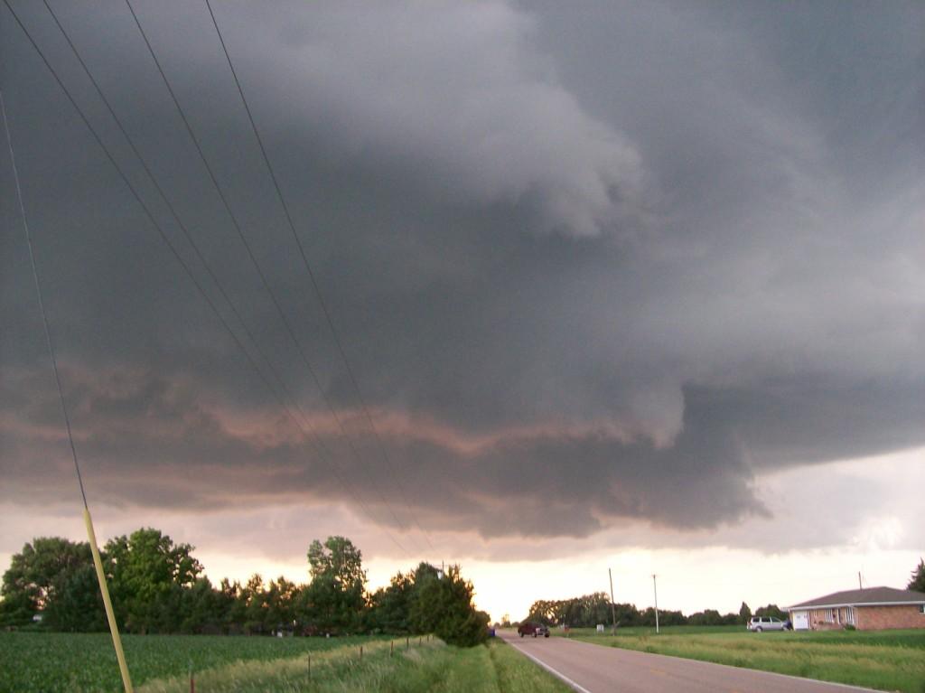
So, much like on May 29th, 2008 and earlier this month on the 5th, we began blazing west on I-80 towards the supercell (thank God for the high speed limits on Nebraska highways!). As we progressed westward, the storm was easily in focus. It was huge and was the only feature in front of us. (There were other supercells that went up near this one to its west, and the storm itself even had a left split that was an anticyclonic supercell, but they were too far away to see.) We could see good structure on it. As we finally approached Grand Island, the storm was in the middle of cycling, so it didn't appear that good on radar as we got there (as told to us by a nowcaster), but quickly gained strength and went tornado warned for Grand Island. It was busy building itself a nice blocky wall cloud as we set up shop on Schimmer Dr. on the very southwest side of town, not too far from Alda. We sat there and watched the storm possibly spin up a tornado (on video I got, it's very tough to see, and I just can't confirm it). It was basically heading straight for us, and we let the front edge of the wall cloud just about get on top of us before we dashed east-southeast eventually to Wildwood Dr. and Blaine St..
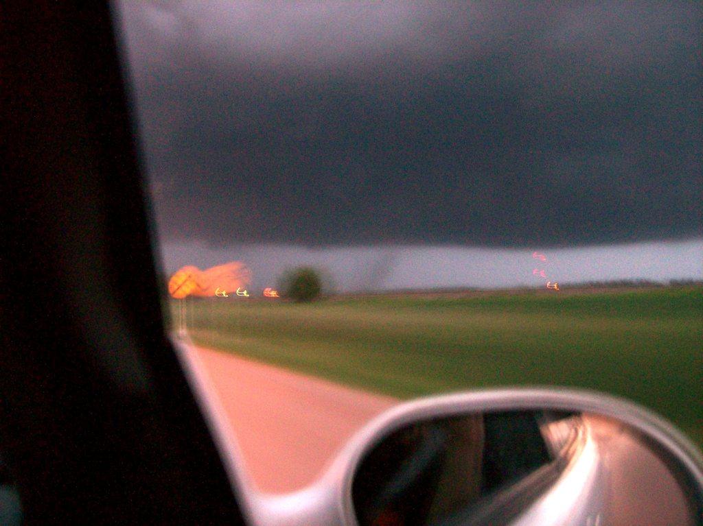
After the move, we witnessed the wall cloud with RFD cuts get better organized and drop a brief tornado on the south side of town. This tornado was visible only by dust swirls on the ground, as no real condensation funnel was visible on it until after it lifted.


It looked very close to dropping a more impressive tornado around this time, but never did. During this sequence, we sat in our spot for too long. We tried to reposition farther east when we realized the Platte River was cutting off our road network.
At this point I became very frustrated at my lack of preparation. I should've seen this coming, as I had a Nebraska Gazeteer with me the whole time! There were only two bridges across the river nearby: one was Highway 34, the other was on I-80. I was uncomfortable with taking 34 across because it was a mile or two north of us and right under where the mesocyclone was. I also didn't have any radar data at this time, so I wasn't sure. Playing it safe, I decided to get back on 80 to get east. It was an agonizing drive back to 281 to 80 (we didn't take Locust St. down to 80, probably because I didn't know we could get on there. I later found out when I looked at the map more closely. Grr!), especially because we saw the storm drop more funnels behind the trees just as we left to get back to 80.
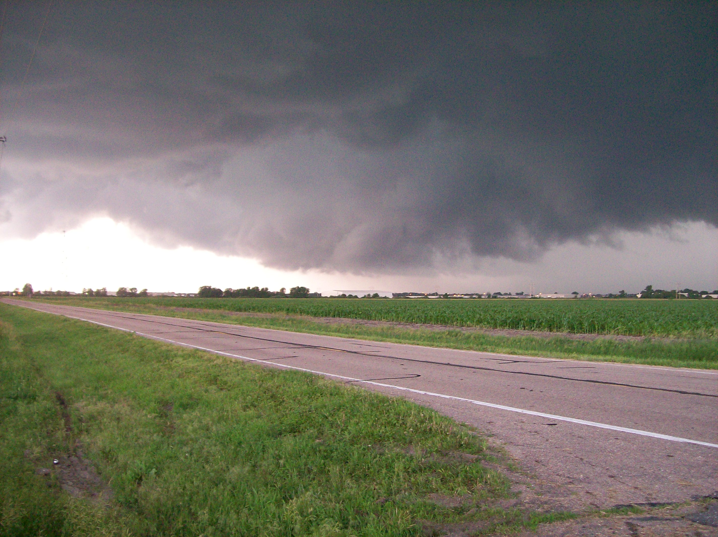
After what felt like forever of a drive, (sure enough, road construction down to one lane eastbound on 80, and despite a 65 mph speed limit, we got stuck behind a semi going 60) we got back off on Highway 2, enroute to 34. We were quite a few miles behind the storm by now, but we could see excellent structure on the back side of it. We could see the RFD flowing out down the back of the storm, with the clouds moving as if they were in a waterfall (I had just recently been taught the term waterfall, referring to violent downward motion of clouds due to an RFD by one of the TWISTEX guys). As soon as we cleared the trees and got an open view of the storm from Highway 2, we saw an ominous figure in the distance: it looked a lot like a tornado on the ground, a fat one (on my video I was calling it a "possible to likely tornado"). The farther we went north, though, the more obvious it became that it was a tornado!
We made the turn east on 34 and after a few miles of closing in, we got past a line of trees and saw it: a beautiful cone tornado with a large dust swirl circulating about it. It was amazing!
We went as far east as about N Rd (or 41B spur, as it shows in video), which I estimated was about 1.75 - 2 miles away from the tornado at our closest point. We stopped and took pictures and filmed for a few minutes as we watched the tornado head for Aurora.
The city was under a Tornado Emergency at the time, so we thought they were getting pounded in there. Luckily, it appears the tornado had narrowly missed town to the northwest where it dissipated. Granted, it was getting very dark by now (it was 9:30) but it was light enough to see all of this (I forgot to consider the later sunset times in central Nebraska owing to its position in the western fringes of the Central Time Zone...Thank God for late sunset times! They saved this chase!). However, contrast was getting very bad in the region of the tornado, so, although it was dissipating as we tried to reposition farther east, we couldn't tell for several minutes. While on our way east on W 12 Rd, we drove right across the tornado's path, marked by a nearly mile-long stretch in which every single power pole on the east side of the road was snapped off, as well as were most of those on the west side of the road.
Due to further lost light, we decided to give up the chase somewhere about halfway between Aurora and York. We think we may have seen another tornado/gustnado/satellite tornado, but it was so dark by then that we had no idea. We had no radar data and knew essentially nothing about what was around us. All we knew was that the worst part of the storm was probably straight ahead of us, so we didn't want to go east too fast.
Eventually we got back on I-80 to fill up and inevitably ran into the TWISTEX crew at the very exit and gas station we chose to go to! They were filling up as well. It was nice to run into them and begin sharing stories. This storm, despite weakening by now, was well enough lit from the back by the last glimpses of fading sunlight to see an impressive updraft on it still. Lightning was shooting out of it occasionally, also. It was a nice end to that storm, which later bit the dust completely while threatening to move right over I-80 and stay there.
Sadly, it was now time to face the consequences of the decision we had made. We were 300 miles (4.5 hours) from home and it was 10:00 PM. We were looking at a return time of about 2:30 AM! And we had been out since 10:00 AM! What a long day...and the day wasn't even over yet...
As we drove home, numerous storms began to fire in Iowa. Our horizon was more than half filled with lightning strikes as we drove east. Somehow we managed to dodge most of them, except for when we got close to Des Moines. We found out that a bow echo with reports of high wind gusts was basically on a perfect collision course with us. We found out it would hit us just about the time we got to Ankeny. Indeed, we made it to the north side of Ankeny just minutes before the gust front hit us. We stopped on an exit road so as to avoid the worst of it while driving. I had my sonic anemometer with me and measured only a 26 kt gust before I got sprayed with water. Granted, we were kind of in a protected area with trees around to break up the winds around us. Apparently, though, gusts to 70 mph were reported with damage in town, but we missed that. After we got back on the road, we witnessed a transformer exploding just off the interstate near Huxley, after which every single light on that side of the road went out. Interesting.
Finally, after dropping everyone off, I strolled into my apartment just before 3:00 AM. What...a...day...!
| Note on the poor quality of the images in this account: many of the pictures were not taken by me, and my camera gets cranky when shooting in low light conditions with the landscape (infinite focus) mode chosen, which I always use for severe weather pictures. I've noticed I have to keep the camera very still when taking pictures with my camera on that setting when light is fading, which on this day it was. Those who were taking pictures surely did not know this, so many of the pictures are fuzzy. They didn't know, so I don't blame them, but unfortunately because of it, I did not get such great pictures this day. |
This day went from nothing at about 5 PM to absolutely crazy in Nebraska a few hours later. In looking at archived Level II imagery, I counted 5 supercells that had developed by 9:15 PM. Two were left splits and were both anticyclonic. I've included a timeline with some images covering the event. I've also included a few detailed diagrams labeling the supercells for clarity in the timeline.
| Mesoscale warm front/outflow boundary clearly visible on KUEX slashing through Webster and Kearney Counties, NE and Jewell County, KS. | 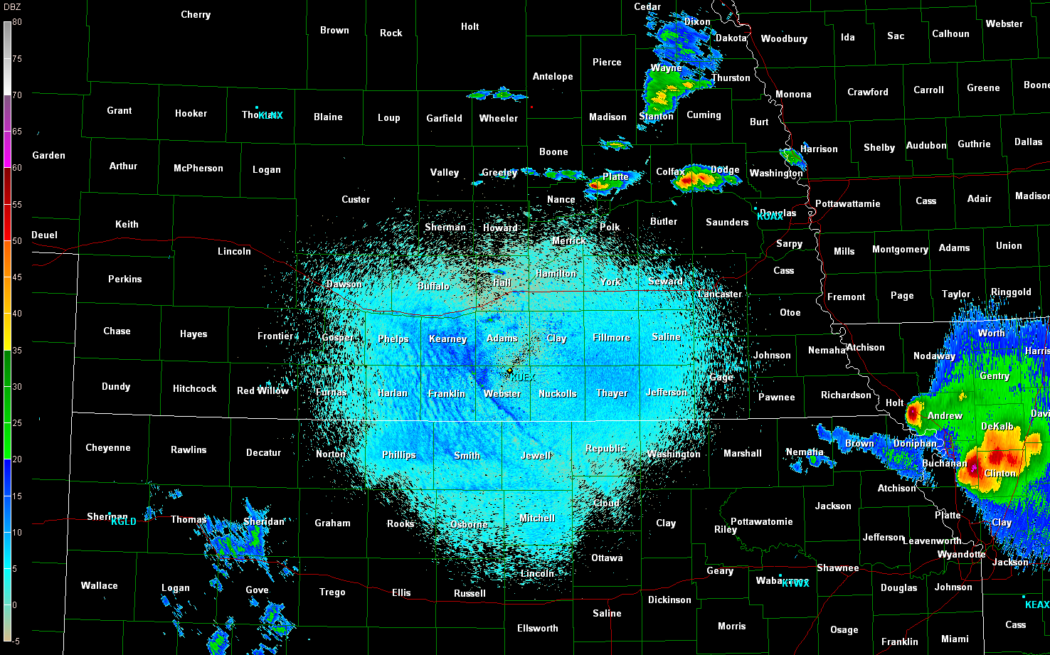 |
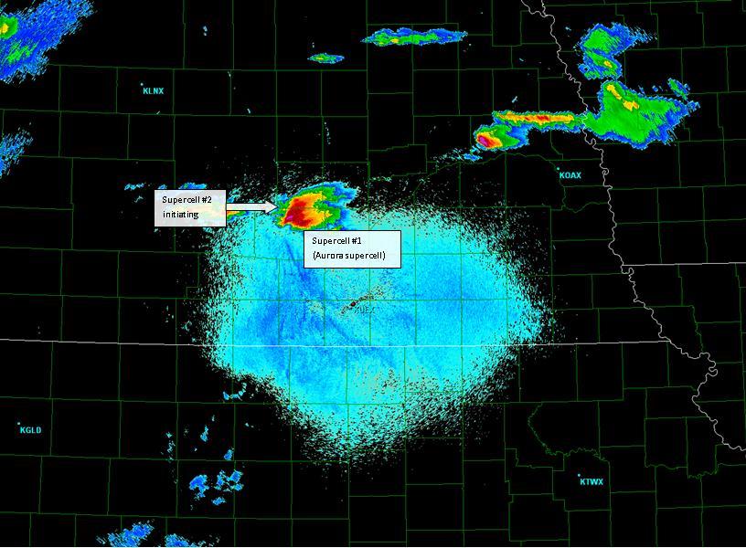
| Aurora/Grand Island supercell (I'll call it #1) initiates along the boundary at 2227UTC. | 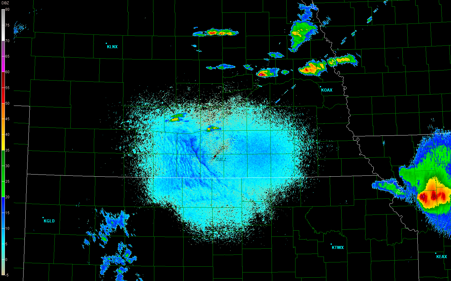 |
| Aurora/Grand Island storm first starts to look interesting (2250UTC). | 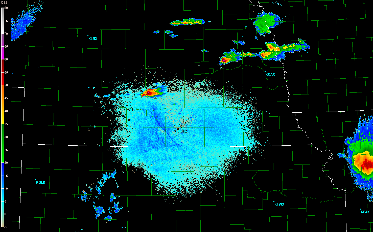 |
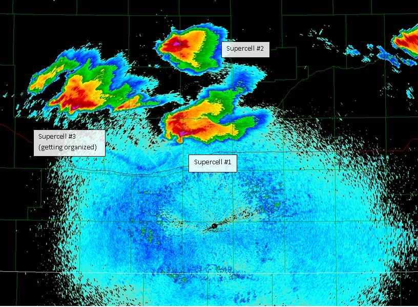
| At 2318UTC, the storm starts to look very impressive. It's obvious that the storm is anchored to the boundary in this image. The boundary, which is only moving at 5-10 mph northeast, is dragging the storm along with it, which is also only moving east at about 10 mph. Also on this scan, you can see the very beginnings of supercell #2, an anticyclonic left split, just beginning to form on the western flank of supercell #1. Consult diagram 1. | 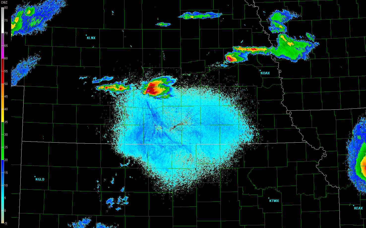 |
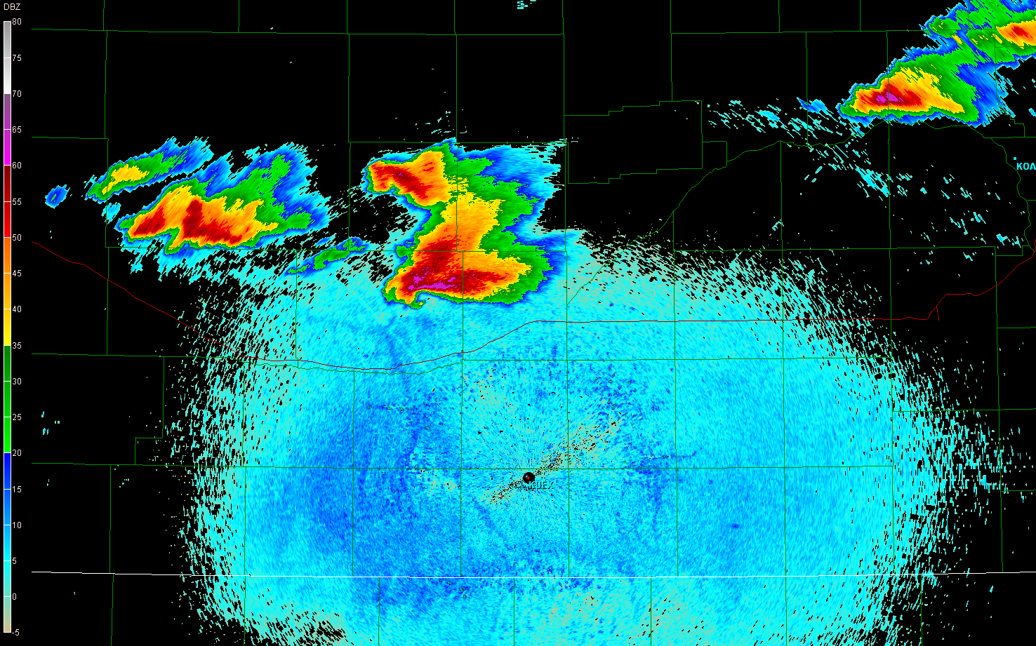
| Just a few scans later, at 2332UTC, the split becomes more visible and starts to take on its own identity. | 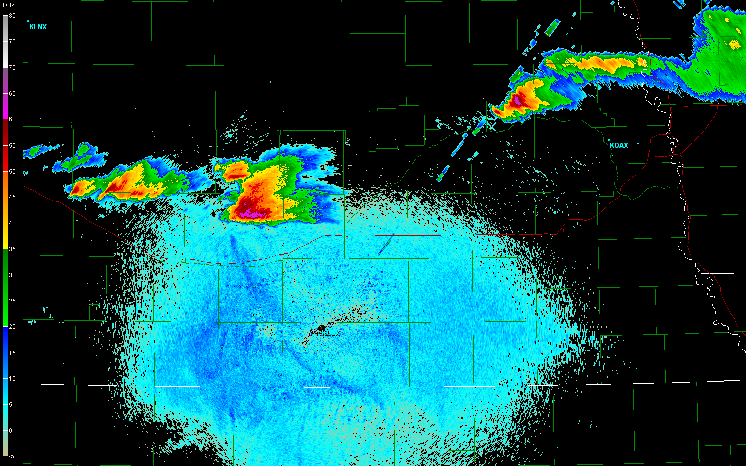 |
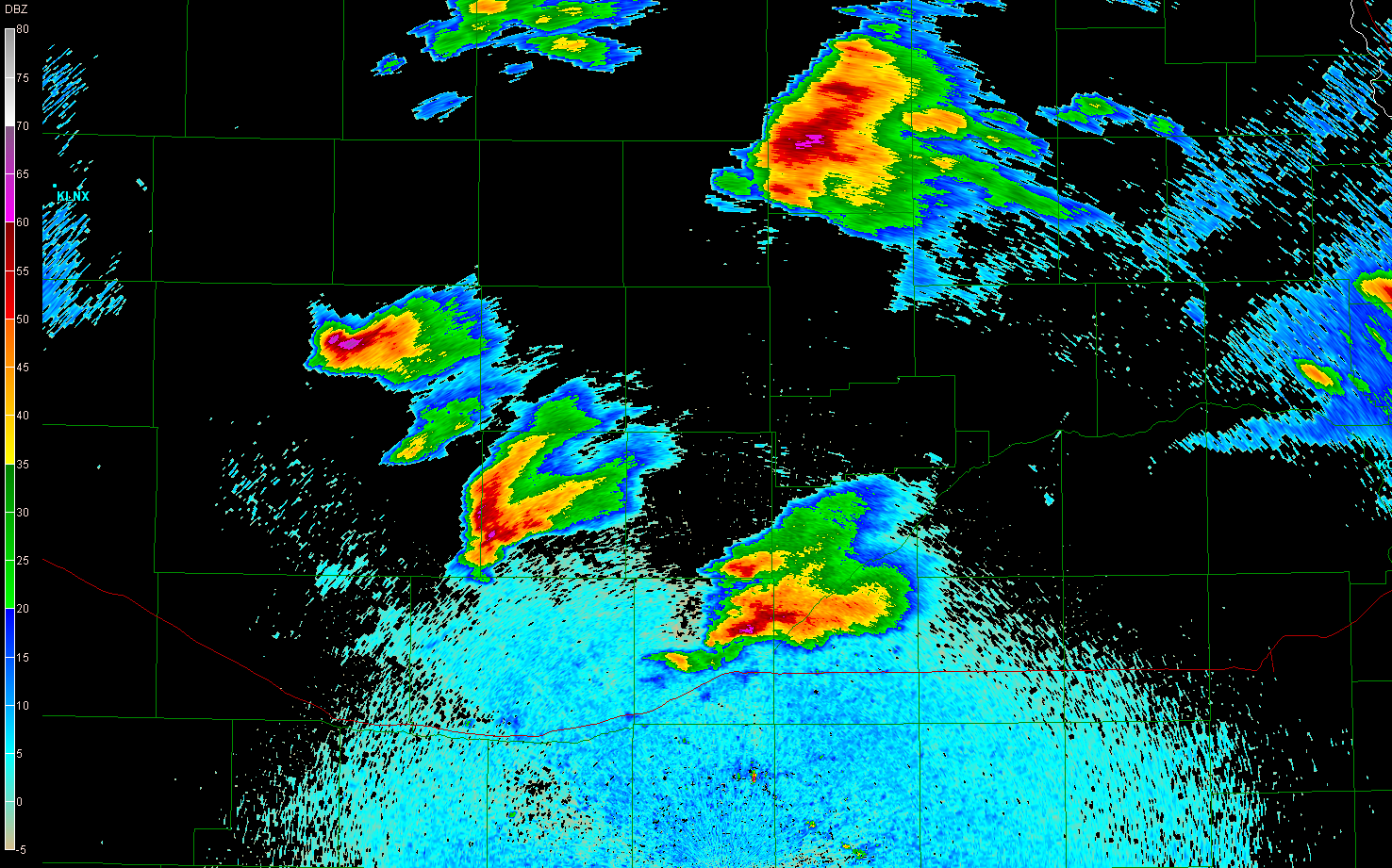
| At 2350UTC, the left split becomes supercellular, appearing much more organized on base velocity than on base reflectivity. What was interesting about this case was that the best rotation signature on the left splits (and only the left splits) occurred on the 1.3° elevation angle. In fact, either the rotation was hidden by purple haze on lower scans or it was not present there. Yet, on the right movers, rotation was plainly visible at 0.5°. Weird. | 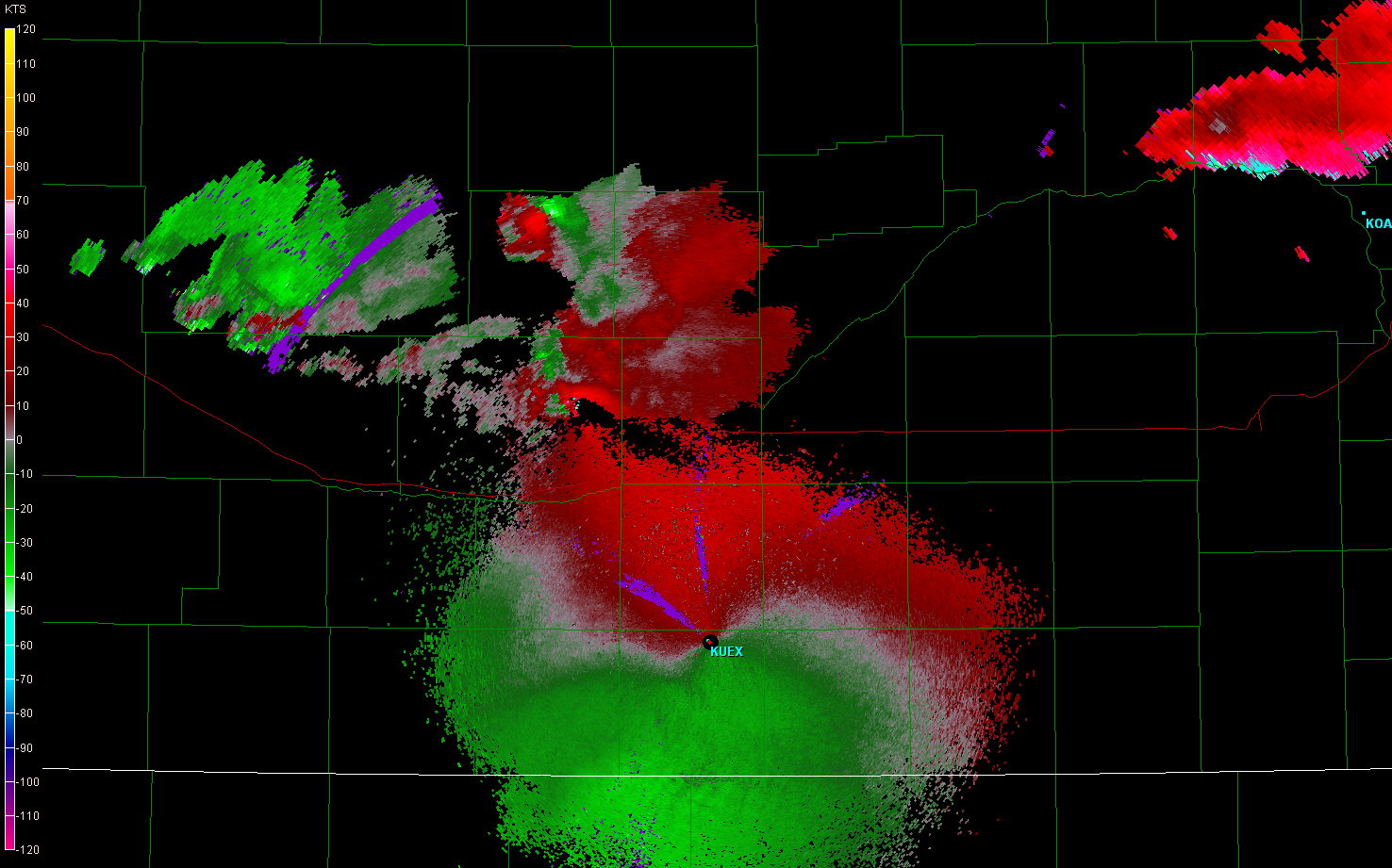 |
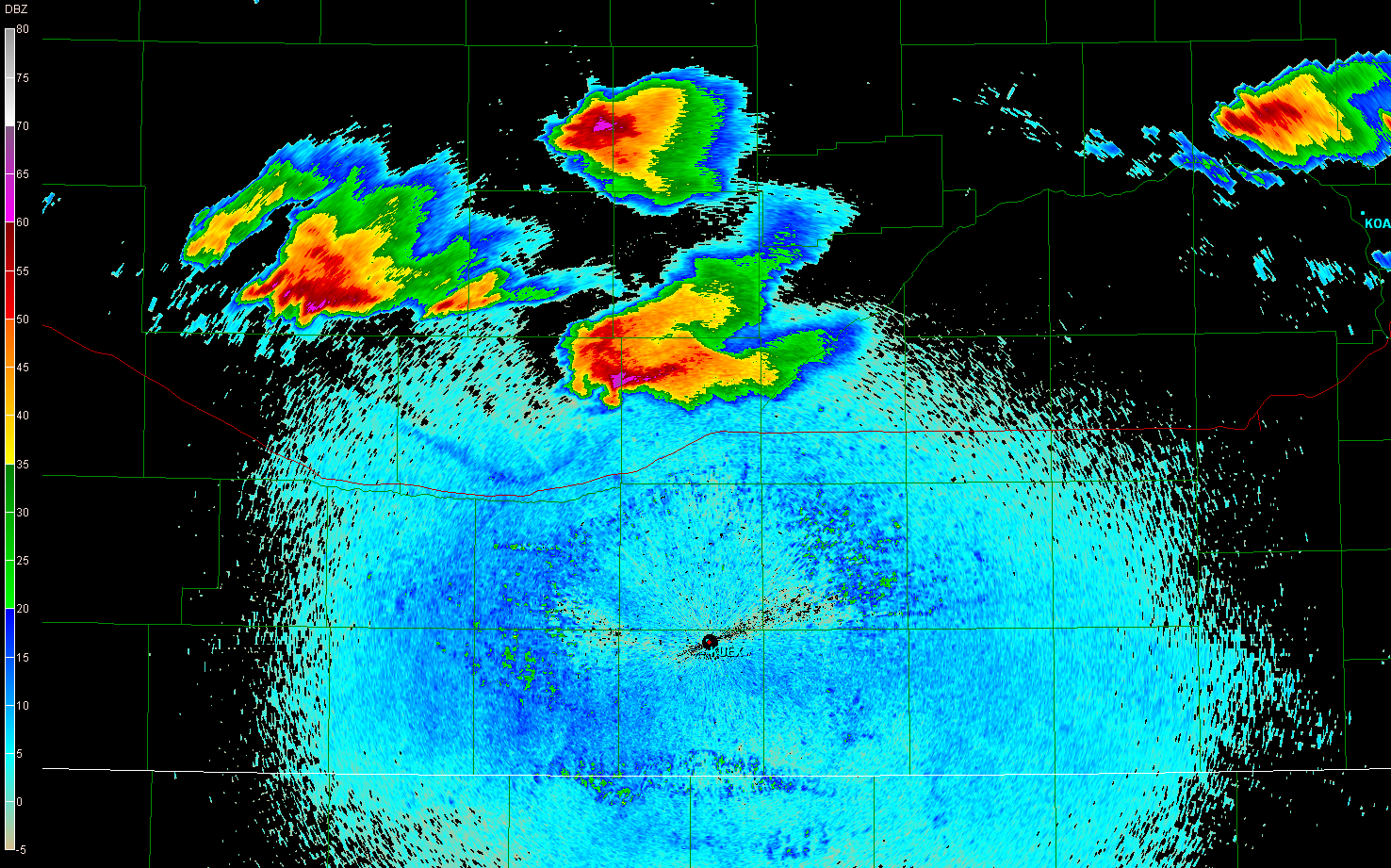
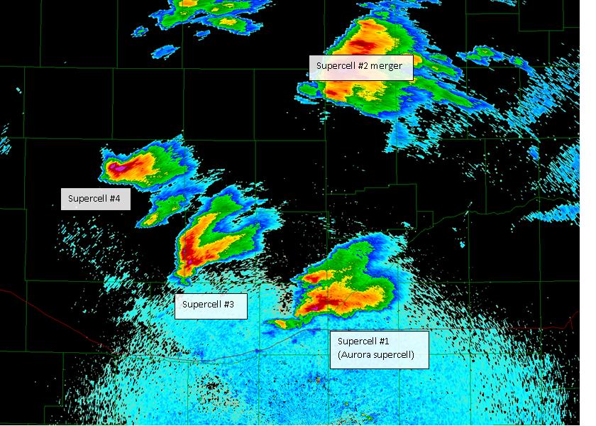
| 0023UTC: The left split continues to fly northeast while supercell #1 continues to drift east, and supercell #3 begins to get organized to the west of supercell #1. Anticyclonic rotation is obvious in the base velocity image. Consult diagram 2. | 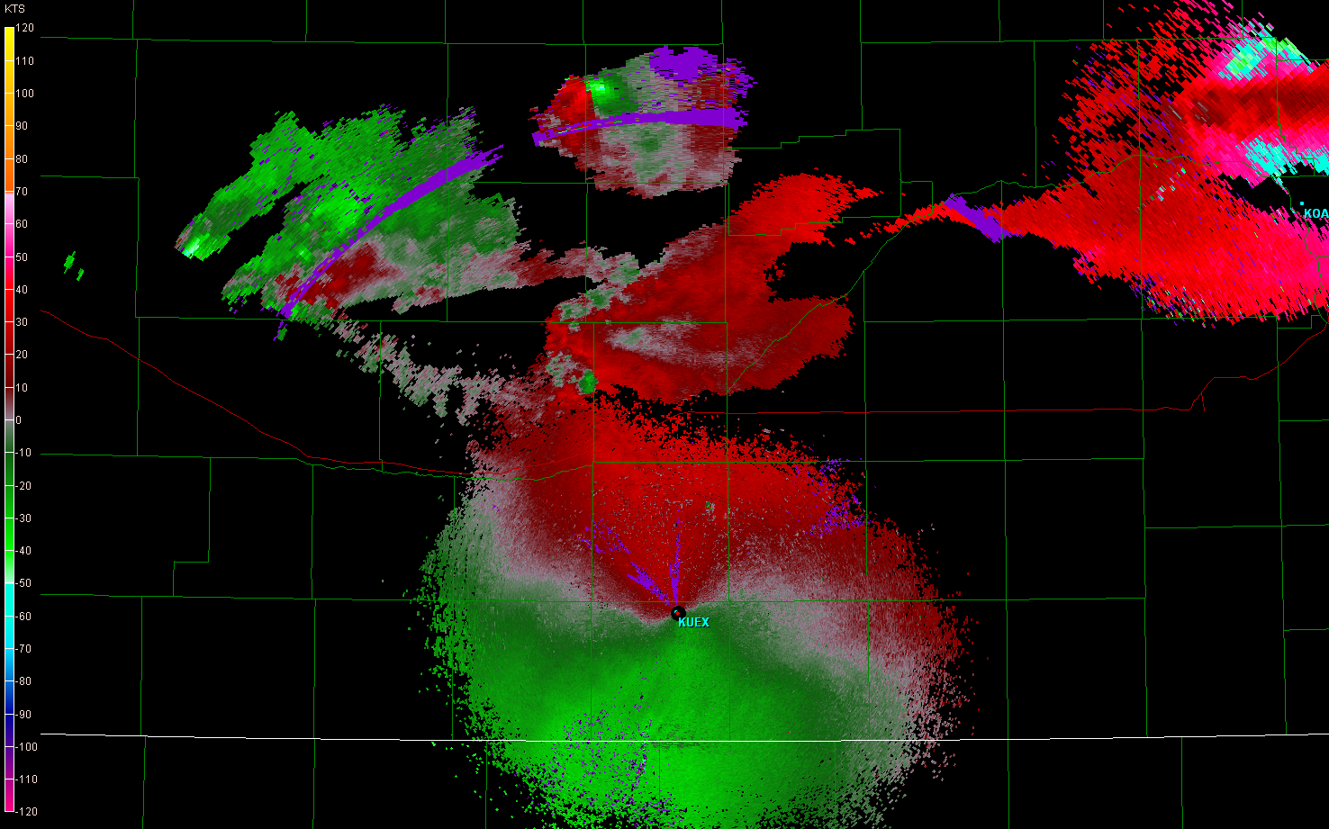 |
| Then, at 0129UTC, out of a destructive cell split in Custer County, a left moving supercell (#4) appears. Consult diagram 3. | 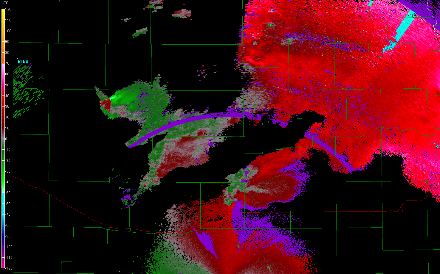 |
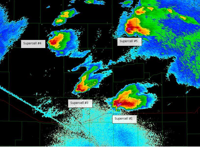
| Finally, at 0156UTC, as supercells #3 and #4 weaken, supercell #5 emerges from the merger of supercell #2 with another cell to its north. Consult diagram 4. | 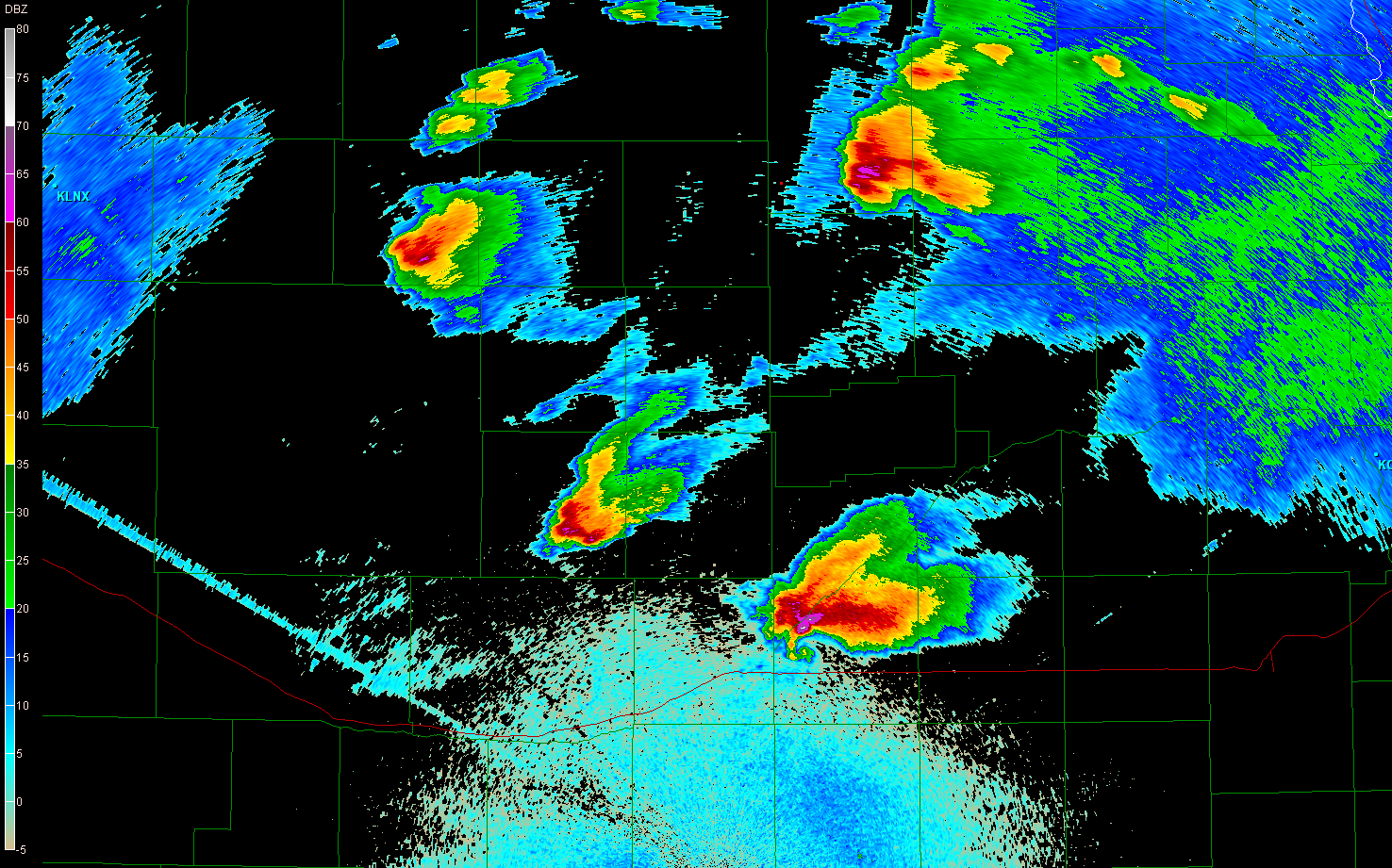 |
Return to 2009 - chasing home page