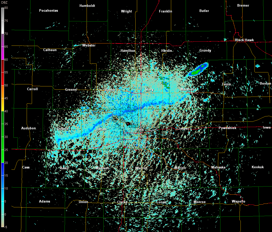
Boundary well visible on base reflectivity (2001UTC 0.5° BR from KDMX).
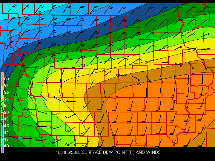
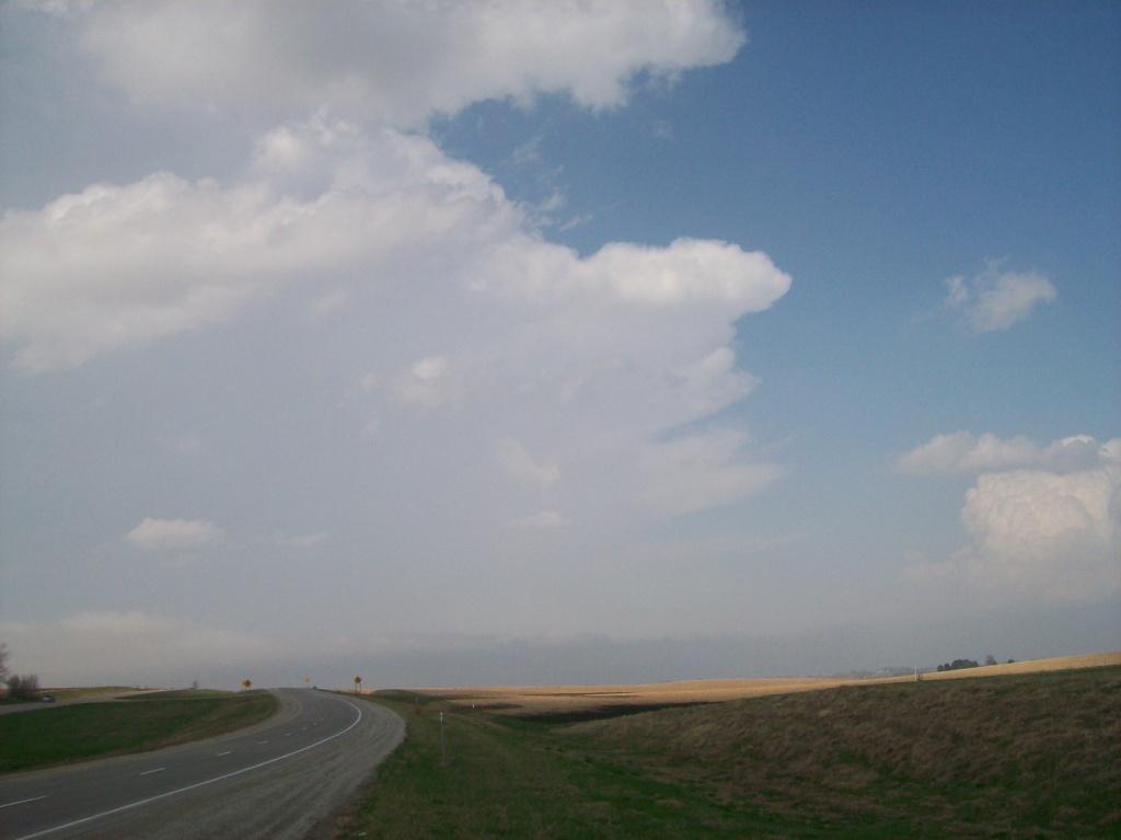
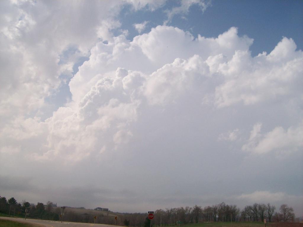
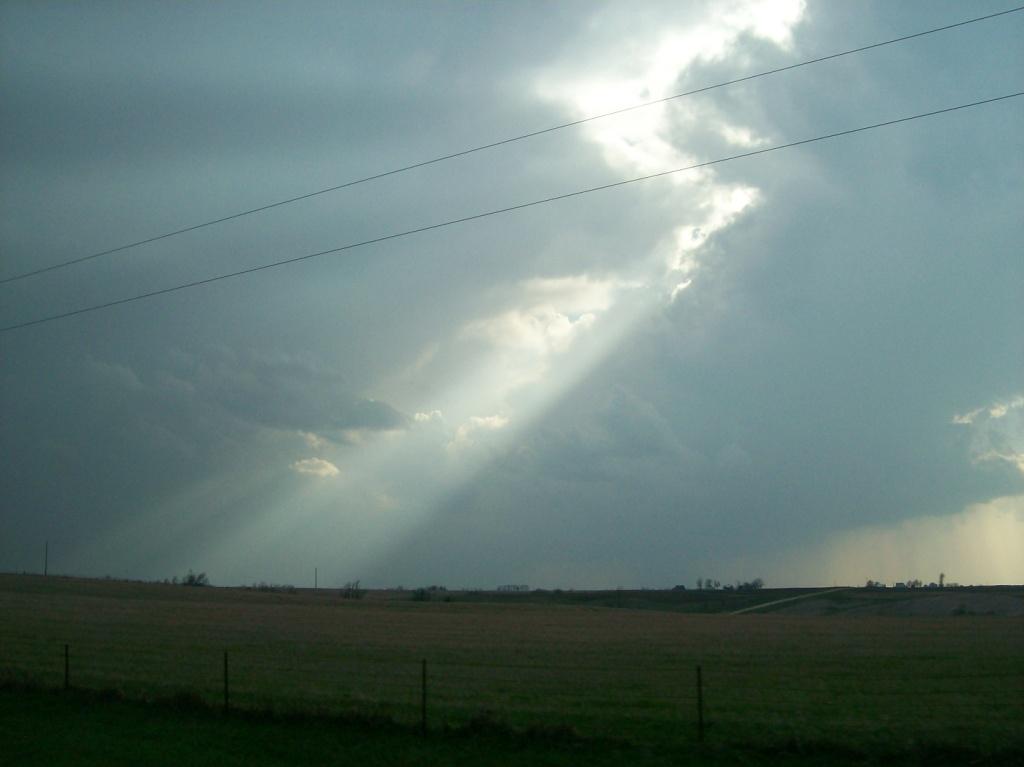
After yesterday's cap bust, I wasn't in much of a mood to go out again today. As I had looked at the models leading up to this event, it was clear to me that the 5th was the bigger day. The problem I had with today's setup was that the surface winds were veered to the southwest, thus providing for a unidirectional wind profile and linear hodographs, which don't necessarily bode well for tornado chances. Capping certainly wasn't going to be a problem, as the upper-level energy that probably kept action from occurring yesterday until almost overnight was finally arriving in the Midwest. Instability wasn't a problem either, as solid low-60s dew points were already established throughout the warm sector, the leading edge of which had crept north into southern Iowa overnight. The front continued to lift north, finally passing through Ames near midday (see time series from the roof of Agronomy Hall on the ISU campus in Ames). Seeing this, the rapidly building instability, and developing towering cumulus just south of Ames around 2 PM, I was finally persuaded to head out. Logan, Ryan, and I headed out at around 2:30. We noted before we left, however, strong northeast winds and cooling in Ames...the warm front was sagging back south. This gave the time series linked above an interesting shape for the day. It also was a killer for the activity of the day.
We initially sat at a park and ride just south of Huxley off of I-35 as the tornado watch was issued. As we sat there, the horizontal vorticity from the baroclinicity of the warm front was very apparent with very noticeable horizontal twisting of the cumulus/scud clouds along the boundary. I thought to myself, man, if only an updraft could form on the boundary and tilt and twist some of that vertically! It would produce before the storm reached maturity! The boundary continued to sag south (thus probably making it a cold front now). It had acquired a bit of a WSW-ENE orientation. That would be good since storm motions would be northeasterly. Thus a storm wouldn't have to turn as hard to the right to begin to travel along the boundary. That was the only way a storm was going to produce a tornado in Iowa this day. There simply wasn't enough/any turning of the winds with height in any other location. That left a very narrow swath, maybe 10 - 20 miles wide, where there was sufficient instability and shear to get a tornado. I knew we would have to stick to the boundary in order to see a tornado. For some odd reason though, I let us stray off track.
We headed east after the front passed back over. We got on Highway 30 and sat near the intersection with state highway 330. The surface boundary was well noticeable: there was a thick stratus deck north of where rising air parcels condensed after riding over the boundary (more theta-e advection). In fact, by about 3 PM, some storms had fired right along the boundary, but they were again rocketing northeast into the cold sector.

I figured these storms were not long to live once they got into the colder air, but I neglected to consider the plethora of elevated instability present from the two straight days of theta-e advection. A few of these storms would go on to become elevated supercells and drop tennis ball hail on the Waterloo/Cedar Falls area. We briefly pursued these storms near Marshalltown, but gave up quickly because 1) we fell behind the storms fast, and 2) we realized how futile it was once we got under that stratus deck. Finally by this time, some weak storms had developed all the way down in south central Iowa, and were hauling northeast, so we began moving south through Tama/Toledo on US 63, eventually getting to Montezuma for a fuel stop.
A number of small cells had gone up west and southwest of us. None looked too impressive. Finally we headed back north towards Malcom. On the way there, the one cell that was finally starting to look good formed a bit of a tail on it right as the core passed over Grinnell. Knowing that the boundary was right about there by now, I said to everyone, "this storm is probably popping out a quick tornado now as it trips over the boundary." Not even 60 seconds later a tornado warning was issued for the storm! Awesome, except for it was still crusing northeast at 50 mph, and we were already 10 miles behind it and stuck behind a slow moving truck. We might have gotten a brief view of a wall cloud, but we lost the storm pretty much immediately.

Despite falling farther and farther behind the storm, we continued to pursue it northeast until we reached Belle Plaine. Then we cut off our chase and headed back to Highway 30, where we were going to turn west and head home. Well, between Belle Plaine and Highway 30, the storm started to slow down and turn right. It was already leaving Benton County, though, leaving us 15 - 20 miles behind it. There was also a train of chasers on 30 in front of us, so getting there was not going to be easy. We sat there pondering continuing the chase for a good 20 minutes before finally turning west towards home. Sure enough, after not being warned for 30 minutes after the first warning expired, it went tornado warned just after we turned. I was rather pissed, but thankfully there were no reports of tornadoes or even funnel clouds from this storm, just some rotating wall clouds. I don't mind missing that.
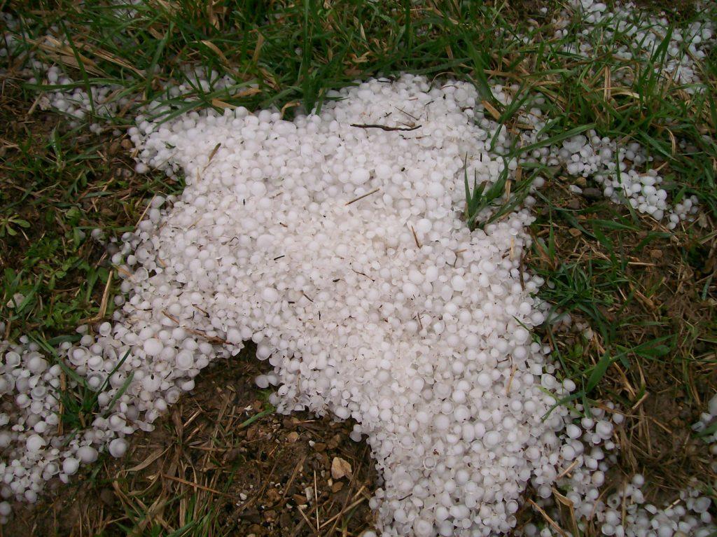
Between the Benton-Tama County line and Tama, we drove across a narrow hail swath that had already fallen. This was strange because I didn't see much in the way of 50+ or 60+ dBZ reflectivity over the area any time in the past hour or two. Nonetheless, since it was the most severe weather we had seen in the past two days, we pulled over, got out, and had some fun with it.

700 miles for the first two chases of the 2010 season, and little to show for it. I was happy to at least get a chance so early in the year, though. These were some of my earliest-of-the-year chases.
Return to 2010 - chasing home page