
This was the best the wall cloud looked. Shortly after, it fell apart.

The storm had decent stucture at this point. You could see some spiral banding and storm scale rotation above the wall cloud.
Many people will remember this as the day Joplin, MO was devastated by an EF5 tornado. While tragic, I had a different story this day.
This day went from being a non-event to a widespread MOD risk with a 15% hatched tornado threat in the 48 hours leading up to it, at least in Iowa and points north. I had seen the potential in the models starting Friday night (the event was on Sunday). As it turned out, the same disturbance that underperformed in KS and OK the Thursday before closed off, meandered over the Dakotas, and began to deepen again as it picked up speed and moved across the upper Midwest on Sunday. Since no fronts cleaned out the warm, moist air at the surface, there was a pretty good setup for severe weather, including tornadoes.
Since the threat area was so widespread and the HRRR was indicating two waves of severe weather would threaten eastern IA and northern IL, I decided to head east on I-80. I left Ames around 11 AM with Logan and Zac and picked up Ryan on the way east. I figured we would for sure end up in IL at some point, but we never did (we didn't need to).
I decided to call my dad who lives in the Cedar Rapids area to alert him of the possibility for some major severe weather (you'll see why I bothered to include that part later).
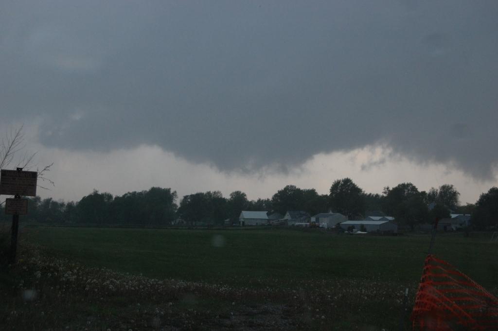
We lunched at the Tanger Outlet mall just off of I-80 near Williamsburg. On the way there, we drove under a building cumulus field. Many of the clouds were pretty large already, suggesting that the first wave of storms was set to fire soon, and probably in our area (this Cu field extended through most of eastern IA). As we were finishing our lunch, we noted some blips of reflectivity showing up about 40 miles to our WSW. We found a hill near the interstate to watch things evolve. Once Logan saw an anvil building off to the WSW (along with increasing reflectivity from KDMX) we decided to move west on I-80 to get in position to intercept the storm.
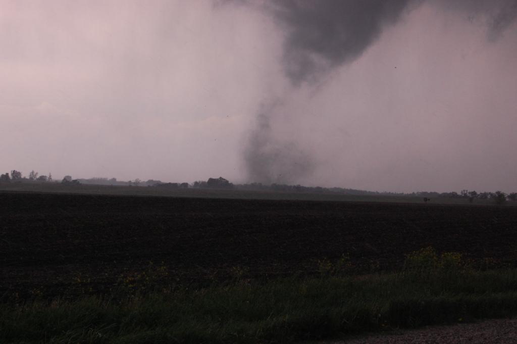
We pulled off at exit 201 and sat just south of the interstate. A solid rain-free base loomed to the west. Slowly over the course of 10-20 minutes, a wall cloud developed under the base. However, despite the good looking structure that was emerging, very little rotation was noted with this wall cloud. Then, it fizzled out and dissolved as it was just a few miles west of us.
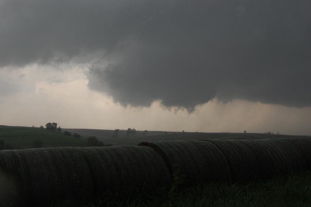
At this point we had a difficult choice to make. A second storm had blown up to the south of this one and was becoming very strong. Everyone knows that when faced with storms stacked meridionally, it's best to go with the southern storm as it usually will destructively interfere with storms to the north (either by cutting off good inflow, sending out cold outflow, or by being there when the northern storm turns right and runs into it). However, we were not in good position to get on the southern storm, and it looked to be producing some rather large hail. Our only choice would've been to core punch right through the heart of it. That's something we didn't want to do, so we opted to stick with the northern storm. We knew that if it were to turn right it would be a goner. But so far it hadn't done that and there was space remaining between the downdraft regions of both storms, so I figured as long as the space remained and the downdraft of the southern storm didn't rain down on the updraft or inflow region of the northern storm, the northern storm might still have a chance. Thus we hopped onto U.S. 6 and made our way to Ladora before pulling off to take a detailed visual look at the storm. That's when things got good.
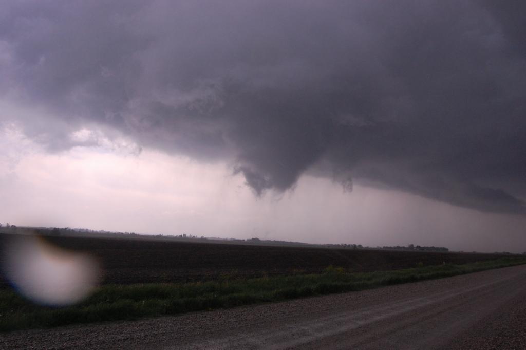
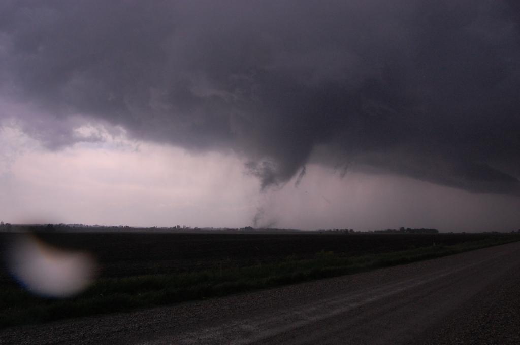
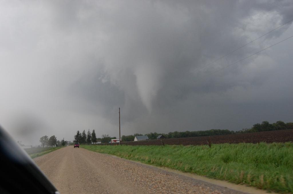
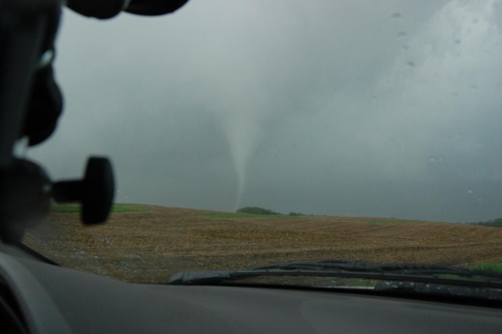
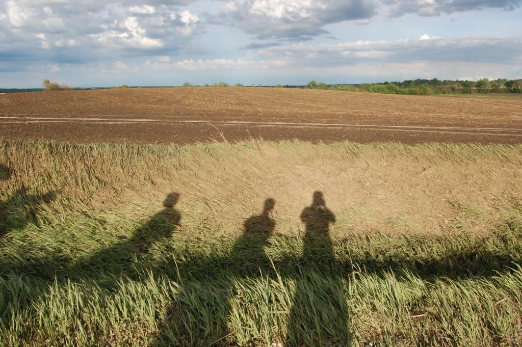
We stopped just south of town. When we looked northwest, although the storm didn't have any obvious or menacing lowering or wall cloud, the base of the storm was rotating, fast! Upward motion was also noted (see the image above). Thankfully, Ladora was not a big town, so we blasted through to the north side of town where we briefly perched on a hill top. Looking northwest, we saw strong rotation and upward motion, and within seconds, a dust whirl on the ground. Tornado! We quickly whipped around to face north again and moved north along G Ave., stopping about one mile north of town where we had a pretty good view of the tornado, from ground to cloud base. We all got out of the car. As I snapped a few shots (below), I realized it was on track to cross the road we were on, just farther up. Thus I shouted to everyone, "We can get close to this one! Let's go! Get in!" Since G Ave was gravel, it was tough to move quickly. We ended up moving north almost another half-mile before stopping again to watch the tornado cross the road. At the time, it looked like we were within a mile easily, and maybe as close as a half-mile. However, when we came back to do a damage survey later, we found that we were barely within 1.5 miles of the tornado. It's amazing what the adrenaline rush can do to make tornadoes look so much closer than the really are.


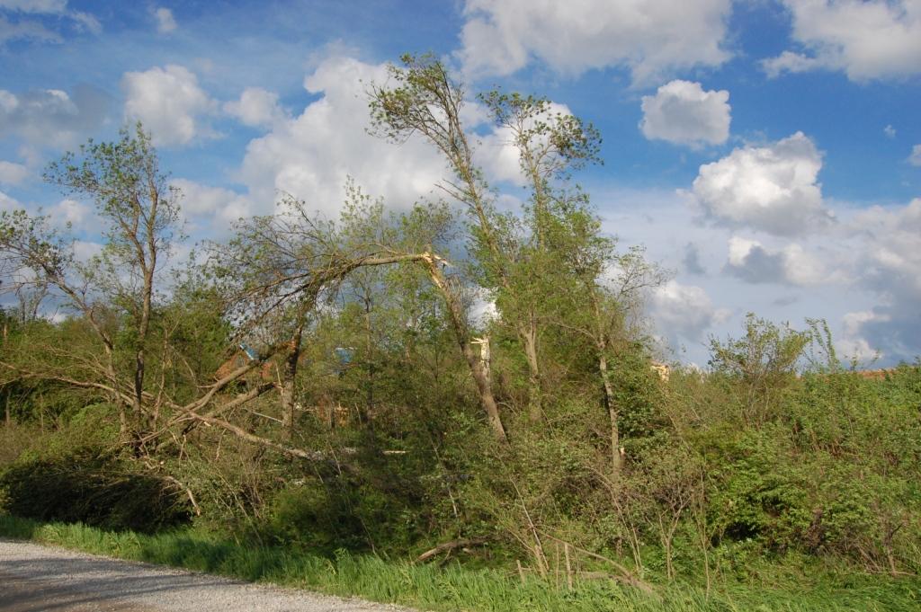
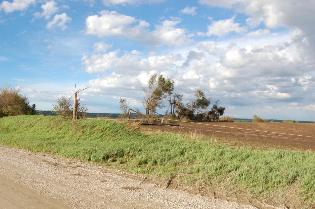
We followed it northeast, but got behind it due to our intercept. It faded into the poor gray contrast ahead of us as it dissipated. When we approached state highway 212, some obvious damage stood in front of us. I called it in to 9-1-1, thinking that a farm house might have been hit behind a grove of trees that was shredded (below), and due to the lofted debris from our intercept.
What amazed me more than anything was how the storm looked on radar while it was producing. It looked like crap! Also, when I checked the motion of the storm I realized it was moving straight towards Cedar Rapids (remember the phone call I made earlier?). That's when I called my dad again and told him, "Okay, now a storm is coming. I just watched it drop a tornado and it's moving right at you." He told me, "We see that. Also, some of the TV weathermen said they got a report from someone they know very well of a tornado northwest of Ladora." I had reported the tornado on SpotterNetwork, and since I knew two of the meteorologists at KCRG in Cedar Rapids because they were ISU alumni, I knew what that meant (I was the someone they knew very well!). Anyway, the storm weakened quickly after the tornado dissipated.
Our attention quickly shifted to the now dominant southern storm, which apparently was also producing a tornado of its own. We still were in no position to get ahead of it. We either had to core punch it or wait for it to pass to our east before cutting back south. We opted to do a core "brush by" as we drove until we appeared to get larger hail, then stopped for a minute to let it get ahead of us again. The lightning got pretty intense during this maneuver, especially as we moved south on U.S. 151 back towards Williamsburg. I think the largest hail I saw on the ground was a broken golf ball, but I can't be sure. We made it back to I-80 without incident.
I was pretty pumped after having such a great intercept before 3 PM on a day in which numerous waves of storms were predicted. However, things did not go very well after this point. The southern storm went outflow dominant as we pulled ahead of it on I-80. We stopped just north of Tipton when it became clear that, for some reason, we weren't going to be able to get ahead of it, and that it was decidedly outflow-dominant. There were numerous other storms now going up to our southwest, back towards Iowa City. However, every storm that began discrete joined a growing convective cluster of crappy outflow-dominant convection in short time. We eventually stopped at a rest area on I-80 where we took maybe one or two quarters and some gusty winds (reported up to 70 mph from I-80 west of us) from one of the last big storms in the cluster. Just behind this cluster a new line of storms was popping west of Iowa City. Initially I thought that was the second wave that was going to go big. Well it didn't, probably because it was too close behind the first cluster. Thus the storms were choking on freshly rain cooled surface air. We cut our chase off at about 5:30 PM, somewhat dissapointed in how the rest of the day turned out. However, we had a big intercept that day, mainly because I think we were one of the only chasers on that tornado. Everyone else had gone for the southern storm. Both decisions were rewarded.
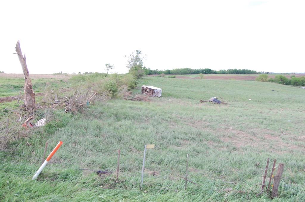
Given how early it was, we decided to go back to the location of the tornado and do our own little damage survey. We first investigated G Ave. between 148th St. and state highway 212, where we found a single family home with minor roof damage, but several trees down around the property, including some snapped off above the ground. On the other side of the road were some obvious convergent signatures in the way the vegetation was blown down. There was also some mud and debris caked on a fence line.
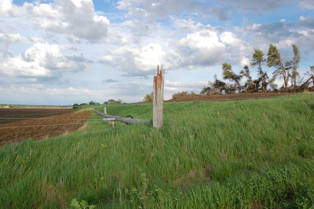
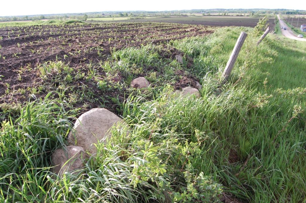
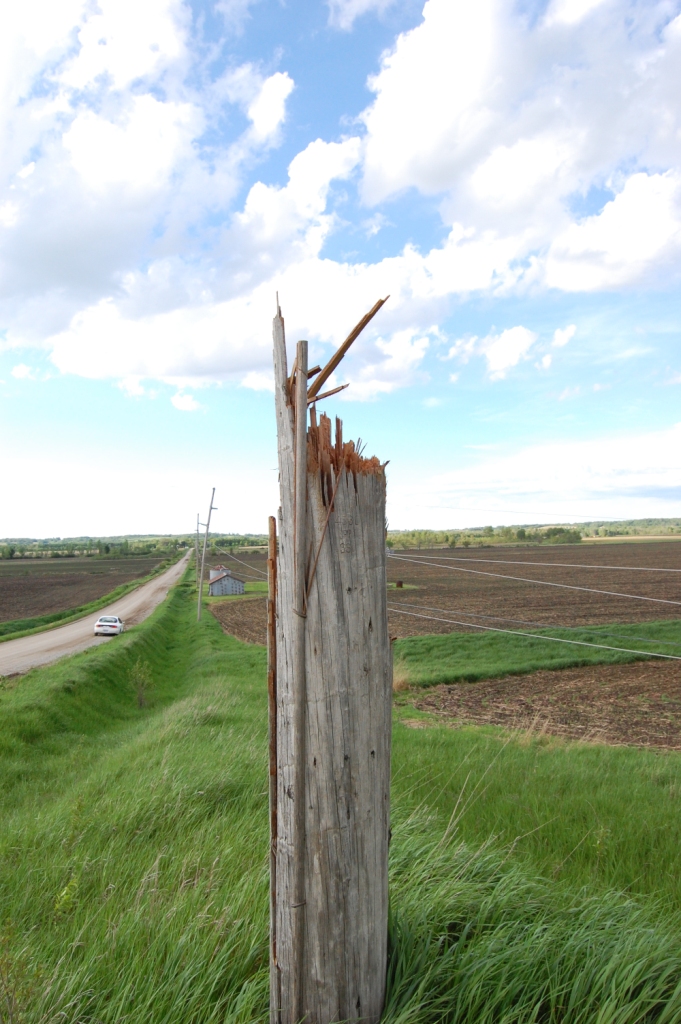
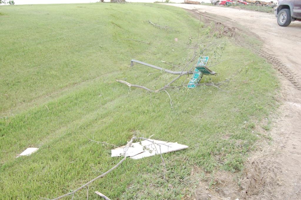
Next we investigated H Ave. north of state highway 212. We noted wooden power poles snapped off at ground level, all laying eastward (no real hint of rotation here, just strong straight line winds, which just goes to show that it can be hard to distinguish small tornadoes from straight line winds from just the debris). There was more mud caking of grass along the ditch on the road side and some widely scattered yellow insulation foam. We also saw a large rock that had been pushed off a pile in the neighboring field and rolled down the embankment. It wasn't a light rock, so it took some pretty fierce ground level winds to do that.
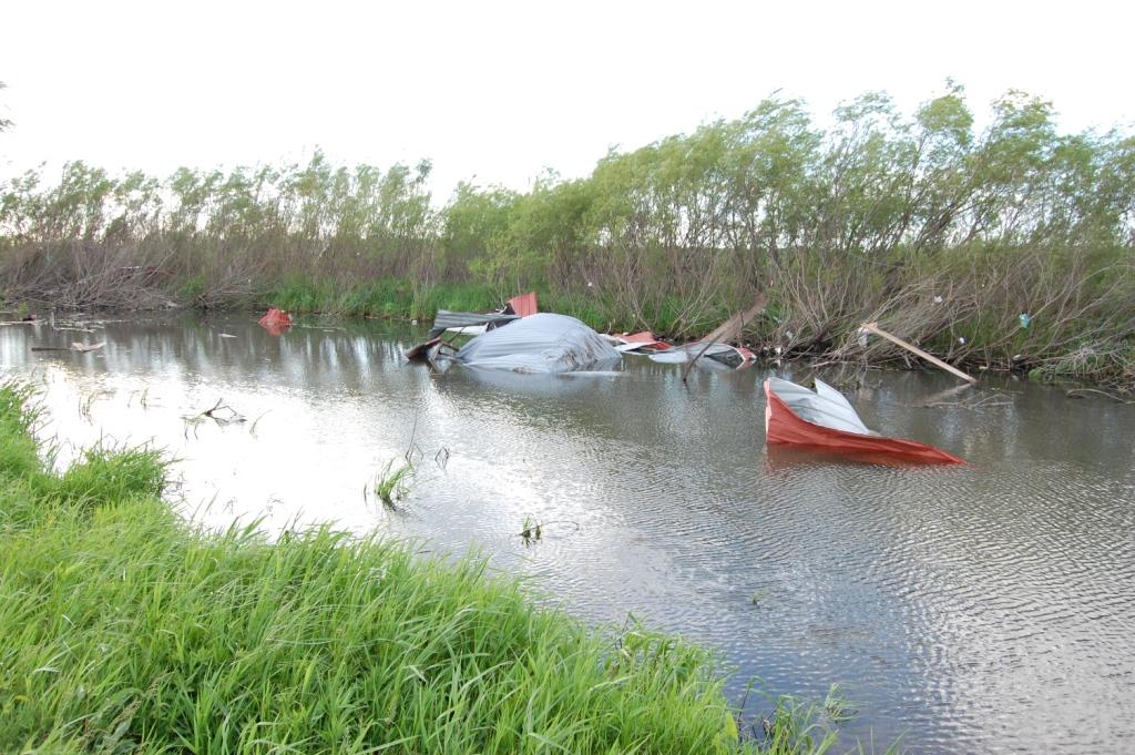
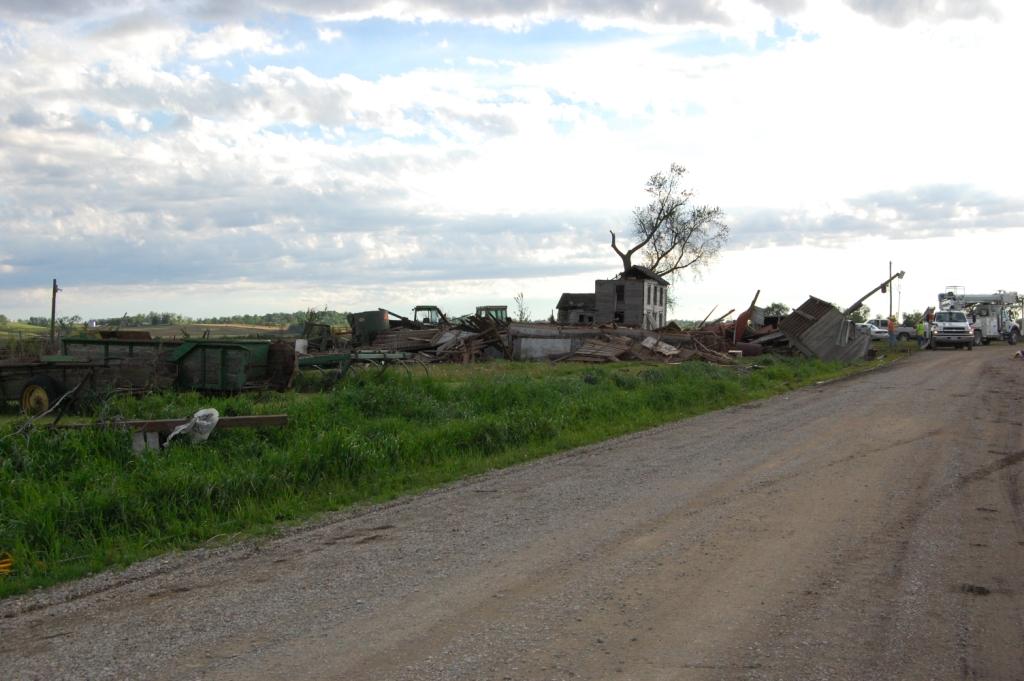
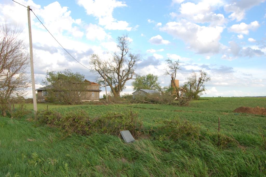
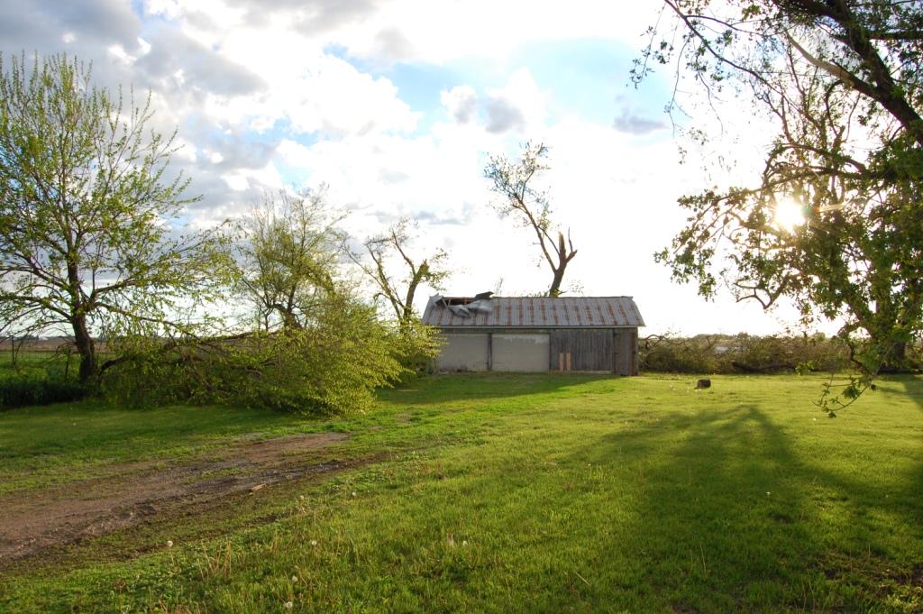
Since we didn't see the tornado much after it passed through this point, we didn't know how much further northeast to search. But when we looked across the field we saw utility vehicles in the distance, so we investigated 130th St. just west of I Ave. The utility crews were replacing the lines that had been torn down (same as along H Ave.), but there was also a dilapidated, seemingly abandoned farmstead that had been pretty well trashed. We couldn't get all the way to ground zero due to the utility crews, but it appeared that many buildings on the farmstead had been totaled. There was even a small shed that was laying on its roof, still intact!
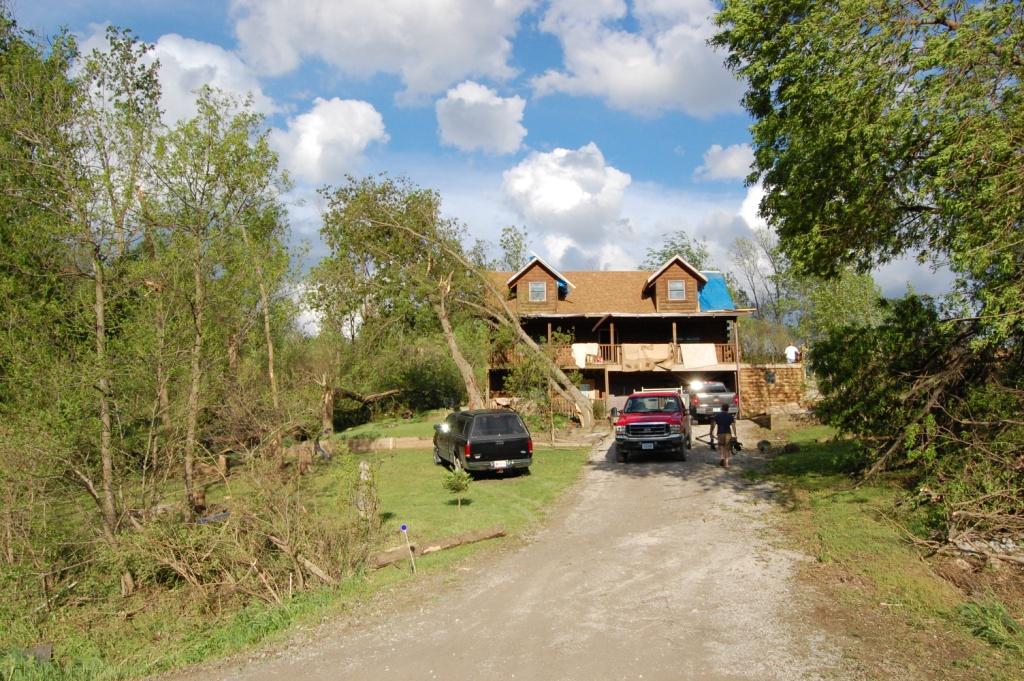
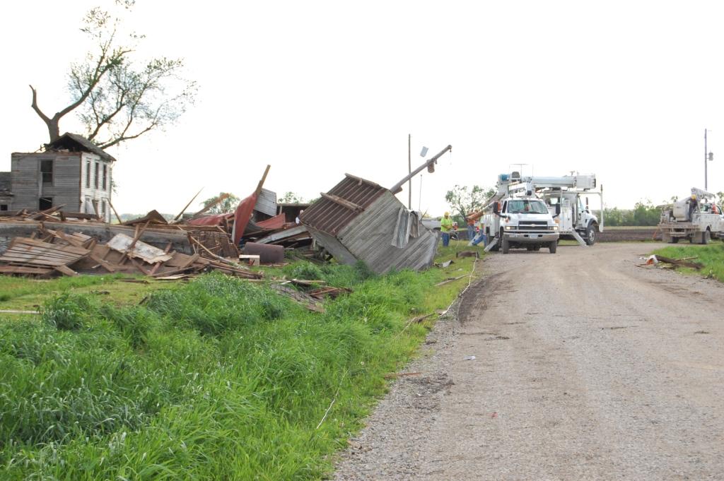
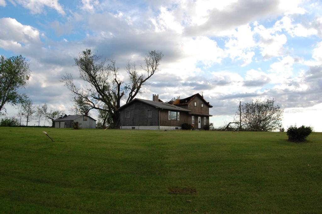
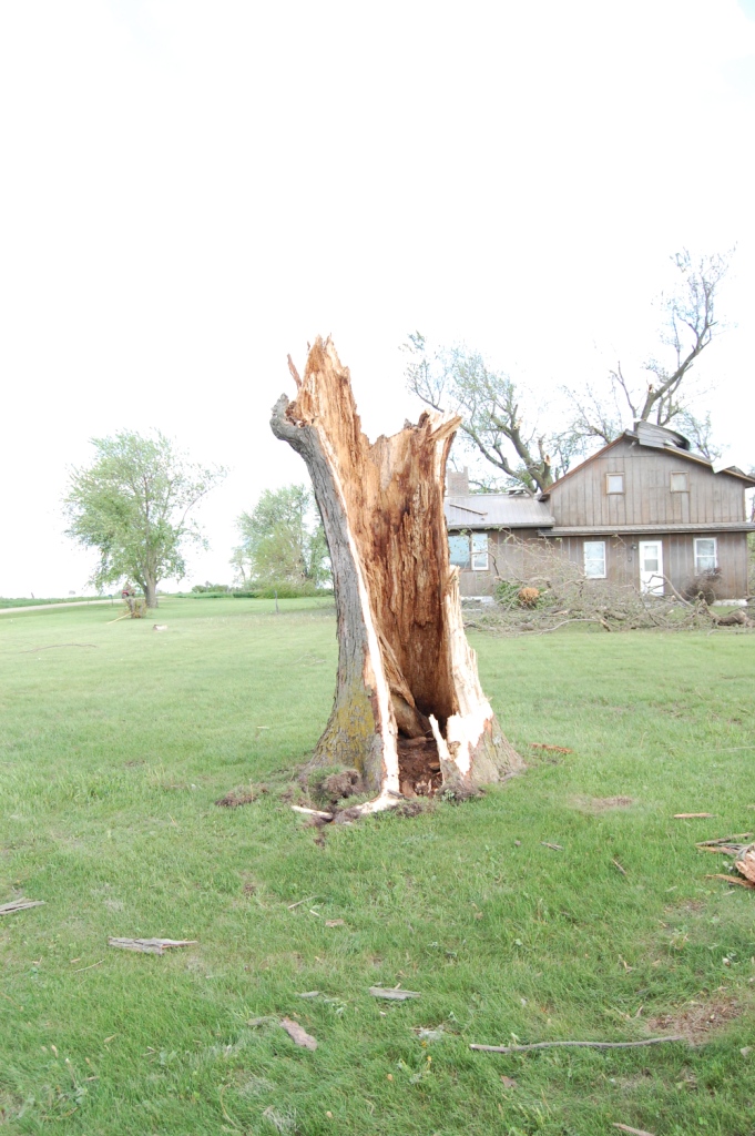
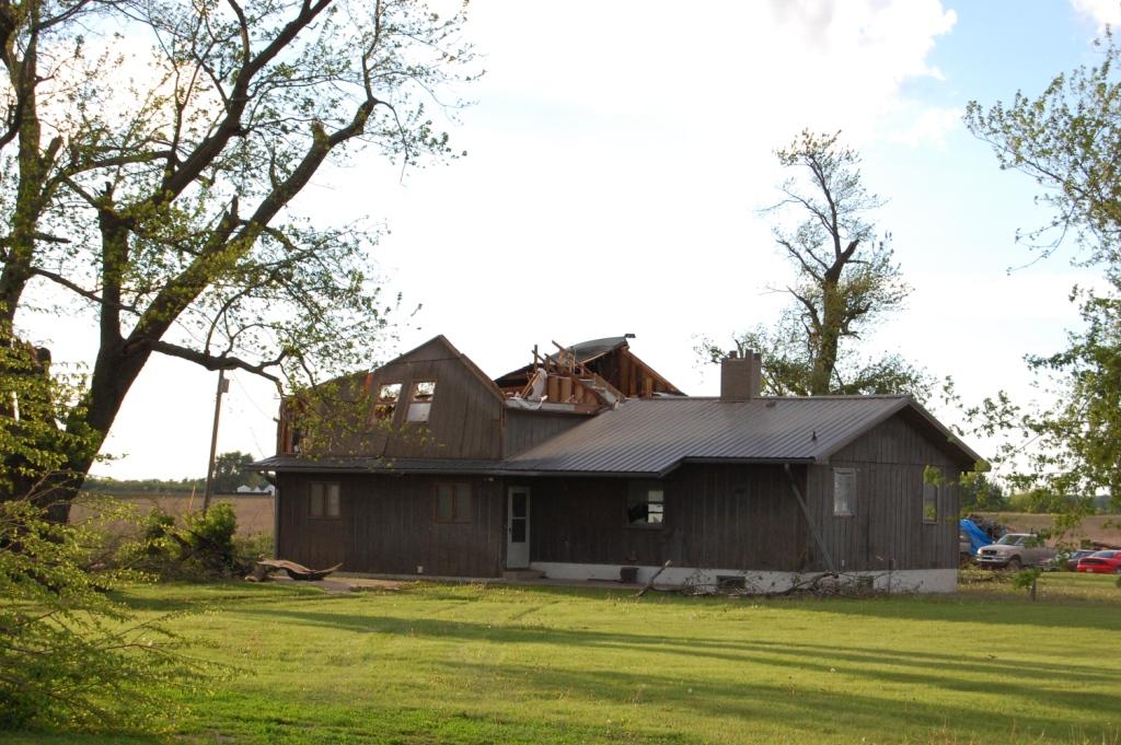
Lastly we investigated the intersection of 148th St. and F Ave., close to where the tornado first touched down. The most significant damage was found here. A single family home had a large section of its roof peeled off and the walls were leaning (this was probably most of the airborne debris we saw). A lot of the upper story of that house had been badly damaged. This is likely why the tornado was given an EF2 rating. A large tree near the house was also snapped off at ground level and a garage behind the house had some roof damage. What was strange was that the property looked pretty well maintained, but it also looked deserted when we got there, with not much evidence of clean up (other than that the large tree had obviously fallen across 148th St. and had been removed before we got there). There was another rather low-quality (redneck, if I may) residence immediately across the road that seemed to be untouched despite the trees down everywhere along the edge of the property both to the south and east of the house. There was also a small truck that got rolled into the field across F Ave. from that house. We also noted a bent street sign along with the plethora of tree damage. Although the tornado probably touched down a bit southwest of this area, there was nothing but a large, open farm field southwest of the house, so there would likely be little damage there.
I must be too conservative in my damage estimation because I was thinking most of the damage we saw was EF0 to low-end EF1. DVN rated the tornado as EF2.
 |
 |
 |
 |
 |
 |
 |
 |
 |
 |
 |
 |
 |
 |
 |
 |
 |
 |
Return to 2011 - chasing home page