
Chase partners: none
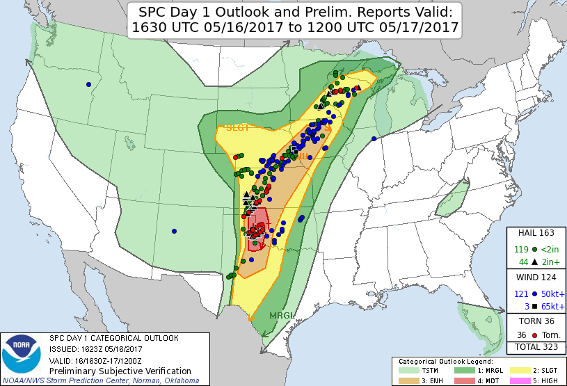
Summary: this was a really solid setup on the synoptic scale. However, when the storm-scale details came into play, they made for a frustrating chase that featured mostly rain-wrapped tornadoes. I recall there only being one single photogenic tornado, and it was one of the very first ones of the day in the Texas panhandle. I missed it, of course, because I targeted the Oklahoma panhandle. I was hoping to apply the classic dryline chasing technique of starting north and gradually working south along the dryline as each new storm developed, matured (produced a tornado), then moved on to the northeast. Instead the storms to the north developed really early (I almost didn't get there in time) and the storms to the south developed quickly after those, and left a nearly 100-mile gap between them along the dryline. I quickly abandoned the storms in my first area (despite them looking good) and zoomed south in time to catch the Elk City tornado, but my chase was cut off after I popped my tire running over a large object.
I got to Woodward for lunch with plenty of time, but unable to see any obvious signs of initiation to the west, I opted to relax as I ate lunch. Once I saw aggressive TCu in the northern tier of counties in the TX panhandle, I knew the game was on and I flew out of town, taking U.S. 183/412 through Fort Supply and towards Guymon. As I flew west I started to doubt I would make it west in time; it became clear it was going to be close. The road construction on 412 with a one-way pilot car between Slapout and Elmwood didn't help matters. I made a note not to use 412 on the way back east (assuming I would come back along this latitude). I got to U.S. 270 northbound in time to see a massive wall cloud hanging below the base of the storm. I flew north to about 4-5 miles south of Beaver where I pulled off and watched the storm slowly organize in the low levels. Eventually a rotating wall cloud appeared, although it didn't look particularly well organized.
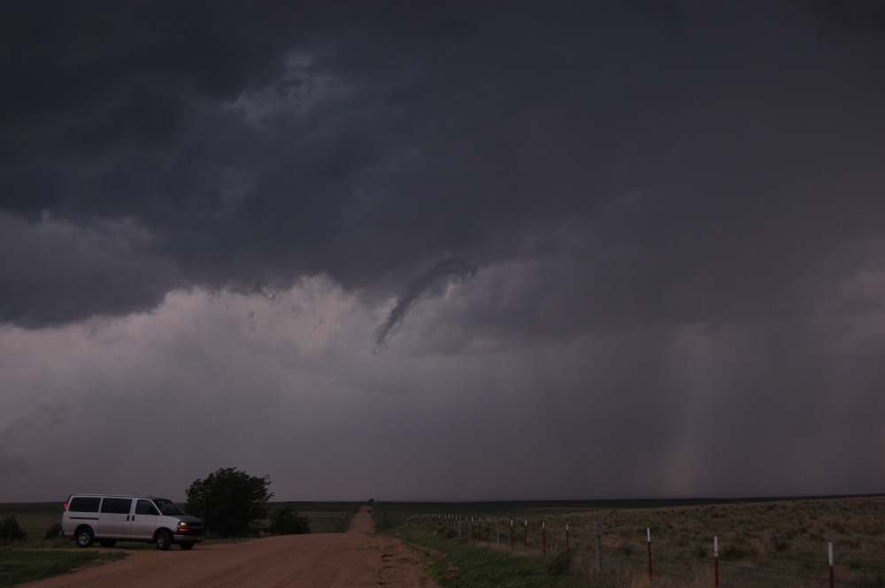
I chased this feature north to the southern outskirts of Beaver before pulling off to the east. On the way, the wall cloud wrapped up and I got within the RFD, but the wall cloud was going right over Beaver and I didn't want to chase it through town. The cycle did not result in a tornado, and I eventually found myself cut off by poor road options east of Beaver. I lost progress on the storm while trying to figure out which way to go. Eventually I decided to let it go and watched from a hilltop several miles southeast of town as it escaped to the northeast. By this point I was already aware of a second supercell back to the southwest that was organizing.
Enough with that. Onto storm number two.
Sadly, the second storm went directly over the track of the first storm, and apparently not enough time had passed for the cold pool to advect away to the northwest. As I headed back to the southwest, now enjoying the wide open, unobstructed, and continuous road grid southwest of Beaver (as opposed to the gritty, hilly, and broken network southeast of town), it became obvious this next storm was going to continue ingesting the rain cooled (albeit very humid) air exhausted by the first storm. This second storm needed to turn right in a hurry if it was going to be a tornadic threat. At the same time I was aware of newly developed severe storms in the Texas panhandle and I knew I was close to a decision point of abandon my northern target area. If I wanted any chance at having fun with the storms to the south, I had to leave soon. Not hopeful that a hard right turn was imminent, I reluctantly decided to abandon the Oklahoma panhandle. It was a shame, really, because I was in a great road network and the second storm had impressive structure as it approached.
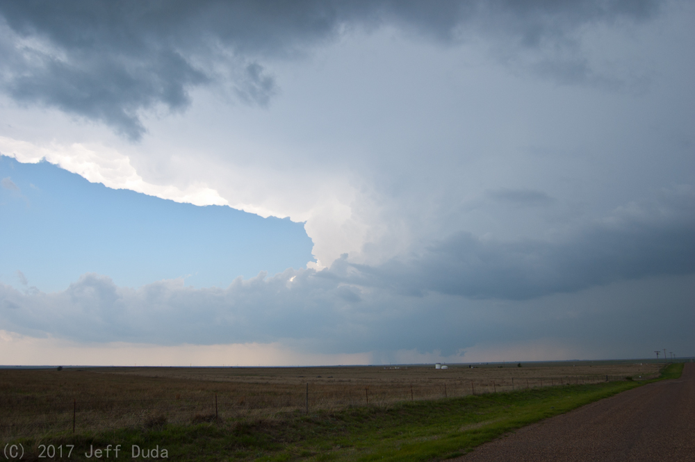
Recalling the construction on 412, I opted instead to cut across the northeastern Texas panhandle (wahoo, new county for me!). I gassed up in Darrouzett and re-entered Oklahoma north of Shattuck. I began an arduous journey south along U.S. 283, constantly re-evaluating at which point I would have to give up and escape east as the forward flank of the current lead supercell encroached on the corridor. I considered having to go all the way east on U.S. 60 to Vici to cut south, but made it past that checkpoint. The next option was to go east on OK-47 at Roll. I made that one, too, but it was getting dark (and disturbingly cool despite the time of day). Eventually I made it to Cheyenne in great time and actually felt like I had a chance to go west to intercept the storm. I knew there was another isolated supercell now moving northeast from near Wellington, TX, and I kept it in mind. A few miles west of Cheyenne on 47 I realized I was heading into a bad situation: I was unlikely to beat the core to OK-30 in time to get south and see whatever might be in there, and doing so put me in worse position for the next storm down the line (ugh, finally the storms work out that way!). I quickly flipped around and decided my play was this next southern storm. But I lost valuable time messing around near Cheyenne.
I zoomed back south on 283, becoming well aware of the intensity of the supercell crossing the TX-OK border - reports of very large hail were beginning to come in. As I approached OK-6 I started to get into the northern edges of the forward flank of the storm. I was not comfortable pressing south to Sayre. I cut east towards Elk City and slipped south on OK-34 without having to go through town (there is a convenient paved road which extends OK-34 to OK-6 on the far west side of town). I flew south out of town, now hearing about softball-sized hail reports coming in near Sayre! I gunned it through the intersection of OK-34/OK-152, where several other chasers were sitting. I thought to myself, I wouldn't stay there if I were you! I approached Carter and eventually felt safely out of the way of the core. I was greeted by good mesocyclonic/updraft structure and one of the longest beaver tails I have ever seen!
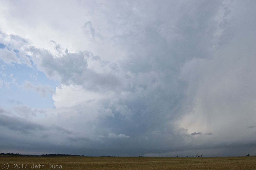
Satisifed I had time to get close, I moved southwest, settling 1.5 miles west of Carter. I was able to sit there for over 10 minutes, and I don't know if a single car went by me the entire time! I saw the news choppers circling around, so I knew people were around. For whatever reason, though, they chose not to use this section of real estate. It's pretty rare to get a section of road like this to yourself in Oklahoma in May, let alone on a moderate risk day like this.
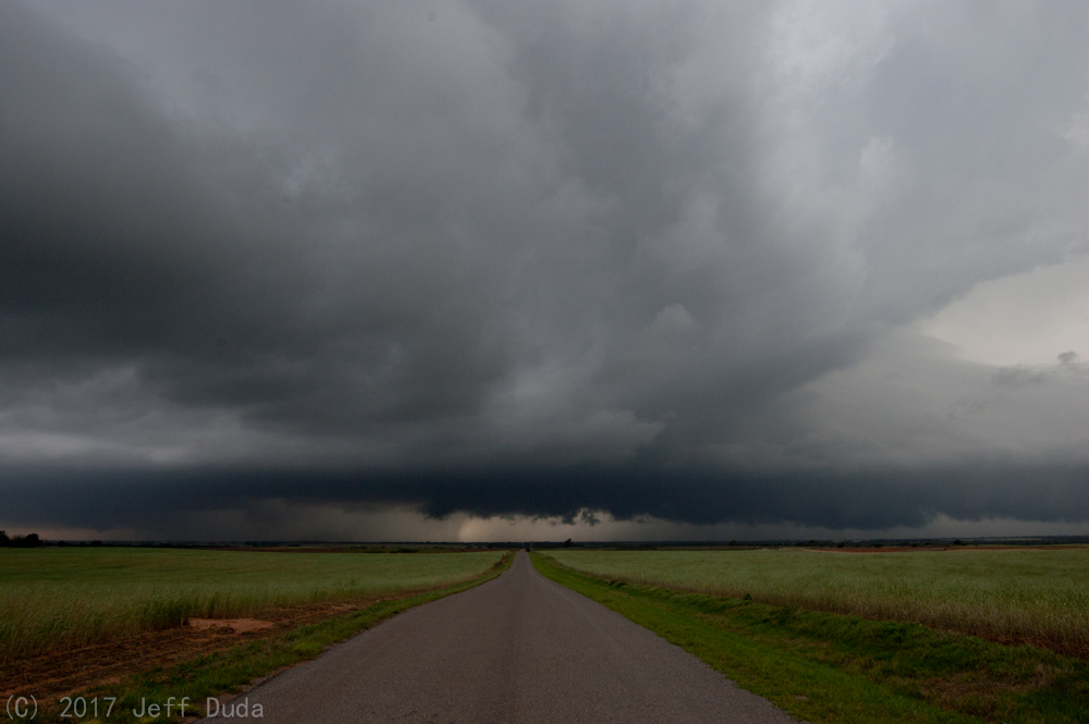
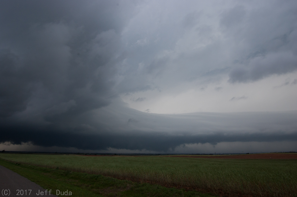
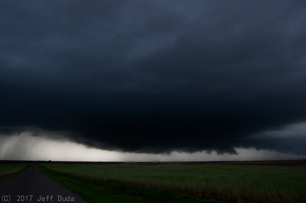
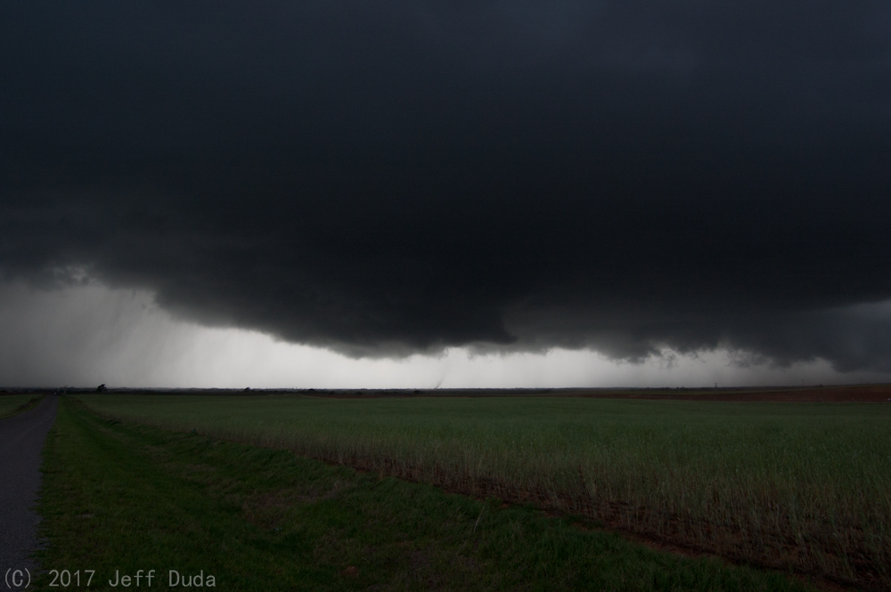
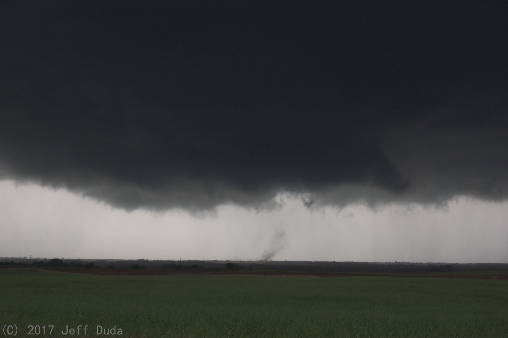
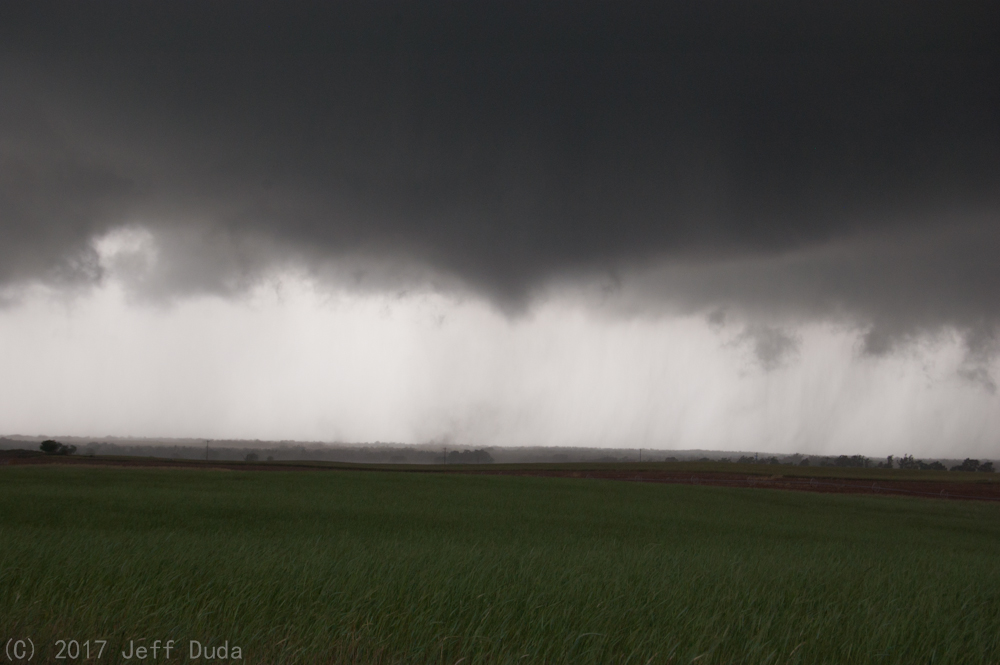
Surface inflow winds gradually accelerated as I sat there. I had the awareness to pull out my anemometer and measure it. Winds gusted to over 30 kts and were sustained at 20+ kts. Not as high as it seemed, but the numbers don't lie. Eventually dust began kicking up in the field, clearly being sucked into the cloud base just a few miles to my west-northwest. Eventually one of those dust plumes went straight up and danced around a little bit. While I had noticed some indications of rotation at cloud base, I suddenly realized a tornado had developed!
It was here where I got my shots of the year. Given the tornado never fully condensed and quickly became shrouded in rain, that's not really a good thing. But enjoy the sequence:
Adrenaline rushing (because I knew I had a possible close intercept within reach), I hustled back towards OK-34. On the way I saw something that alerted and disturbed me - a white utility truck flew northward across the road up ahead, clearly blowing a stop sign at high speed (I knew there was a stop sign because I used that same road to get here). Not wanting to go through town, I took the same road as the white truck, although 20-30 seconds behind. The rotation in the wall cloud was increasing, but I could already see the beginnings of rain shafts to ruin the show. I couldn't get a decent view at the intersection of N1940 and E1230 Rd., and both not wanting to go north on the unpaved grid and risk running into the tornado, and also seeing the white utility truck sitting on that road, I opted to turn east to get to 34. The white truck got in behind me and tailgated me down the road. Intimidated, I pulled to the side and let him go around, but the road was narrow and he almost hit another pickup truck facing the other direction. I pulled a complete stop to check my road options as the truck flew on by and turned north on the highway. While that was the last time I personally saw this truck, I learned later that fellow long-time chaser Tony Laubach had an incident with a vehicle that looks exactly like the one I witnessed. I am sure enough to say it was this guy. Tony details the incident here. Given the events of chasers getting in car wrecks and dying earlier in the year (and there was a separate incident just a few miles north from my current position as well!), it was unnerving to say the least.
I decided not to be on 34 to avoid power lines being knocked down and blocking the road. I instead tried to cheat up east of OK-34 to get to OK-152. It did not go well. As I neared the county road two miles south of 152 along N. County Road 1960, I entered the rain-filled tornadic circulation. I could not see the tornado, and as I continued on and turned east, the dirt road quickly turned muddy and slick. With enough rain and wind to make me believe I was uncomfortably close to a possible monster tornado, I turned back, slipping and sliding my way back out of the rain. I made my way back to 34.
Just south of 152 I crossed the damage path. Thankfully it was light debris - sheet metal, plastic tarp, and little else. The lines were okay! I turned east on 152, now at least a few miles behind the circulation. I crossed the damage path again, but again debris was pretty light. There were structures along the road that had not been severely damaged. I got caught in traffic at the intersection of 152 and OK-6. I pretty much lost track of the tornado at this point. I decided to continue east to put myself in position for another cycle. By this time I was well within the chaser train heading east. Progress slowed. I hopped north towards Canute on N2080 Rd., finally making some progress. But then the chase began its siren song; just before turning east on E1120 Rd I ran over a large object right in the middle of the lane. Somehow the vehicle in front of me missed it or their body was high enough to clear it. It looked like the motor to an appliance, as it had tentacles and spikes sticking out of it. It took several miles before I could feel the air slipping out of the tire. I had no choice but to stop a few miles west of OK-44, where I got out and confirmed the puncture. I had to change the tire in a hurry to at least stay out of the storm's way (I was still possibly in its path). Thankfully another chaser was in the same pull-out and saw my predicament and was eager to help me. With his help we had the tire changed and ready to run in barely 10 minutes! I forget his name, but it was Trey or Tony C. He said he had been chasing for 25 years and was from Texas. If you're reading this, buddy, thanks a bunch for your help! It meant a lot to me! You're a good man.
I was thankful just to be on the move, but no longer in the mood to continue the chase. It didn't matter much, though, because the storm showed signs of weakening as it moved away. I began the slow trek home, stopping to gas up and eat at the Love's between Weatherford and Clinton, which somehow was the only place within miles to have any power (the entirety of both Clinton and Weatherford were powerless despite neither being hit by anything). The place was overrun both with chasers and regular commuters, so lines were long and gas pumped slowly. It was frustrating to see, given the area had not been hit by a storm (nor was in the path of one).
I limped back home by 11:30, inadvertently intercepting one last storm along the way (it had been supercellular, but was dying in the increased stability and darkness).
Return to 2017 - chasing home page