
Chase partners: Logan Karsten
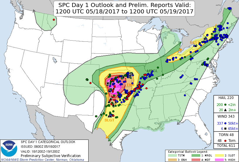
Summary: There was no doubt in the mind of SPC forecasters that this was a High Risk day. The High Risk area was outlined in the first Day 1 outlook the night before and barely changed throughout the day. Personally I saw this as a deficiency in SPC's forecasting methods because, as a participant in the Hazardous Weather Testbed Spring Forecasting Experiment in the National Weather Center, and as a budding professional scientist and one who pays attention to advances in numerical weather prediction models and the forecasts they make (especially at the storm scale) more or less for a living, I saw signs in the experimental convection-allowing ensemble forecasts for this day that suggested a failure mode - capping was not expected to be particularly strong, and thus storm competition looked to be a potential issue limiting the coverage of the severe threat. Moreover, storms developed and matured early, eating up the instability before the wind profiles could mature into nice looking hodographs. Had initiation held off an hour or two, a more significant event would have likely transpired. The meteorological moral of today's story is that you need initiation to hold off on days when the shear isn't expected to materialize until late in the day. Even when a big trough and moisture are present, sometimes the wind profiles don't iron out until the late afternoon. Midday initiation, as happened this day, will ruin otherwise great setups.
But it was a High Risk day, and Norman/Moore wasn't in the 10%-hatched tornado area - the rule wasn't in effect! So of course I'm going to be a little more excited than normal about it. Well, the excitement transformed into disappointment by the end of the chase. While the day verified statistically, it felt like a hype bust to me. Logan and I ended up empty-handed tornadowise. We missed the big one near Seiling (we weren't even on that storm...how it became the storm of the day is a matter of very small scale details that no one could have predicted). We saw two supercells, though, both of which were the HP variety.
We left Moore around noon, with an initial target in west-central OK along I-40. Not long after clearing the OKC metro to the west we saw the first storm initate in southwest OK. It quickly organized and we knew before we got to Clinton that was our storm. We dropped south on U.S. 183, increasing our speed to get ahead of the storm; too late and we would've faced a core punch. Not something we were looking forward to on a day with this level of combination of instability and shear. Luckily we got south with time to spare.
The storm had already produced a tornado by this point, and as we diverted west from 183 at Roosevelt, we could already see a monster base on the storm. It looked very promising.
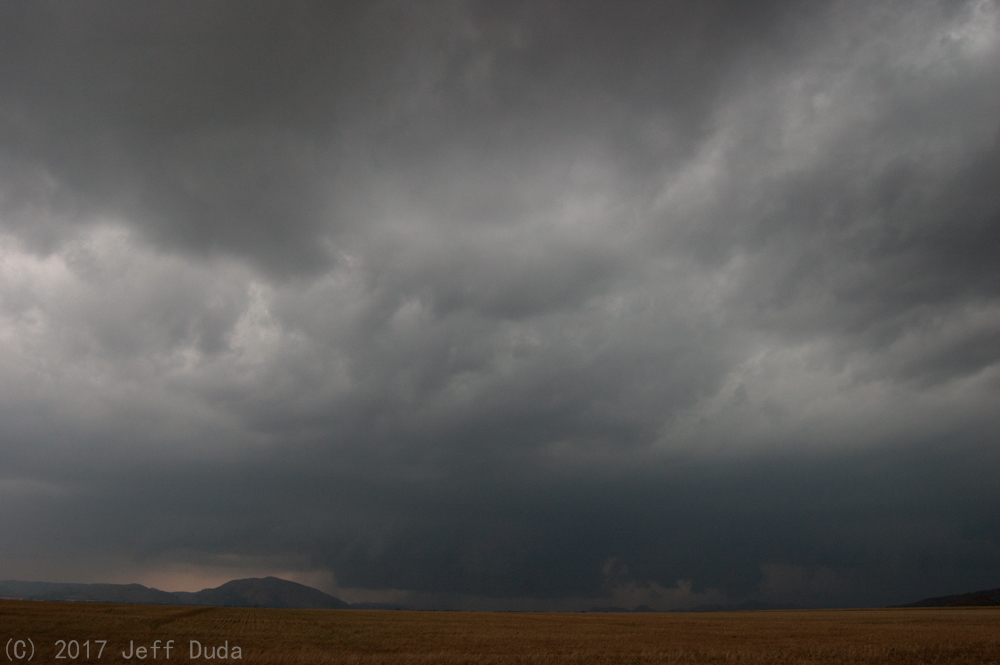
But then nothing happened.
The massive lowering gradually dissipated without any real sense of a wall cloud or rotation. At least mid-level rotation was pretty clear and persistent on radar, but this storm didn't seem to want to rotate at the low levels. We found ourselves behind the core heading into Hobart as sirens blared in town (the storm no longer posed a threat to the town by this point). It was clear at this point that any possible tornadoes on this storm would be buried in rain. Forget that. We abandoned the storm in favor of a new one south of the Red River which looked good on radar and ended up producing a tornado, but before we got to it.
Morale was already decreasing as we dropped south. We never even chased in the High Risk area, and were leaving the Moderate Risk area and the 10%-hatched tornado risk area for this new storm. We were getting a bit far south to be in the good shear, and yet everything back to the north already looked hosed. Storms had blown up all over the High Risk area, but convective coverage was pretty high and no dominant storms appeared to be materializing from it. It looked like a huge bust already.
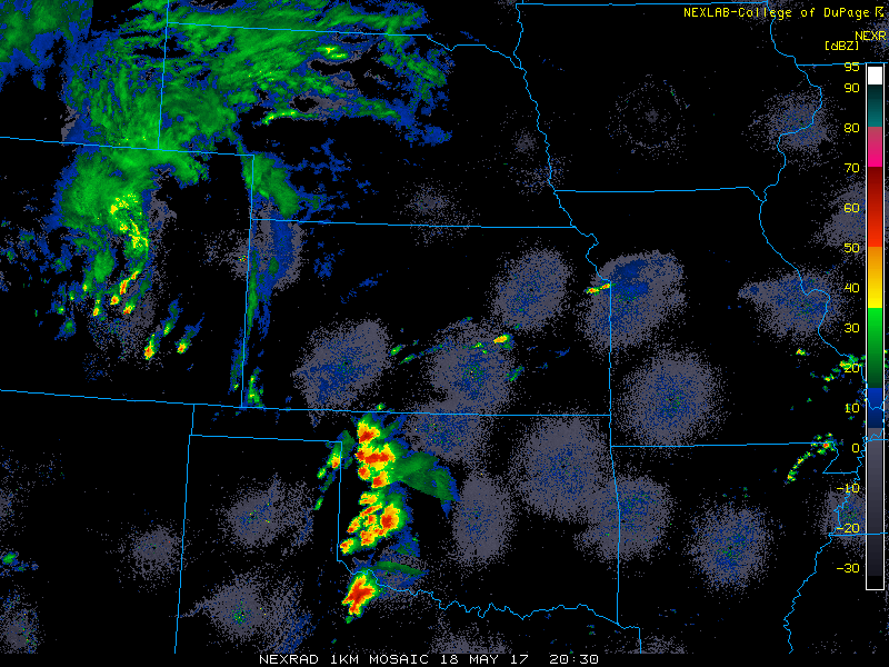
Logan and I couldn't make the river in time to avoid a core punch on the southern storm, so we had to cut east on U.S. 70 and spent most of the rest of the chase between Davidson and Grandfield. We waited forever for the storm to get far enough north. During this time we found out about the tornadoes near Seiling. Anyway, the storm finally made enough progress that we could see the business end of it, and it wasn't particularly exciting. There was definitely a wall cloud and perhaps occasional rotation, but the storm was edging on HP in nature, so we only saw it by virtue of having sat along the edge of the core for 30 minutes, thus putting us in position to be able to look down the notch. We stayed with it as it approached Grandfield. A few miles southwest of town we watched the HP storm attempt to wrap up, but rain did its job in obscuring anything that might have happened in there. The storm structure here became the highlight of the chase, and that's sad.
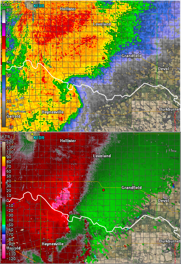
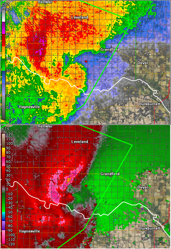
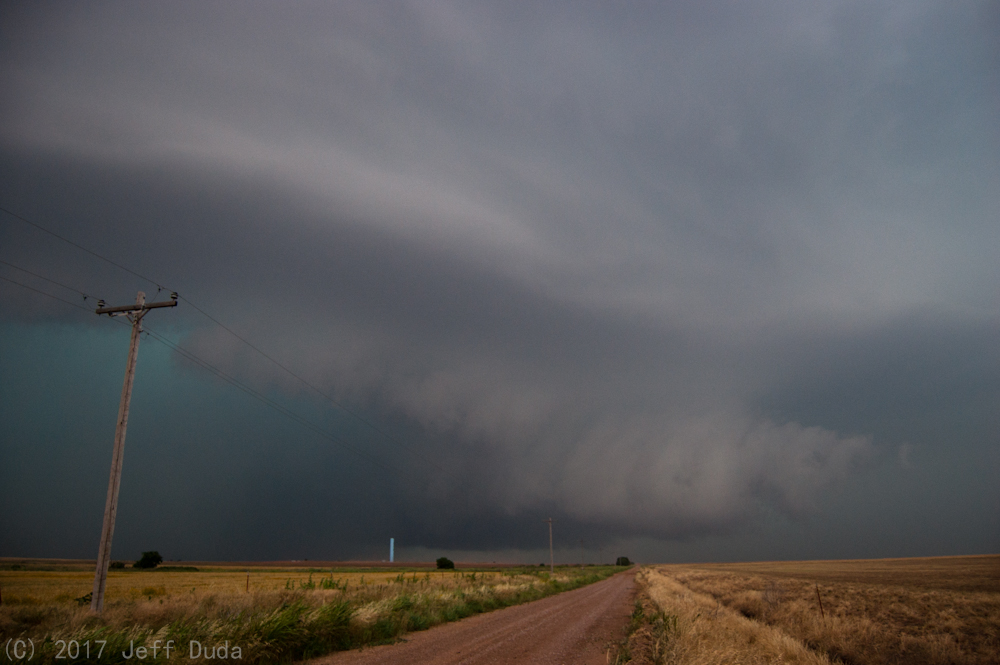
The storm had neighbors while we were on it, and it transitioned into a linear complex and became outflow dominant. We called the chase at Randlett and got on I-44 north to return home. We ended up driving back through the line. It got pretty bad around the toll booth at Walters. We had to pull over for a few minutes due to zero visibility wind and rain. Shortly after it cleared enough for us to continue on, we learned that a 100+-mph wind gust was produced at the Walters mesonet site! We were probably within 5-7 miles of that site at the time, so who knows what we narrowly missed.
We ate dinner at Interurban in Norman. The storms continued on and hit Norman while we ate there, indirectly causing multiple power failures at the restaurant. The final one lasted so long the staff started excusing customers without charging for food! So our consolation prize was a free (and not cheap) dinner.
Return to 2017 - chasing home page