
|
|
|
|
|
|
|
|
|
|
|
|
|
|
|
|||||||
|
|
|
|
|
|
|
|
|
||
Introduction
Satellites have played an increasingly more important role in making remote observations and measurements
of global environmental parameters. Begun with the launch of TIROS
1 on 1 April 1960, these satellite
measurements have provided increasingly more detailed information through an expanding network of ever
more sophisticated sensors. The attached photograph is the first complete view of the world's weather from
the TIROS IX satellite on 13 February 1965. In this unit we will get an overview of environmental satellites
deployed by the US and other countries. We will start by reviewing the physical concepts governing satellite
motions and constraints on where satellites are deployed to orbit. Satellite sensors and the physical properties
of the atmosphere, ocean, biosphere, and cryosphere (ice masses) will be overviewed. Much of the basic information
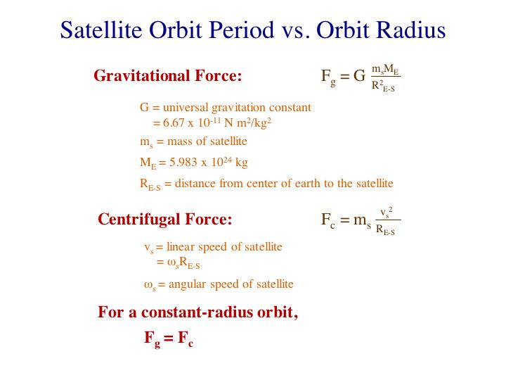
in this unit comes from NOAA (1985). Satellite motions are governed by the balance between the force of gravity
and the centrifugal force due to the satellite's orbital velocity. Figure 1 gives the factors in each of
these forces. Figure 2 gives the condition for a constant-radius
orbit and the derivation of the equation giving the orbital period.