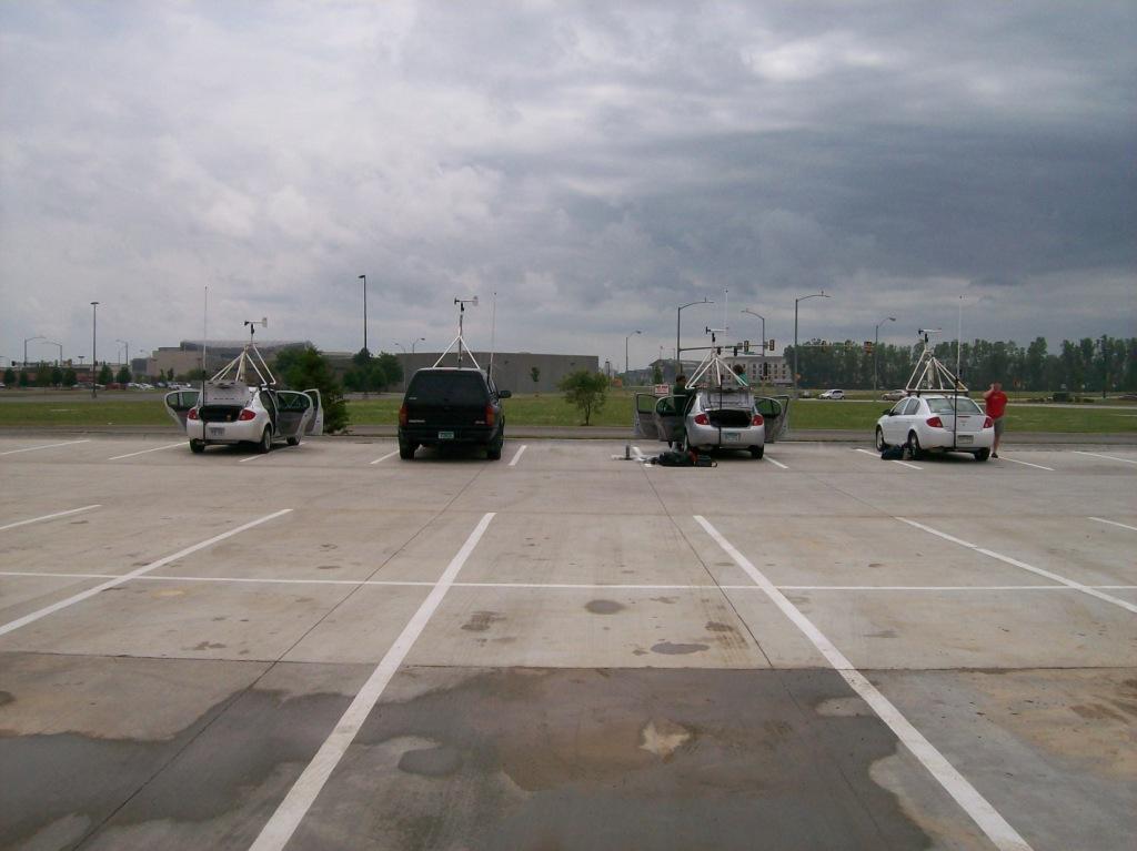
TWISTEX armada in the hotel parking lot.

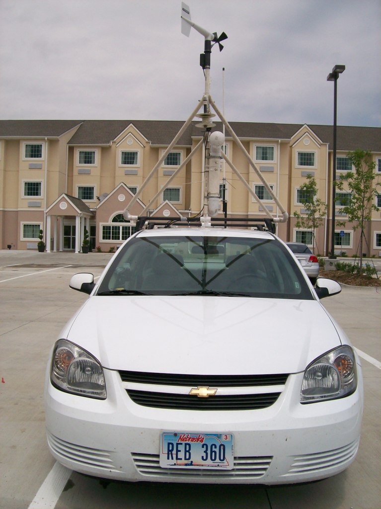
I got some up-close pictures of M2 also. It looks nice, doesn't it? Sadly, this was one of the last times it would look so nice.
After a dissipointing cap bust the day before, Tony and I were elated to see the new Day 1 outlook just before going to bed Saturday night. Our first moderate risk since the trip started! I'm pretty sure the moderate risk verified for the hail probabilities...but as for the tornadoes...you'll have to read on.
Things initially looked very good. Instability was going to be very great and shear was forecast to be there, although not as good as yesterday. Our biggest worry heading out today was the monster hail that looked to be likely with any supercells that formed.
We decided to target extreme southeast Nebraska and extreme northeast Kansas. I took some pictures of the TWISTEX armada because I was encouaged to and thought the cars looked cool alone in the hotel parking lot like they were.
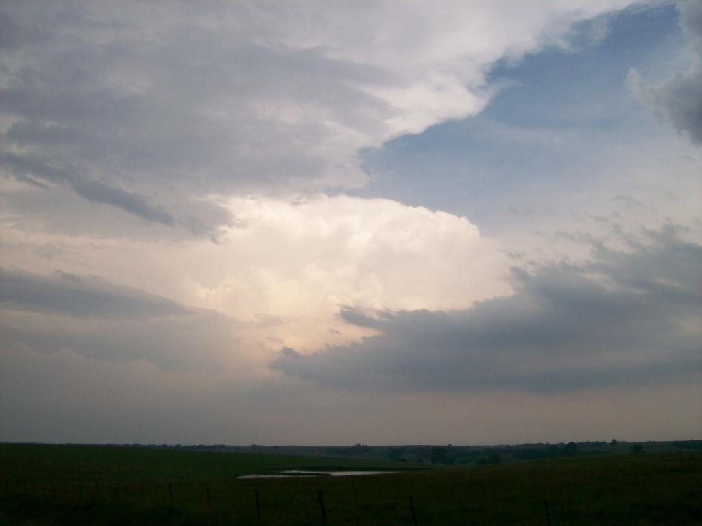
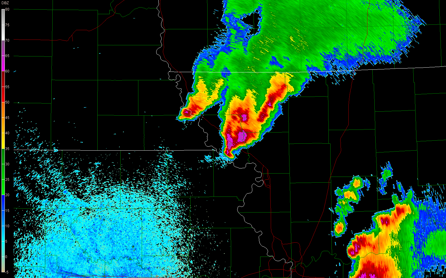
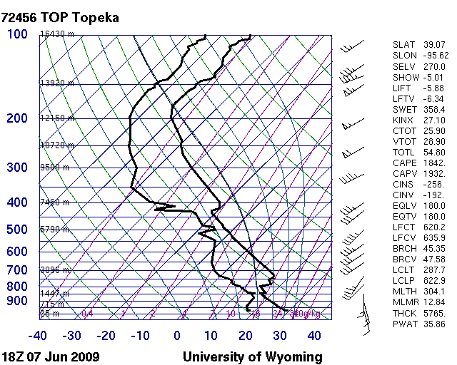
Once we got in the area, we began seeing things we didn't like: high level clouds and a cap that was pretty strong just to our south. In fact, the convective temperature on a special 18Z sounding from Topeka was well above 100. However, we did notice an intense moisture convergence band running just ahead of a band of mid level clouds that were precipitating lightly (possibly raining virga down into the cap and eroding it) just to our west on the SPC mesoanalysis. That moisture convergence band eventually initiated convection, which was plainly visible on KTWX (below).
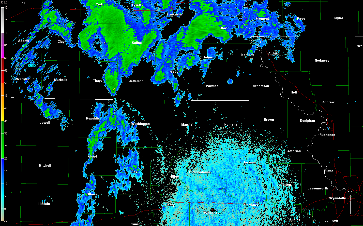
Convective initiation as viewed on GR2. The moisture convergence boundary is visible as a fine line of very light reflectivity in a wide arc shape spanning Washington and Riley Counties in Kansas.
We watched, excited, but aware that we needed to be patient and not just jump on the first thing that went up. Shortly after initiation, we watched a storm root into the boundary layer (acutally, Tim saw it first and pointed it out...genius for looking for that and being able to see the storm slow down and turn right in just a few scans). That storm quickly took on supercell characteristics along with having an a-bomb shaped updraft. Wow did that thing erupt!
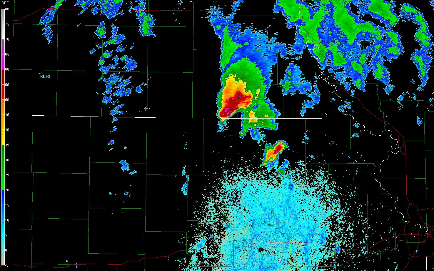
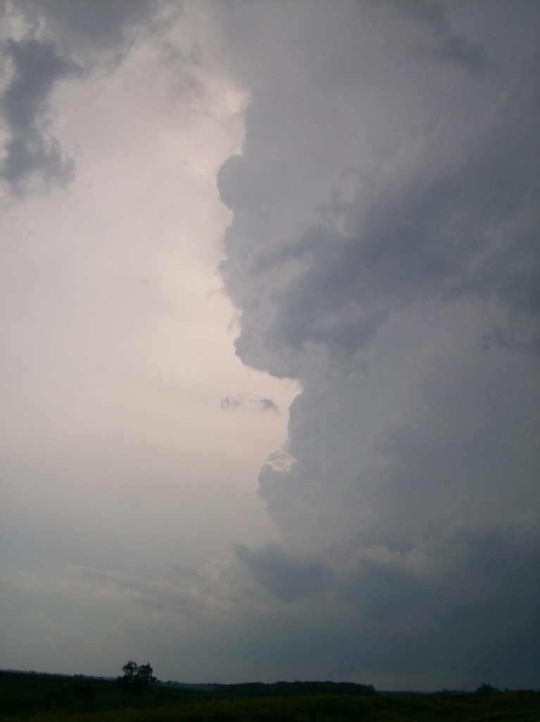

We ran operations on it, but it struggled to do more than look cool visually. The updraft base seeemed elongated and the rotation was weak and seemed more like outflow than rotation. We noted that surface winds were again weak. This would continue throughout the day.
We were chasing this supercell, flirting with the KS/NE border, when we ran into a problem: we ran into an area with a really poor road network, and the storm was moving over the only good road to get us back into an area with a good network. We thus made a mad dash up Highway 8/99 trying to get east of the hook to Pawnee City. We didn't make it. Shortly after turning north, we began getting hammered by small-baseball-sized hail.
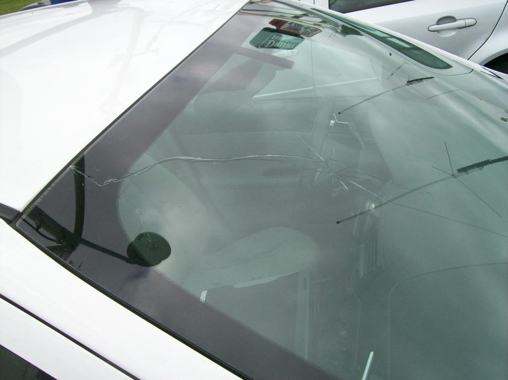
Within five seconds of entering the hail shaft, we got smacked in the windshield, putting a circle crack in it right by my head. We quickly whipped back south, unfortunately taking about 20 more seconds of abuse from this large hail. We took at least two more hard hits that severely cracked the right side of the windshield. I recall Chris basically leaning over in my lap trying to fade away from the hail that was prefering the right side of the car. Thankfully we made it out soon, but the turnaround left us with only one other option to get back to the storm. We had to drive down into Kansas and take random dirt roads to get back to Highway 50/63 and 8.
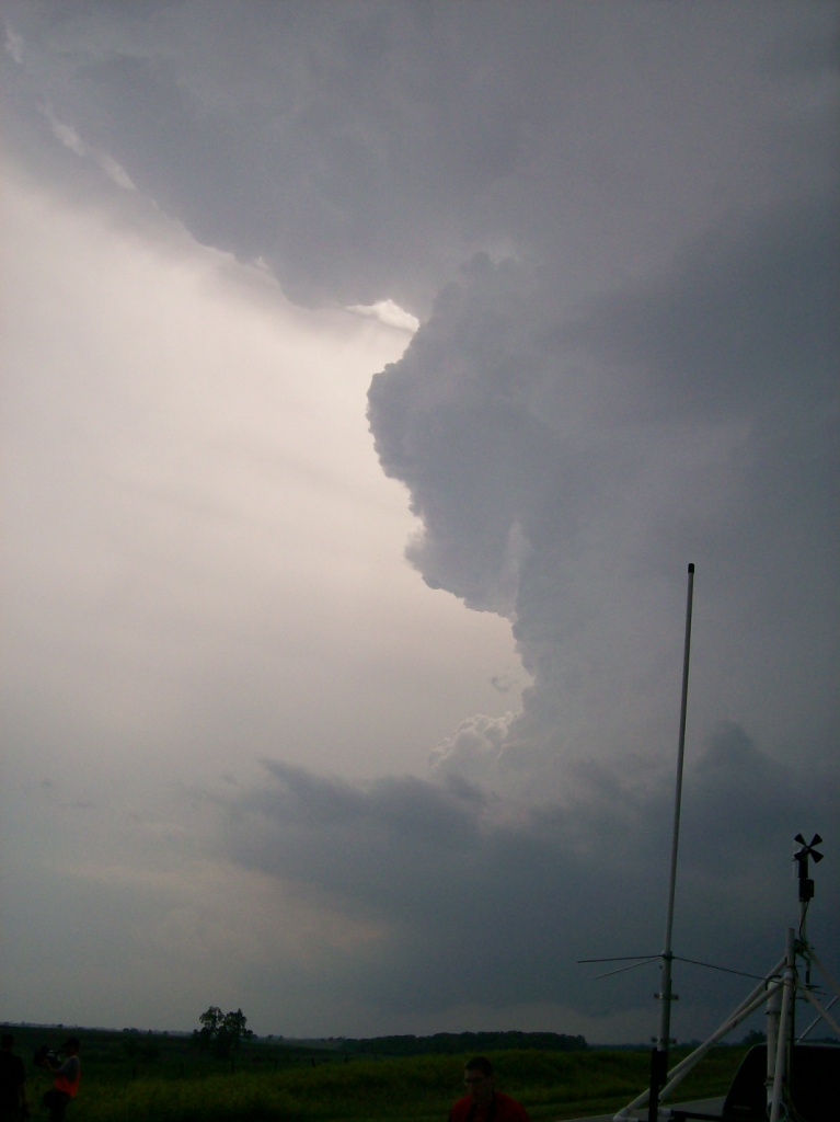
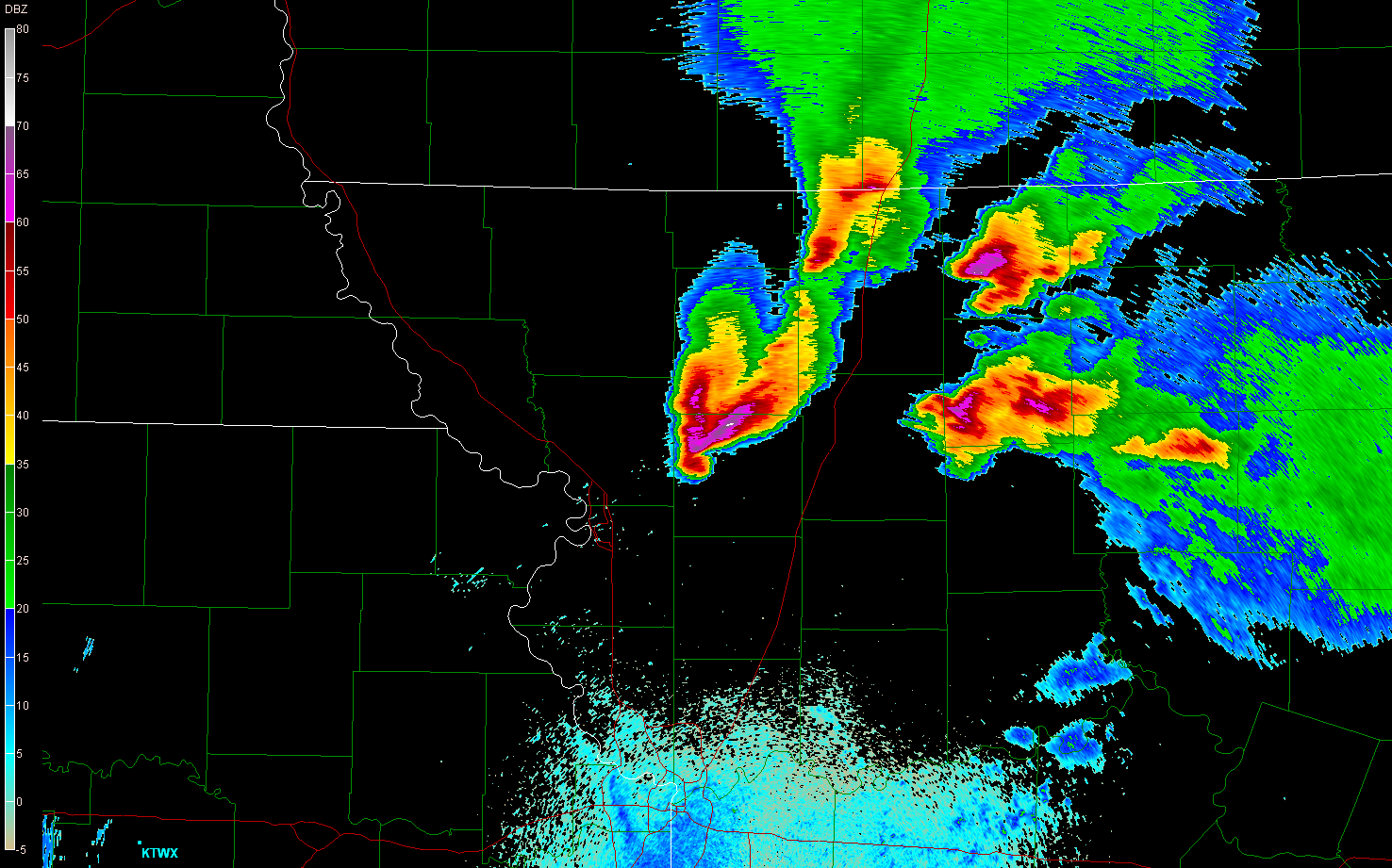
This detour turned out to not be so bad. The storm started to become less and less organized as we went east. It put out a few RFDs, and they were warm, but it wasn't enough to save this dying supercell. While we were chasing it, we had noted another cell that had gone up to the southeast. It didn't look nearly as good as the one we chose, though, and we continued to feel that way, even as it slowly gained strength and organization as ours was dying.


We picked up on the strengthening and organizing trend eventually. A few minutes after I took the photo above, we said goodbye to the first supercell and went after the southeast one, which was going tornado warned by the time we started pursuing it.
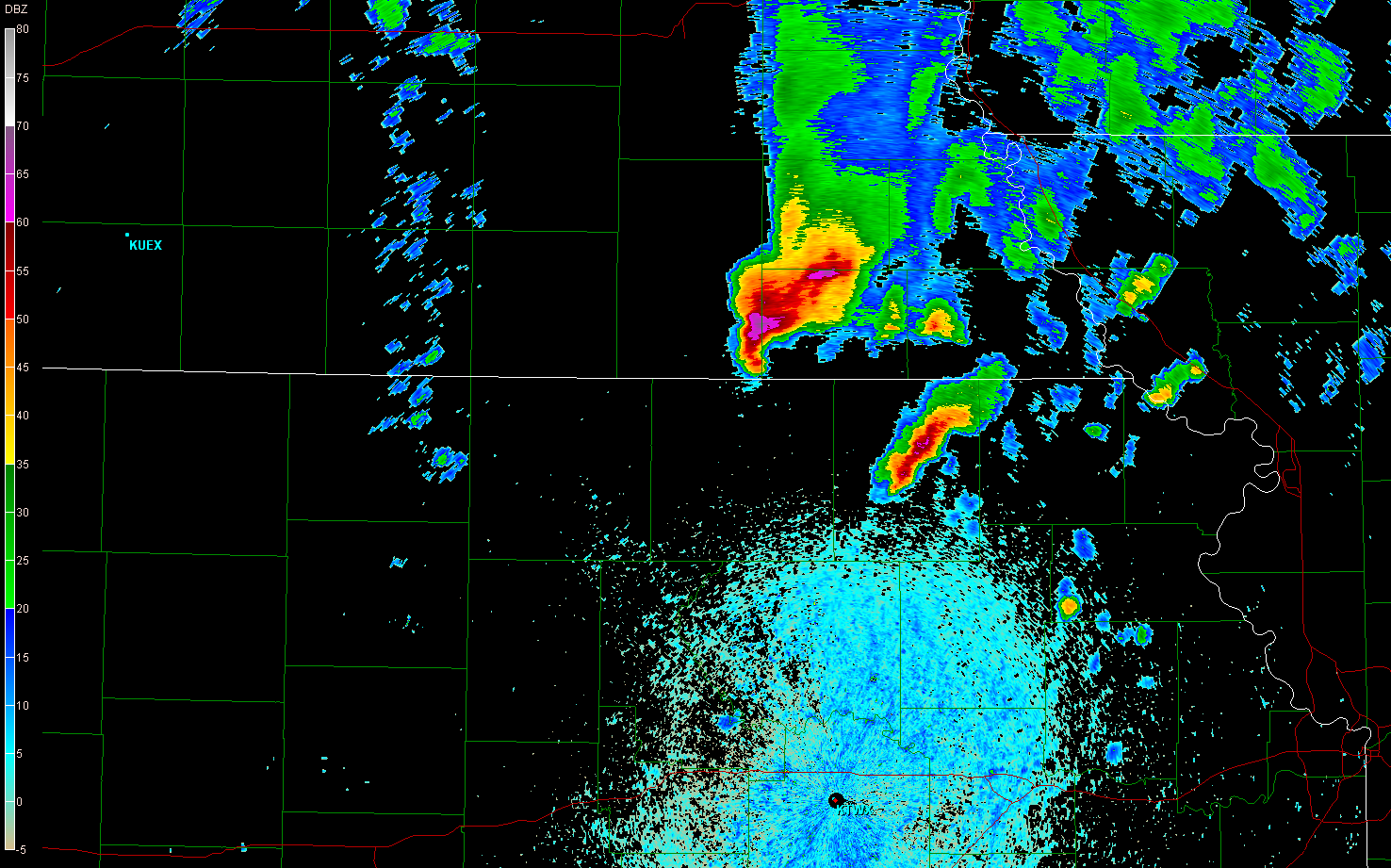
We went east through Falls City and crossed the river at Rulo, already noting large chaser convergence on about the only road within miles that would keep us on the storm. Since the core was passing over the highway, though, we had to stay behind it and wait until the road network allowed us to get southeast. At this point, reports of baseball to softball sized hail were coming out of this storm, and we were right behind the core and the hook, so we were reluctant to punch it. We drove through Forest City and Oregon, MO, where we indeed saw hailstones of baseball to grapefruit size. Scary.
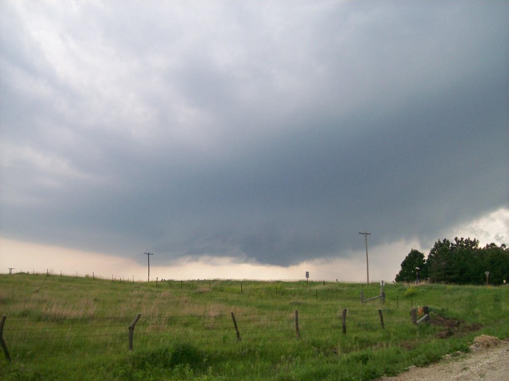
We continued to chase east. This storm, though, seemed to have the same problem the other one did: the rotation on it was more like outflow and surface winds were weak. Seriously, this storm was barfing outflow.
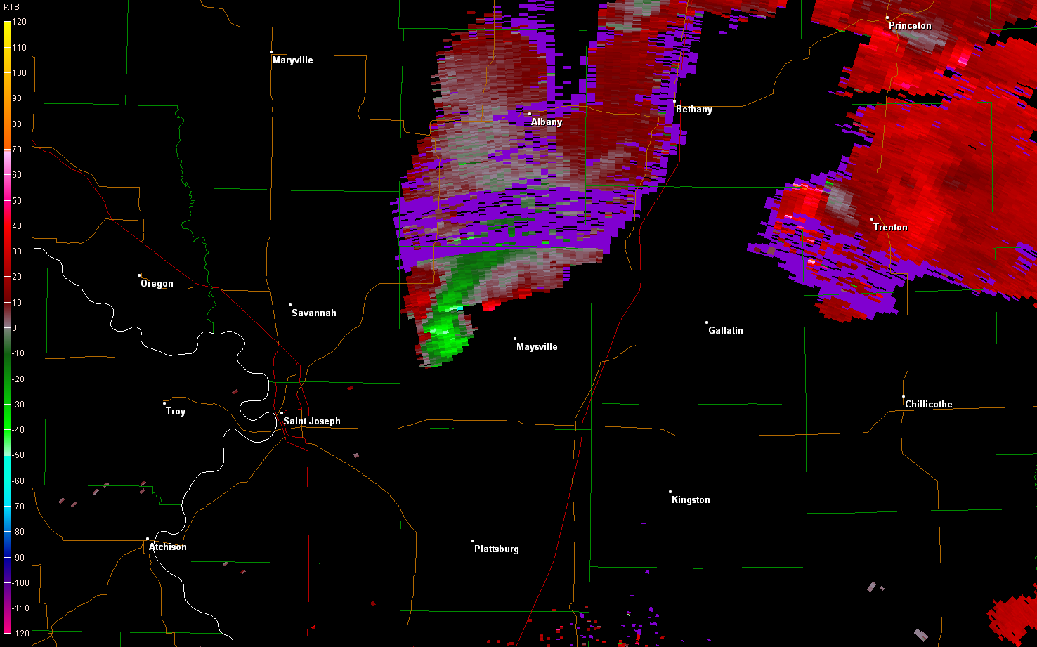
We went into operations, which kept us traveling directly under all of the RFDs that this storm was producing. It produced RFD after RFD, yet none of them were leading to tornadogenesis. At times I recall being able to see straight up into the RFD core and seeing blue sky inside. Nonetheless we continued, but the only thing that changed was the chaser convergence and CG threat. This day quickly transitioned into a chaser-convergence-from-hell day. Once the storm was beween Savannah and Maysville, the only decent road to chase it on was Highway 6, and every single chaser and his/her grandma was there, causing serious traffic congestion. Not to mention, the storm began spitting out violent CGs left and right. At one point, we stopped off the road in a church parking lot, thinking the storm would finally produce, but it didn't. Instead, just more CGs.
We chased the storm as far east as about I-35 before we decided it wasn't going to happen and we wanted to get out of the chaser convergence train we were stuck in. When I thought about it later, I realized it was a good thing the storm never dropped a tornado, because if it had, it would've likely crossed Highway 6 at some point, and with all the chasers stuck on it moving 30 mph due to people getting on the road, slowing down and getting off, and just flat out stopping in the middle of the road, someone would've likely been hit and hurt by it.
We filled up for gas at a convenience store in Altamont, where we encountered some less respectful chasers. The best thing about this encounter that I can say is that no punches were thrown. It was tense though, because some people decided to hog the pumps without actually pumping any gas. I asked one of them nicely to please move so that we could get in and fill up. The guy in the car just blew me off and ignored me completely.
We decided to stay in St. Joseph overnight. As we drove there, more storms fired and quickly became severe, with hail icons showing up on GR3 at up to golfball sized. We managed to miss the worst of it, only seeing marble sized hail. When we got to St. Joseph, though, we saw that numerous cells had developed around us, including some that looked supercellular to our west, in a similar area as to where our chase started today. They never made it to St. Joseph, though.
Recapping:
Two supercells, tons of RFDs, tons of huge hail, and close CGs, but no tornadoes.
To add insult to injury, we had learned earlier in the day that confirmed tornadoes had touched down in Denver (one rated an EF1), and near Des Moines.
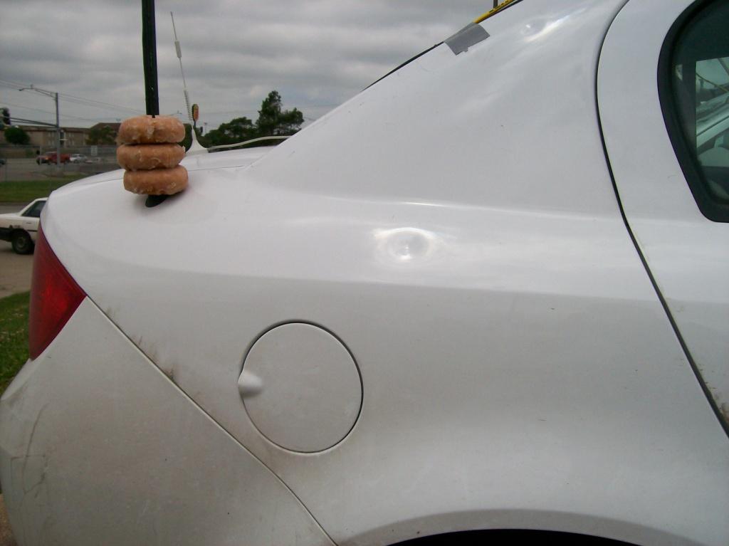
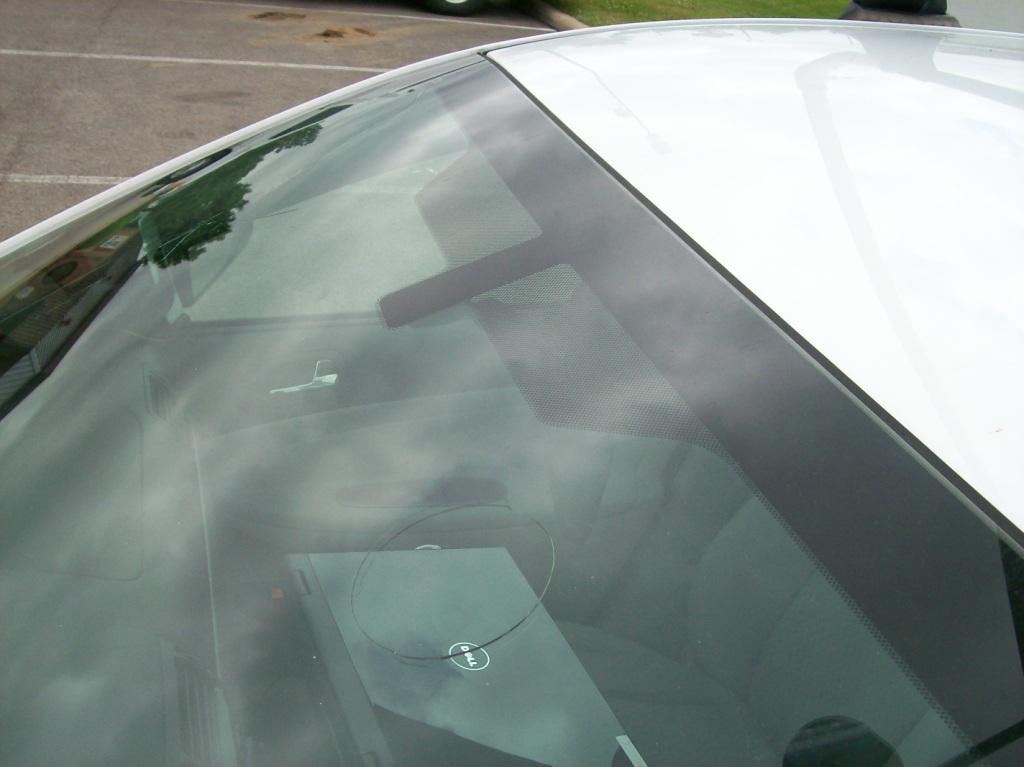
| Like I said, those first pictures were during the last few hours where that car would look so nice. These next images show what it looked like the next morning. | 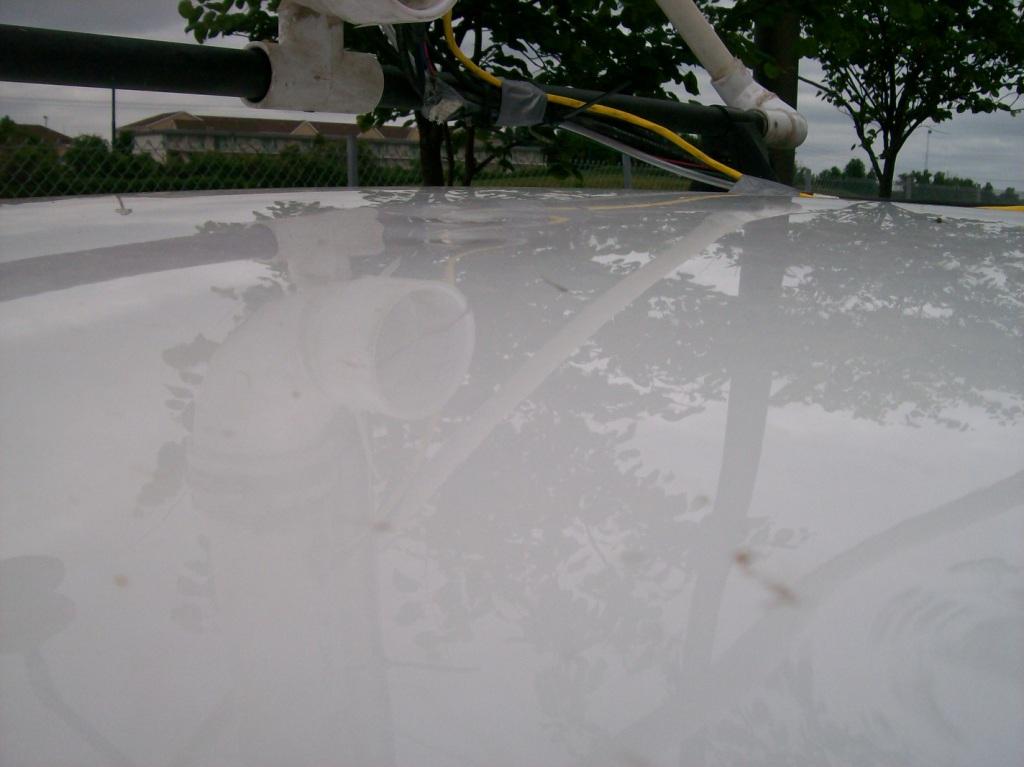 |
   | |
|---|---|
| Bruce and Cathy had the brilliant idea of applying a wire mesh over the roof of M1 to keep their sunroof from being broken. The size of the depressions in the mesh gives a sense of the size of the hail that we drove through. | 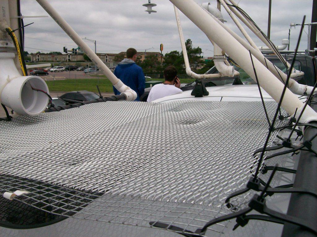 |
Return to 2009 - chasing home page