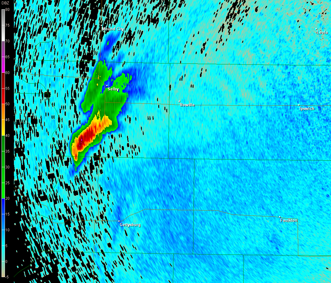
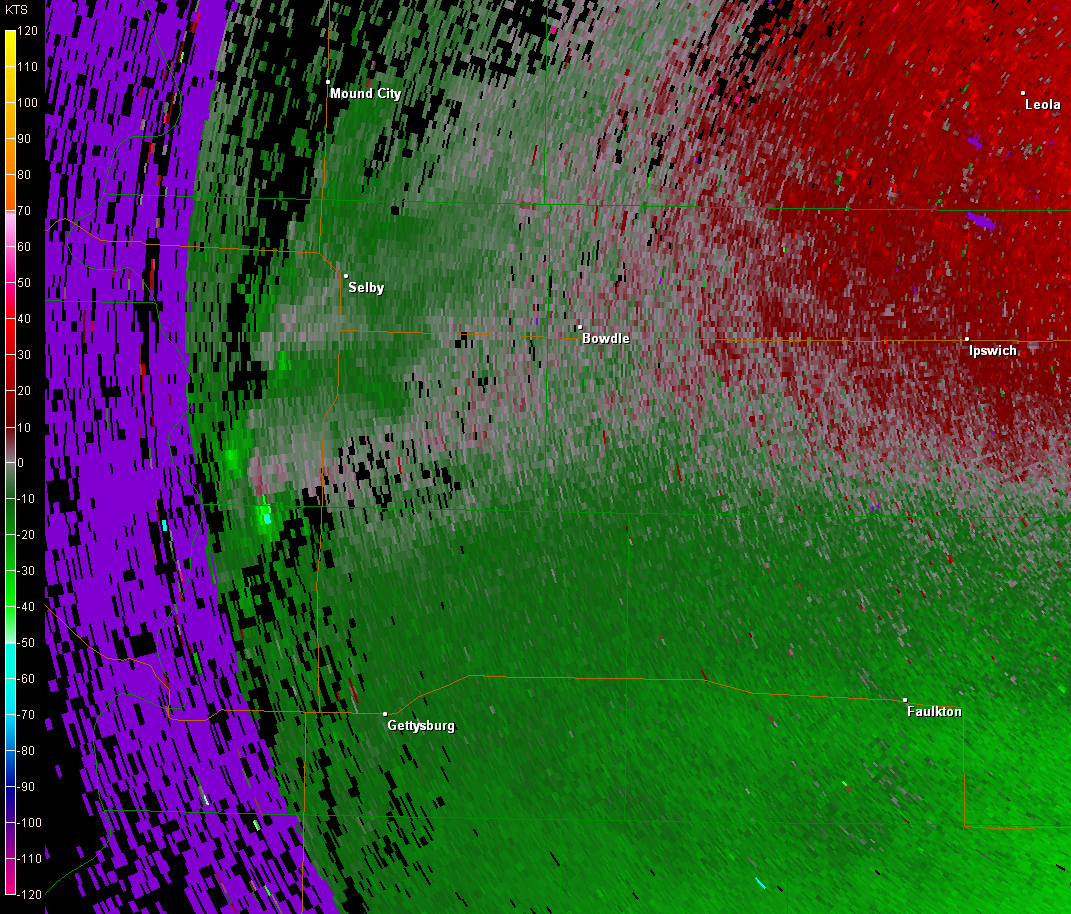
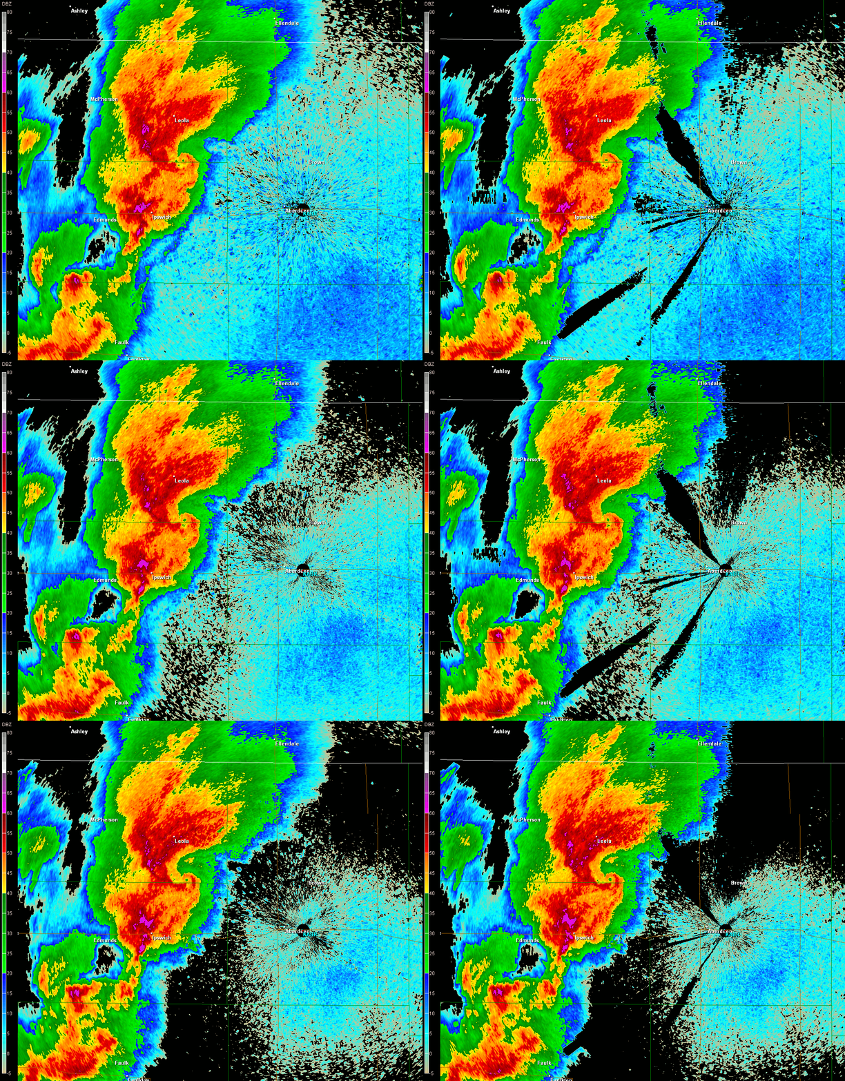
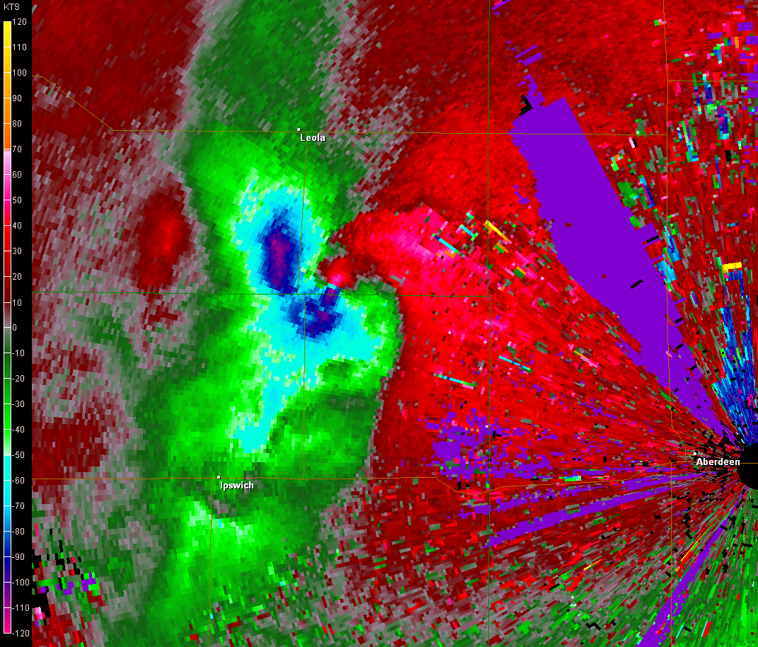
2219UTC 0.5° base reflectivity from KABR showing the storm at the time of issuance of the tornado warning. Base velocity at the same time is below.
Holy hell, what a day this was! I saw my first wedge tornado which was also the most violent tornado I have ever seen.
Me and the TWISTEX crew started the day in Chadron, NE after a rather mediocre chase the day before. I woke up sort of early and decided that since I had brought some sweats, I would go for a run through town before we met for the morning. Well, after I got back, the first thing someone said to me was, "we've been looking for you. We're leaving in 15 minutes." I thought it was a joke, but hearing it again from a second person made me a believer. I thought I would have plenty of time to run and get ready this morning but apparently someone saw something that convinced the team we needed to go to North Dakota to avoid the cap. Thus we left pretty early. At least I got a shower.
We headed east and north into South Dakota, eventually reaching Pierre around mid-afternoon for a lunch stop. Afterward, we moved north along U.S. 83. This would be my first time in that part of the state, and I was amazed how great the chasing terrain was. It was so flat and treeless, but not desolate in the way that west Texas, Kansas, or Oklahoma is. There were more farms around, but not as many as in Iowa. We stopped once between Gettysburg and Akaska as we watched a pretty strong cumulus field go up around us. Although there had been worries about the cap, it became apparent that it would not be able to hold back daytime convection on this day (see outlook text below).
|
From the 06Z SWODY1 from SPC: AN AXIS OF 2000-3000 J/KG MLCAPE WILL BECOME LIKELY AS THE BOUNDARY LAYER WARMS. A WARM EML WITH TEMPERATURES UP TO 14C AT 700 MB WILL LIKELY CAP THE WARM SECTOR MUCH OF THE DAY.... EFFECTIVE VERTICAL SHEAR OF 40-45 KT AND STRONG INSTABILITY WILL SUPPORT SUPERCELLS. WINDOW OF OPPORTUNITY WILL EXIST FOR ISOLATED VERY LARGE HAIL AND ISOLATED TORNADOES FROM CNTRL NEB INTO THE CNTRL/ERN DAKOTAS INTO THE EARLY EVENING. |
The wording of the Day 1 outlook became more certain the next morning: |
| From the 12Z SWODY1 from SPC: BY LATE AFTERNOON EXPECT MLCAPE VALUES IN THIS AREA TO EXCEED 3000 J PER KG. WHILE CAP WILL LIKELY HOLD ACROSS MUCH OF THE PLAINS SOUTH OF NEB...COMBINATION OF SURFACE HEATING AND WEAK HEIGHT FALLS WITH APPROACHING SHORT WAVE SHOULD BE SUFFICIENT TO OVERCOME REMAINING INHIBITION AND SUPPORT THUNDERSTORM INITIATION IN STRONGLY SHEARED DEEP-LAYER FLOW. MODEST LOW LEVEL HODOGRAPH CURVATURE AND MAGNITUDE OF INSTABILITY SUGGEST THAT A COUPLE OF TORNADOES AND VERY LARGE/DAMAGING HAIL WILL BE POSSIBLE WITH DISCRETE STORMS/SUPERCELLS. THIS ACTIVITY MAY STRUGGLE TO BECOME MORE WIDESPREAD INITIALLY DUE TO STRONG CAPPING AND TENDENCY FOR STORMS TO TAKE ON MORE LINEAR CHARACTERISTICS AND BE UNDERCUT ALONG THE FRONTAL ZONE WHERE STRONGEST MESOSCALE FORCING CAN ACT TO FURTHER ERODE THE CAP. |
It appears that the thermal axis at 700 mb had moved east enough to allow for some cooler temperatures to move in over the area of initiation. See 700 mb analyses at 18Z, 20Z, and 22Z.
As we sat along some county highways south of Lowry, we witnessed initiation. It was quite a sight to be in the right spot before the storm even fully developed. We could clearly see the storm intensify and become better organized with each updraft pulse. Instability in the area was very strong, with SBCAPE reaching nearly 6000 J/kg around the hour of initiation! Low level CAPE was also in abundance. Coupled with good deep layer shear, strong low level shear, and the significant tornado parameter basically saying GO HERE (where we were), the stage was set for a big time event in a small area.The storm went tornado warned within 10 minutes of seeing its first 50-dBZ bins.


We ran operations on the storm. At least one decent wall cloud/RFD punch failed to result in tornadogenesis to begin. Finally as we were moving east on Lowry Road, the storm finally put out a (the best way I can think to describe it) rather long-lived nipple funnel. It refused to become a tornado, however.
As we headed north on 315th Ave. the storm finally put down a tornado. I didn't see it myself, but Tony announced that it was there (he was ahead of us and had a better view). I'm counting it as a tornado(1) since I saw the area in question and it looked like there could be one there. After it dissipated, the wall cloud moved over the road. By this time it was absolutely massive and spinning violently. It didn't put down another tornado as it crossed, but it sure looked menacing. Surely, something big was soon to come out of it.
As we traveled a few miles north along 315th Ave. the storm finally started a good show by putting down a sweet, fat elephant trunk/cone tornado(2). It was large and stayed down for several minutes.
Since we had fallen behind the mesocyclone, we had no choice but to get up to U.S. 12. However, since the front flank of the storm had rained down on the dirt road, it was very muddy and we couldn't move much faster than 35 - 40 mph. By the time we got east on U.S. 12, we were several miles behind the storm.
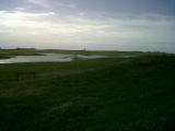
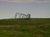
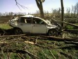
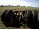
We caught up to the storm shortly after both (us and the tornado) made it to 321st Ave., where a farmstead had taken a direct hit as the next tornado(3) (what would become the Bowdle wedge) touched down. As we drove by the farmstead and began to re-enter the RFD, a power pole that had already been snapped a few feet above the ground finally fell over towards us. It was somewhat startling, but it missed the road by a safe distance (probably 30 or more feet). Shortly after passing that, we finally got close enough that the tornado came into view. At first, I wasn't totally sure where/what it was since the tornado had grown so large and had such a massive mesocyclone/wall cloud that was not far above the surface. But indeed, a huge, violent tornado loomed just to our north.
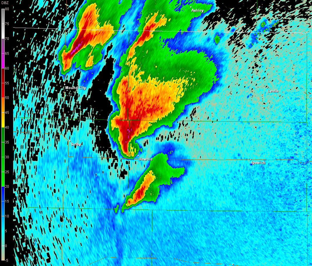
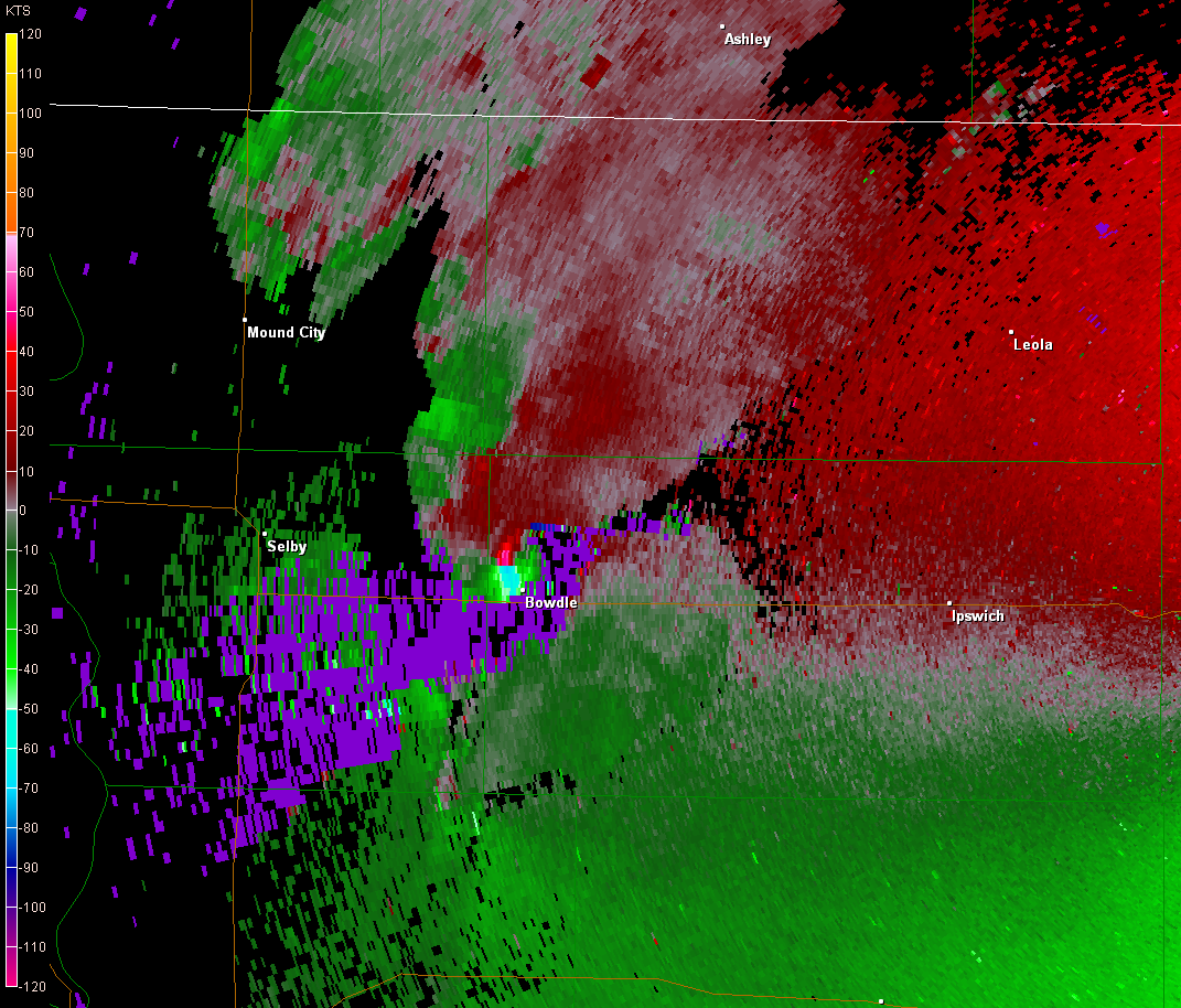
We sat on the northeast side of Bowdle as the monster churned across the land about 1.5 - 2 miles to our northwest. This tornado was absolutely mean. From as far back as we were, I could hear the roar of it. People say it sounds like a freight train or jet engine. That's exactly what it sounded like, only distant. I can't imagine the deafening roar one would hear if they were within close proximity of it. The tornado also slowed to a crawl as it made its way east-northeast. In fact, it took forever to cross state highway 47. Even more so, as it did, it began to shrink so that the eastern wall of the funnel actually moved back west across the road again. As all of this was happening, the entire team was getting wailed on by strong RFD. We lost visibility of the tornado from time to time due to rain in the RFD. After sitting in one spot for at least 10 minutes to watch the beast, we finally lost it for good and turned around.
As we headed east on U.S. 12 to catch back up with the storm, we witnessed a multi-vortex elephant truck/stovepipe tornado(4) to our north. The storm became decidedly HP around this time as new convection was developing and moving in from the south. This action did not apparently affect further tornadogenesis since the storm continued to produce. However, many of the tornadoes after this were smaller and harder to see due to the precipitation. As the team continued to run operations on the storm, I do remember briefly seeing a tornado(5) amongst wrapping rain curtains a few miles to our WNW. I believe we were on state highway 253 at this time. The movement of the meso became confusing around this time, as it looked to have turned all the way to the ESE, thus putting Roscoe in grave danger. Nothing happened there, though.
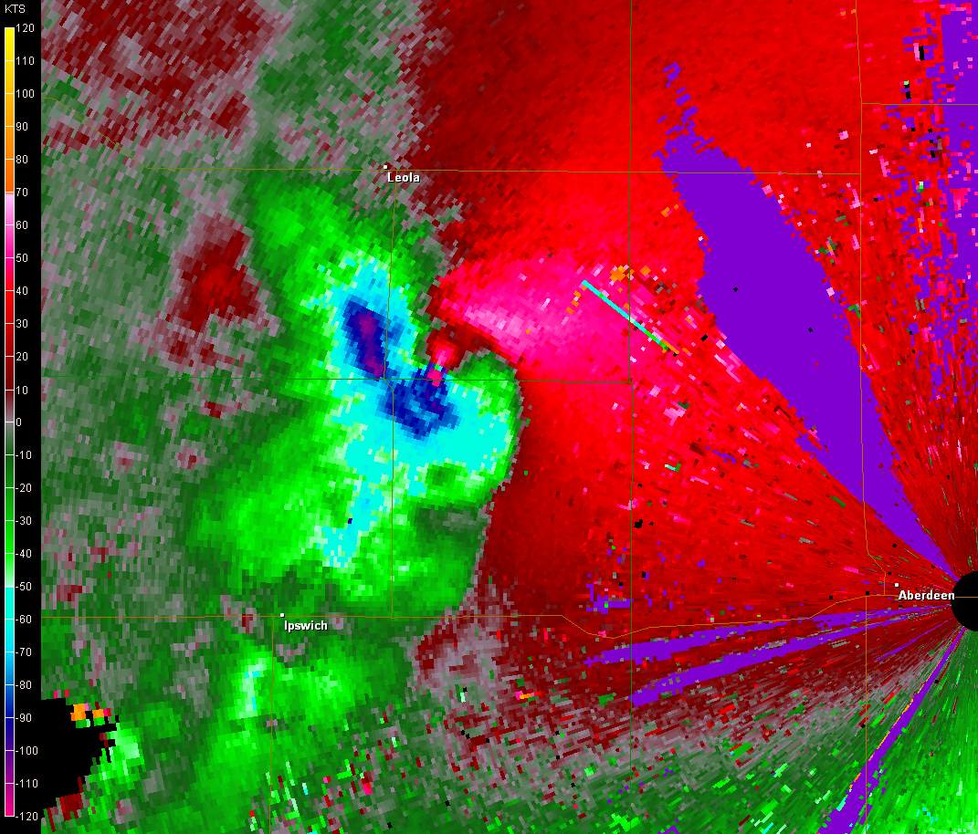
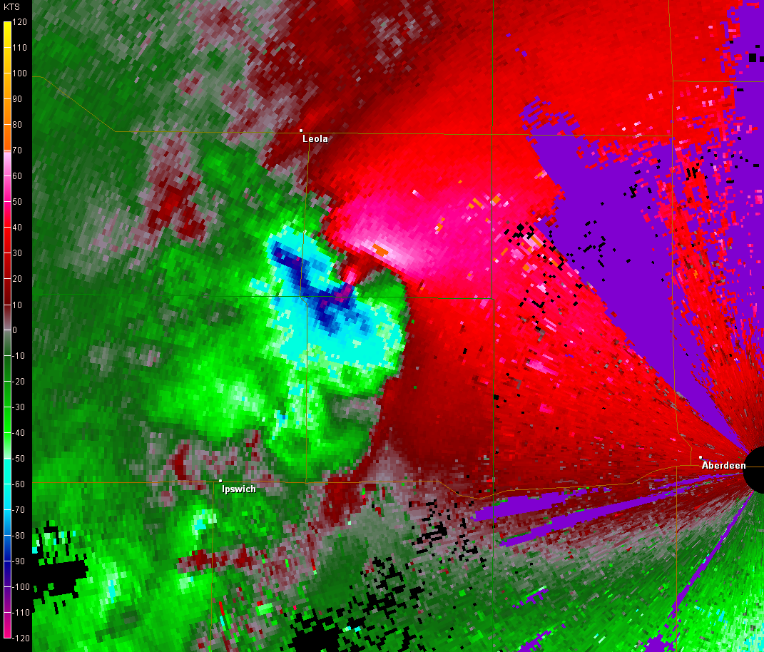
We made our way to Ipswitch and sat on the west side of town to wait as the storm approached, recycled, and reorganized. I believe I saw one more brief tornado(6)just west of town during this time. It was the last I would see. North of Ipswitch, the storm had a shelfish appearance to it. However, the threat was well to the north of U.S. 12, storms continued to go up just to the south of this one and run into it, and it was starting to get dark, so operations became difficult to run at this time. This storm continued to ravage the countryside, however. As it crossed into McPherson County from Edmunds County, it put down a fairly long-track tornado that was rated EF-2. I'm surprised it didn't get a higher rating. The radar presentation of the parent circulation was crazy. See below images for an explanation.
I thought this day would be hard to top. As it turns out, there would be two days later this season that would try to do just that...
 |
 |
 |
 |
 |
 |
 |
 |
 |
 |
 |
 |
 |
 |
Return to 2010 - chasing home page