
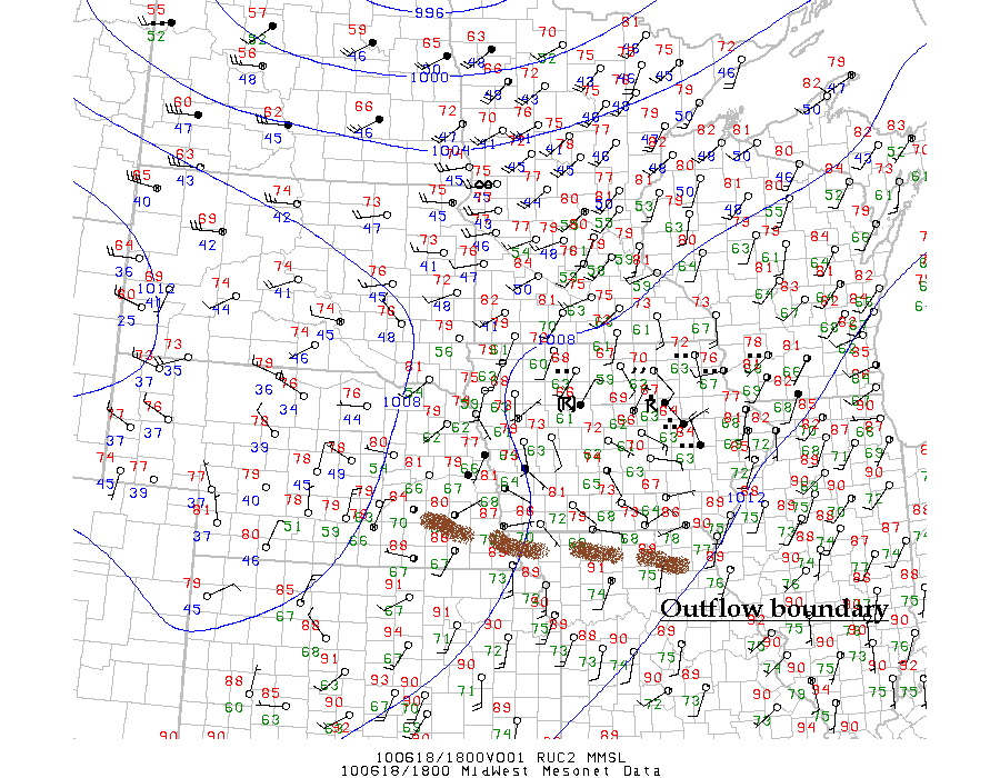
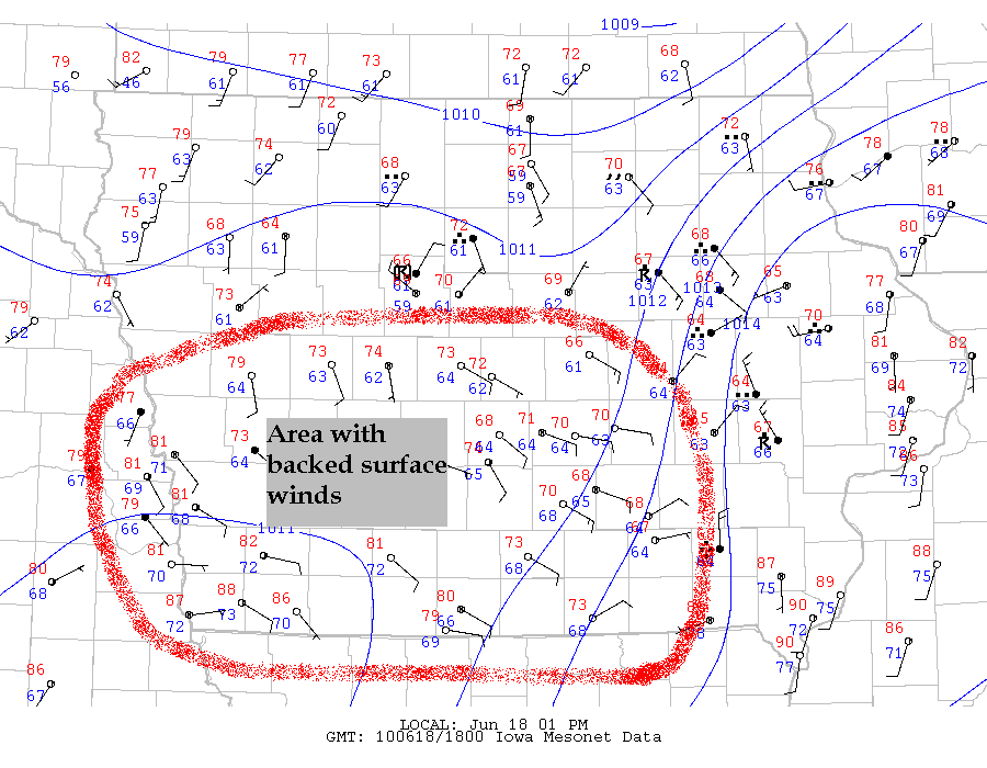
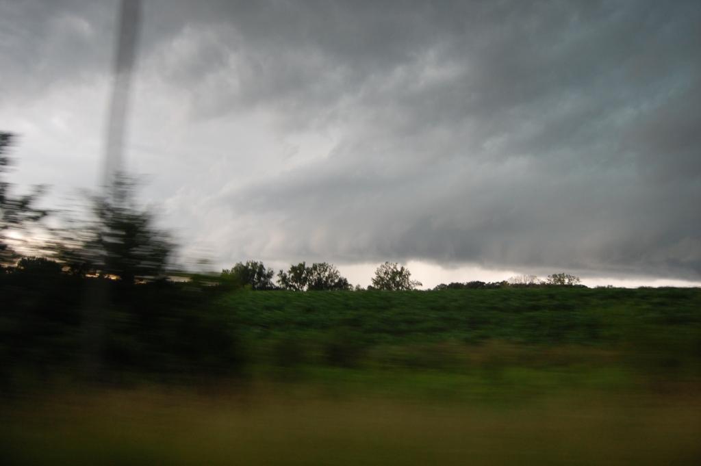
I was reeling from a chase hangover from the day before, so I wasn't planning on chasing this day when I woke up. Overnight from the 17th, a second MCS developed in northeastern Nebraska and cruised through Iowa during the early to mid morning hours (see 5 AM - 2 PM radar loop). This left an outflow boundary along with an area of backed surface winds in its wake. Since the front that triggered yesterday's storms and the good upper level flow that made yesterday a free-for-all tornado outbreak were still in the area, the stage was set for another round of severe weather. Adam convinced me to go for it especially since the target was not very far away.
We initially targeted the area between Shenandoah and Red Oak and left in the early afternoon, heading south on I-35 south of Des Moines. It's a good thing we went south first to get there because starting south of Des Moines we began adjusting our target progressively more north and east. Unfortunately, as the outflow boundary moved north throughout the early afternoon, the locally backed surface winds quickly veered back to the south and even south-southwest. Our target moved east to Creston, then to Winterset. We fueled up in Afton after we had moved west on U.S. 34 from Osceola before hitting U.S. 169 north. As we did this, a healthy CU field had developed all around us, with some taller towers noted. Me and my chase partners Adam, Ryan, and Kristy were having a fun time telling jokes and what not as we moved and awaited a better target when all of a sudden I looked up out the front windshield at a pretty healthy updraft/tower right in front of us! I laughed at how dumb of luck that was.
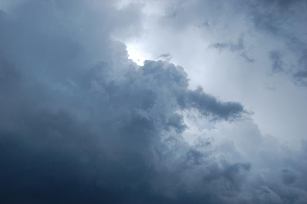
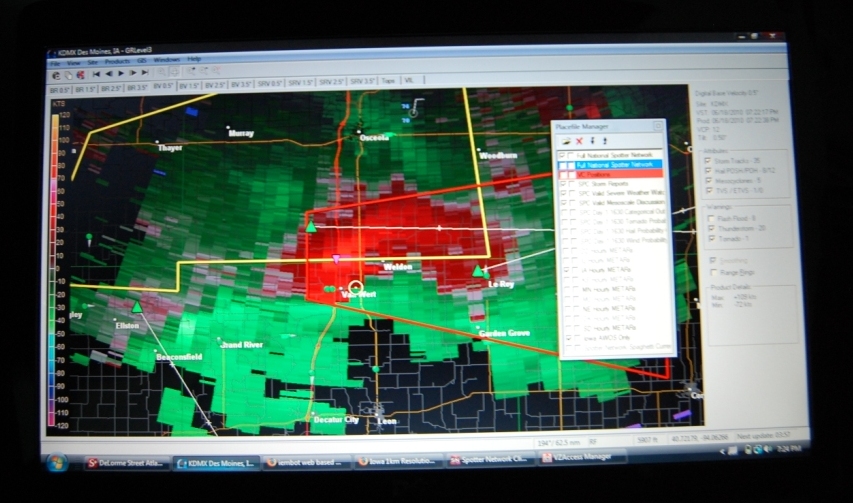
There were a number of very small blips of at max 30 - 40 dBZ showing up on KDMX at this point, and we did see some drops on the road as we under the very back side of a little shower that had begun to fall from this tower. It continued to grow in size and strength over the next several minutes, and within 25 minutes, was joined by several other good looking towers with accompanying rain showers in a small area around us. Since another good looking storm was starting to go up to the northwest of Winterset near I-80, we decided to put ourselves between the two storms (which were becoming dominant locally) to hedge our bets and have the pick of which to go after when one decided to go crazy. With SBCAPE in the area approaching 4000 J/kg, deep layer shear at or above 40 kts, and 0 - 1 km shear at or above 20 kts, surely one of them would.
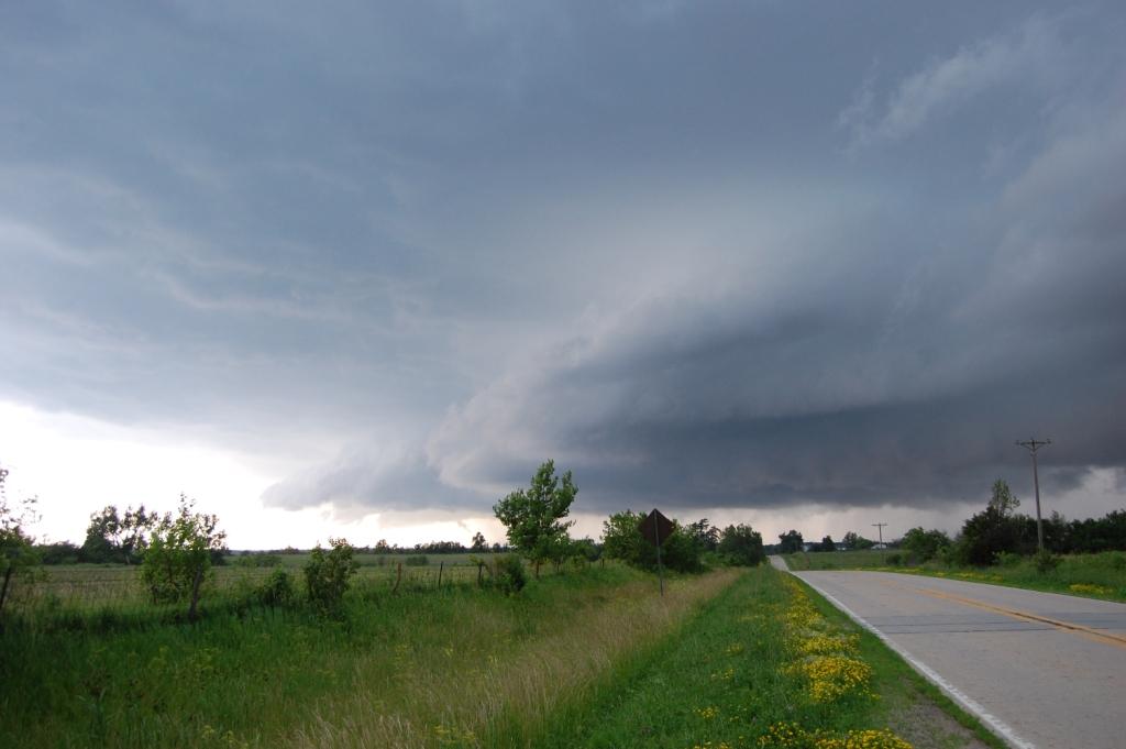
We passed Winterset and continued north and east on County Road G4R (Cumming Road). This would turn out to be a mistake if one could be made today. The storm just to our east/southeast (the first one we drove under) was looking increasingly organized visually, just not on radar, whereas the storm to the northwest looked a little better on radar, but we couldn't directly see it. The southeast storm even started to take on some small striations very near its base.
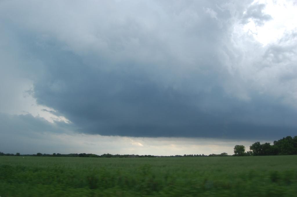
The road network wasn't the best in our location. Since we had gotten onto CR G4R we were pretty much committed to staying on it all the way to I-35, which fortunately wasn't too far. Seeing the southeast storm start to look so good visually got me thinking we should probably forget the one to the northwest and focus on the one right next to us. I hoped the storm would continue its northeastward motion, as all storms were doing, so that we could get back into a more ideal position before it went supercellular and made the right turn that many supercells do. When the first hail reports of 0.88" - 1" came out from this storm just east of Winterset my stomach began to sink. I didn't want to get to I-35 then punch back south through the core risking getting pounded by what may be much larger than 1" hail by the time we got there, or even worse, driving blind into a tornado that may be there the way this storm was going and the environment it was in. However, I wasn't willing to put my car, myself, or my chase partners at risk, so we decided to get up to state highway 5 that bypasses the Des Moines metro area to the south, then fly back south on U.S. 65 towards Indianola, an area with a better road network.
Sure enough, earlier than I had hoped, the storm slowed down and made a hard right, turning ESE and going tornado warned as we were about to make it to U.S. 65. As we booked it south, a tornado reort came out of the storm near Bevington at state highway 92 and I-35. Son of a bitch! If we had just gone east out of Winterset, we probably would've been sitting just east of there when the storm put down the only tornado report of the day in Iowa. Grrr...
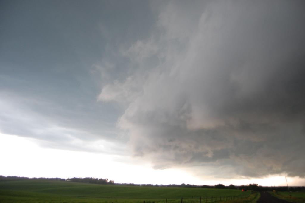
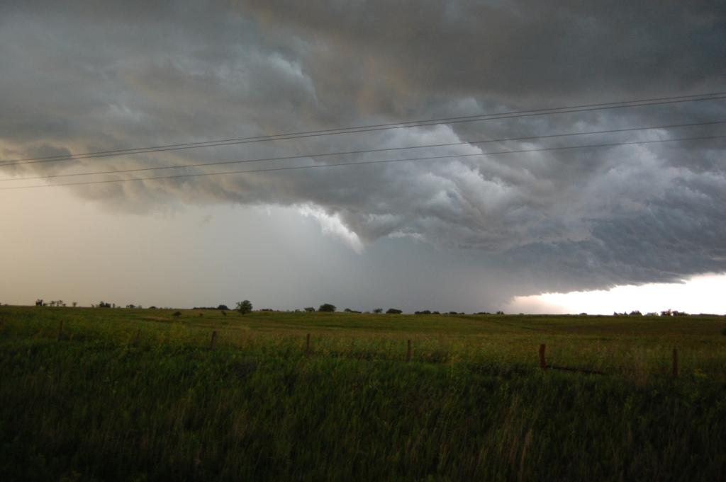
Because it was Friday at around 5 PM, of course U.S. 65, which is a main road in Indianola, was full of traffic and red lights. By the time we got to 92 at the center of town, the storm had already begun to rain down on its updraft and vault region, thus masking any tornado that might still be there in moderate to heavy rain...the kind of stuff you wouldn't be able to see through. Thus we just skipped our west route and kept going south out of town. Some new development was occurring just to the southwest of our current storm, and I hoped that maybe it would also produce. By the time we got clear south of Indianola and could see well, it looked like the battle had already been lost. All we could see was a ragged shelf cloud.
Despite knowing I messed up with the navigation choice, we tried to keep with it. However, it was obvious the storm had already started surging since every time we tried to head east, the edge of the outflow and shelf would overtake us from the north in no time flat. By the time we got down to Chariton, seeing a small-scale bow echo with inflow notch at the north end (might even call it a line-echo wave pattern) to our northeast by many miles and speeding up as it sank southeast, and having cool outflow air hit us with the leading edge of the rain still 10 miles away, we gave up on it. I scanned other areas of the state yet unaffected by convection and discovered a few discrete cells had developed along a SSW-NNE oriented line that went through Creston. We decided to head west on 34 towards I-35 thinking if the storms were still discrete and looking decent by the time we got to I-35 we could continue after them, otherwise just head home.
As we approached Osceola, the storms managed to stay discrete and intensified (a little). One of them well to the WSW of town even had a little tail on it. Thus we decided to take a drive through the rural Iowa countryside of Clarke and Decatur Counties. At times, the storm appeared to be trying to form something resembling a wall cloud...and a shelf cloud at the same time. After watching it struggle to do anything, we started making our way back to the east.

On our way back to I-35 and civilization we managed to hit a deer. It just popped out from the four foot tall grass on the side of the road (no shoulder) and cut across the road at a 45° angle, thankfully with a component away from the car. Thus when we hit it at 30 - 40 mph, we just lifted it off the ground by the ass and threw it off the road without it touching the ground. Just as Ryan and I jumped out to inspect the damage (I saw the deer get up and run away apparently not seriously injured) a nearby CG struck, which just added to the fun of being miles away from anything just having survived a deer hit. Thankfully, we were able to get moving again soon with only cosmetic damage to my car. The incident can be seen on Ryan's time lapse video on YouTube: http://www.youtube.com/watch?v=PrPElnEIXSc.
Just as we neared I-35, a familiar light showed up ahead of us. The TIV (minus Sean...interesting, what happens when the crew who's actually in it scores a tornado hit when he's not in it?) sat just west of the interstate. I watched the storm begin to surge into us as my partners got pictures with it.
Just as we sat there deciding what to do, the storm went tornado warned right on top of us! I got a new radar scan just as that happened and saw a broad couplet just to our north. If there was going to be anything, it was going to be just to our north, buried in the mass of water.
Of course there was nothing tornadic in there, and the tornado warning was probably completely unnecessary. We tried to stay with this storm as it headed south and east, but just like with round one between Indianola and Chariton earlier, this storm gusted out and wasn't worth chasing after 10 minutes. The outflow boundary was already a few miles ahead of the rain, and the process was likely to continue like it did with the previous storm. Somehwere north of state highway 2 on state highway 204 we decided to call it a chase and turned back north on Highway 65 on our way home.
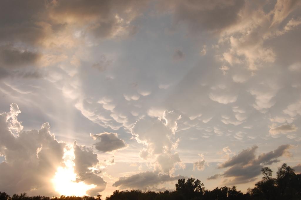
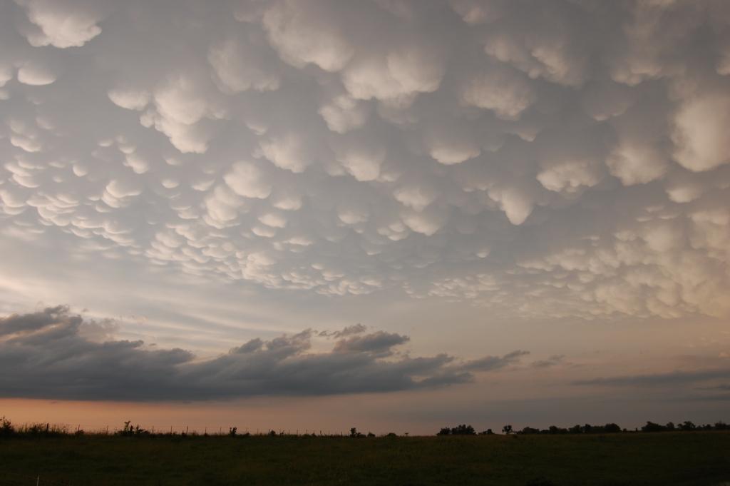
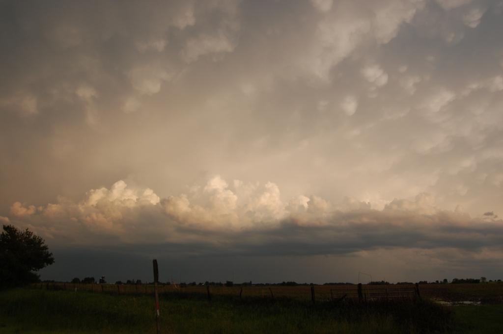
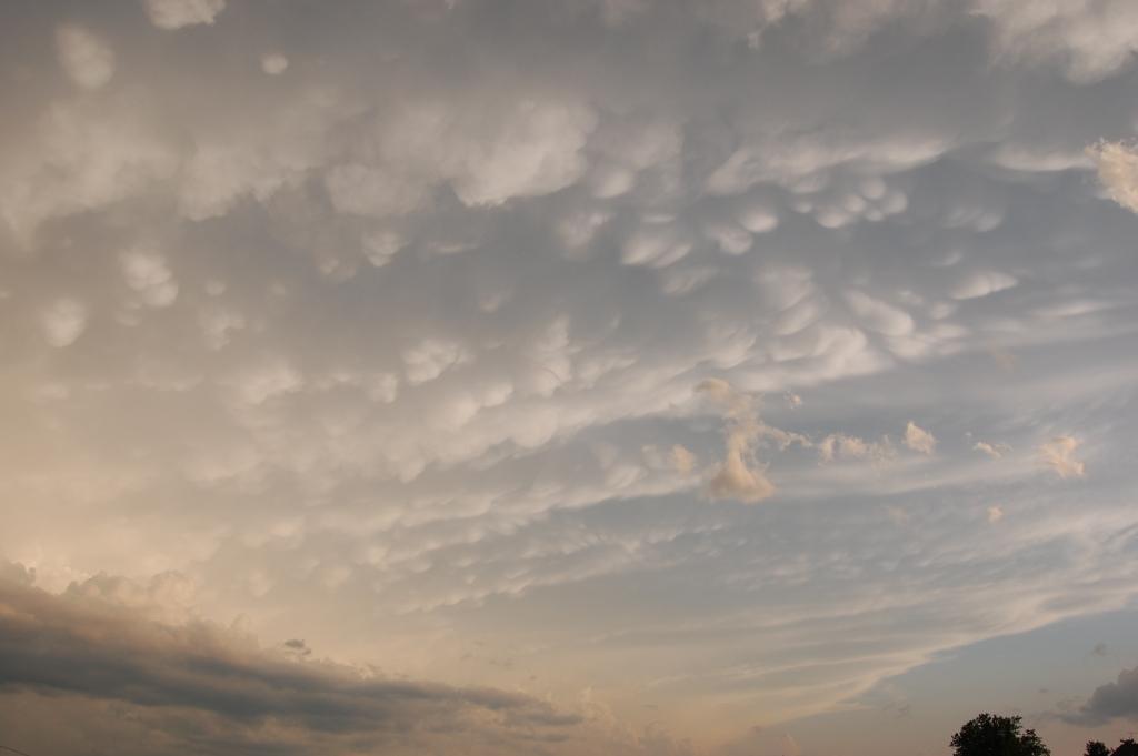
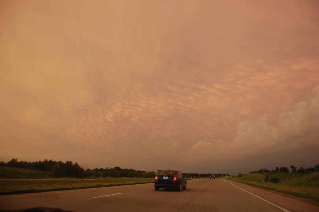
We punched through the developing linear MCS and saw some very small hail and some gusty winds, but probably nothing exceeding severe limits. Did see one or two large tree branches down. Actually, the best show of the day came long after we had called off our chase. Not only did the storm system give us a persistent, vibrant rainbow for our viewing pleasure, but it also gave us a beautiful backlit mammatus display on our way back. The only thing that interrupted some of the view of it was a field of cumulus clouds that developed behind the storm and eventually formed into some sort of rear-inflow band. I don't know exactly what it was (a true rear-inflow notch wouldn't be manifested through visible cumulus clouds).


Return to 2010 - chasing home page