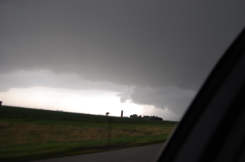
Wall cloud now visible after the funnel dissipated. Hail and heavy rain had begun to fall as we found ourselves in inflow suddenly.
Many a chaser will say that one day can make a season. For me, this day made the 2011 chase season.
Summary: saw three tornadoes, one of which we came within about one-half mile of. Also saw a lot of 1"-2" diameter hail as we sat in the core of a storm for awhile. My car now has about a half dozen dents because of it.
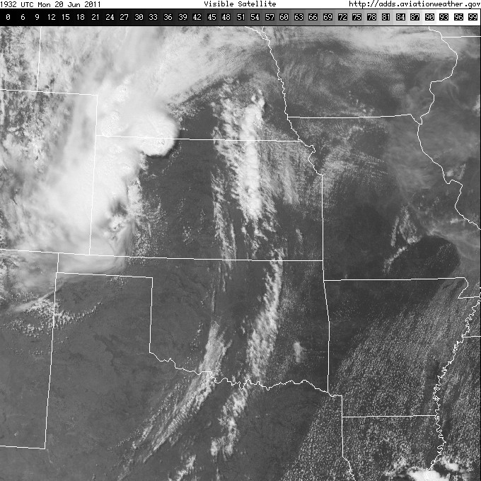
This day initially looked like it was going to be a classic Midwest/Northern Plains severe weather outbreak from model forecasts 84-72 hours out. However, like many Plains events this year, as the lead time decrased, the forecast began to fall apart in the models. Finally, the night before, the models dramatically moved the system and made it look very much less impressive than it had even 12 hours before. It was very gloomy, especially since I had another miserable cap bust chase in Missouri the day before. While SPC had a lot of confidence in this being a big event the day before, by the time I woke up on the day of, the confidence understandably dropped. This felt like the straw that broke the camel's back when I saw it. I realized the only way to have any fun chasing this day would be to drop my expectations dramatically. While I was desperate for a tornadic supercell, I came to realize that a shelf cloud may be all I could expect given the likelihood of storms going linear quickly this day. Logan agreed with the analysis, and we left Ames around 11 AM.
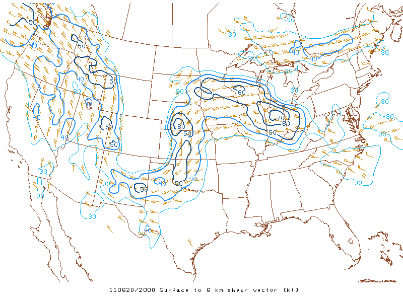
Our target shifted several times during the day. Initially we were still going to try to play the triple point which we had been targeting all along. Thus we chose Sioux City as a first staging point and headed west on Highway 30. However, after some more analysis and discussion, Logan and I agreed that the warm front would never make it that far north, so we shifted our target to the Denison-Blair corridor along 30. However, as we got there, it became clear that the system was putting on the brakes big time and pretty much came to a screetching halt. Thus we shifted farther west into Nebraska. When we reached Fremont for a pit stop, we observed a rapidly building CU field over our heads. It was also pretty warm and juicy. For a second we thought Fremont might be a good place to sit. However, we noted that the CU field was part of a large south-north oriented band of mid level clouds moving in from the west that probably marked the back edge of the insane cap that would keep Iowa storm free for awhile. We had also been watching a surface trough extending north and east from the surface low through northeastern Nebraska that had a notable wind shift associated with it. There was instability and shear there and the cap wasn't as strong, so we wanted to see if anything was going to fire up there. However, clouds were filling in that area, and the best instability was where the only clear area remained: southwest of us. Also, an obvious arced reflectivity fine line showed up on KUEX indicating the dryline moving into south-central Nebraska. I had communicated with Darrin Rasberry about teaming up this day. He was already in Columbus by the time we left Fremont, so we headed out to Columbus. When we met with him and Dan Melby there, we analyzed the situation again and noted that this time the deep-layer shear vector was oriented perpendicularly to the dryline near Hastings. We didn't want to bite on the already raging tornadic supercell that had come in from Kansas, so we decided to get south towards the dryline.
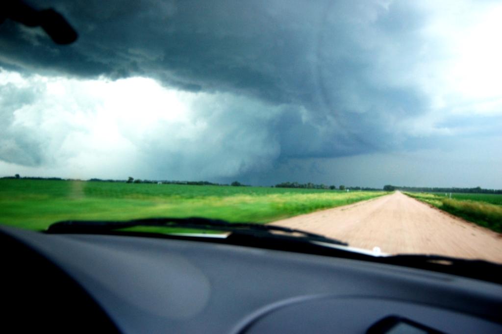
Logan and I jumped south out of town on U.S. 81 towards York. Darrin called me shortly after we got out of town and said they were going to take 30 southwest for a more direct route. I immediately saw the utility in doing so, and was going to suggest that we get to 30 by taking NE-92 west after 81 turned west. However, on the way to that juncture, I saw two blips go up to our SSW, just ahead of the dryline. Given their initial motion of straight north, we decided to stay on 81 south towards York. As we drove south past Osceola, we were covered the anvil shadow of the building thunderstorms (that's always so eerie and cool, and the first time this year I got to do it with such visibility - see the first picture of Logan's album on facebook for what I mean). As we continued south, we noted a rain free-base far to our SSW. That became our "target" so to speak because 1) visibility is high under a rain-free base, and 2) rain-free bases tend to indicate updrafts which mark a good place to look for tornado development. We got west on U.S. 34 and south on NE-93A/Road B towards Henderson, eventually stopping at E. 7 Rd. and S. Z Rd. That's where things began to get good.
What was up with all of the semi traffic on U.S. 81? We were stuck behind three 18-wheelers at times on that highway. Thankfully they cruised pretty fast, but it took them forever to get up to speed. It was frustrating being trapped behind them all the time. Thankfully, by the time we got to Henderson, the slow traffic stopped holding us back for awhile.
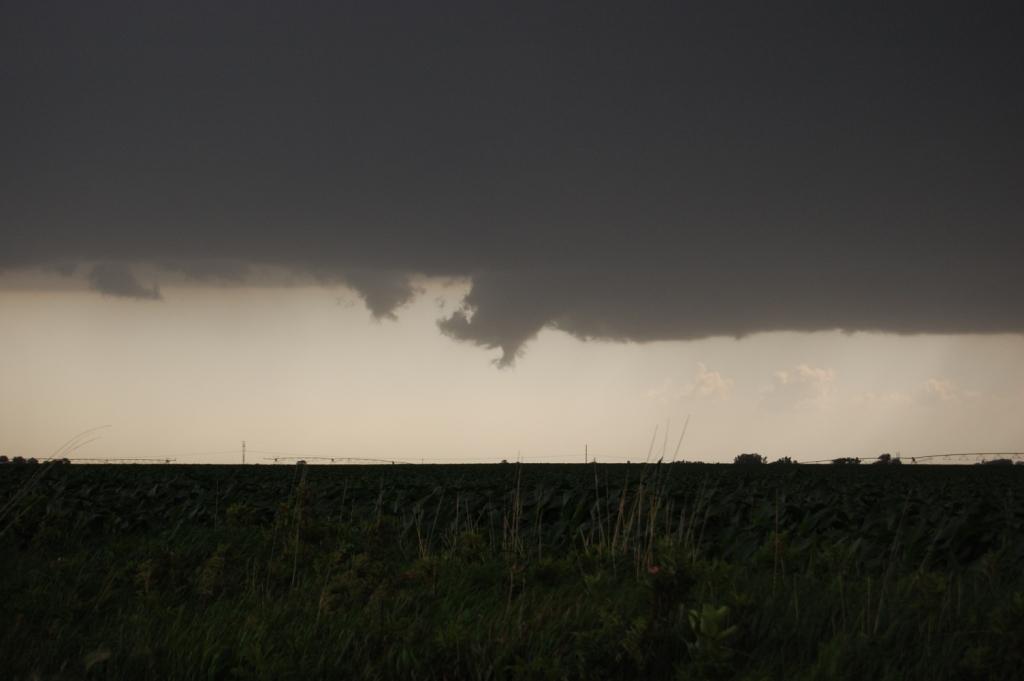
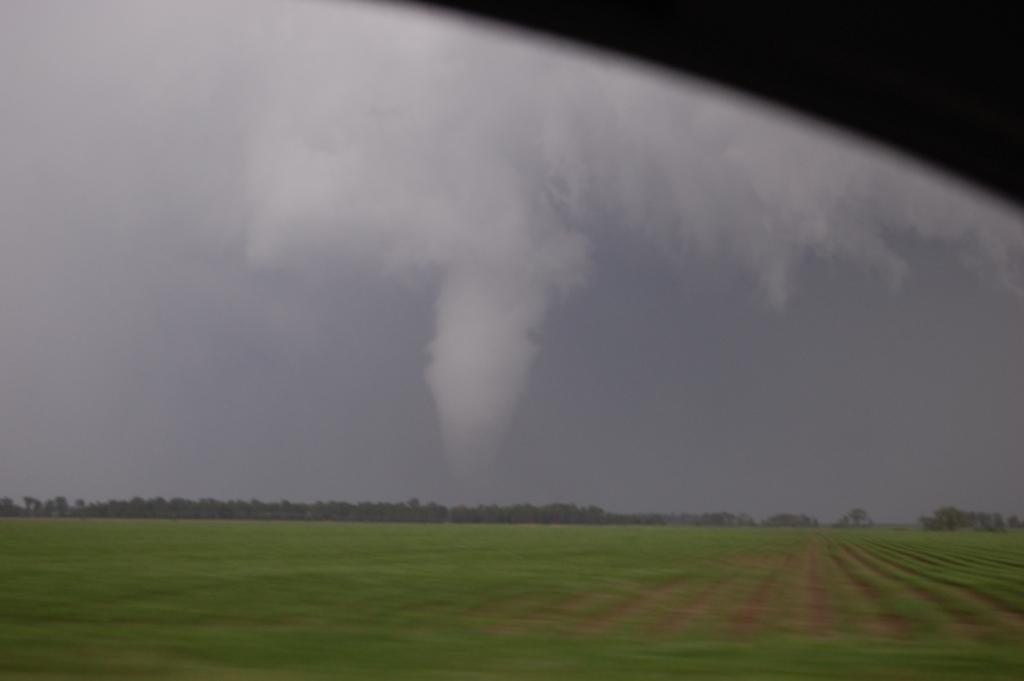
The lightning was pretty intense, so we had to lay low when we got out of the car. But as soon as we did we saw a funnel cloud pop out of the left edge of the rain-free base with no obvious wall cloud above it! Even from as far away as we were we could see rapid rotation in the funnel. It persisted for a minute or two but never came down more than about 15% of the way. We lost it as we drove west in an attempt to get due north of it for an intercept (you know, on the chance it would develop into a tornado).
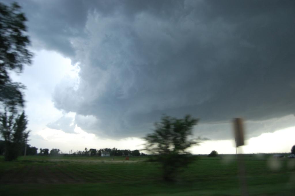
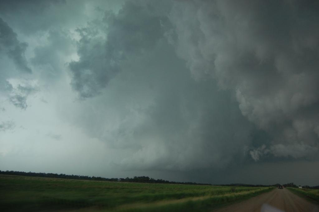
As we sat just NNE of the former circulation heavy rain and small hail began to fall. Then strong easterly winds full of warm, moist air began to creep up. We suddenly realized we were in inflow, but to what? We could clearly see the tornado-less wall cloud to our immediate SSW and that's not where the inflow was pointing. It was pointing due west into a zero-visibility mass of water. On radar a decent couplet had appeared to our west associated with some random hook on the backside of the mess of convection around. Sadly it looked like a linear mess, which had us somewhat perplexed given the orientation of the shear vector. However, within minutes there were hints that the line was breaking apart into individual cells. Confused and slightly alarmed, we decided to move north back to I-80. Once we got east on I-80 to stay out of the rain, I turned back to see a rope funnel high in the air sticking out of the back of the rain-free base. This apparently did not touch the ground.
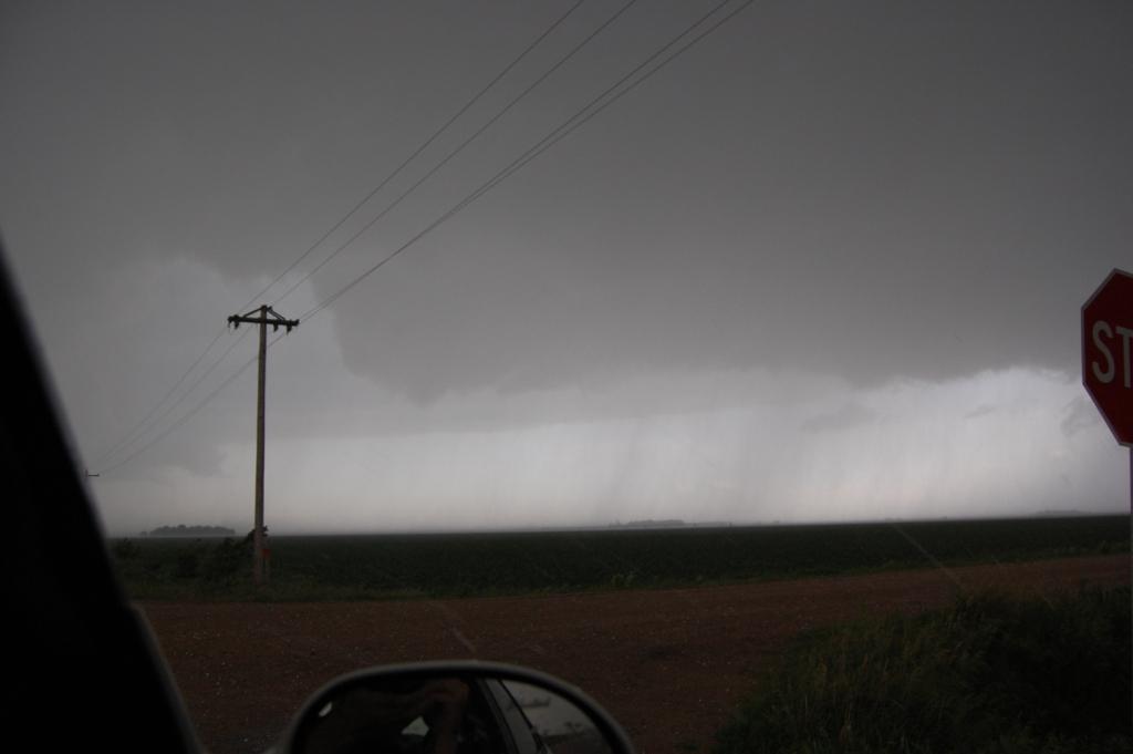
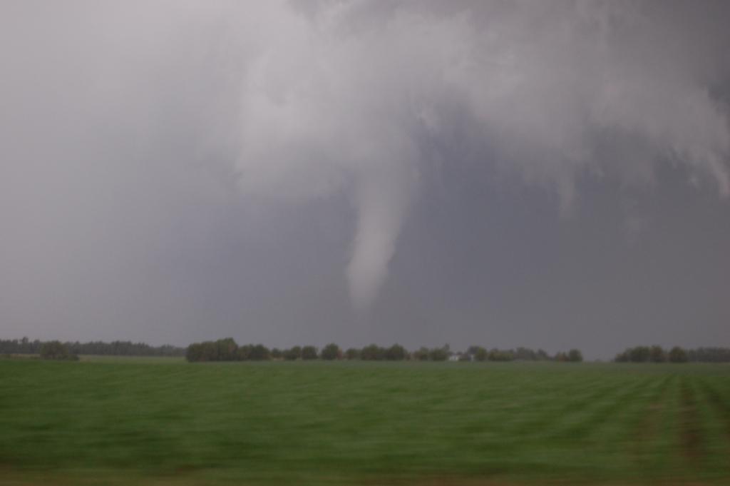
We ended up back on NE-93A/Rd. B a mile or two south of U.S. 34 where we stopped to watch the storm evolve. We noted a suspicious, poor-contrast object several miles to our west in the rain. We could barely see it with our own eyes at the time, but it sure looked like a cone funnel/tornado. We began to take on some rather large hail, easily >1" in diameter, with some stones much larger than that. The last time I was in hail that large the windows on the car I was in took a beating and broke in several places. Thus I was slightly nervous as the hits got louder and more deep, especially as some stones were bouncing a few feet off the road. Thankfully, the car survived this part of the barrage just fine.
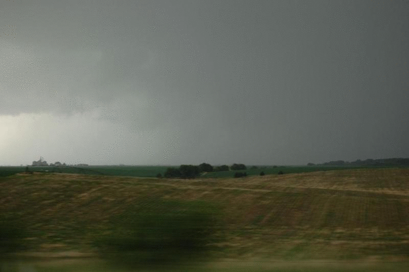
We slowly moved north and east a few miles to get out of the large hail, yet to keep an eye on a feature that had finally shown up in the original area we were first interested in. Before this time, there was just an innocent blob of cloud with no rain under it. There was no interesting structure that would make one think it was a mesocyclone or something, especially given its displacement from the heavy rain. However, as we moved east on U.S. 34 a HUGE cut formed in this cloud formation, making it look like a gigantic RFD cut.
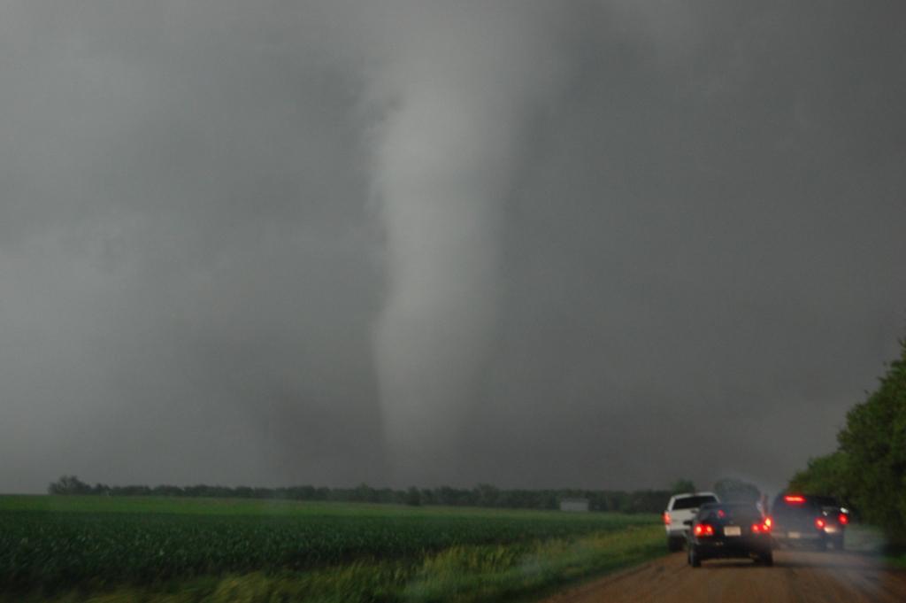
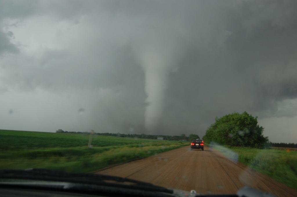
Now the funny part: we were driving by Bradshaw when Logan looked back and said, "is that dust being lofted back there?" I turned around and saw, through a gap in the trees, a half-condensed, dusty cone tornado on the ground to our southwest! I exclaimed, "HOLY S--T, there's a tornado on the ground there!" I say that's funny because I had been checking that area every minute or so but didn't see anything. Then suddenly Logan says something and BOOM, tornado!
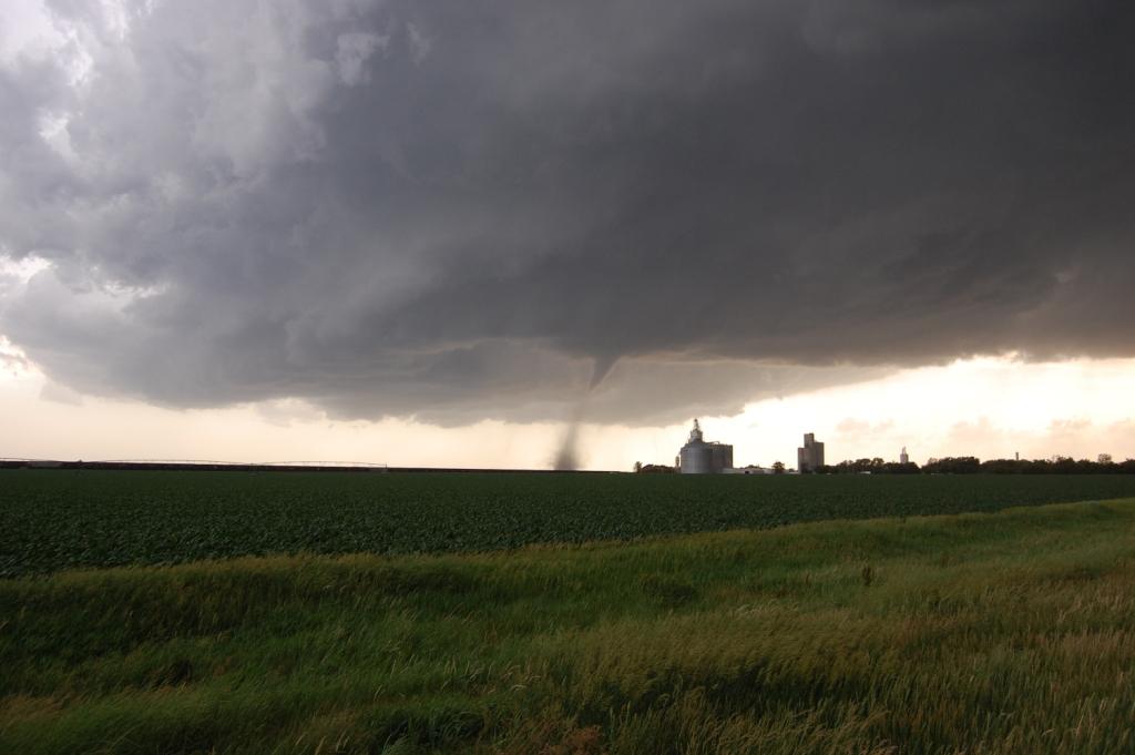
We whipped around to the west back across Bradshaw, stopping just west of town for a better view.
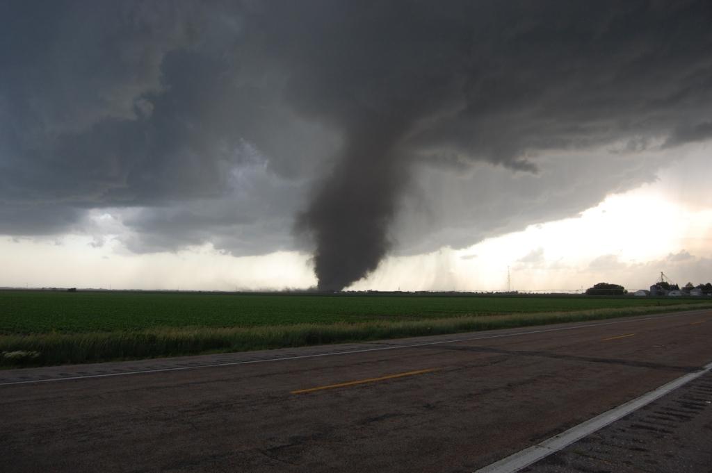

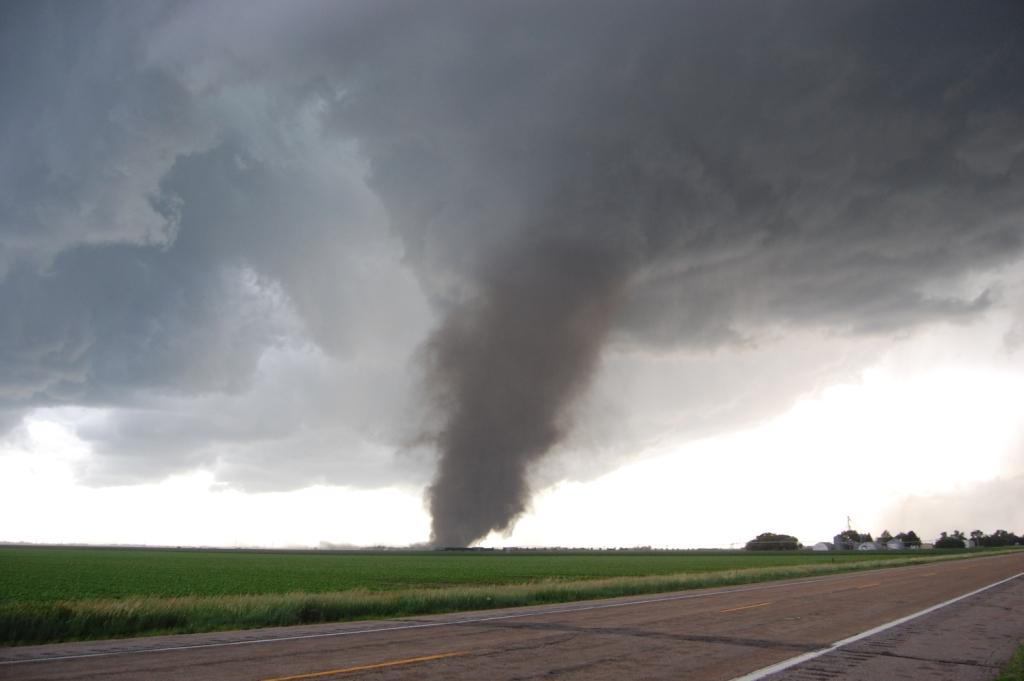
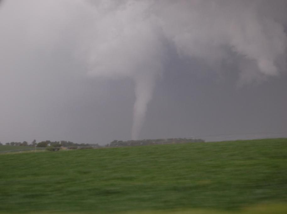
We knew we could get even closer given the NNE motion of the tornado and the great visibility. Thus we zoomed west about a quarter of a mile, eventually stopping about two-thirds of a mile from where the tornado was going to cross 34. In retrospect, we could've gotten even closer, but I can't complain with the view we had as the tornado crossed the road!
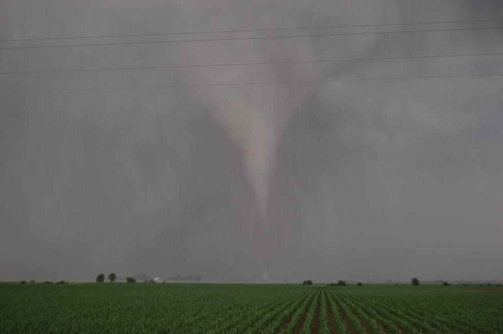
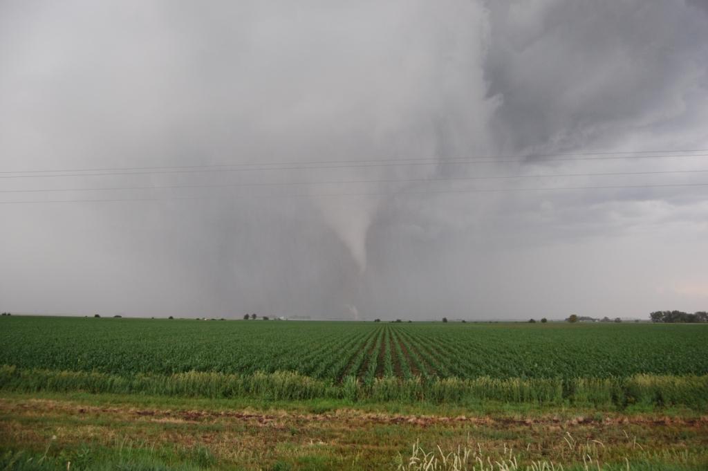
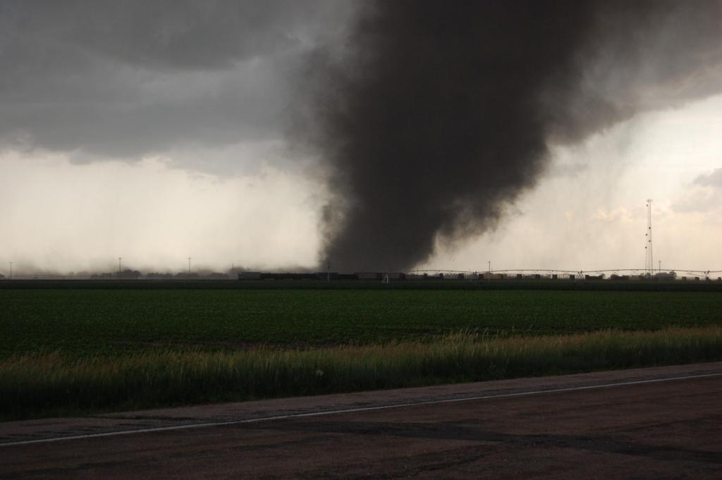
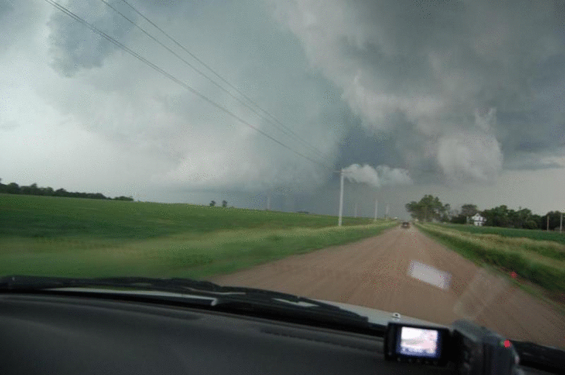
We probably sat there a few minutes too long, but eventually got going north and east. We got to enjoy the wonderful Nebraska country road network, a perfect one-mile by one-mile grid with flat, straight, well built dirt roads that allowed us to go up to 65 mph to catch back up. The tornado remained on the ground for 20 minutes, and we got to see just about all of it even though the contrast got bad as it got north of us. The tornado fully roped out a few miles north of us as we were able to see it.
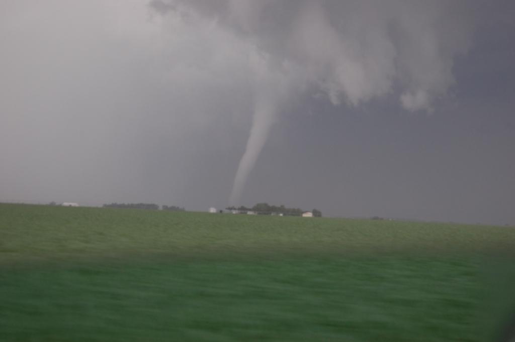
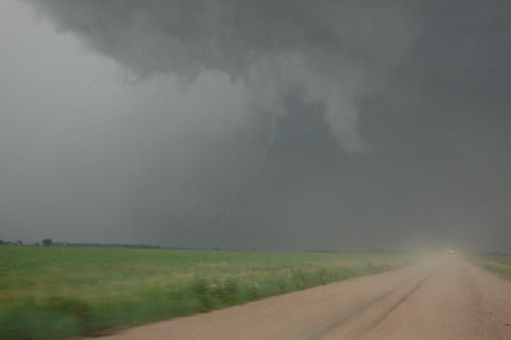
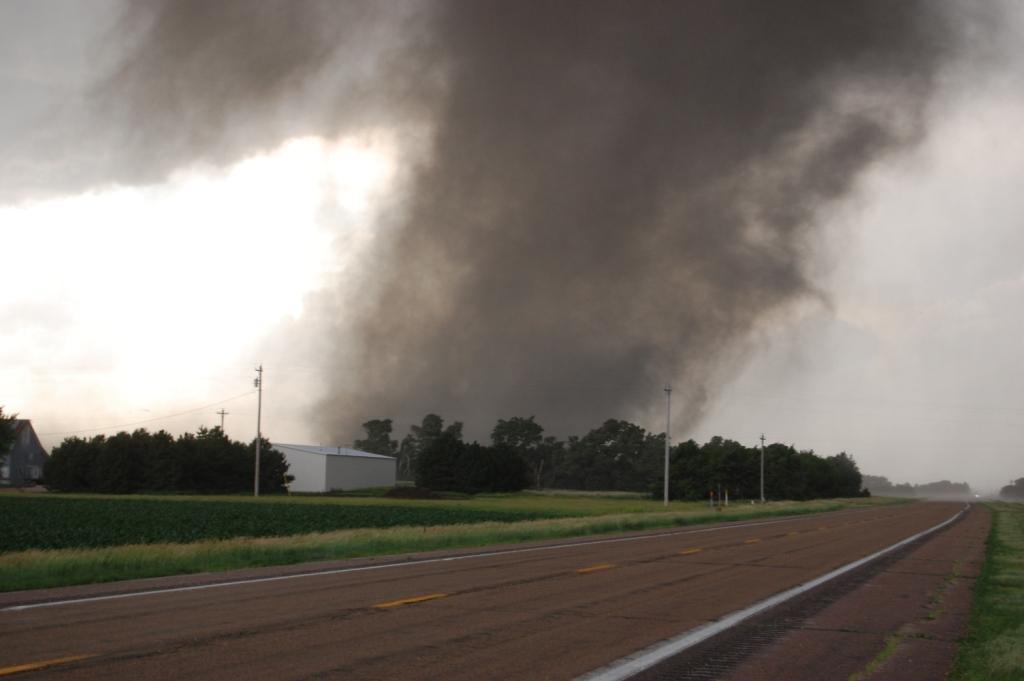
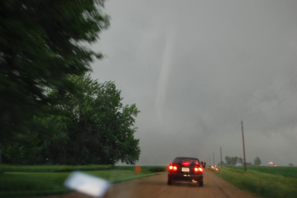
As we continued to pursue it north, some great structure emerged as a clear slot exposed a large cylindrical mesocyclone miles to our north. At some point, it put down another strong tornado, although it took us several miles and minutes of catching up before we were confident we were seeing it. Gradually, a stout stovepipe came into view under the beast of a mesocyclone (it reminded me of the meso that produced the Bowdle tornado). We chased it north until it roped out as we finally got to within a few miles of it.
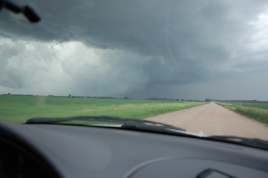
After the tornado dissipated we went east on 92/81 through Osceola and then north again on more wonderful dirt roads across the Platte River to get to Highway 30. Unfortunately, the storm was evolving into an outflow dominant cell. We made it back to Columbus and waited for Darrin so we could celebrate, but he called me and said they were going north out of town after it, so we followed. There were brief moments where it seemed that it was trying to reorganize, but it quickly fell apart once it neared Madison. It was very cold under the outflow of the storm at that point despite still having an unobstructed rain-free base. All we saw after that point was some nickel-quarter sized hail along 81 south of Madison. We called the chase off there and saw a few StickNets and TTU mobile research radars on NE-32 on our way east. I tried to organize a celebratory steak dinner between a group of people, but no one seemed interested. Thus we drove home via 30, following the severe MCS that developed later on.
Easily the best day of 2011 and in contention for my best chase ever. The two big tornadoes we saw were rated EF2 and EF3, respectively. Given my luck after the big day in mid-late June in past seasons, Logan and I decided that this should be our last chase of the season.
And I LOVE chasing Nebraska! It doesn't pay off much, but when it does it's always spectacular.
Return to 2011 - chasing home page