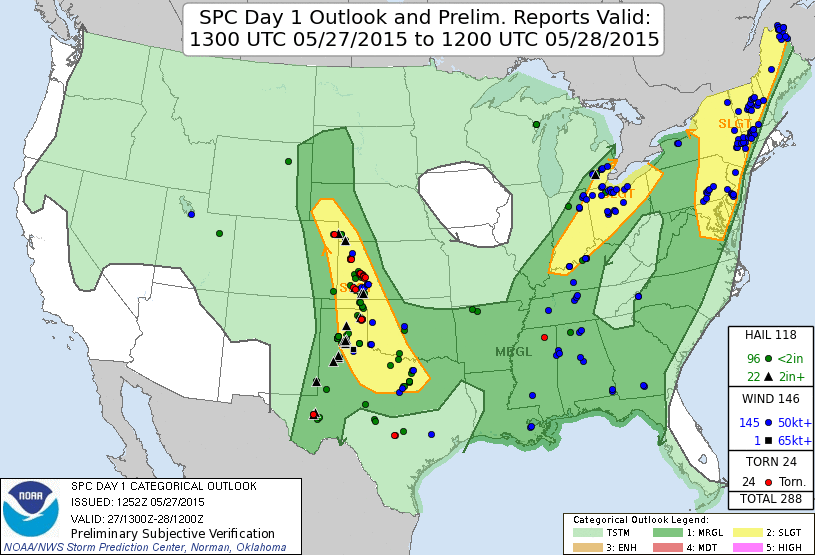

Summary: A very rewarding chase on a day with weak synoptic scale forcing. My last chase of the spring season, and a great one to end on.
Chase partners: none
It took me awhile to get out to the target area. I knew I wanted to be in the eastern Texas panhandle north of I-40, but I debated between taking the northwest passage (U.S. 270) to Woodward and just going west on I-40. To stay south of any possible southerly development, I opted for the latter. I had to stop multiple times for various reasons on the way out. I was somewhere around Elk City when the Canadian storm went up. Thankfully it sat in one place for 4 hours and waited until I was on it before it started producing tornadoes. I missed the initial funnel cloud. When I finally got on it, it didn't have the most impressive mid-level structure, but it had a persistent meaty wall cloud.
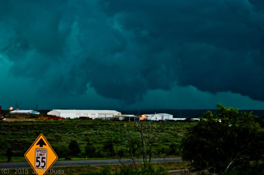
I'm glad the eastern TX panhandle is big-sky country, because the road network in that area is terrible. I managed to find a dirt road that went west of Canadian for many miles. I was worried about getting cored if I went too far north. When I initially arrived on the storm it had begun to sink south very slowly. After 30 minutes I could tell it had wobbled back north. The wall cloud persisted, but I saw no further lowering nor any increased rotation. Eventually seeing some sort of wrap going on to the north, and seeing the storm simply not press south, I decided to go back to town and go north. On the way I noted the cloud base on the southern edge of the RFD/gust front region had noticeable anticyclonic rotation, but no lowerings.
I stopped a few miles north of Canadian on U.S. 60, perched on a high spot looking west for a long time. I decided I would sit there as long as the core didn't overtake me or as long as big hail didn't start to fall.
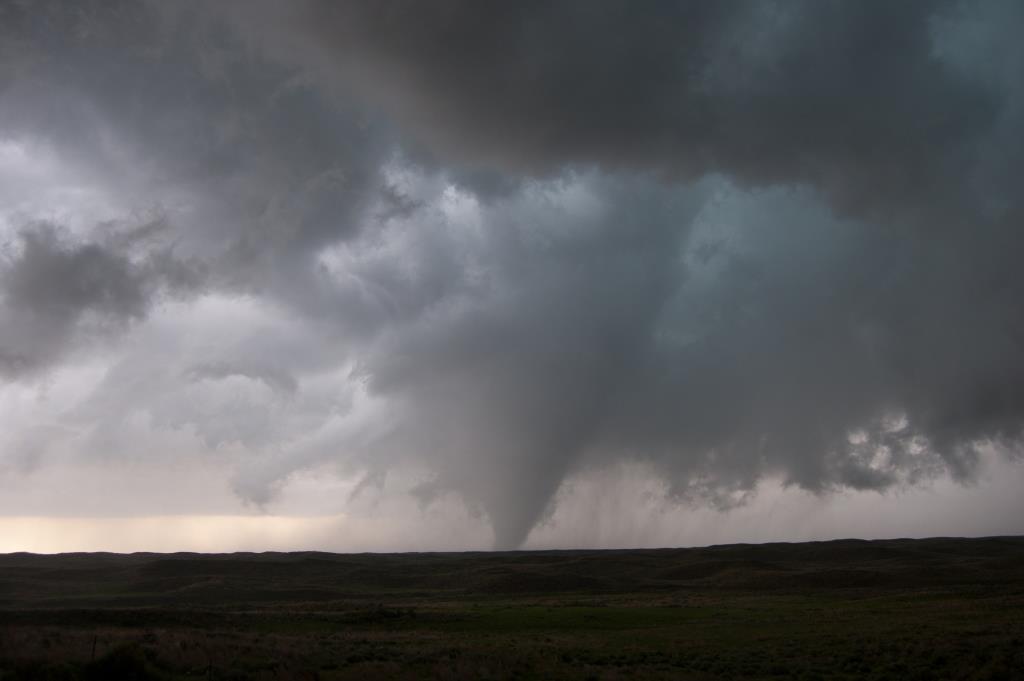
Neither happened. In fact, I was able to sit there through the entire big tornado that formed. It honestly surprised me. The RFD pushes that led up to it were fairly cold and really lifted the cloud base. That was probably one of the largest RFD regions I had ever been inside. I could clearly see the southern edge of the wrap pass many miles south of me without actually hitting me. I noted the pretty broad lowering off to the west with extended cloud tags preceding tornadogenesis, and it was fun being able to look up at a steep angle into the void left by the RFD above, but it didn't look like a tornado was going to be imminent. I was thinking about moving south when I looked out my window and saw the funnel almost to the ground...another Holy Shit! moment.
Seldom in my chasing career have I had 1) the opportunity to comprehensively document a tornado (almost always caused by meteorological or logistical problems); and 2) actually taken advantage of such opportunities. I managed to snap off about 50 solid pics of the tornado while also remembering to adjust my windshield-mounted video camera inside the car. I made a brief movement north after the tornado started because I thought it might move off to the east/northeast, and I wanted to stay in the path for best contrast. So I missed a minute or two of video of it while moving, but caught all the rest. If only there hadn't been so many random spits of heavy rain while the tornado occurred, I probably would've gotten even better shots. I happened to be parked near Greg McLaughlin during this sequence, so I shook his hand while we each shouted with joy. We observed a single tumbleweed get blown east across the highway, then a few minutes later get blown back west. We also started to notice a newly formed rotating wall cloud less than a mile to our east. In fact, after the main tornado finally died, I only moved back south a bit because the west edge of the wall cloud had shifted over my head.
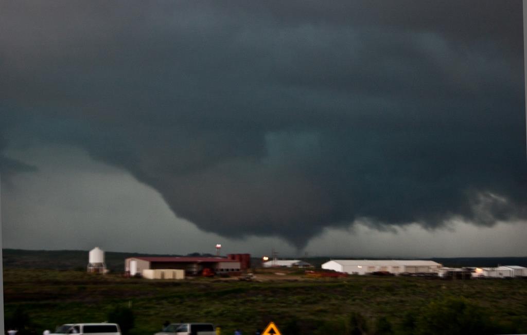
If only that next wall cloud had produced...I would've had a front row seat for that one. As with many of the wall clouds/low-level mesos on this storm, it slowly moved southwest. Given the stationary nature of the entire storm, however, that doesn't surprise me too much.
That wall cloud fizzled but was soon after replaced by another one in almost the same spot. Seeing other large wall clouds already present back to the southwest, I went all the way up to F.M. 1920 to position myself at a good angle catch two possibly tornadic wall clouds simultaneously. It eventually became clear to me that the near wall cloud was not going to produce either. With the core looking to move in, I fled back south to the south end of town where I spent pretty much the remainder of the chase, perched on a high spot off of U.S. 60/83.
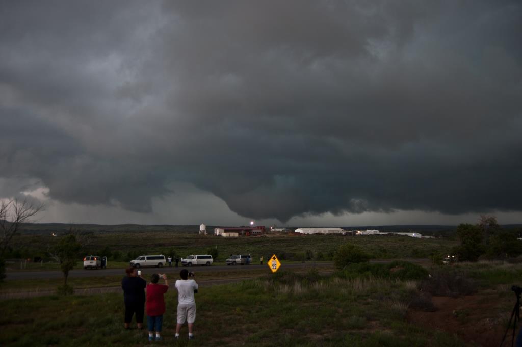
At that point it appeared the entire town had just stopped. Traffic was just insane, and it wasn't all chasers at that point. There were a lot of 18-wheelers going through town throughout the chase. Presumably they had a lot of commerce in the area (and only one big highway through town). Areas south of town were disgustingly crowded with spotters/chasers/locals. For example, when I first got to town early in the chase, I was able to find a spot to park on Exhibition Rd. with only one or two other chasers nearby. By the time I came back to that road, there was literally no room for any more cars to park along it, and barely enough room to drive. The spot I settled on about 1/4 mile north was initially almost empty, but I was boxed in within 15 minutes. It's a good thing I was never compelled to try to move.
I witnessed the final few tornadoes from that spot, although the contrast wasn't great (because of distance and looking into the core). I tried to adjust between shooting the short-lived funnels that continually emerged from random circulations at the cloud base and occasional CG barrages. David Reimer and Paige Burress were right next to me and had more success with that than I did. I never managed to capture a single CG, although random inflow wind did blow my tripod over and slightly damage my camera. Oh well. Not the first time my D40 has taken a hit. It still works just fine!
After the final tornado I decided to core punch to see if anything was going on in there. I went up on F.M. 1920 again, this time several miles. I passed by a low spot where it looked very close to becoming submerged in water, so I knew I couldn't stay in the area for long. Visibility also dropped quite a bit, so I turned back, getting blasted by several close CGs. The storm was disorganizing, but I still managed not to experience any hail at all.
Return to 2015 - chasing home page