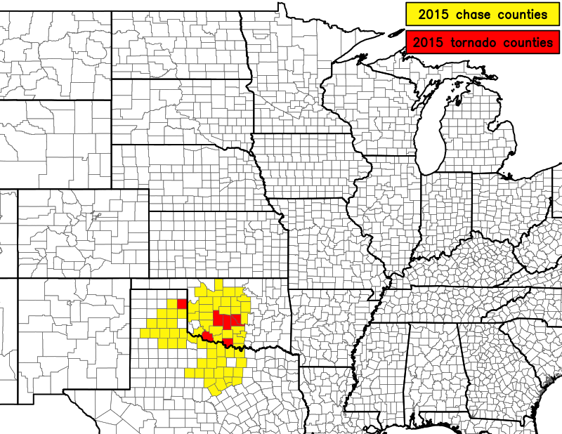
2015 was a pretty good year for redemption. Not only did I break a nearly two-year-long tornadoless streak in May, but I also scored my first tornado on a solo chase. Not only that, but ALL of my tornado days this year were on solo chases. At one point I saw tornadoes on four consecutive solo chases (May 6, 16, 19, and 27). Also interesting about this year was the fact that I didn't chase outside of Texas and Oklahoma. Lastly, the theme of this chase season (at least the spring portion of it) was wetness and rain-wrapped, low-contrast, or low-cloud-base tornadoes. And especially in April, it was the year in which I was on storms that others saw tornadoes on, but I didn't for whatever reason. Very frustrating heading into May.
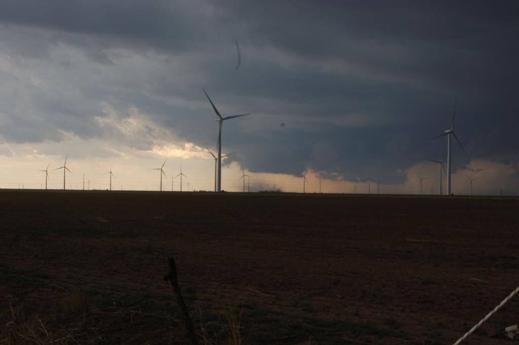
April 22 |
May 6 |
May 16 |
May 19 |
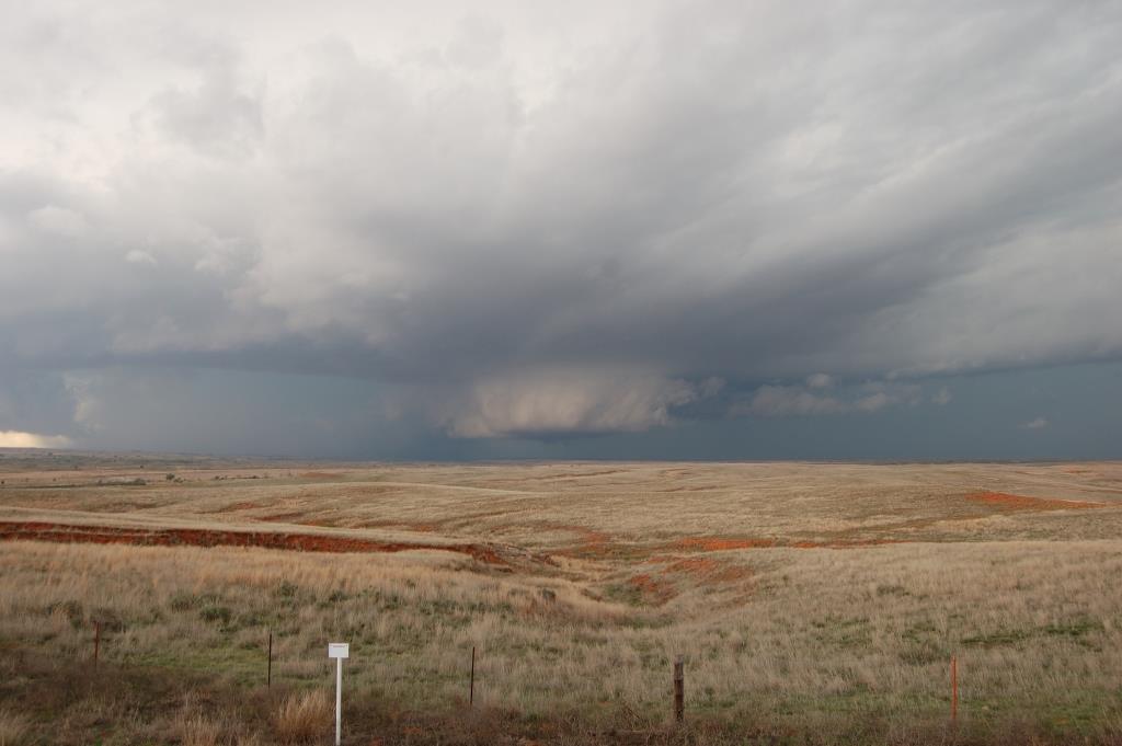
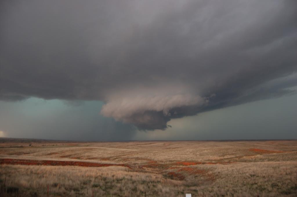
May 27 |
November 16 |
Full: Left Norman just after 3 PM with an initial target of Stillwater. By the time we got to Guthrie it was apparent the front was going to shove our play southward, so we went east on OK-33 towards Cushing. A storm pretty much developed right on top of us (actually just north of 33) as we were near Perkins. Before there was even 40 dBZ on that storm, moderate cloud base rotation was visible, despite the high base and lack of precip core. It was impressive to see, especially since we were almost right under it. That storm tried to produce a tornado at least one or two other times later on. As we headed north on OK-108 near Ripley, the storm made a good strong attempt at tornadogenesis - there was moderate-to-strong upward motion with vapor strands going right into the mesocyclone (no real wall cloud). A hard RFD push shortly after ended the fun. The RFD air was pleasantly warm and moist, but that didn't seem to matter. The storm weakened after that (just as the storm just west of Tulsa was starting to produce the Sand Springs tornado).
We headed back to the southwest to intercept newly developed storms. We intercepted the next storm west of Chandler along U.S. 177 near I-44. It had surprisingly decent supercell structure. It even had a somewhat persistent skinny lowering (puny excuse for a wall cloud perhaps) under a rather high base. We went back and forth on U.S. 177 between there and Carney waiting for something to happen. The only event was that the storm became messy, so we dropped it and prepared to head back to Norman. We were going to take OK-66, but a new and absolutely nasty looking core had developed over the road. It was some of the darkest and most saturated teal hue I have ever seen. We decided to avoid potentially getting very large hail and went south on U.S. 177 instead.
The next 12 or so road miles were a mix of frantic driving and brief stops to see an absolutely mean looking dark green core chomping up the road behind us as we pushed south. We were straddling the gust front the entire time, so we would switch between NW and S winds. At one point the horizontal vorticity along what was really the shelf cloud at that point was among the most impressive I had ever seen. One end of it looked to be tilting into the vertical to our immediate southwest, so we figured it was time to bail. We pretty much collided with whatever it was (probably a gustnado) as a large spray of dust and very strong winds went over us just a mile or so down the road. Also at some point along this I glanced at my phone's radar and back to the road to see some moron driving at full speed the wrong way on the shoulder on OUR side of the road...AND with their headlights off!!! It bothers me to see that kind of ridiculous behavior in a situation like this. In general there were way too many people driving around without their lights on during a time in which it was almost as dark as night under the storm.
By the way, since an EF2 tornado struck Moore, I had missed four tornadoes that struck Norman or Moore while I was out chasing since 13 April 2012.
A rather frustrating chase. What looked to be a robust event several days out turned out ended up having many problems including predictability, as model forecats appeared to diverge as the event got closer. It also ended up being the only event of the year in which the cap presented a serious problem...yeah, in early April.
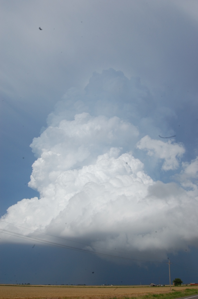
Initially staged in and around Enid, then drifted west as the only storms to fire did so well to our southwest and northwest. During our waiting time around Cleo Springs and up to near Aline, it became pretty clear that the widespread thick high clouds over much of OK and TX were killing off the event. With the cap in place like it was we needed to get into the mid-upper 80s to even have a chance at uncapped surface-based convection. The only place that even came close to happening was right along the boundary across NW OK. However, the T/Td spreads were a little high near the northern storm. Plus, seeing it backbuild and rebuild so many times, we figured it would start going outflow dominant and would not be a serious threat. After all, it first developed right on the front and it never really looked good on radar until it finally started to produce, well after it had begun interacting with the front.
We eventually went after the southern storm, but we waffled back and forth between the two storms for too long, and thus were late getting on it (we could see the core of it from 40 miles away as we approached, but we could not see the full extent of the updraft until we were just about on it as it began to die). Near Seiling we thought we saw some quick rotating bits of the wall cloud, but nothing substantial ever presented itself. We got some nickel to quarter sized hail as the storm died, but that was it for us. Went back to Enid to eat dinner and then noticed the new cell back near Clinton getting interesting.
Other chasers claim to have seen a tornado out of the evening storm, and it did make it into NCDC's Storm Data, but the narrative is hardly convincing. With CIN building back as early as 6 PM and as much as there was by 7-8 PM, I have a hard time believing any updraft would've been strong enough to fully lift SB parcels enough to get tornadic rotation at the ground.
I could've called this my first tornado chase of the season, since I saw a phenomenon that was reported as a tornado, but from 20 miles away...and it was more dust than condensation. The storm I was on allegedly produced several more tornadoes, but I saw none of them. Not bad structure, though.
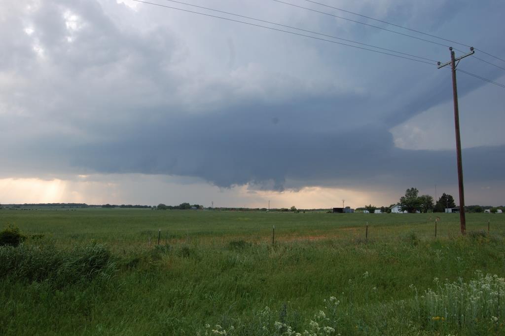
Left Norman around 11 AM with an initial target in the Wheeler-Perryton corridor, but eventually got dragged through Miami to west of Pampa before I was actually on a storm. This area was new chase terrain for me, and I was pretty appalled at how poor Roberts County (Miami) was.I was persuaded just to stick to the southern end of the entire complex, so I went south to White Deer, then southwest on TX-152. A few miles southwest of there I saw a big cloud of dust on the ground 10 miles to my south/southwest. It was under a developed wall cloud, but I could not see a funnel nor any discernible rotation in it. This was reported as a non-mesocyclonic tornado, but I'm still not going to count it. Do they even have an EF-scale rating for tornadoes that weak?
I moved all the way south to the southern edge of what was pretty much a short line segment by this point. On my way south I was racing to find pavement before a wall of water just to my west overtook me. I found my way to F.M. 293, which was the first point where I saw another chaser that whole day. After that, the crowd gradually increased. I eventually went all the way south to I-40 via F.M. 294, stopping several times along the way to view a shallow hybrid shelf/wall cloud that had a ton of horizontal vorticity along it, with numerous attempts at tilting some of that vertically. Throughout this stretch I saw a lot of modest rotation in the cloud base, and enough vertical motion at times to get me a little excited. After several failed attempts, though, it was clear to me something was missing - probably low-level shear, but perhaps it was also just too cool.
I witnessed a large number of gustnadoes along the southern flank of the storm(s). I didn't see any evidence whatsoever that any of these could be landspouts.
Figuring the day was about over, I started pulling well east of the storm. Of course this was when it decided to form a hook and produce a tornado well inside a wet hook for which you'd have to be north and east of it to have any chance of seeing it. Psh.
The road network is pretty spotty in parts of Gray County, so at this point I decided to just fly east to find a better road network, then get north and get into the notch. I briefly stopped near the remnants of Lake McClellan (it wasn't a lake at the time) to peak. I eventually ended up getting off I-40 at McLean and flew north, finally far enough ahead and far enough north to start to see some structure. I planned a route north and east through Kellerville back to Wheeler. I stopped on a hill that a local had named "Lookout Hill" (I know this because he joined me after I had already spent 10 minutes alone there) about 5 miles SW of Wheeler. The view to the west was spectacular.
Apparently I was a trend setter here. I sat in this spot for 40 minutes as the storm closed in. About 10 minutes after the local showed up another group of chasers finally showed up and stopped on this hill also. After that, the chaser train arrived. By the time I left that spot, there were some 10-12 vehicles parked there and 30-50 others had already gone by. It was nice to have that time to myself on a chase with a storm encroaching...in Texas...in 2015. The storm eventually produced a nice looking wall cloud, but based on the individual cloud fragments comprising it, and in spite of the increasing easterly surface winds, I could tell it was having trouble organizing at the low levels and was most likely not going to produce a tornado.
I pretty much never saw even a hint of rotation in this wall cloud the entire time it existed. I eventually decided not to take the core of the storm, so I bolted back to Wheeler and then farther east from there. Apparently the storm (and perhaps a nearby neighboring storm immediately to the north) produced at least one or two weak tornadoes during this stretch, but they certainly weren't worth the effort in my opinion. I was pretty much ready to call the chase at that point since storms were really going up everywhere by this point, including on top of me, and I continued to not see strong signs of organization.
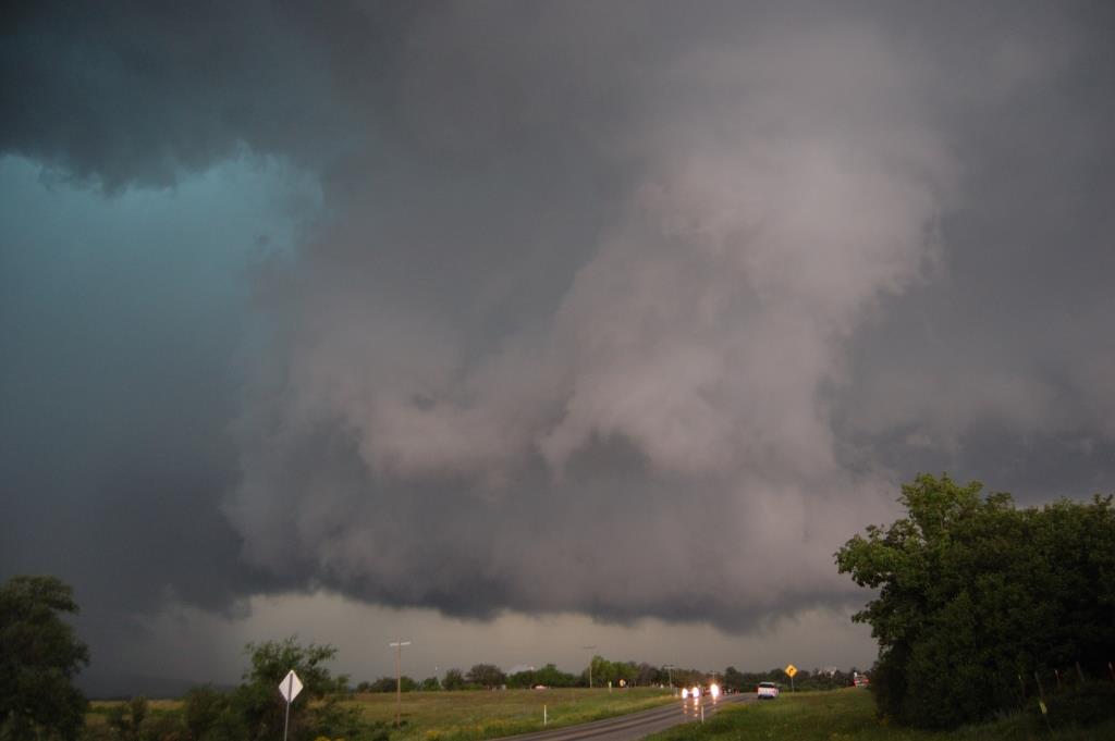
The chase became even more frustrating after dark. I decided to find dinner and gas up in Elk City before heading home. Right as I got my food I learned of the tornado warning 20 miles to my southwest near Sayre. I didn't see anything on velocity that made it look worth chasing. Then came the tornado reports. Whatever...that storm was never a supercell...just some weird spin-up. Why didn't any other storm this day do that? So of course I bolted back out after it and it promptly shriveled up and appeared to die. At this point, the old storm from before was finally crossing the OK-TX border and went tornado warned back near Sweetwater. I didn't want to chase it since it was pretty much dark at this point and I was already pissed about the Sayre tornado, but I went after it anyway. I ended up a few miles southwest of Cheyenne west of U.S. 283 on a narrow hilly road. After the former Sayre storm re-intercepted me, dumping some small hail on me, and after getting out of my car to sample some uncomfortably cool air, and after the tornado warned storm stopped being tornado warned without producing a tornado and a new tornado warning was issued back to the southwest, I got really tired of playing keep away, switched off my radio, closed my computer, and drove straight home while telling mother nature she was #1 for an extended portion of my drive home. It made me get home an hour-and-a-half later than I would've if I had just gone home from Elk City.
Left Norman just before 11 AM. Initial target was somewhere near Stephenville. Planned on taking U.S. 281 south from Wichita Falls to get there. After lunching in Wichita Falls, however, we noticed storms exploding off to our southwest. We kind of missed/overlooked the storm farthest south, and at the last second at the junction of 281 and TX-79, went towards Archer City instead. We intercepted a supercell while north of Albany as it approached from our southwest. It initially looked pretty good and even appeared to try to produce a tornado, but it went outflow dominant and we abandoned it. At this point we decided that we would try with new storms developing immediately west of the current storm, back where there was more clear sky and heating, and just ahead of the dryline. That turned out to be a mistake, as we didn't consider the poor moisture return thanks to the first tornadic supercell moving eastward to our south. Add in the outflow from our first storm, and I think it just messed up the environment too much. Regardless, we drove all the way west to about 10 miles east of Anson before turning back to the east.
At this point I thought we were screwed for the day. It looked like outflow from the primary supercell - by this point nearing Stephenville - was going to persist and completely ruin the environment we were in. We didn't think we'd be able to get east and then south fast enough to get on the storm, but we drove east anyway, albeit somewhat leisurely. We stopped in Breckenridge for gas and then entertained ourselves by letting ourselves get cored by a new storm that popped up just south of town and had 60+ dBZ on it. We only got very small hail out of it.
After that core passed we noticed new development due south of us and a little behind the primary supercell. Although it was north of the outflow boundary, it looked to be growing fast and was headed generally NNE - almost right at us. So we zoomed south on U.S. 183, diverting to TX-112/TX-6 to Eastland, where we caught some small hail from the north side of the left split of what was becoming the second tornadic supercell of the day.
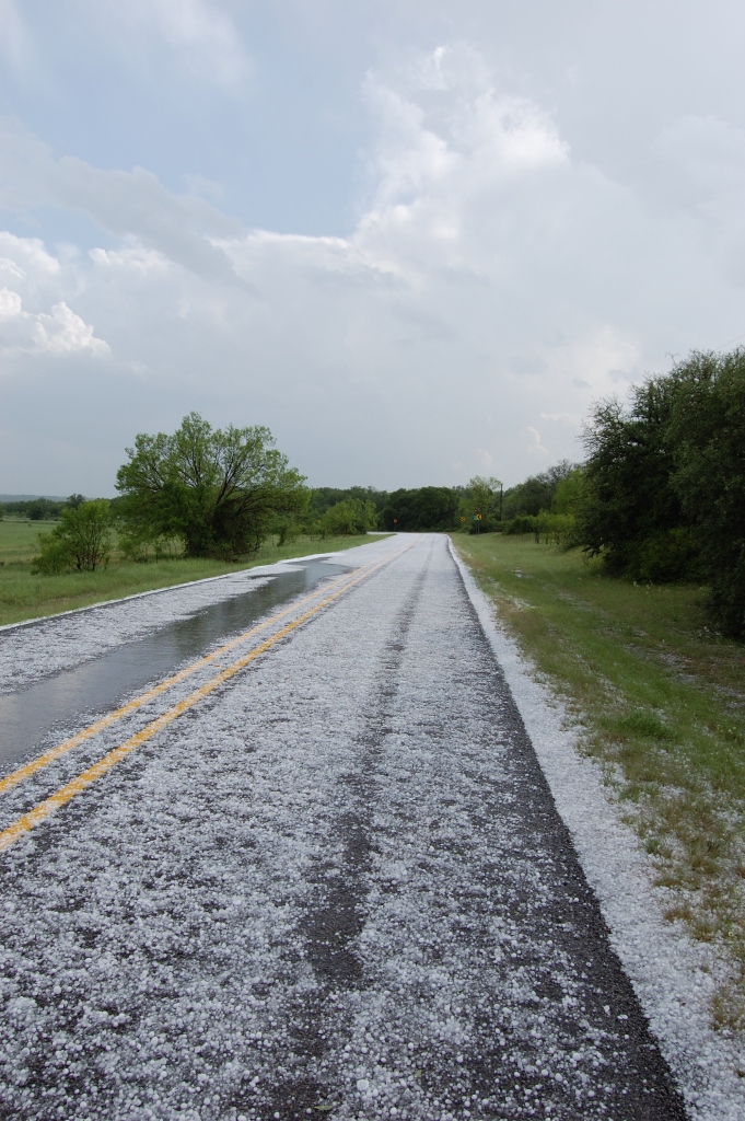
As we moved south towards Carbon, we had to decide to either core punch the storm by continuing southeast on TX-6 or by sliding in behind it by taking a ranch road (1027). We chose the latter. Although I doubt the core punch would've ended well (given what we encountered on the ranch road), we definitely did not help ourselves by making this choice. The road was twisty and covered in hail. There was also a lot of water very near the road surface. The biggest stones were golf ball sized, and there were plenty of 1" and larger stones.
Not only did the hail and road path slow us down, but we also had lost internet by this time. We got one radar scan around the time we got to FM587 that showed the storm had a bizarre shape and didn't look organized anymore. Couple that with the knowledge of it being north of the outflow and how friggin' cold it was in the cold pool (car temp was 13-15 °C the whole time), we figured it was not going to pose a tornado threat, despite having a nice wide base easily visible to our east. We passed on it and got on TX-36 southeast towards Comanche.
I saw an MD suggesting the tornado threat would increase between 00Z-01Z as the atmosphere south of the outflow was recovering, and we were very near the boundary and could see clear skies to the south with new storm bases to our southwest. One particular base, which would become the third big storm of the day, was clearly visible to the distant southwest and looked good.
Even after we reached Comanche we could get absolutely no data. I had to call a friend to ask what the radar was showing around us. He informed us that the storm we had previously left (#2) was producing a tornado near Stephenville. We chose not to go after that storm because 1) we figured we were too far behind to catch up, 2) it was wrapping hard and we'd have to get east of it, and 3) the storm to the west of Comanche had improving looking supercell structure and a mean looking cumulus tower aloft.
We went north of town on a few different roads to get a good view of this storm. It briefly developed a wall cloud that was slowly rotating and even appeared to try to produce a funnel cloud before the RFD came in and blew everything out.
We went back to town and went east on U.S. 67 to intercept. We had plenty of time to wait for it to pass us by Proctor. It again developed a large wall cloud with continuous upward motion, but little, if any, rotation could ever be discerned. A large RFD punch came in but never did anything.
At this point we were getting in behind the core and put ourselves just behind the updraft base. There were several areas that were low-hanging and occasionally appeared to rotate, but we never saw any sustained rotating wall cloud. It really looked like the storm was struggling to convert shear into vertical vorticity in the low levels.
Darkness was setting in as we moved east on TX-6, and we briefly stopped to observe what looked to be wrapping rain curtains, but by the time we could see again, nothing was apparent. We saw it again after turning north on 281 again, but it was getting really dark by this time, so it was hard to make anything out. We cut back up to 67 again via F.M. roads 1824 and 2481. By this point it was almost completely dark, and even though we could see some sort of darker column under the base, it was too dark to tell for sure if it was anything. The absence of lighting also wasn't helping. It finally started to pick up after we got back to 67 and were basically ready to call off the chase since the storm had, in our experience, continually failed to produce anything resembling a tornado. We were right behind the hook at this point and were ready to head home, but the storm was basically blocking our route back to I-35. We said, "to hell with it," and hook-sliced and core-rubbed our way past. We could never see anything ominous during that passage, and only encountered about quarter sized hail northeast of Glen Rose. Sure enough, as soon as we got clear south of Ft. Worth, the storm began producing tornadoes. It was a nice slap in the face as we watched the madness unfold on radar on the way home.
A pretty underwhelming chase despite expectations. Logan came down to chase with me on this, the first of a two-day stretch.
Storms went HP quickly, and we had no luck getting into the right place to see any of the tornadoes that occurred. We chased two HP supercells, both of which produced tornadoes, but all were weak and apparently buried within the rain. All we saw was teal and walls of water. The first storm moved east from west of Vernon, across the Red River, and towards Waurika. At least the chase terrain for that stretch was pleasant. The second storm was interesting near Bowie. We may have seen a funnel cloud while pinched against a retaining fence on a hill on TX-59. I unknowingly stepped on a red ant hill and ended up geting several in my shoe, and got bit all over my foot and hand before I even realized what was going on. Drove through an extremely heavy rain core near Ardmore on the way home. Southern Oklahoma got really pounded with flooding rains during this period.
Targeted an OFB/dryline intersection near Childress. On the way, we diverted south of Norman to check out a rotating storm near Lindsay. It had impressive inflow in the cloud base, but it was cool at the surface and there wasn't much wind. We passed on by and ended up in Lawton when I noticed the first blips showing up along the dryline farther south in Texas. I knew the moment I saw them that we needed to get to the southernmost one, which unfortunately was 150 miles away. That storm was right on the edge of the cap and thus was going to get an open source of inflow uninterrupted by other storms, and it was in an area with extreme instability (3000+ MLCAPE). Unfortunately, because early day convection essentially shunted the entire play of the day south by 300 miles, the storm was in an area with sub-optimal deep shear and poor anvil relative flow. Not believing much would happen between SPS and that storm, we went all out and blazed a trail southward towards it. We took no chances, going out as far as Jacksboro - Mineral Wells - Stephenville to get out ahead of it. We watched it on radar attain a classic supercell shape, then watched velocities suggest it had a tornado on it. After that first cycle it was done being a classic supercell. It looked like the flanking line was blowing up into its own new storm, thus perfectly raining down on the updraft.
By the time we got on it northwest of Stephenville, it was just another ordinary, low-contrast, HP piece of garbage. The best thing it showed us all day was +CGs. We found a good viewing spot near Huckabay to watch it roll in. It was a great spot because the meso and associated wall cloud it produced eventually crossed the road no more than a mile or two from us. During that time it actually looked like it was trying to go back to being a classic, and it developed a pretty meaty wall cloud that was pulling in scud pretty well. It even began to show low-level rotation as the RFD came around and cleared the rain for long enough for us to see it cross the road.
Once the wall cloud crossed the highway we started to lose vision in the trees, so we repositioned. Apparently during those few minutes it decided to spit out a cone tornado, not under the wall cloud, but along the front edge of the RFD precip. Go figure. So we missed that. We were able to stay up in the notch for awhile, meandering around some local roads between there, Morgan Hill, and Bluff Dale. But as time went on it became more and more clear that this storm was fully HP and was not going back. There was no way we were going to be able to see any subsequent tornadoes lest we drive into the core. Mother nature made the quitting decision easy for us when the storm simply lost its supercell characteristics and became a multicell cluster that subsequently died while passing over us in Ft. Worth as we ate dinner before heading home.
Caught a small tornado 10 miles from home on the day the May record for precipitation at OKC was broken. Did not plan to chase, but after seeing reports of a large tornado near Minco, decided to head out briefly.
Broke my solo-chasing tornado streak with this chase. Was probably doomed from the start, as I had an early afternoon appointment, and thus didn't get out of Norman until around 3 PM. Was never in time for the main storm in northern Texas. Instead played around with junkvection that briefly organized as it crossed the Red River near Wichita Falls. The view from behind one of the updrafts was a decent consolation.
Return to storm chasing home page.